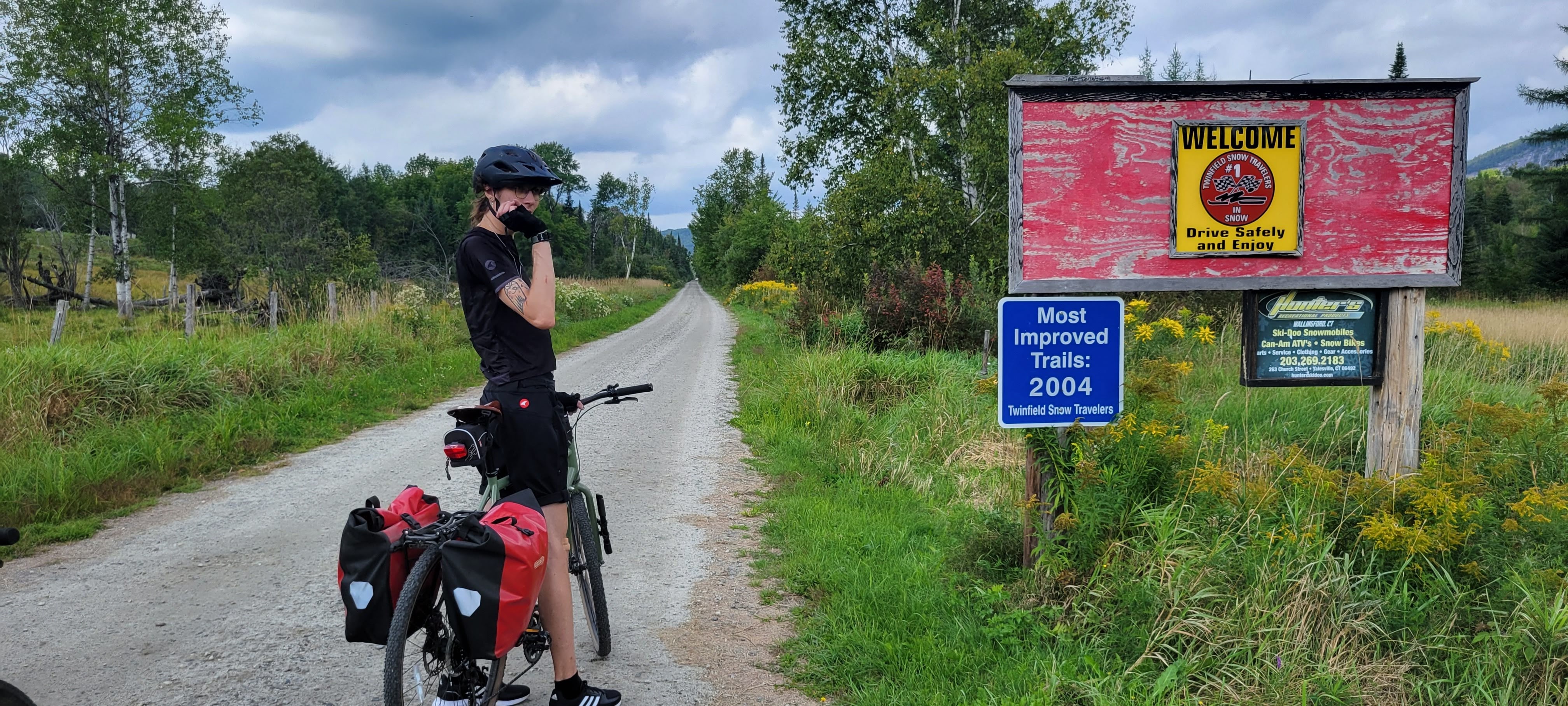
Two months ago we landed in Colorado and began the process of Unpacking and Setting Up The House. I haven’t been on my bike since October at this point – so long ago TrainerRoad knocked my FTP down to a level I have never seen. (To be fair, I only have a power meter on my trainer, so while I may have been at this level before, I’ve never *seen* it)
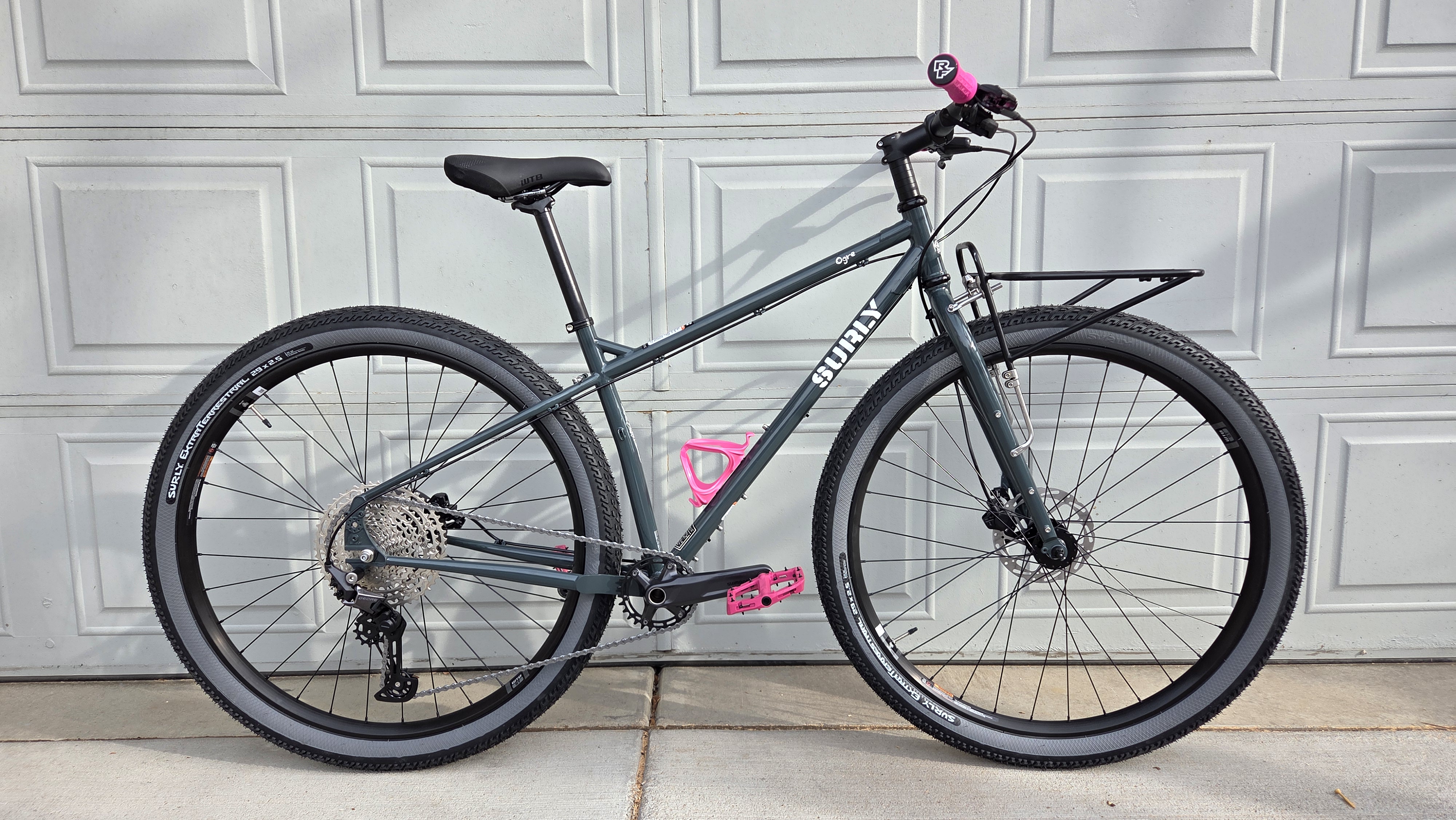
Our new location is stupid convenient to everything, so I decided to buy myself a dedicated About-Town bike. Look at this beauty!
I’m not usually a Pink Girl but it looks so good next to the green-grey frame
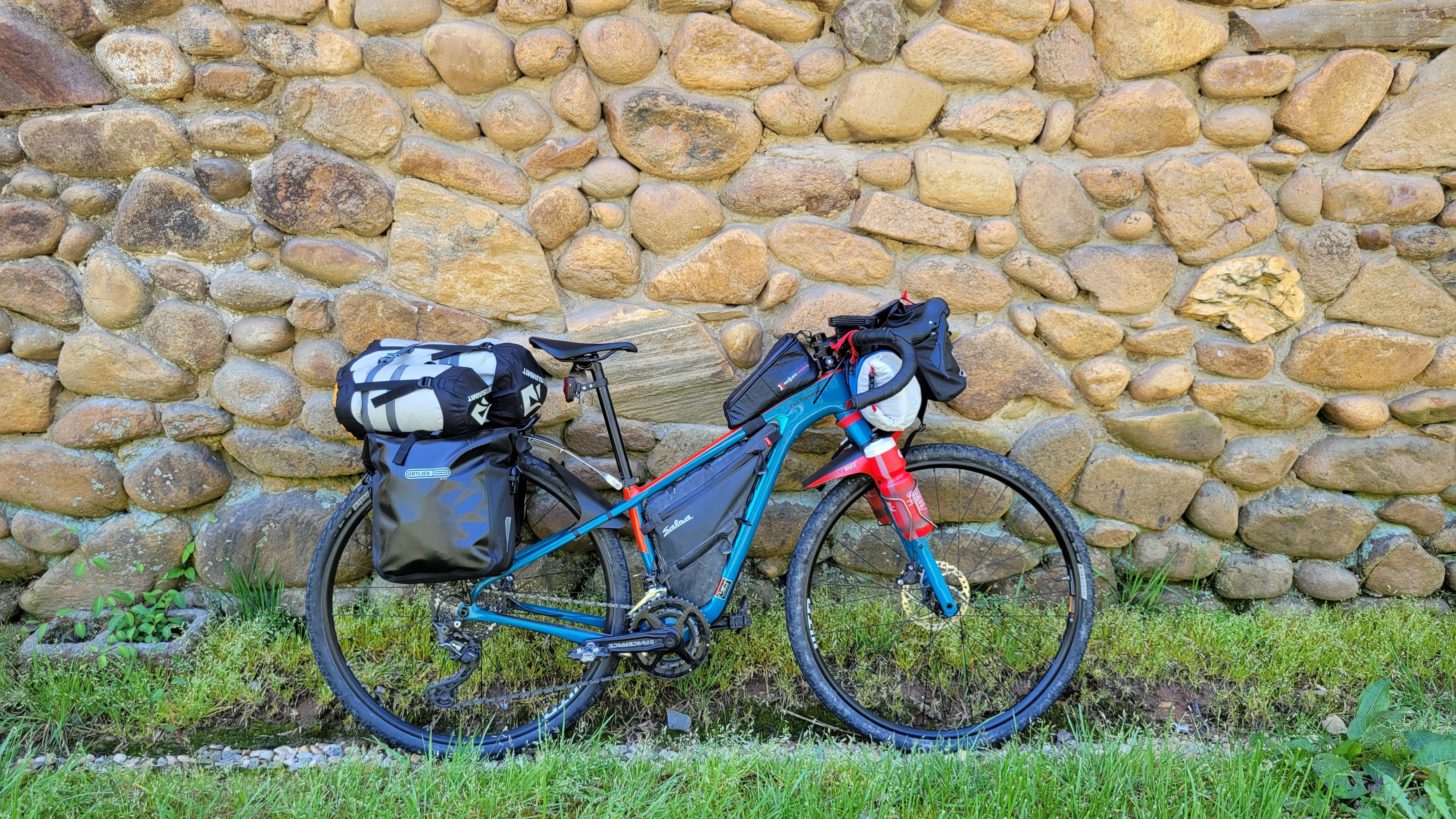
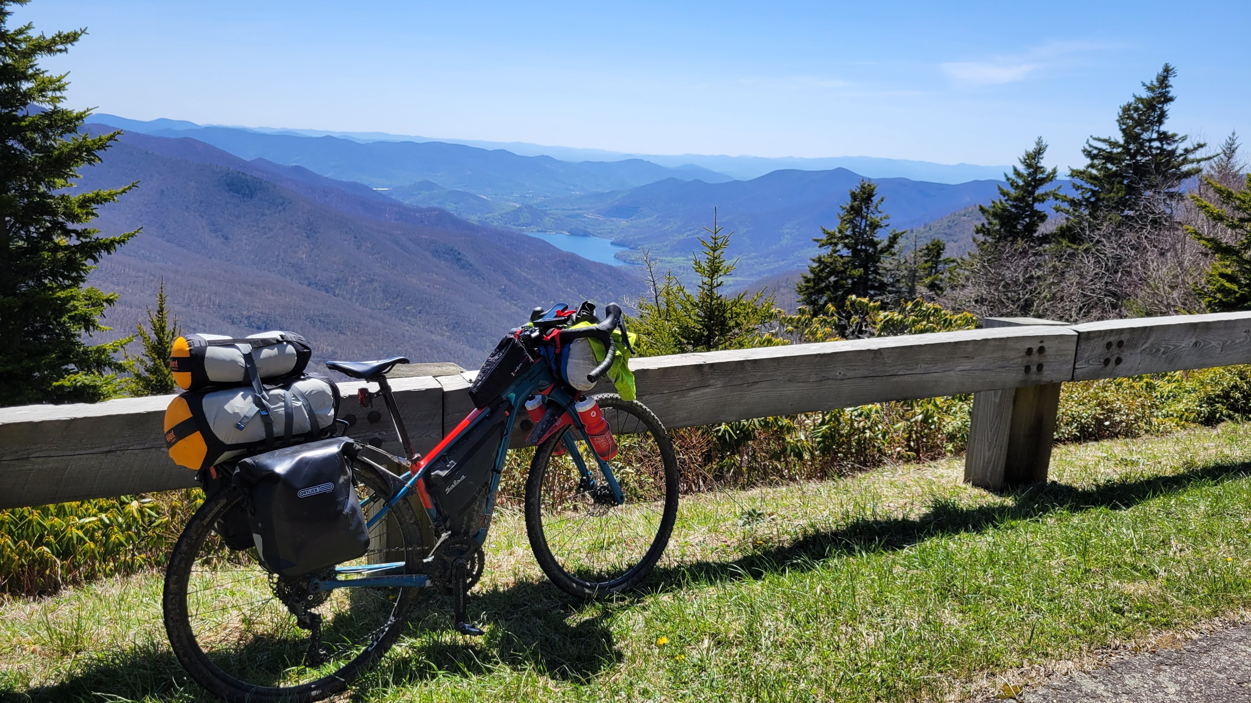
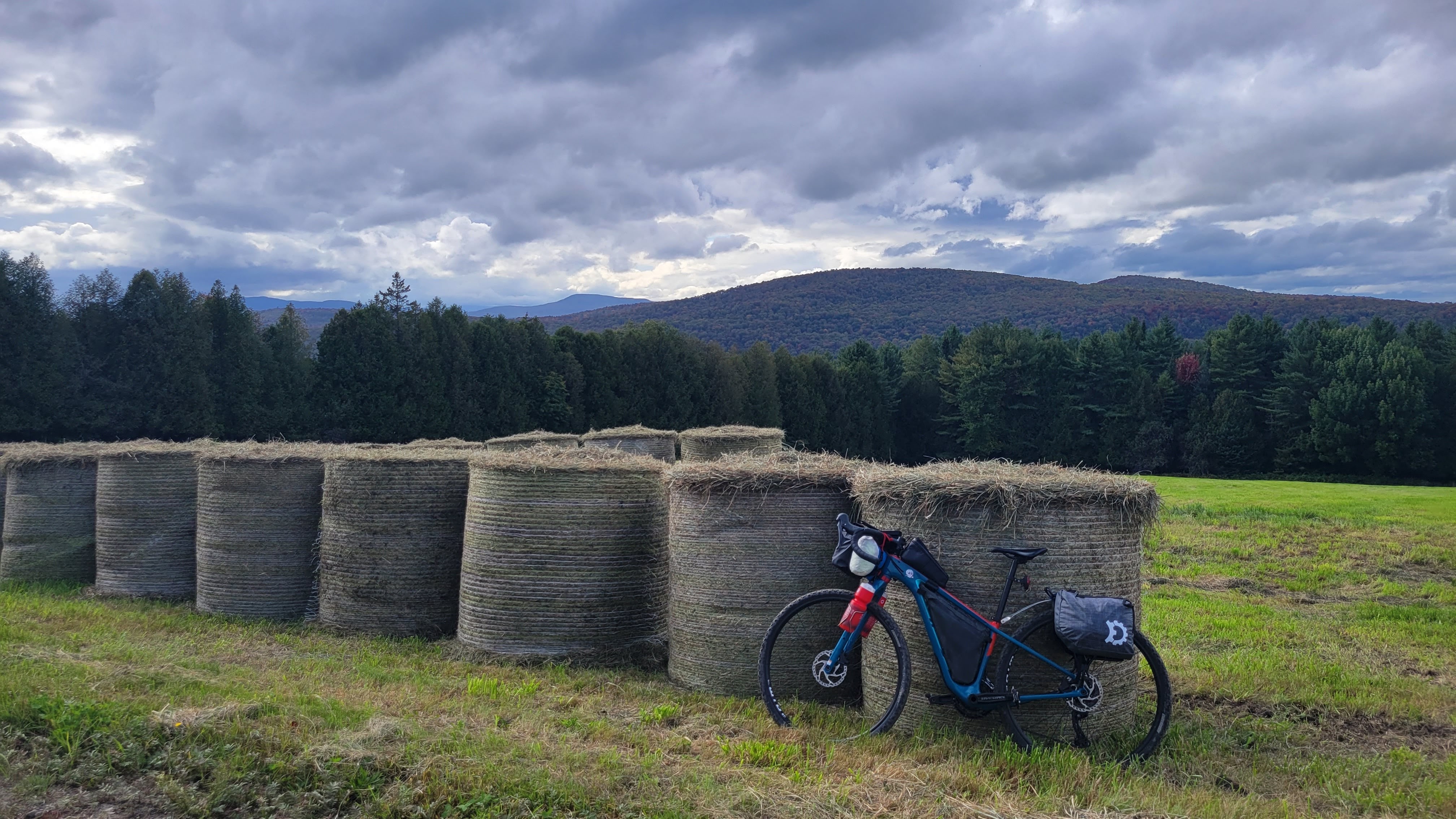
(For fellow bike nerds, she’s a 2025 Surly Ogre in Orlock’s Shadow with a Surly first-gen 24-pack front rack. I recently added a Waald 139 half-basket. Why a first-gen? Because I can move it to my Wednesday for bikepacking, should I find a suitable fatbikepacking route locally)
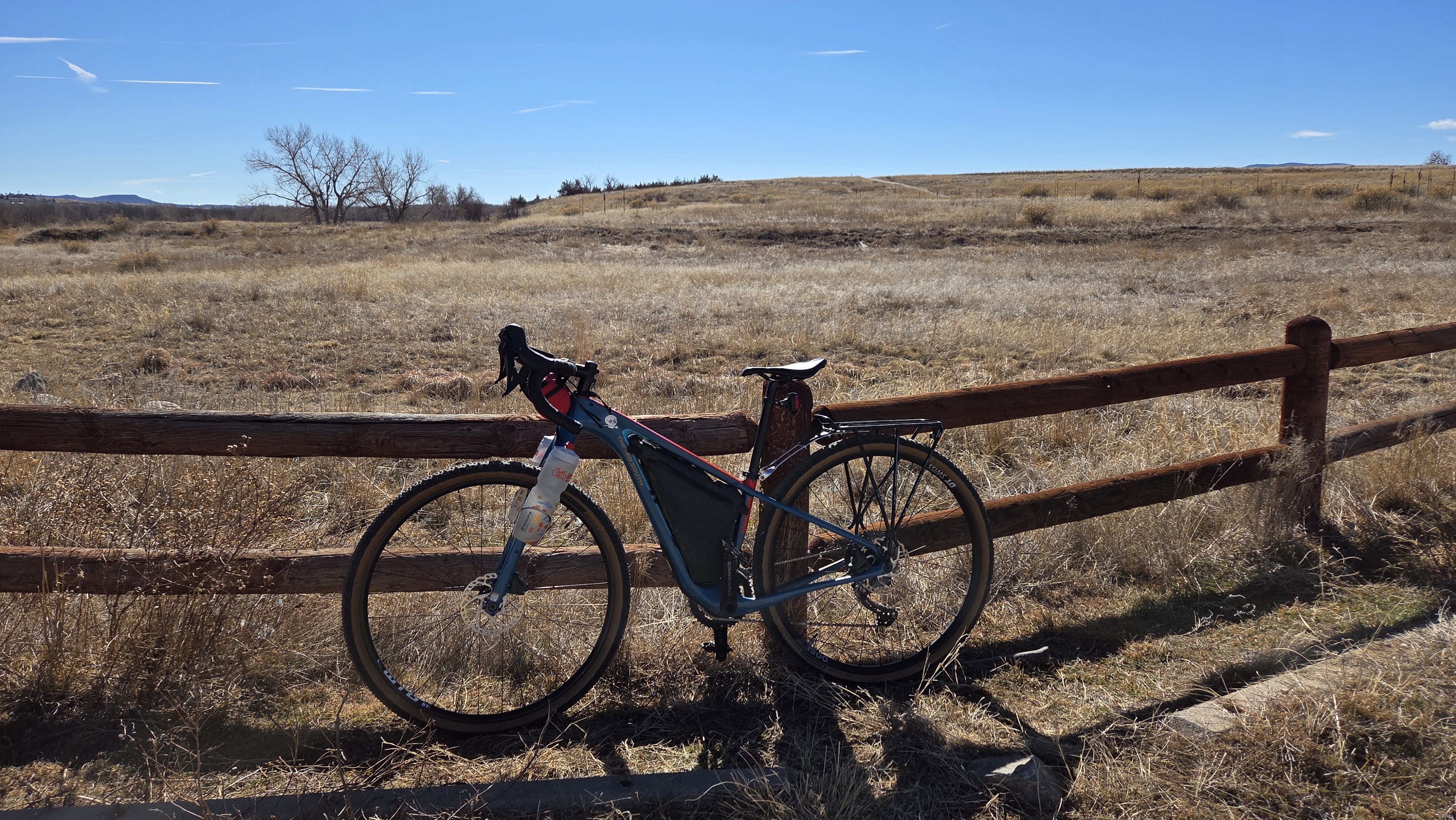
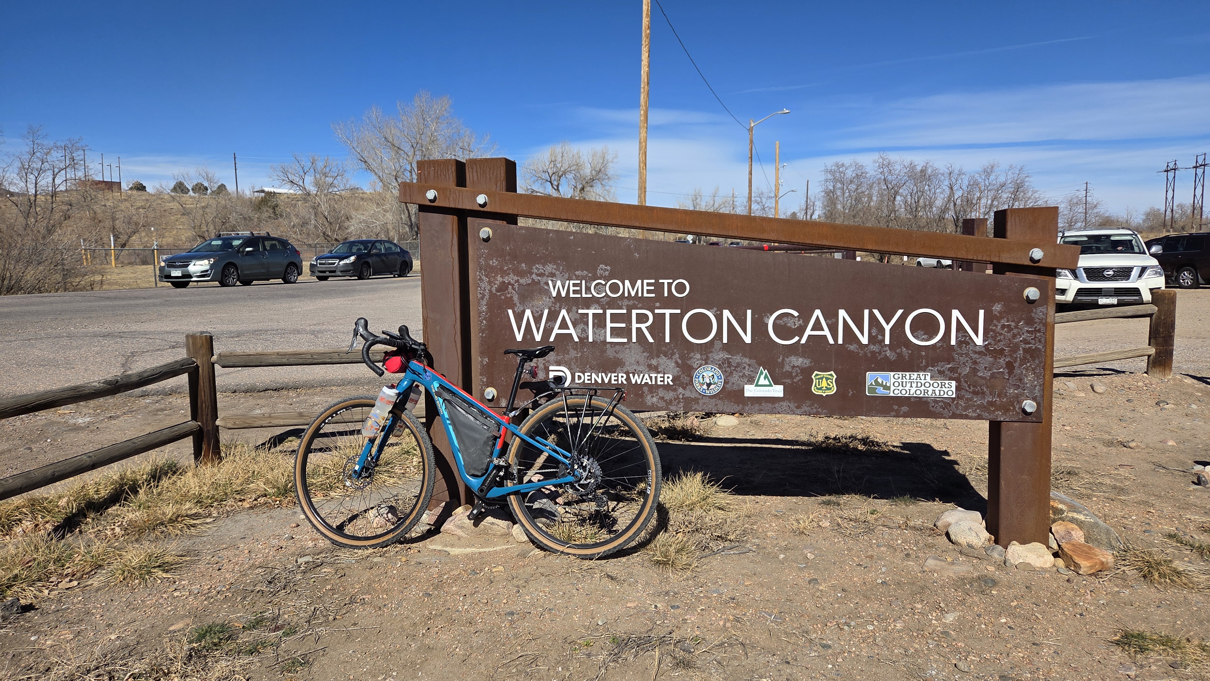
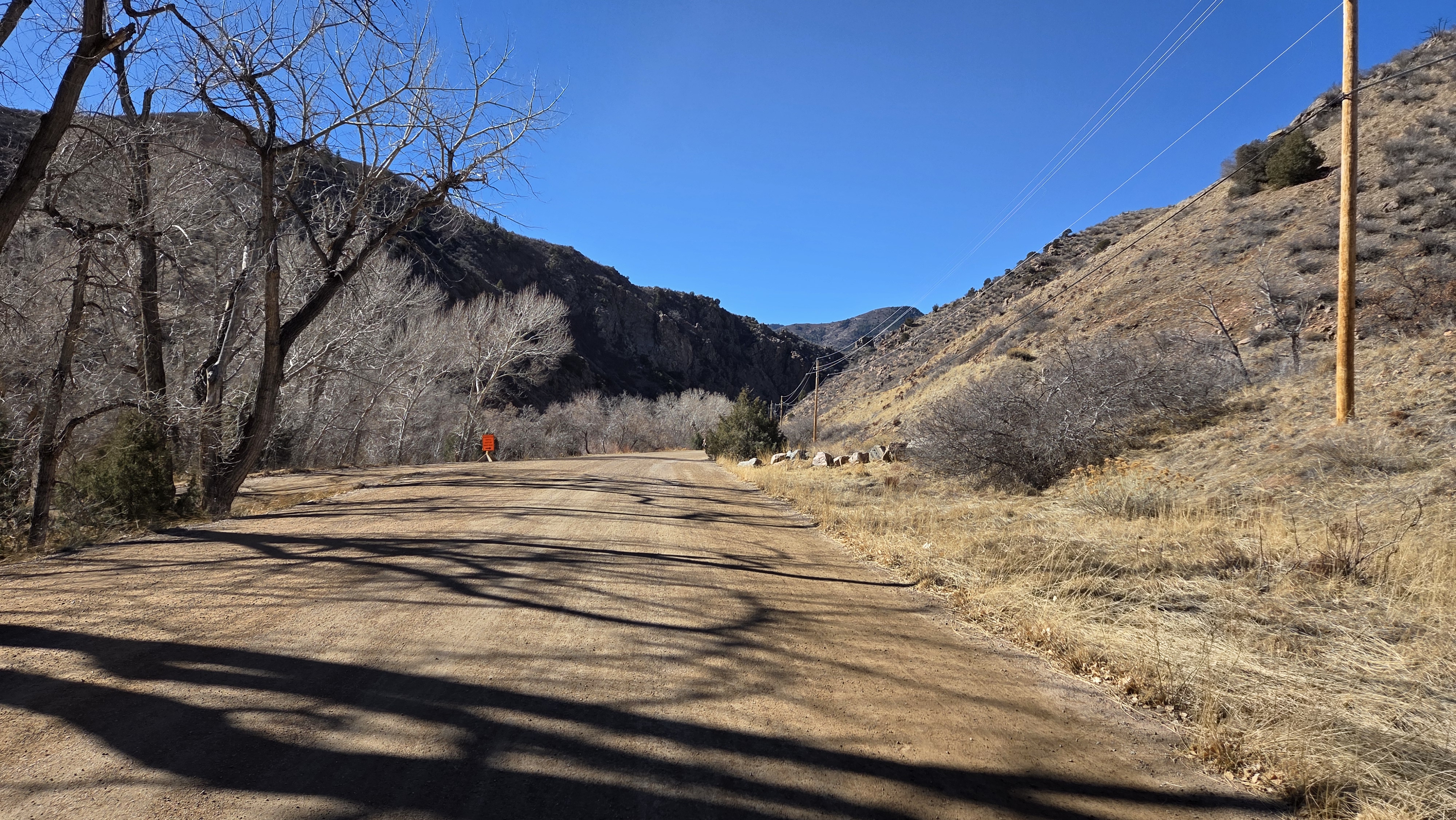
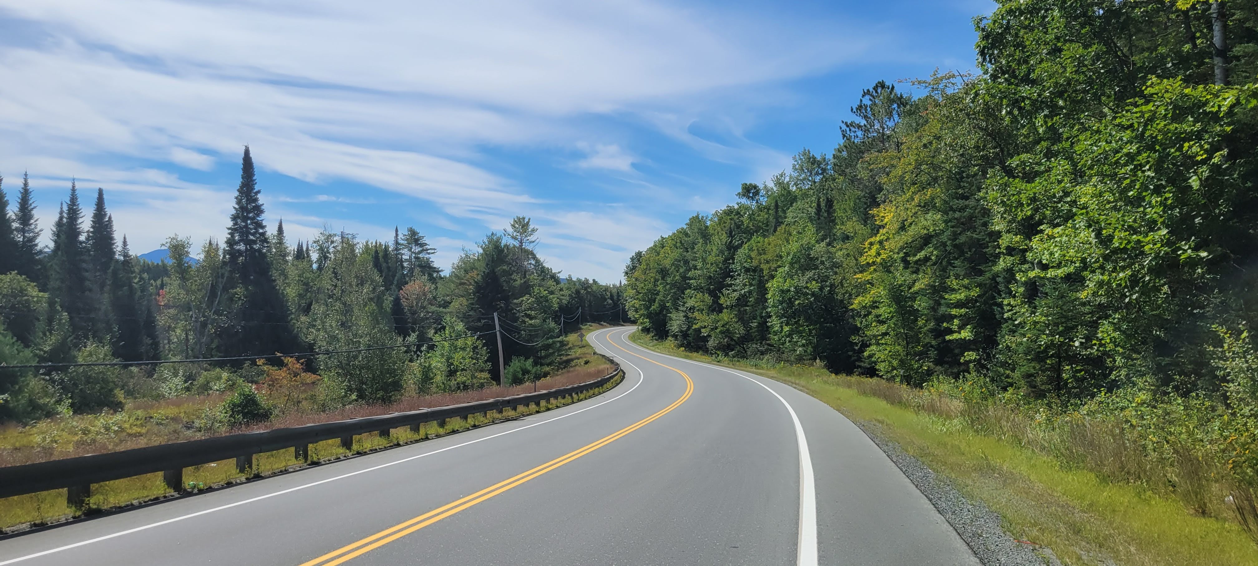
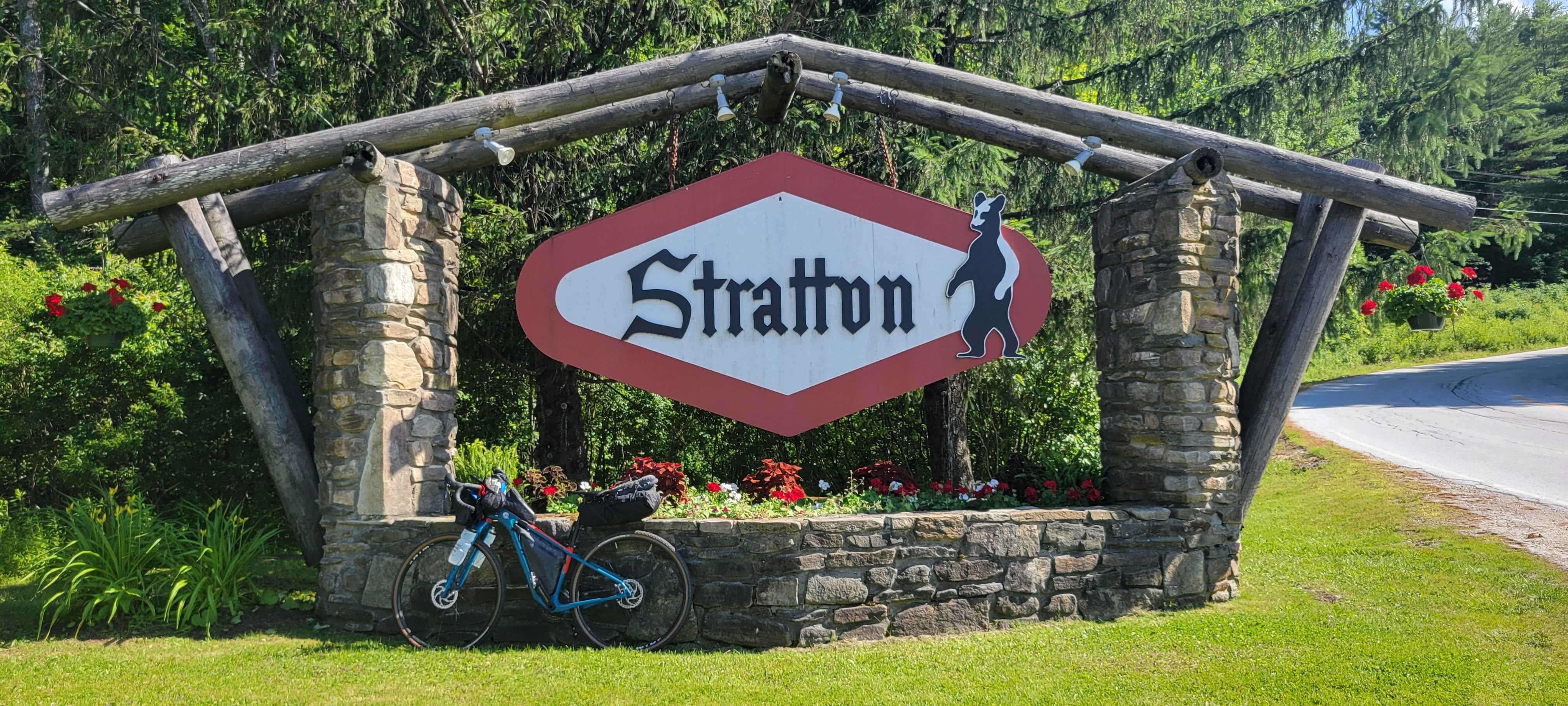
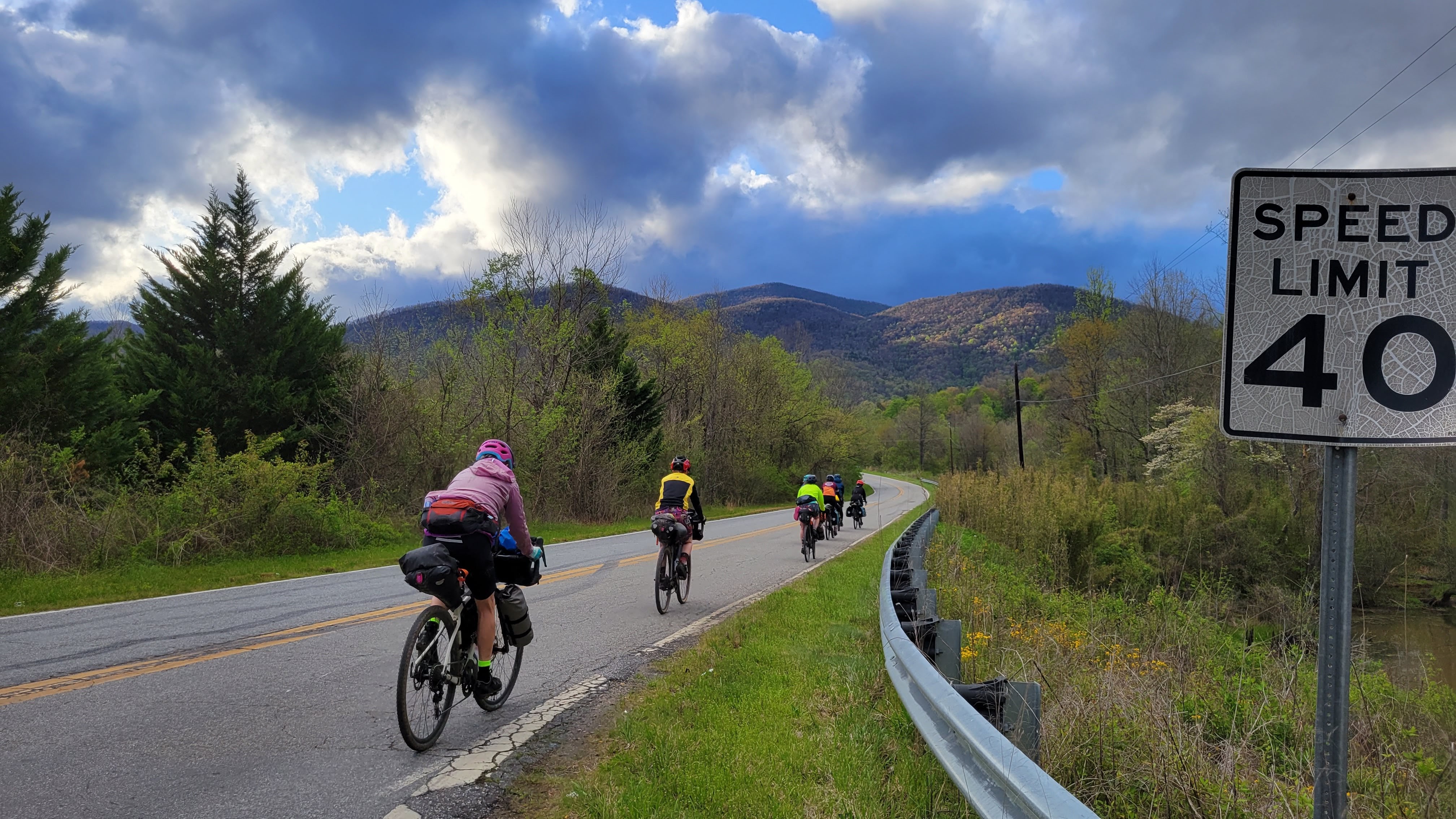
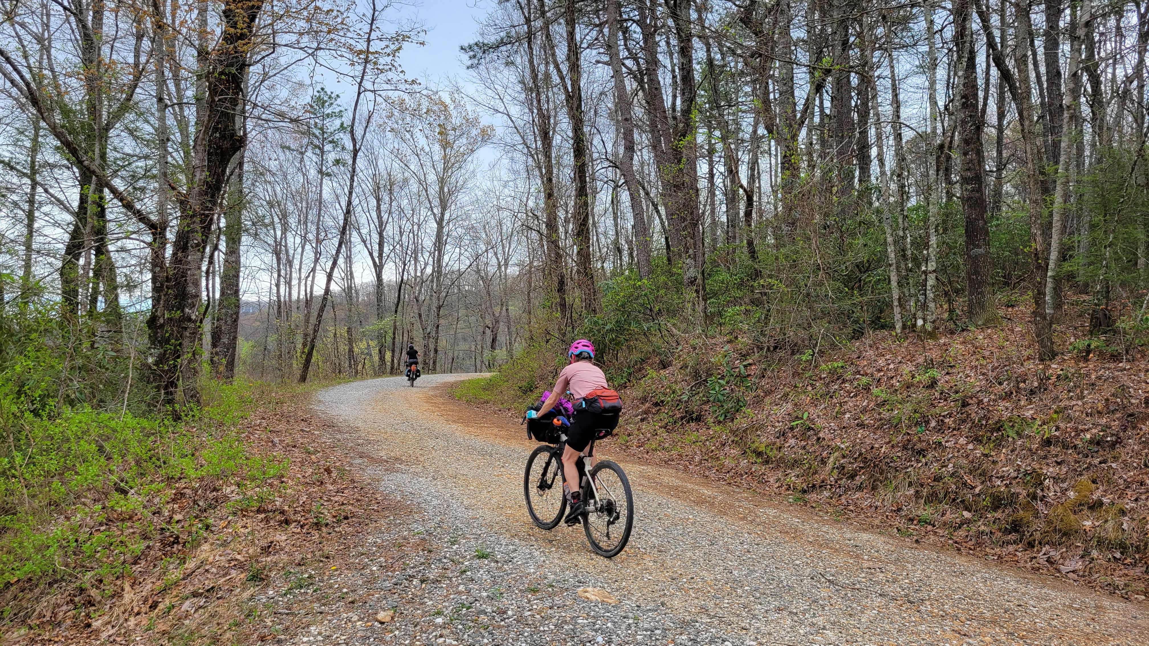
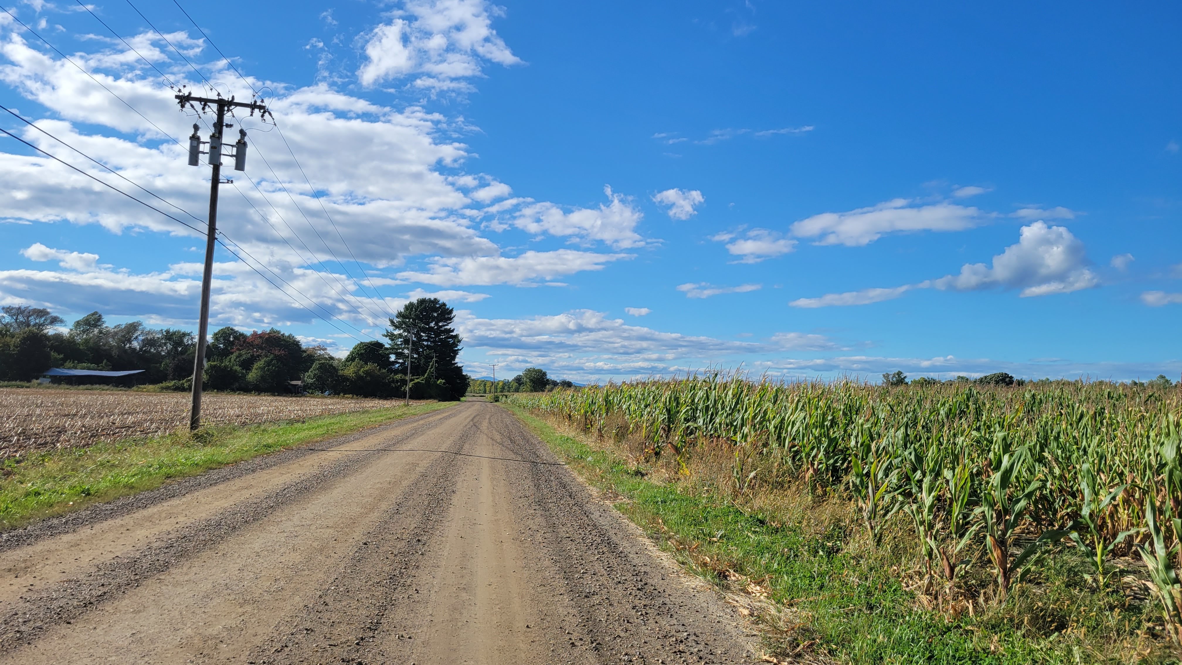
Anyway, we are deep in a Climate Change Winter here. We had a cold snap a bit ago, but overall it’s been very pleasant. Sunshine, blue skies, jeans-and-a-t-shirt weather. Yesterday, the temps were expected to be in the upper 60s, so I decided to try a route I found on Gravel Bike Adventures – Dirty Chatfield & Waterton Canyon. Waterton Canyon has been on my To Do list since I moved to New York and discovered a love of dirt roads.
(full disclosure, the two lonely routes in New York are mine)
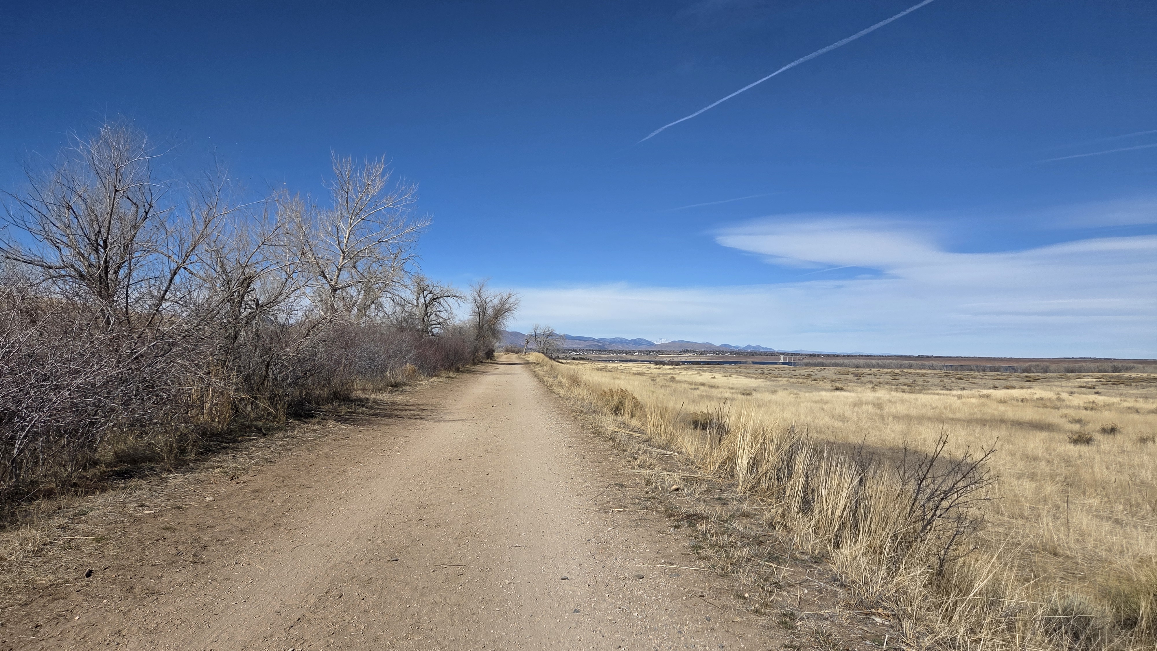
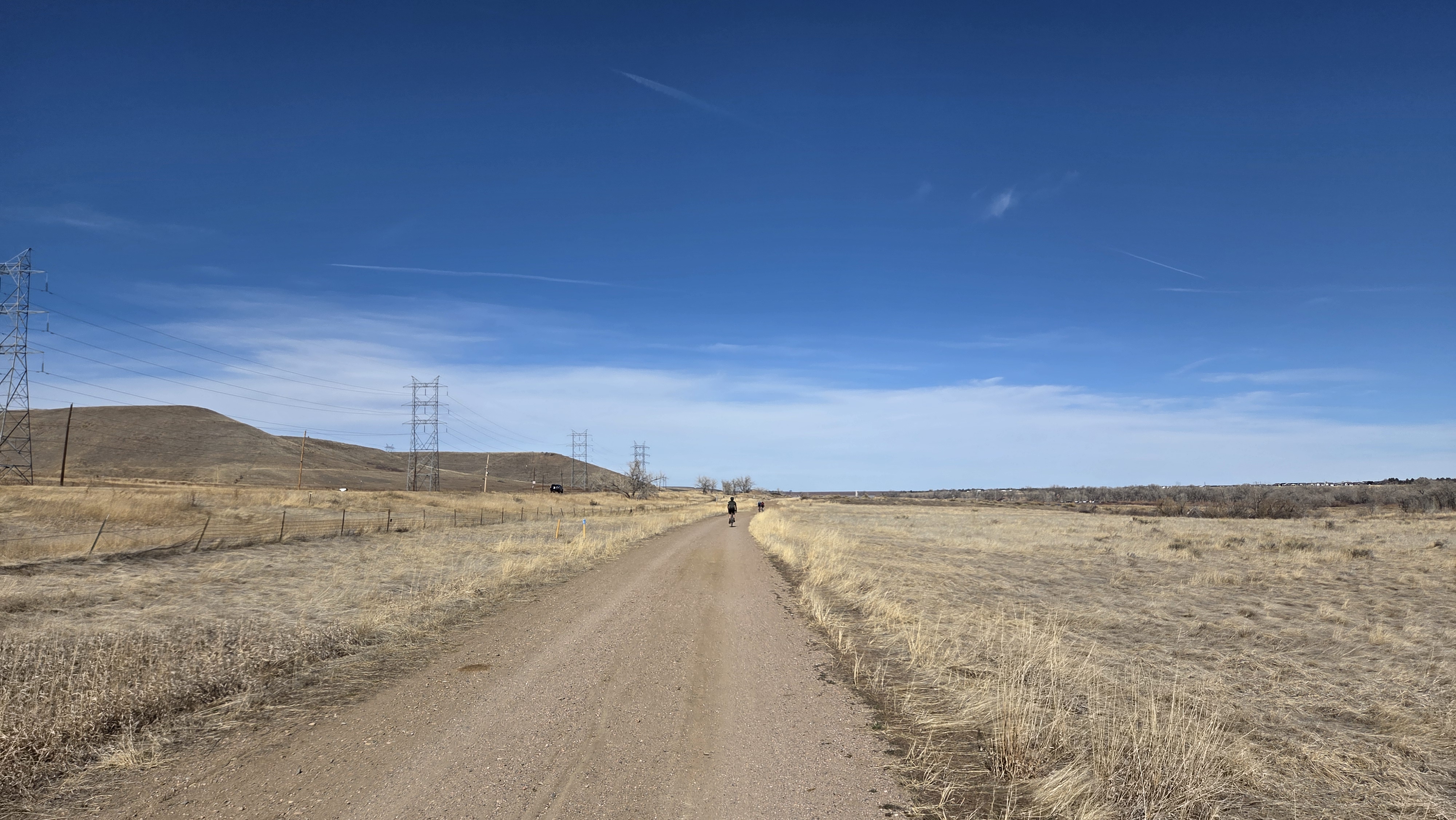
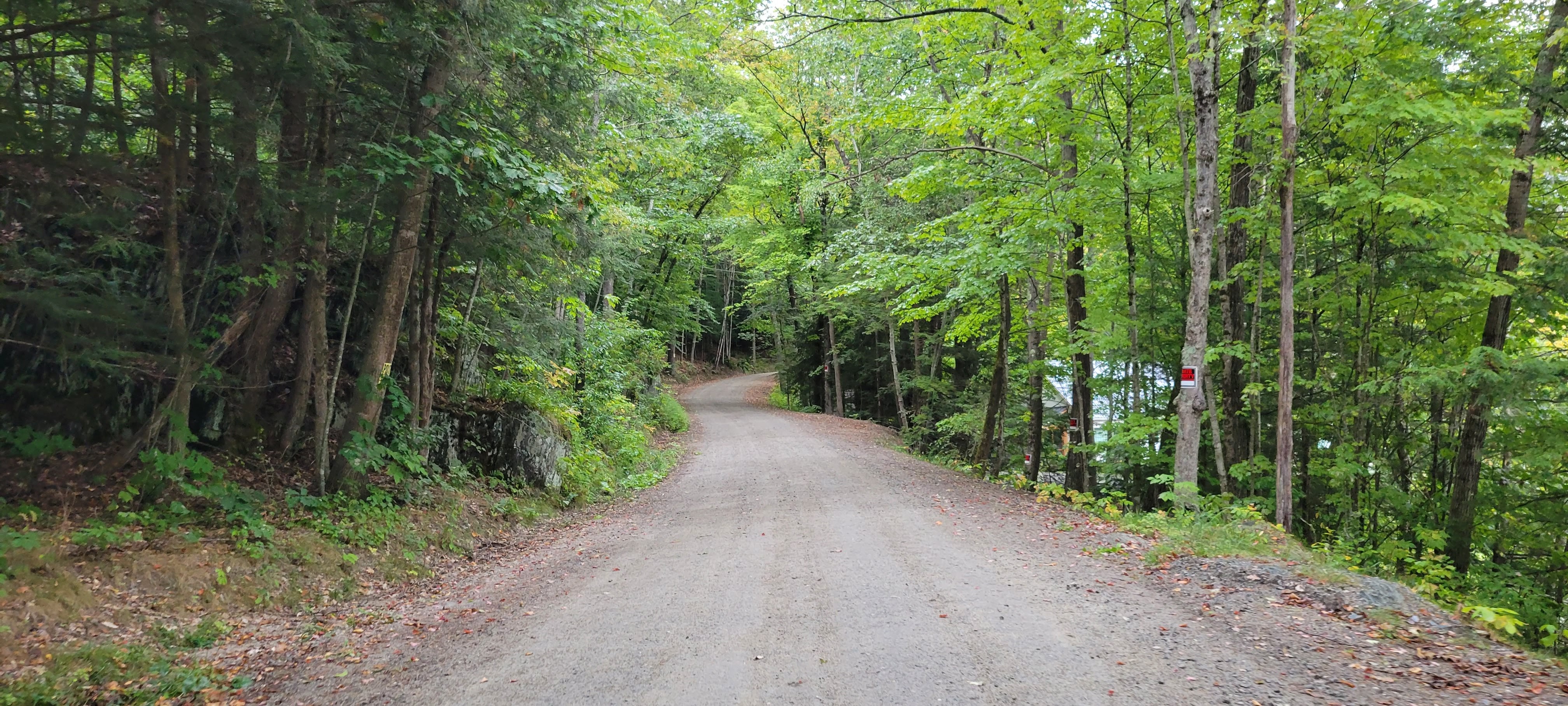
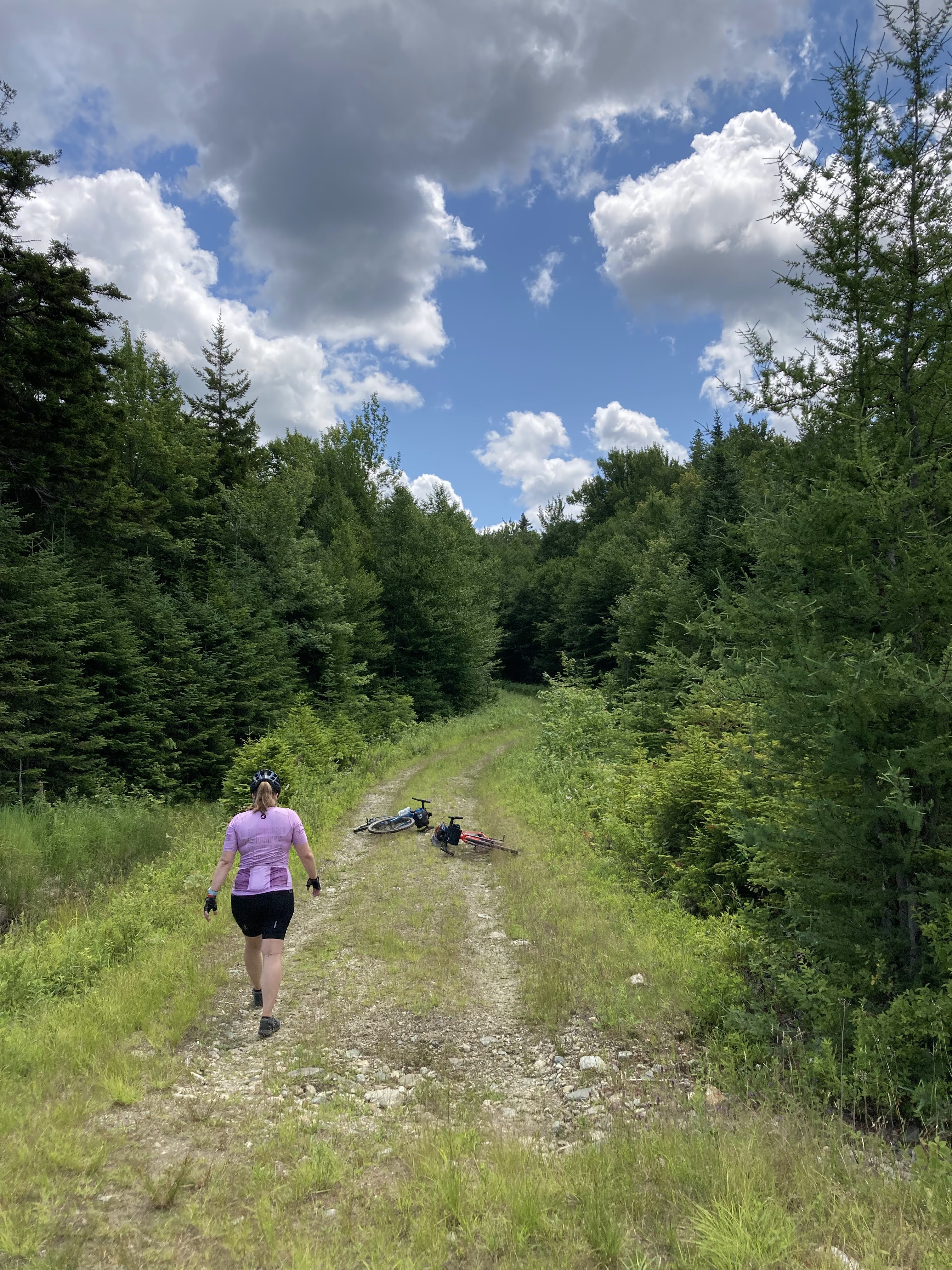
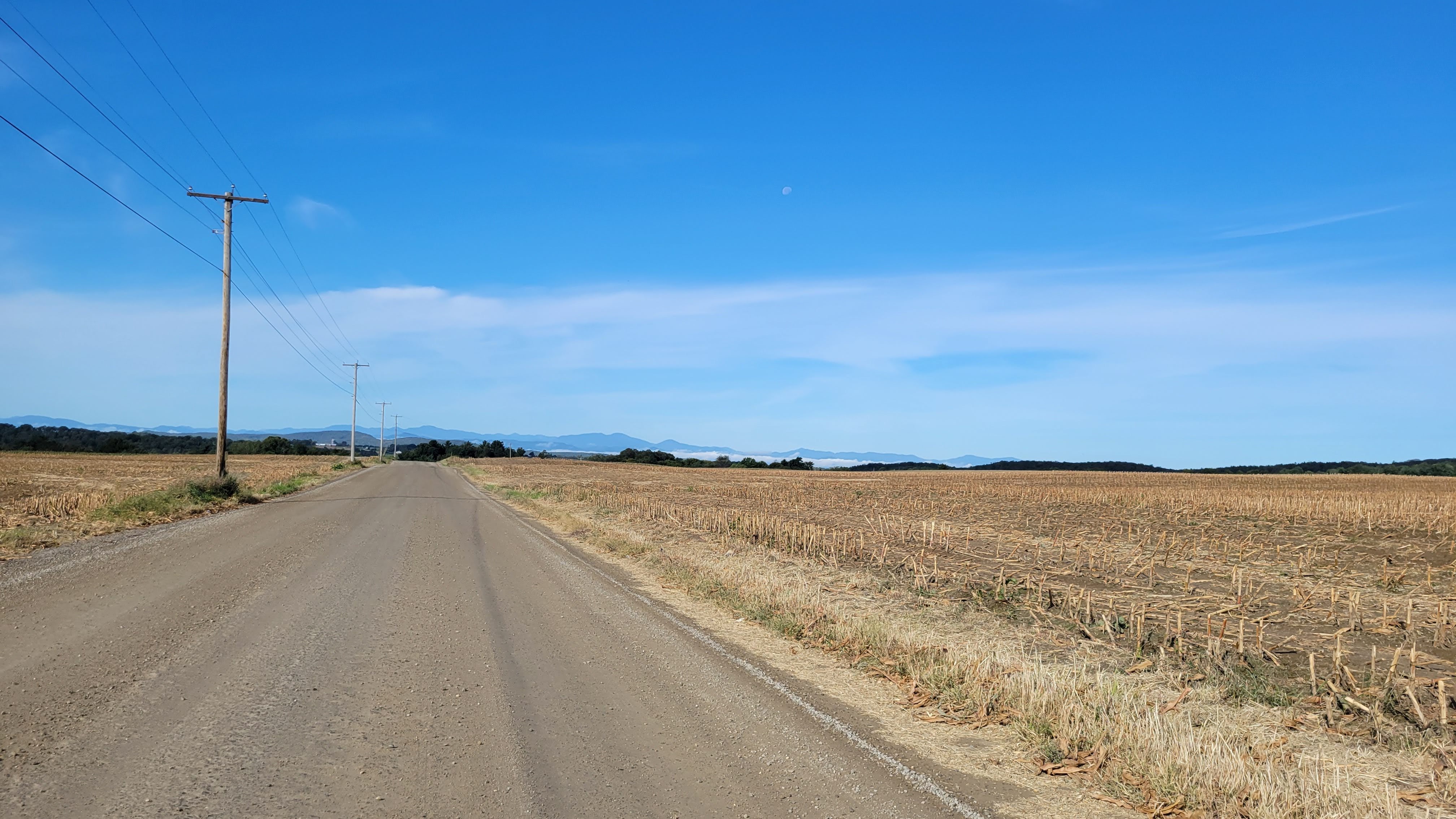
Within 3 blocks, I was on the local multi-use trail. The one thing I – didn’t really forget so much as haven’t had the ability to take advantage of – are the abundance of off-road multi-use trails. In the Denver metro area, it’s very possible to bike 100 miles – maybe more – without meaningfully being on a road with cars. This also means not a ton of hills in the traditional sense. Noting I’ll need to seek out hills to regain my climbing prowess.
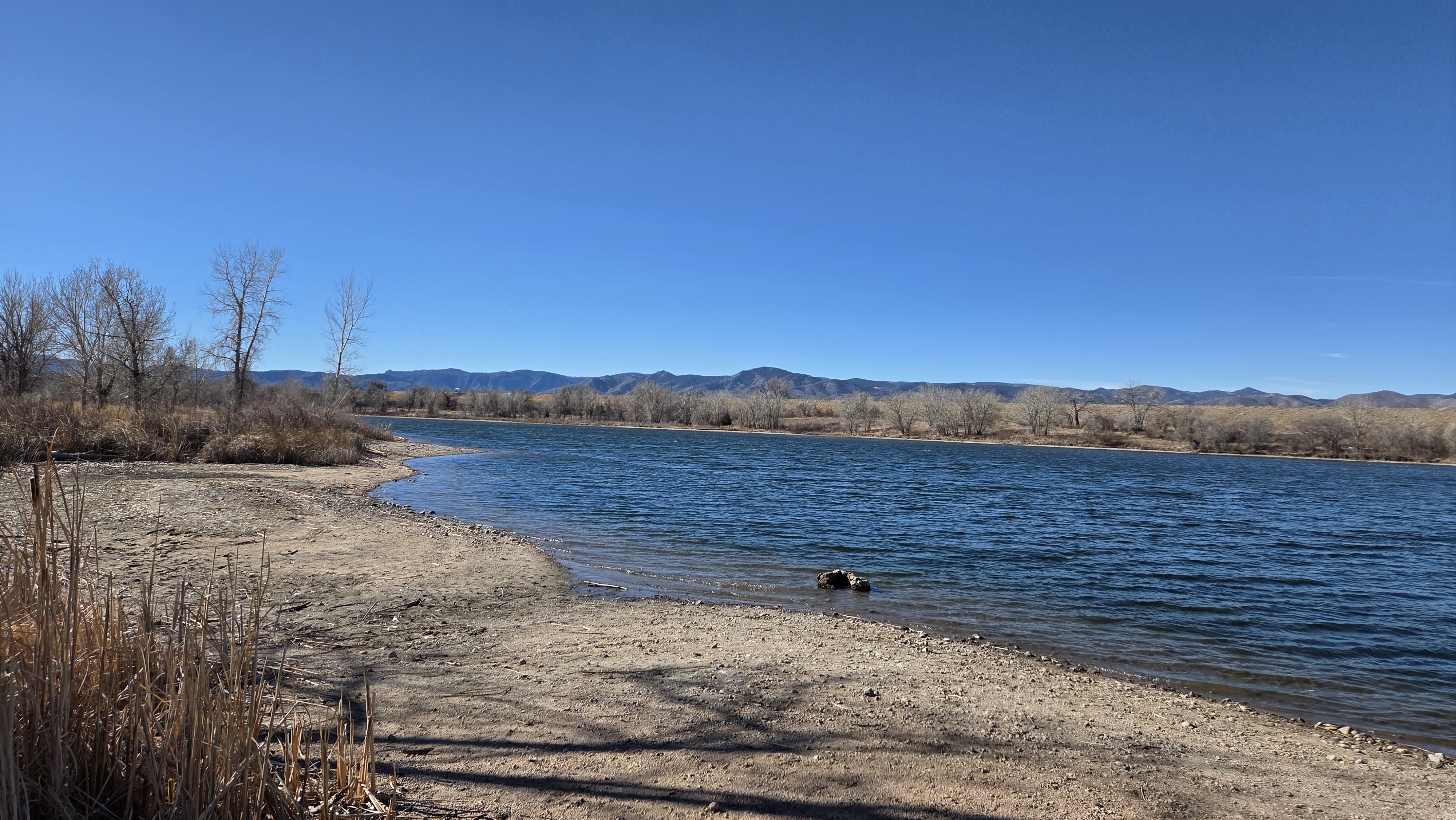
Being a beautiful day, the trails were busy with families, people on bikes, people walking their dogs, and plenty of anglers in the Platte River. As I got closer to Chatfield Reservoir, more roadie cyclists appeared.
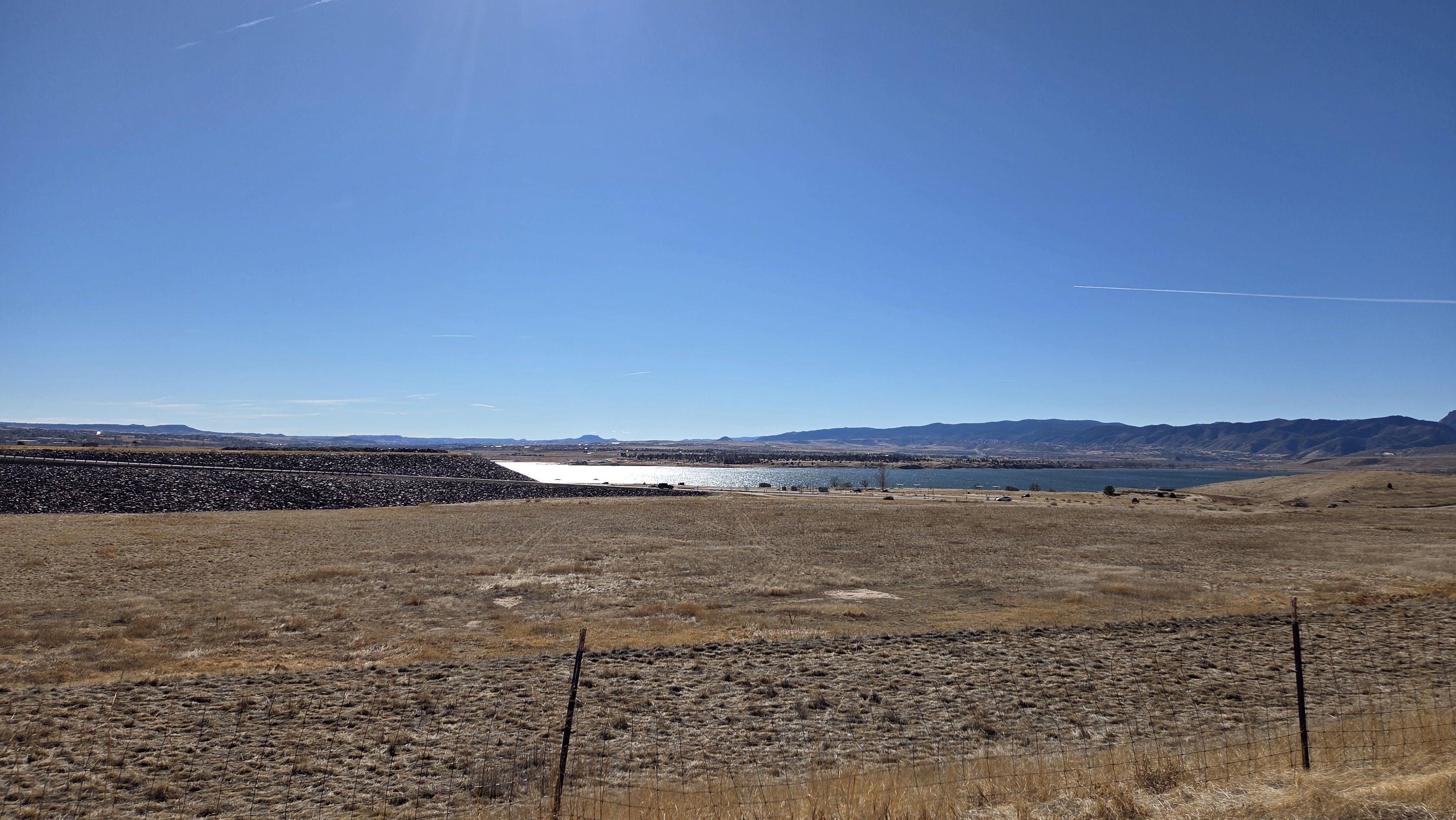
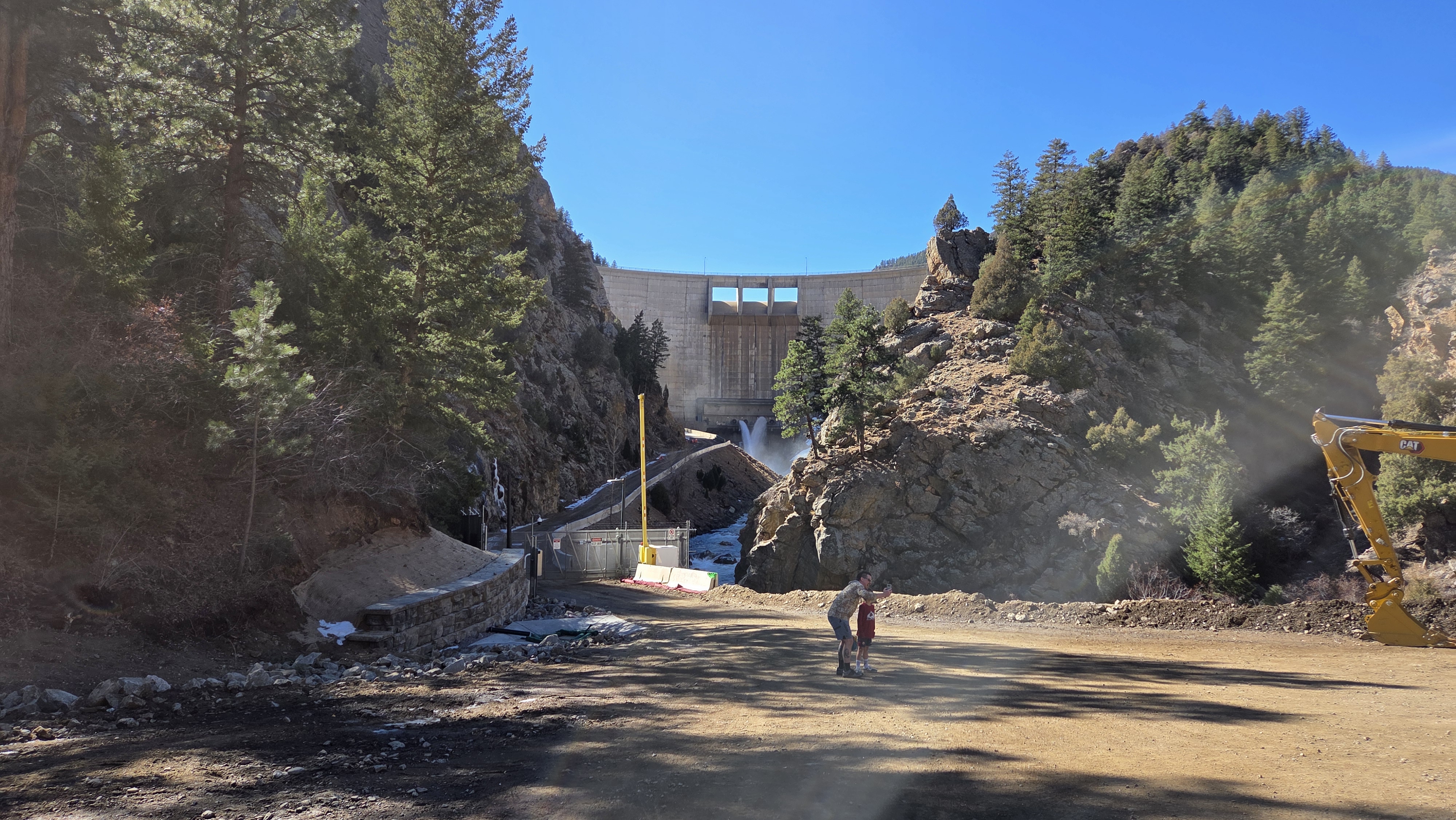
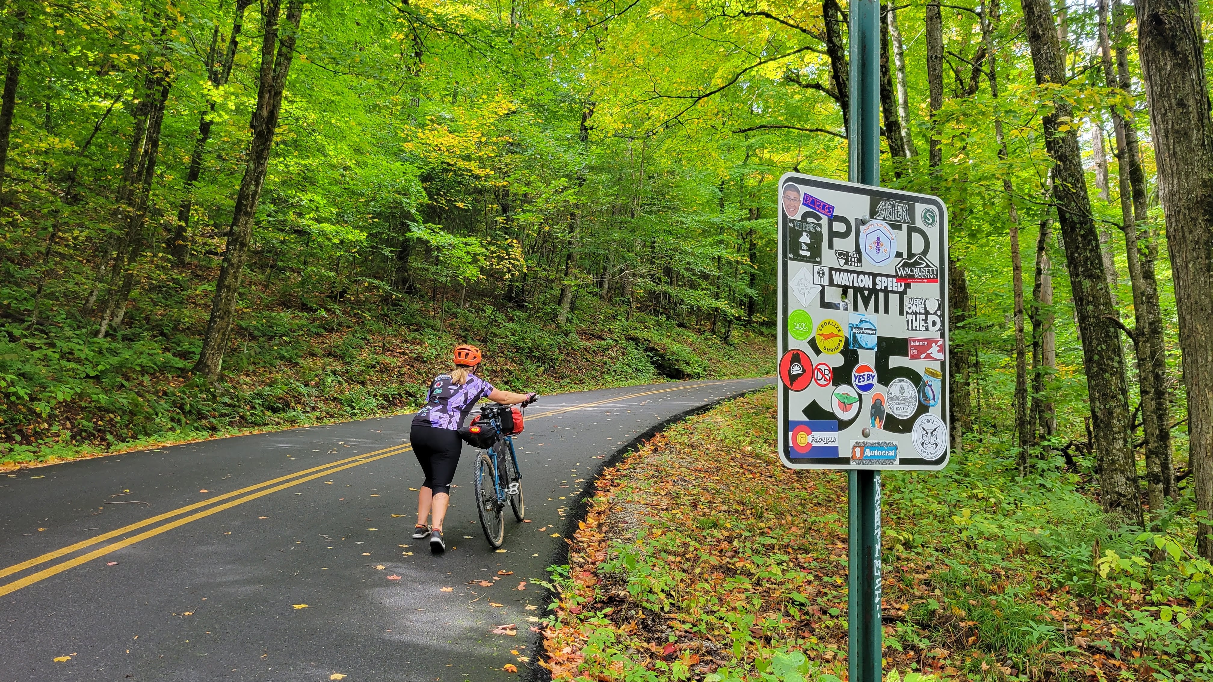
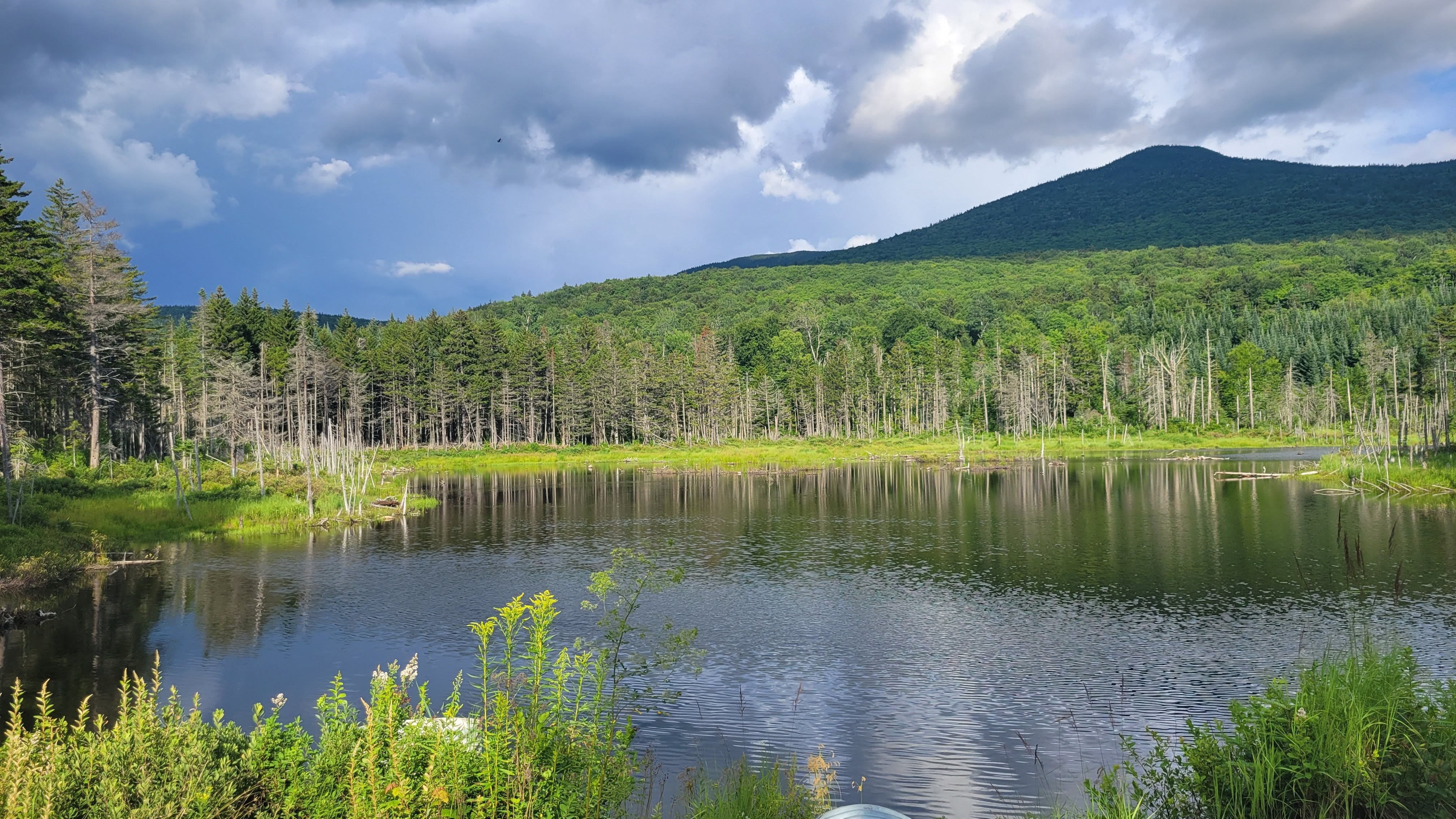
Platte River north of ChatfieldA view of the reservoir and dam
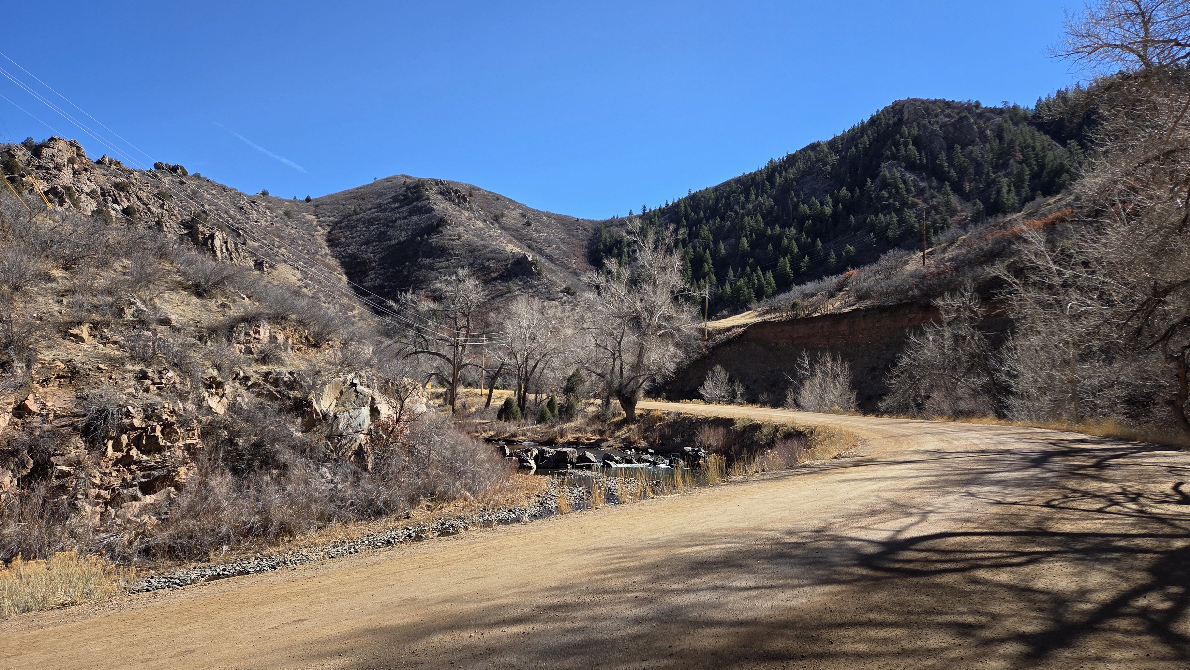
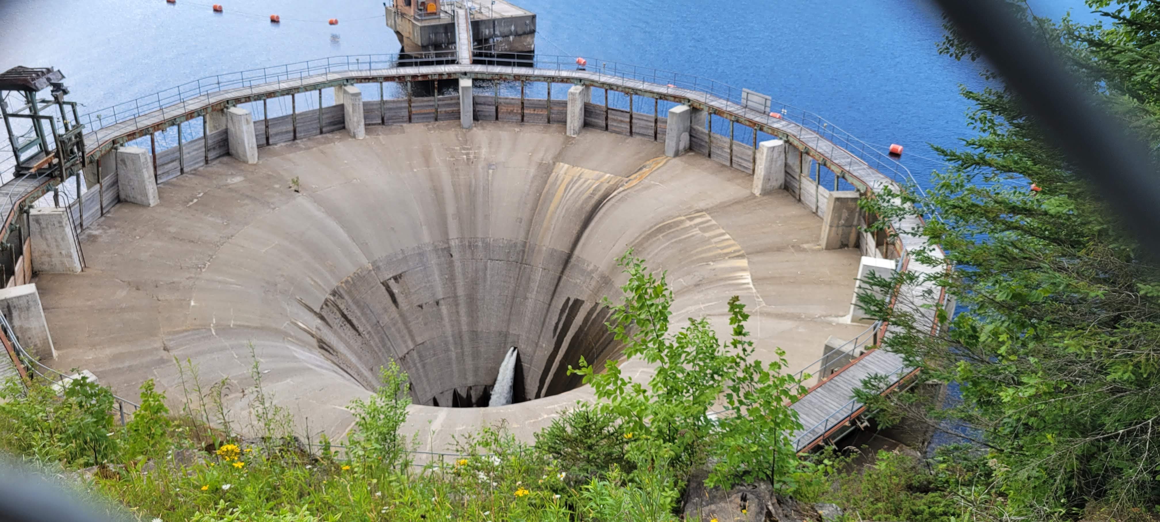
I climbed up the dam, a gentle half-mile at slightly-higher than railroad grades, and crossed the top of the dam. Another thing I didn’t really forget so much as didn’t have to deal with was the wind. You can see a million miles – and the wind will always find you. As I headed southwest, the headwinds and sidewinds prevailed – so I reduced my speed to avoid burning through energy on the flats.
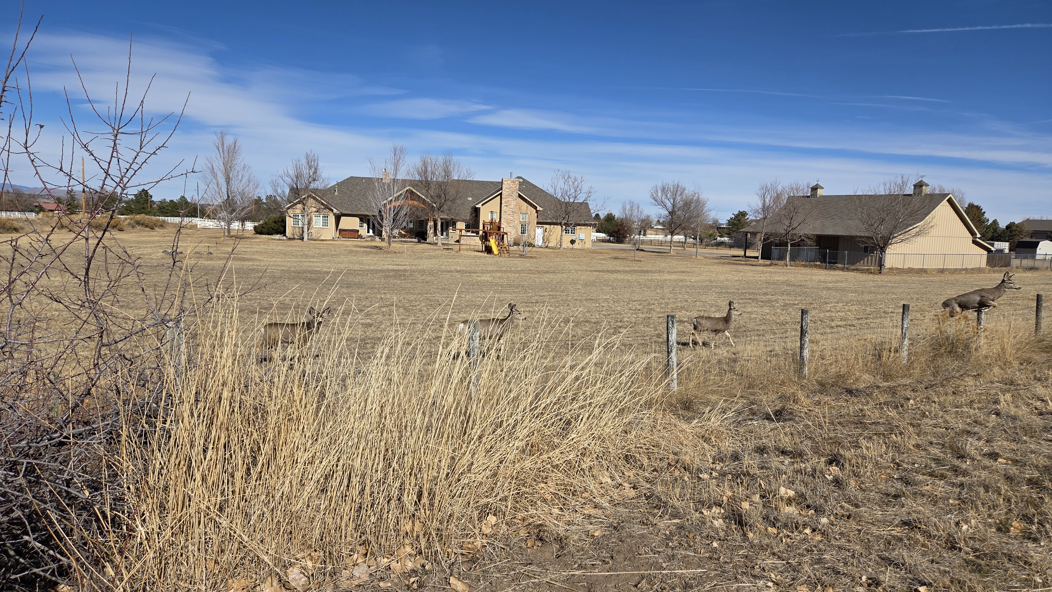
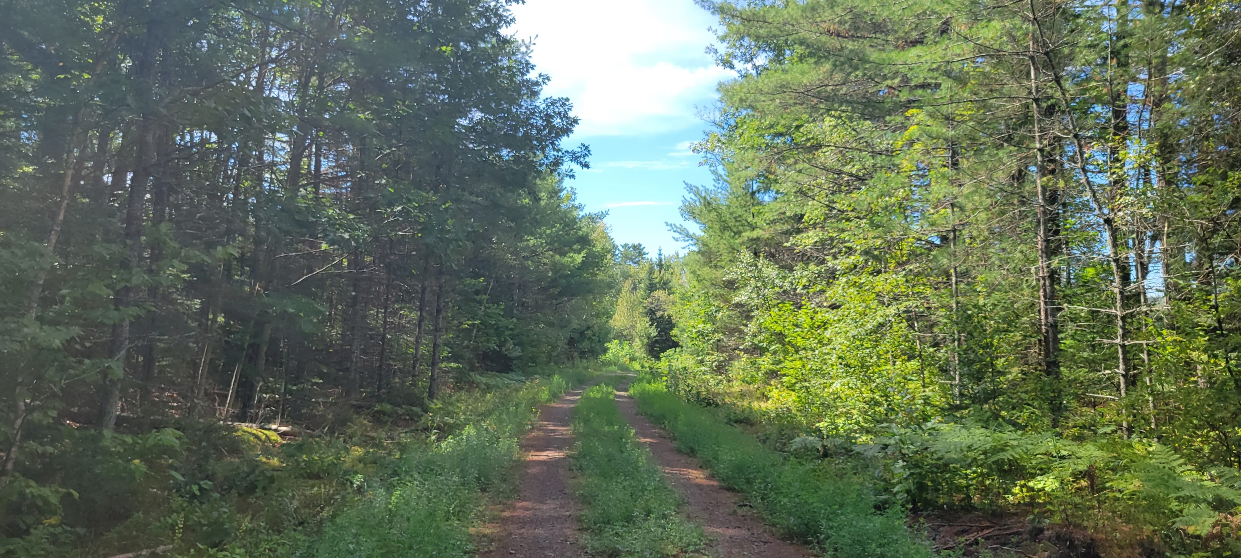
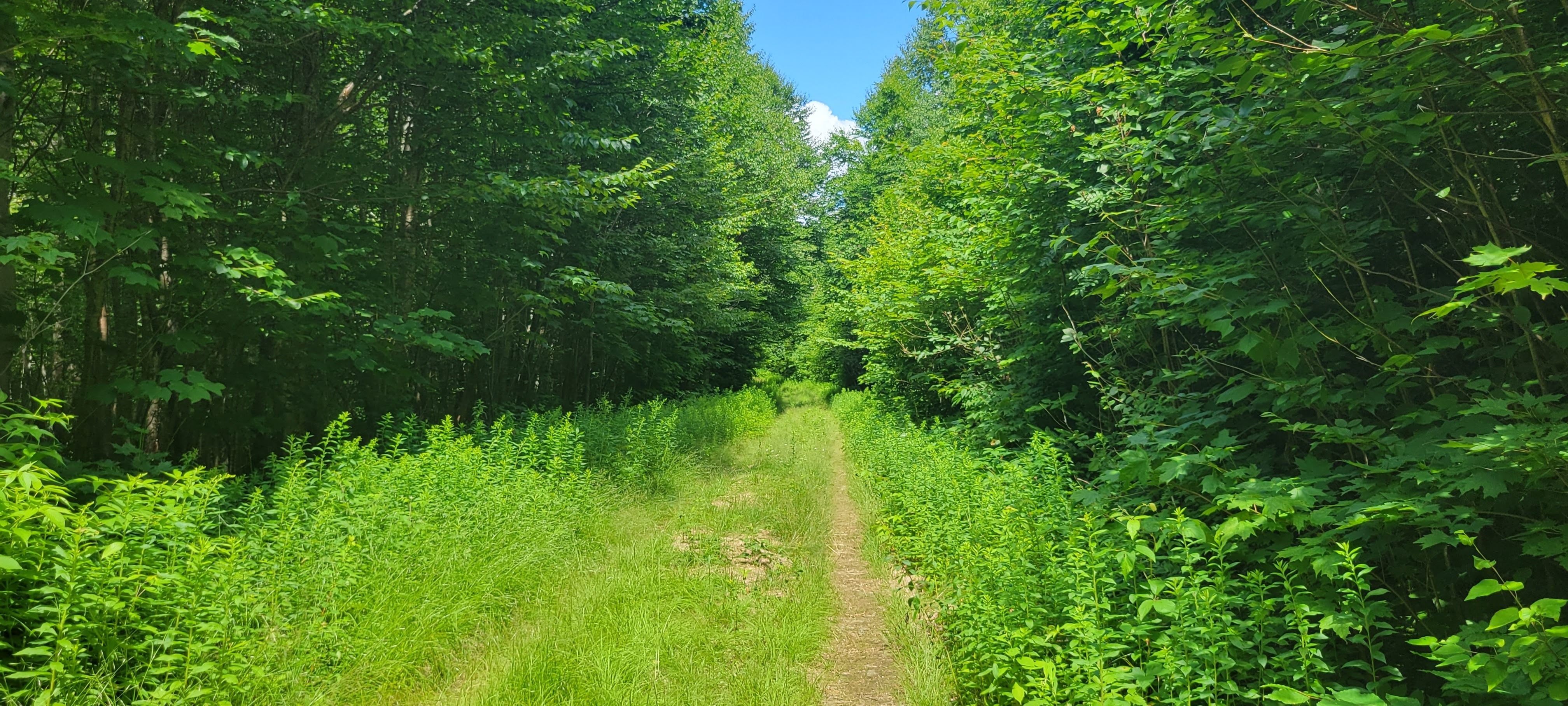
Dropping into the southern trails in Chatfield was a treat. I didn’t see another person for several miles and enjoyed the rustic Western beauty. The route took me southwest onto the High Line Canal trail, winding its way through the plains and into new housing developments south of the park before pushing back into working ranch territory.
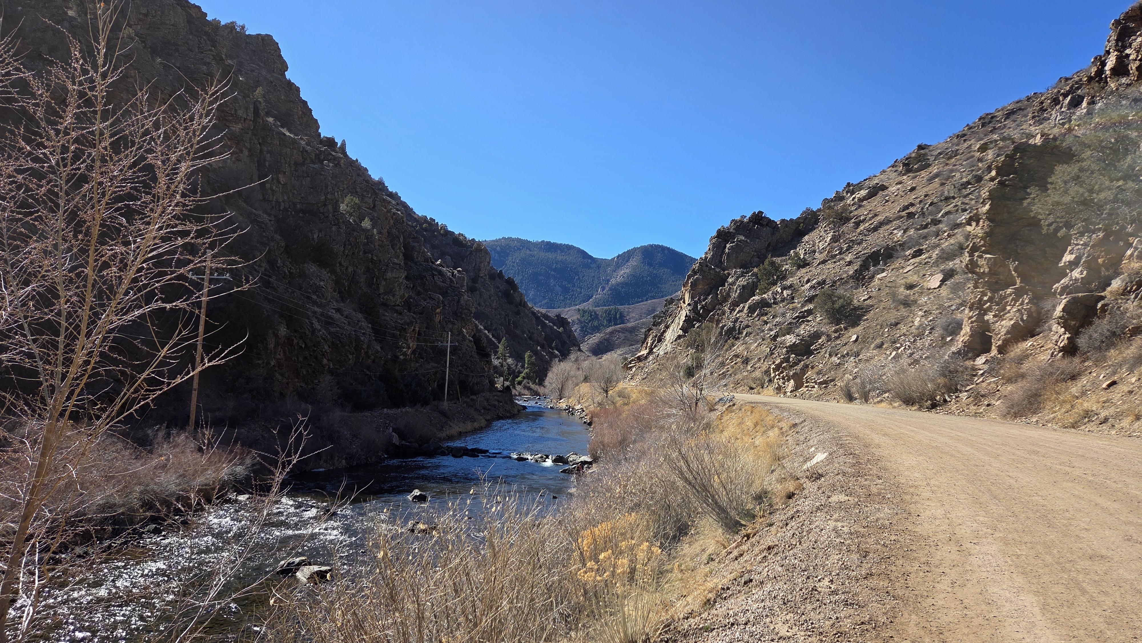
A right turn onto a road led me to the Waterton Canyon trailhead, which was swarming with people of all ages and abilities. Notably no one had their dogs, which is prohibited due to the wildlife in the area. Sadly, I did not see any big horn sheep – but I did see a pack of mule deer!
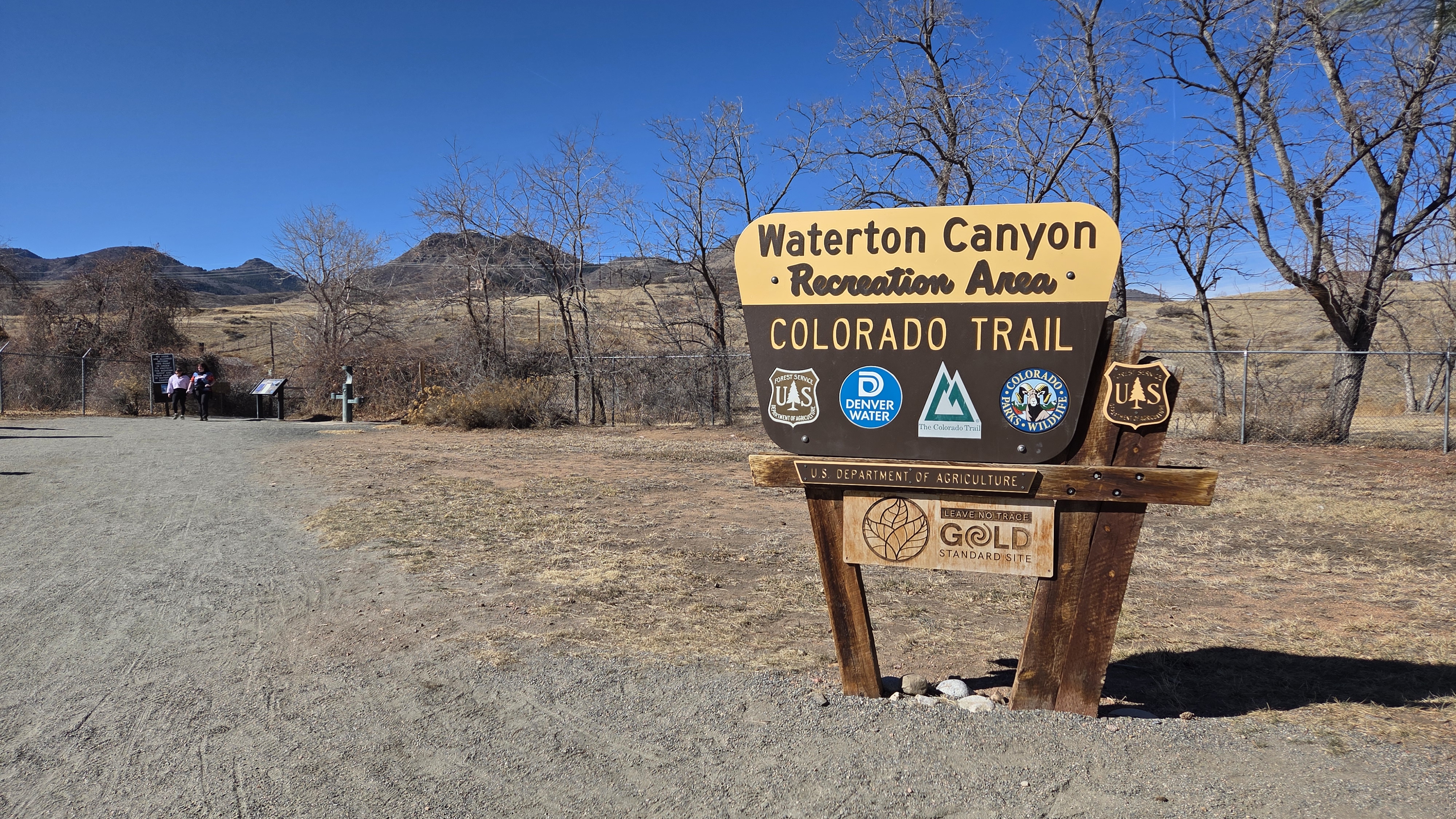
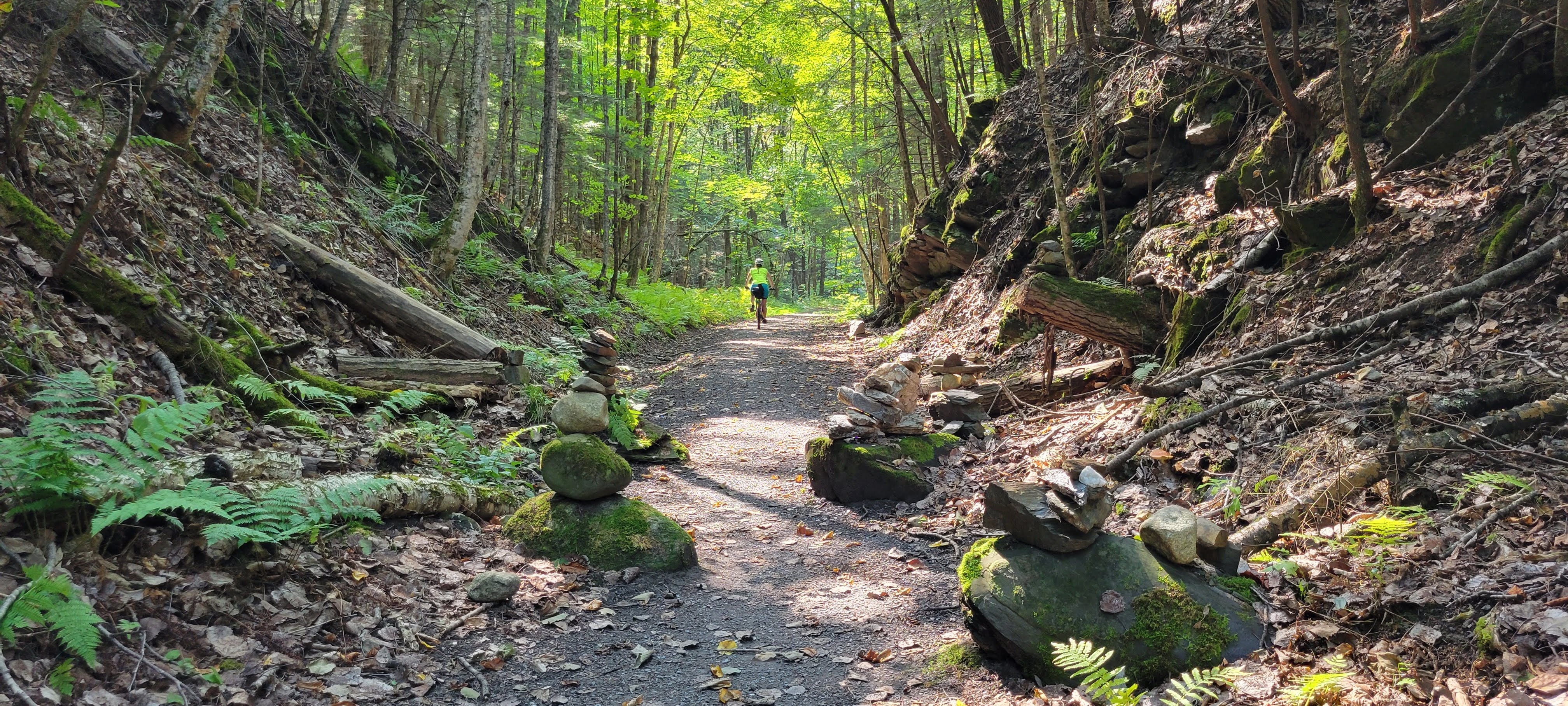
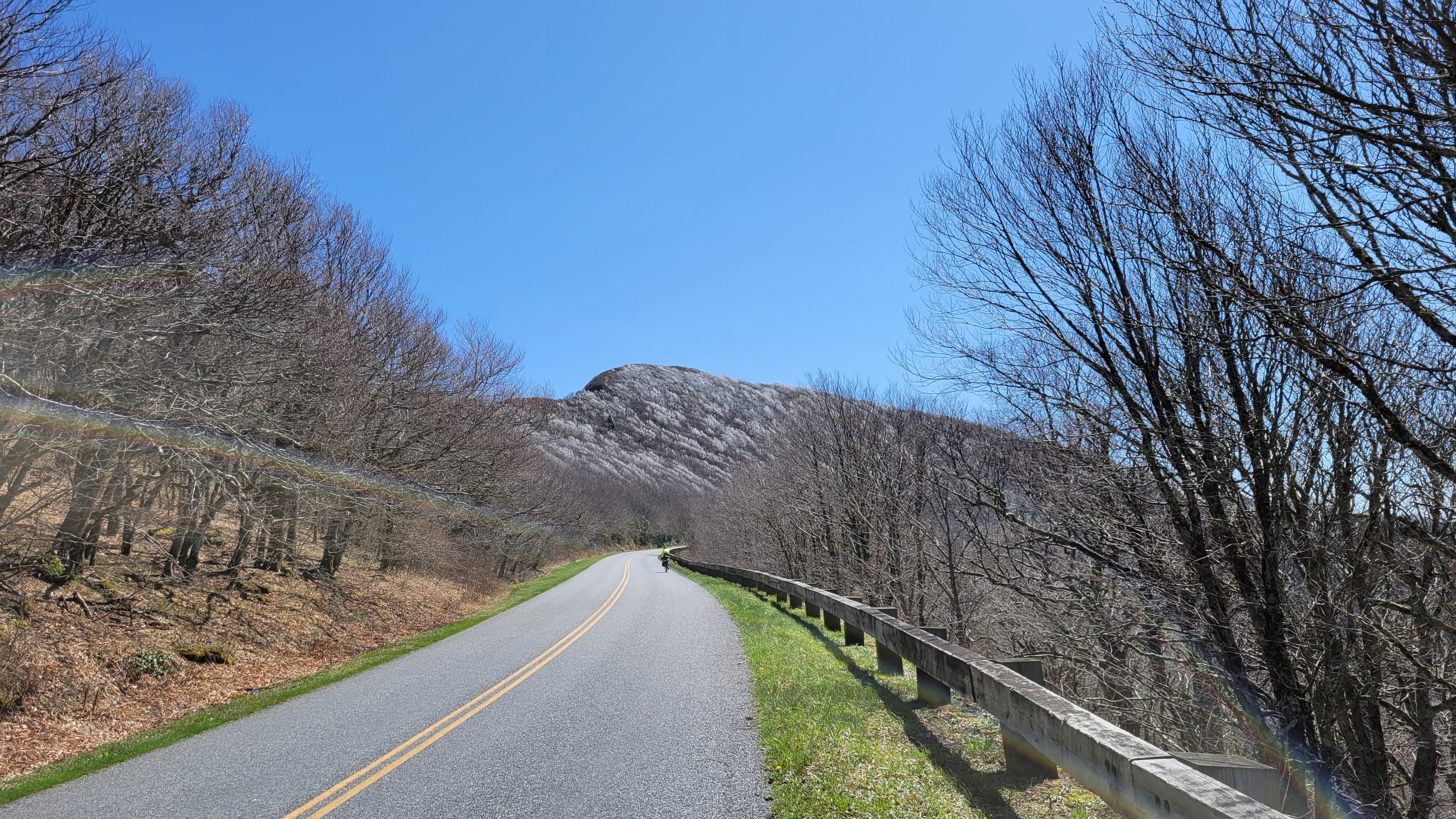
The climb itself is very, very accessible. The lower portions were more heavily trafficked, and the farther up the canyon, the fewer families and more cyclists, hikers, and anglers. 6.5 miles at a steady 1-2% grade on a wide, hardpacked road. Around every corner was another stunning view of the soaring mountains surrounding the valley. There were also plentiful pit toilets, picnic areas, and trash/recycling receptacles. Literally no reason to not Leave No Trace.
why yes, there is ice and snow in the shade
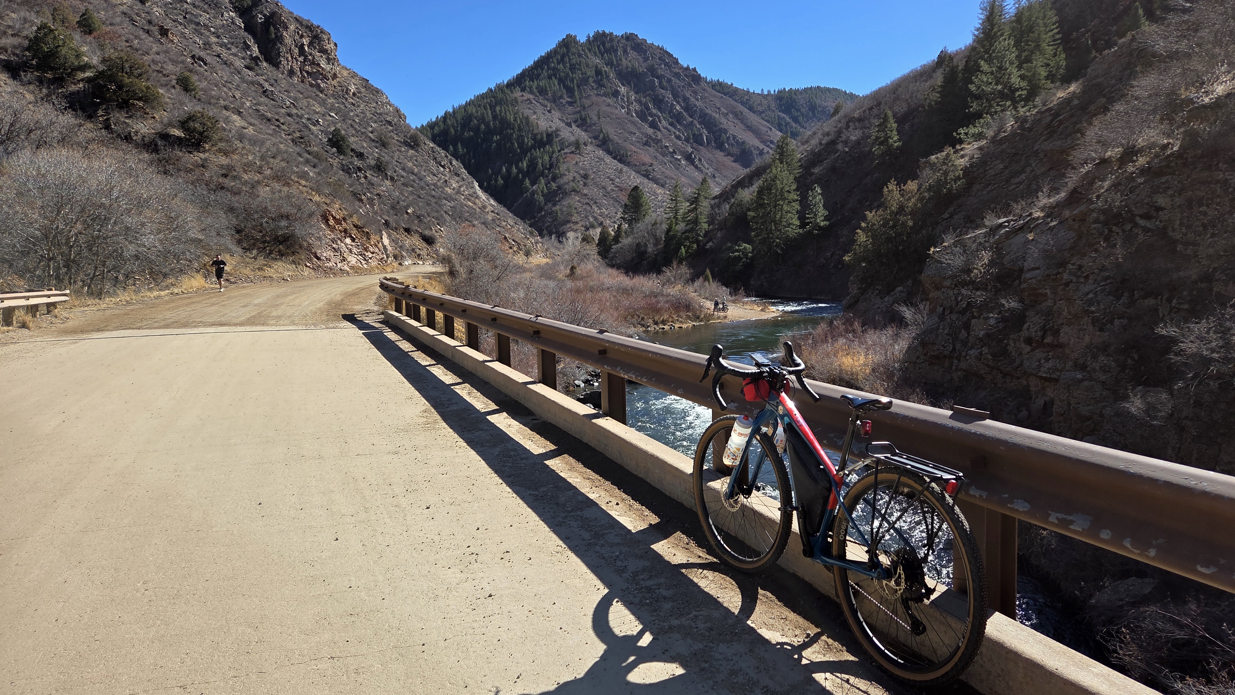
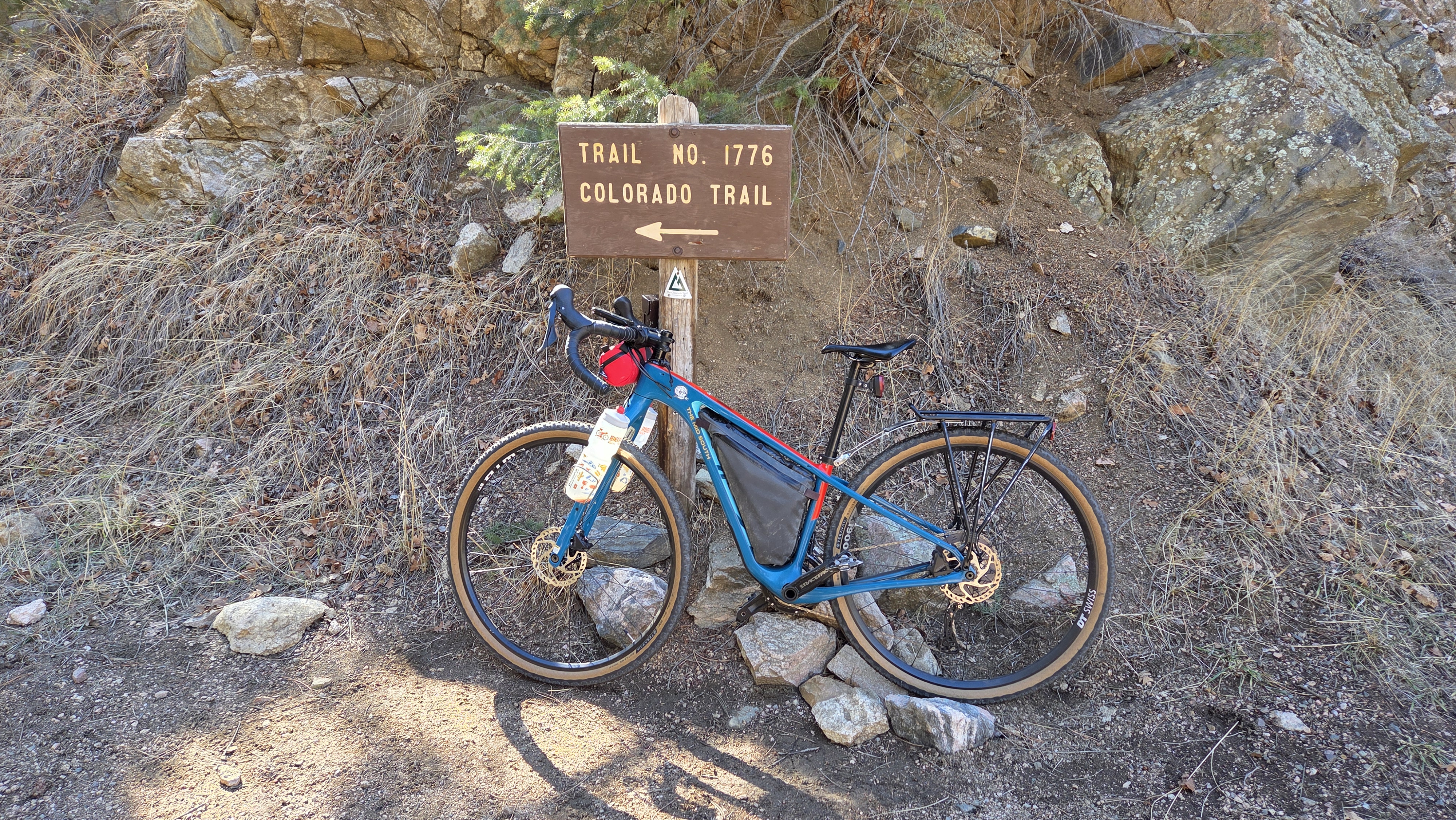
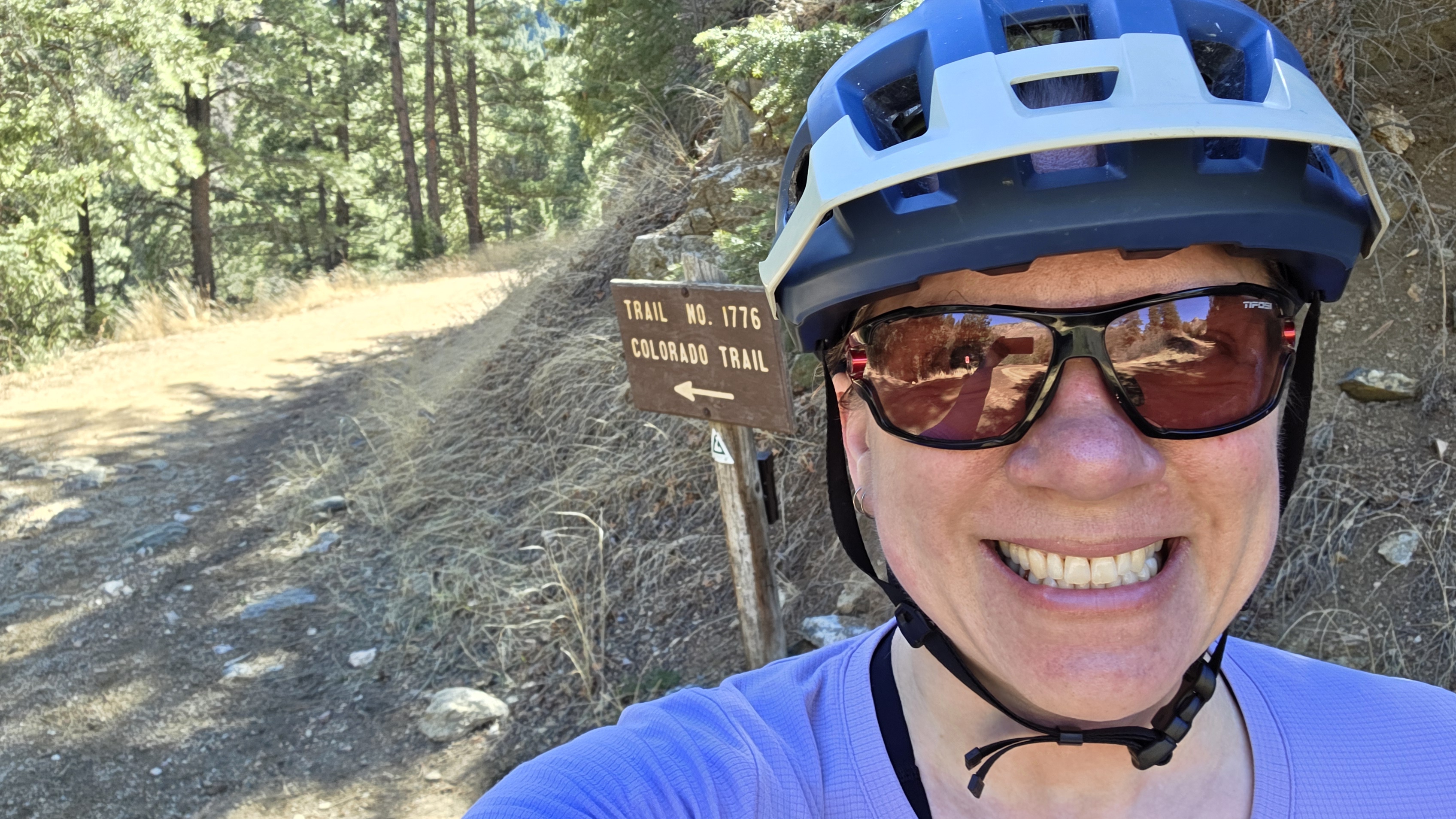
The hardest portion of the canyon is the final 4/10 mile past the dam, which takes you to the Colorado Trail. I took a short break to catch my breath and have a snack before gliding back down the canyon and heading towards home on the western trails in Chatfield. I ended up leap-frogging with a group of groadies (gravel roadies, a term for gravel riders on high-end, aero gravel bikes meant for racing with a background in road racing).
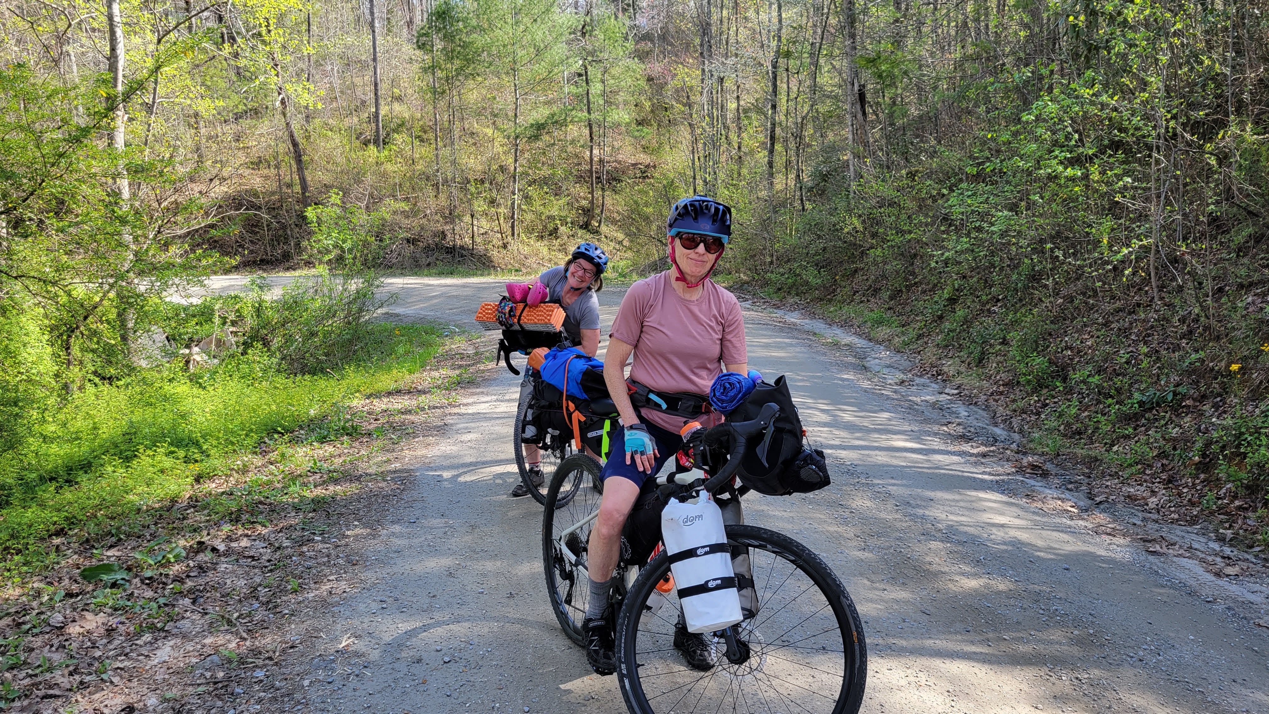
As I descended the Chatfield dam, and noticing all the roadies and groadies, and wondering if I’d find my people. I was on my Cutthroat with my bottle mounted out on the fork – a decidedly Not Aero position for them but highly convenient when bikepacking – just noodling along when I saw …
Tall, thin guy, tattooed arms and legs, old-timey mustache, flared bars … and bottles on the front fork.
My People.
I pedaled the remaining miles up the multi-use trail smiling, feeling seen, and that I will eventually find my people. I’m already in contact with Front Range Overnighters to get more involved in the local bikepacking scene, my goal being to not only figure out bikepacking Out West for myself, but also help lower the barriers of entry for others to try bikepacking.
Thank you to Gravel Bike Adventures for the core route – it was very enjoyable! Looking forward to exploring more of their routes locally.
Along the journey, Jess and I fielded a lot of questions from others on how we got to the place of actually going on the trip came together.
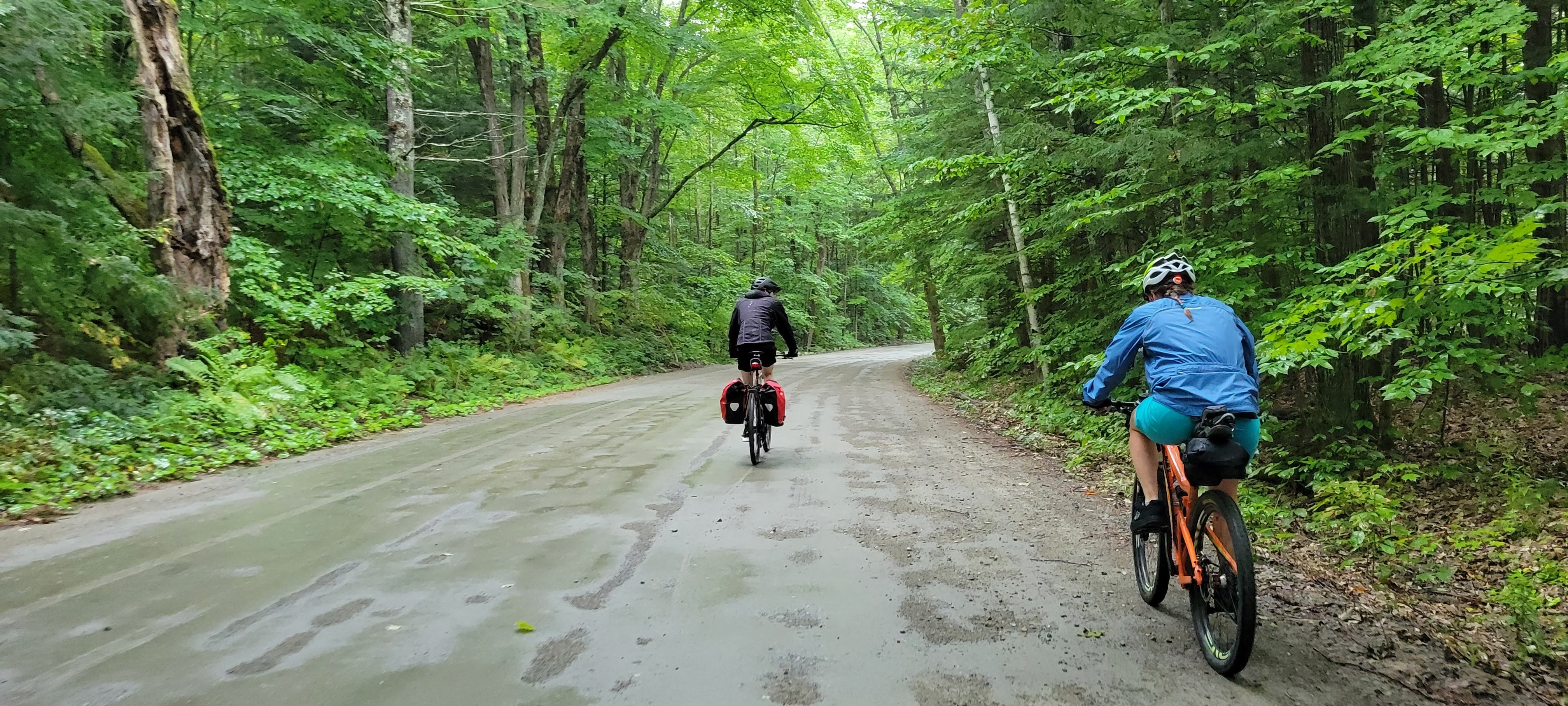
First, no – we aren’t sisters. We were internet friends for a bit because I knew Jess’ husband when we were younger. Our first time meeting was on the Green Mountain Gravel Growler 2021 trip – and it was so much fun. So it felt organic to do another trip together.
Second – it takes a lot of planning to go on an epic journey. This was our first time doing a multi-week bikepacking trip – and our first multi-week trip with camping as the primary lodging accommodation. But camping helps keep the overall costs down (even if we did have to bring all our camping gear as well as our bikes and bags on the plane).
My goal is this post will help others feel confident in planning their next big adventure.
Getting There
We don’t live where we were going to ride, so we weighed the options: drive out or fly out. My drive would have been longer than Jess’ (20 driving hours) – so flying was the obvious choice to minimize the number of days off we needed to take from work.
Most airlines have policies around traveling with Sports Equipment so be sure to check out your airline of choice’s rules. I flew on Delta, which allows bicycles as a checked bag (provided it meets the dimension and weight requirements); Jess flew on Southwest, which features a flat fee for bicycle bags over 51lbs (provided it meets the dimension requirements).
Of particular note is the 50lb weight limit. You might think that since your bike isn’t anywhere close to 50lbs you’d be OK – but the bag itself weighs somewhere around 20lbs. Jess used the Dakine Bike Travel Bag (18lbs) and I used an EVOC Bike Travel Bag (19 lbs). Both are excellent choices for air travel and require only a minimal amount of bike disassembly to pack.
Jess crammed as much as she could into her bike bag because Southwest doesn’t charge for the first two checked bags and has a flat fee for bike bags weighing 51- 100lbs. I incurred Delta’s overweight and checked bag fees because my bag weighed 55lbs, which was due to the inclusion of my bike, 2.2″ tires, rack, 3 water bottles, shoes, and helmet.
We also had to bring all of our gear – not just a change of kit and snacks, but also our camping gear and food. Most camping gear can be put in checked baggage so I stuffed everything into a 7-day suitcase that came in at 43lbs (Jess had a larger carryon sized suitcase for the rest of her gear).
Of note, you cannot bring camp stove fuel or bear spray – even in your checked bags. We purchased these items from an REI in Minnesota and picked them up on the way to Duluth.
Campgrounds, Ferries, and Layovers
It was important to us that we knew where we wanted to try to stay each night before heading out.
August is apparently a heavy tourist time for the Northwoods, so we booked our sites in advance as soon as the ability to book a site came up. Jess started booking campsites in January and didn’t stop until sometime in March when the last few campgrounds opened their booking windows.
The only campground we missed was for the first night in Minnesota (Gooseberry Falls) and the second night in Wisconsin (Two Lakes). The first sold out almost instantly; the latter we didn’t realize we’d booked a campsite at the wrong campground until the night before. Both times it worked out, but to avoid the stress of trying to beat holiday travelers to first come first serve sites (which you very likely will not get, especially on a weekend) – book ahead of time. It also gives you a stopping point to look forward to each day.
It also pays to keep trying, even if the campground is full. The third night in Michigan, we had intended to try to get a spot at a rustic campground that is first come first serve because the state campground we wanted was closed for renovations. However, when we rode by, it was actually open and we had our pick of available sites. The ranger said it was a last-minute decision to reschedule the renovations so the campground was slower than usual.
lake views from our tents
The ferries to and from Isle Royale National Park had a bit of scheduling to maneuver around – but it wasn’t onerous or overly complicated. The ferries don’t run every day from Minnesota but they do from Michigan. For planning we picked a date range and then figured out when the ferries were running based on our planned route and adjusted accordingly. We then reached out to the operators to confirm how to book our bikes for the trip as well and got on their manifests.
We also booked all of our indoor lodging in advance as well. This gave us peace of mind as well as targets to look forward to when setting up camp again. Booking ahead is how we got the cute cabin at the Minnetonka Resort instead of a boring motel room. We also were able to build in an additional layover day between Michigan and Wisconsin that we could use – or not use – as we felt.
Things We Couldn’t Live Without On This Trip
Many people asked us what was the most important thing we brought as well as what did we wish we hadn’t brought or didn’t need.
We tried really hard to think of something we brought that we didn’t need and could have left at home and came up with nothing. Even things we didn’t break out were things that could have been needed (first aid kits, trowels, water filters and Aquatabs).
We agreed the number one best thing we brought was theGarmin Messenger satellite tracking device. Our families back home felt at ease being able to track our location and communicate via text, even without cell service.It’s small (3″ x 2″) and light (4oz), making it easy to find a home for on our bikes (I stashed it in one of my handlebar-mounted Mountain Feed Bag mesh side pockets). The Messenger has flexible monthly plans, so you aren’t paying for service when you aren’t using the device. I chose to pay for Search & Rescue insurance to offset S&R costs should that be a necessary action.
Another item that some may think is frivolous, but we found this item to be worth its (less than 2lbs) weight: backpacking chairs. Jess had an REI Flexlite chair; I had a Helinox Ground chair. We had these chairs out at almost every campsite – to relax, to eat dinner or breakfast, or just stare out across the lake.
With a few days and nights of rain, it was important to know if our gear was waterproof or water-resistant. Jess had awesome panniers with so many exterior mesh pockets – she was able to carry a lot more on-the-fly items than I was. But they were water-resistant, which meant additional packing of key items into waterproof containers (ZipLocks, drybags, etc). I had my Ortlieb front rollers (12L each), which are waterproof, but also had to have an extra-large Sea to Summit eVent compression bag (waterproof) to house my soft goods that needed to stay dry.
We also brought a spare small drybag to use as a pack-out container. We also brought a roll of small compostable garbage bags to use at camp and then packed the garbage bags into the drybag, attaching it to the rear rack until we found a garbage bin.
Oh – and camp toilet paper. We had a few campgrounds where the vault toilet did not feature toilet paper. Having our own was clutch.
Finally – skin care. Yes, that sounds super Extra – but the reality is, if we didn’t care for our faces, the trip would have been miserable. Between heat rash and cystic acne, it’s easier to bring witch hazel and facial cleanser wipes than it is to deal with the aftermath of not taking care of our skin. This is in addition to the body wipes and chamois creams we brought. And sunscreen and bug spray.
Jess also brought her Kindle and probably would say that was a super solid choice to bring.
Fueling Strategies
An epic adventure is not the place to underfuel. Both Jess and I worked with registered dieticians to dial in a framework for how to fuel day after day. We didn’t have “numbers to hit” but discussed real foods that support adequate protein, fat, and carbohydrate needs above and beyond everyday nutrition. It doesn’t have to be perfect – but you do need to eat consistently to ensure your body has enough fuel to cover the last hour or so of the journey.
We started our first sports nutrition bar within 60-90 min after starting the day and stopping every 5-10 miles to eat and drink. Lunch was planned for just after the half-way mark.
It’s also important to know your body’s signals that it needs more or is getting enough. The second day in Wisconsin I started out a bit too fast and by lunch, I knew I wasn’t eating enough of what my body needed. When we got to camp, I set everything up and then relaxed while eating salted nuts and Skittles until dinner, which was the highest-calorie meal in my bag. After dinner I felt much better and was able to get a good night’s sleep for the next day’s ride.
Part of our planning was to assess how many nights we would have access to services in a town vs where we would need to have everything we needed at camp (and for how long).
Breakfast consisted mostly of oatmeal, trail mix, and nut butters. I went a little bougie and brought a small can of Starbucks Premium Instant Coffee. This was a brilliant selection as we both had ample coffee for the entire trip. I prefer sugar and cream in my coffee so I packed sugar packets and non-dairy creamer packets into a tiny ziplock with a 1 tsp measuring spoon.
Lunch was often on the side of the road and more often than not, we ate Bumblebee Snack on the Run! Chicken Salad kits and supplemented with chips, sports nutrition bars, and caffeinated beverages (Cokes, Red Bull). The kits were super lightweight, easy to eat on the side of the road, shelf-stable, and delicious.
lunch almost every day – we packed out the trash in the small green bag
Other options were typical gas station fare – hard-boiled eggs, cheese sticks, salty potato chips, full sugar ice teas, peanut butter sandwich crackers, trailmiz bars, granola bars, Skittles and Snickers bars. And pickles.
Dinners were dehydrated backpacking meals. The ease of just needing to boil water to have a satisfying meal at the end of the day is most welcome after a long day. There are a lot of brands out there, but we used Packit Gourmet, Wild Zora, Farm to Summit, and Good To Go with the last four days being Mountain House Adventure Meals (as this is what is available at Walmart). We carried 6 dinners to get us through the first 8 days of riding as we knew 2 of those days could be a restaurant meal.
100%, Jess and I did not jump into this trip without building up our fitness and capacity for multiple days of riding with a full load. Even with being careful in what we brought (and I’m sure many ultralight bikepackers would be appalled at the amount of stuff we brought), we had about 40 pounds of gear and supplies loaded to our bikes every day.
Most of our training consisted of just riding – getting out as often as possible.
After Mid South, I put my smart trainer in a closet and forgot about it for a few months. I focused on riding for fun with friends and not worrying too much about speed or power. It was everything I needed it to be. But come June, I knew I needed to start working on building real capacity and pulled the smart trainer back out.
I set up my Trainer Road training plan for a stage race, because Riding Consecutive Days. I didn’t follow it as strictly as I had for Mid South as I could still get out at least one day on the weekend – but this summer has been pretty wet and it was nice to have an indoor option instead of forcing myself into the rain.
I’m sure some would say I needed to train for riding in the rain, but I’ve done enough of that, thanks.
I also put my 2.2″ tires on my Cutthroat so I could get accustomed to riding them. They always feel so plush until the road tips upward – then it’s just extra rubber to push. But I quickly became acclimated to the extra effort and saw an increase in my FTP when I tested it – so it must have helped
Jess did outdoor rides, loaded, that would simulate our longest days. That was an excellent idea as well.
Mental Preparation
The last topic is mentally preparing for the journey. Not just in planning optimally, but also considering back up plans and alternate routes (and when you would have to make a decision about said alternate route). Having this in your back pocket makes heading out easier because you know you have options.
I’ll be honest that when I thought about the entire trip, I would have a mini panic attack. what are we thinking? can we even do this? But when we thought or talked about a section – one state, one day – we felt calm and confident in our planning.
The takeaway here is – break your big trip into smaller, manageable sections. Think about each section when you are experiencing it. Don’t worry about the next section – you just need to get to the next campsite to be successful.
Once we were on Isle Royale, the trip didn’t feel so big and we could think about more than just the next day in front of us. We had just completed 1/3 of the trip!
We also started thinking in terms of how many more nights of camping in that state to mark passage of time. The longer we were out, the less relevant the day of the week or day of the month it was – especially since we had prebooked all our accommodations. The only times we saw others was either in town or on weekends (lots of ATVers enjoying the trails).
Final Thoughts
With exactly one multi-week adventure under our belts, I feel more confident in planning other multi-day/week trips – and confident that with the right planning and training, these types of trips are accessible to those willing to put in the effort. I’m sure over time we will refine and dial in the stuff we bring (or not bring) and maybe even experiment with not pre-booking our sites to have more flexibility – but at this point, that’s the level of planning we feel comfortable with.
I’m already starting to think about what amazing adventures 2024 will hold.
Last summer, my girlfriends and I set out to end-to-end-to-end the Cross New Hampshire Adventure Trail (XNHAT), adding in a loop into White Mountains National Forest. We ended up cutting the trip short due to inclement weather but the stunning scenery and ample off-road riding opportunity made the route a group favorite.
My friends gently tease me that I’m a Finisher or Completionist … that I like to Do The Whole Thing when it comes to adventure (which, 100% Facts). I’ve been trying to figure out how to end-to-end the XNHAT all year (without having to ride the route in both directions just to get back to my car).
PROLOGUE
Logistics are always the hardest part.
I realized I could extend the trip and ride my bike across Vermont too. Figured 3-4 days to do both, could camp or book rooms depending on the weather and if I could get anyone to go with me. (Spoilers, I’m learning people are more likely to adventure with me when I say I booked lodging for the trip)
GAME ON …. if I can figure out how to get to the start. Originally planned to take Amtrak from NY to Portland, ME and then …. figure out how to get to Bethel, ME, about 65 miles away. A solid day on the bike, or an expensive Uber ride. Amtrak has a train that runs from Burlington, VT to NY so I was set there.
I was talking to my oldest (adult) kid in Philly, and they decided that sounded like a super fun trip to do together. Later, I was telling my sisters and one of them decided this was going to be her birthday present to herself – fly out to Vermont and ride bikes with her big sister and oldest nibling.
SCORE. the Squad has been assembled. The plan has been created. It’s GO TIME.
But wait, Laura … what about transportation because this is a one-way trip?
So glad you asked. We originally booked a pickup from Maura: At Your Service. Maura provides transportation services predominately in the Presidental Range area, but will also do pick-ups in Burlington (among other locations). I scheduled with her almost a month in advance, as we were planning to need the ride right before Labor Day Weekend and I didn’t want to scramble for such a long ride (Bethel, ME is about 3+ hours from Burlington, VT). Unfortunately, the week before she had to cancel but provided contact information for two other ride services (Priority Transportation and Trail Angels Hiker Services) that may be able to take our (very long) journey.
Dan at Trail Angels was available and a fantastic driver. All three services were wonderful to speak with; definitely recommend reaching out to them for long or short shuttle needs.
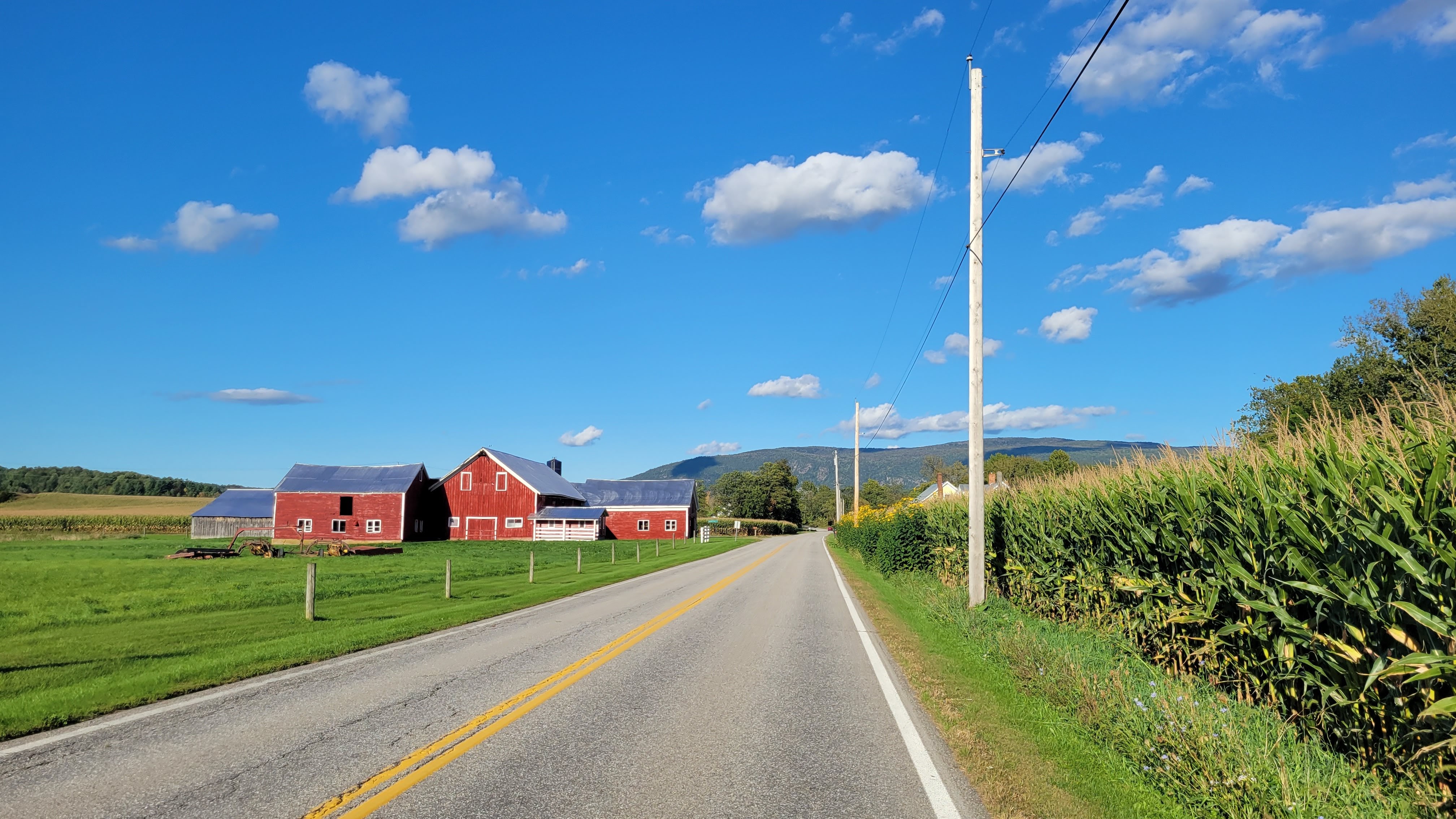
Day One Bethel, ME – Whitefield, NH 52 miles, 2,390′ climbing
Setting out under sunny skies and virtually no humidity, we rode into the town center for breakfast only to find the diner packed and a sign on the door indicating they were short-staffed and patience was requested. So we hit up the Walgreens next door for breakfast-y foods, ate in the parking lot, and wandered over to the paved bike path to begin the journey. The bike path had painted games for kids, including fun options for those with mobility chairs, which was super cool to see.
The first 13ish miles are a lovely paved backroad that runs along the Androscroggin River.
North Rd in Maine
There wasn’t a sign when we crossed into New Hampshire, but we found the stone marker that denotes when you’ve crossed state lines.
Crossing from Maine to New Hampshire
North Road continued for a bit until we turned right onto Hogan Road, a true gem of the route.
quick water break
Lunch in Gorham for delicious sandwiches and salads followed by coffee and ginger molasses cookies at the cafe bookstore. We still have another 25ish miles to go before we can stop, so we shove everything into our bags and get back to riding.
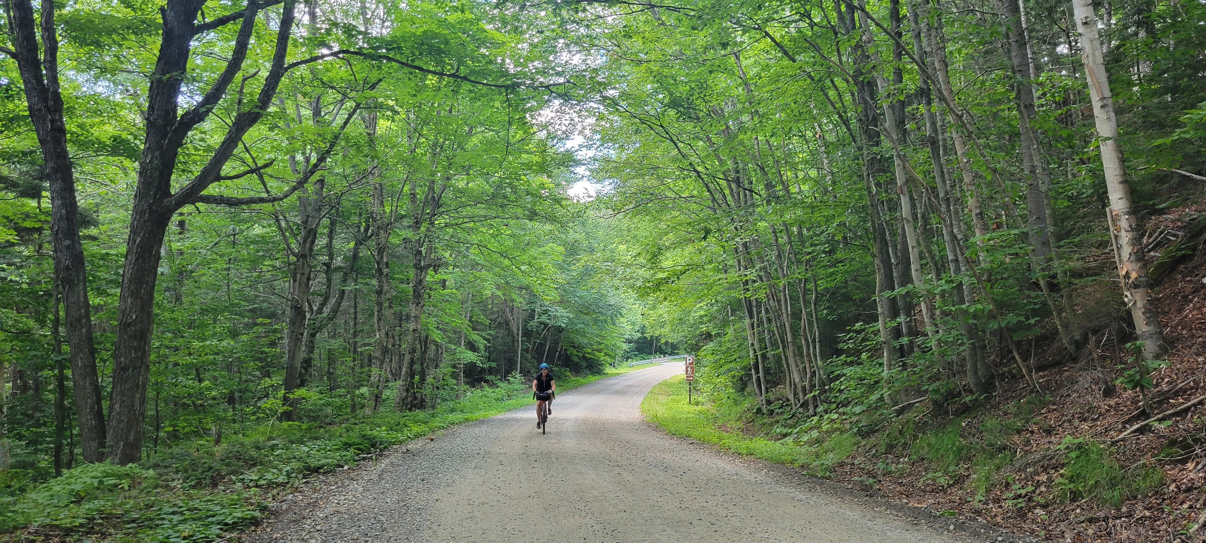
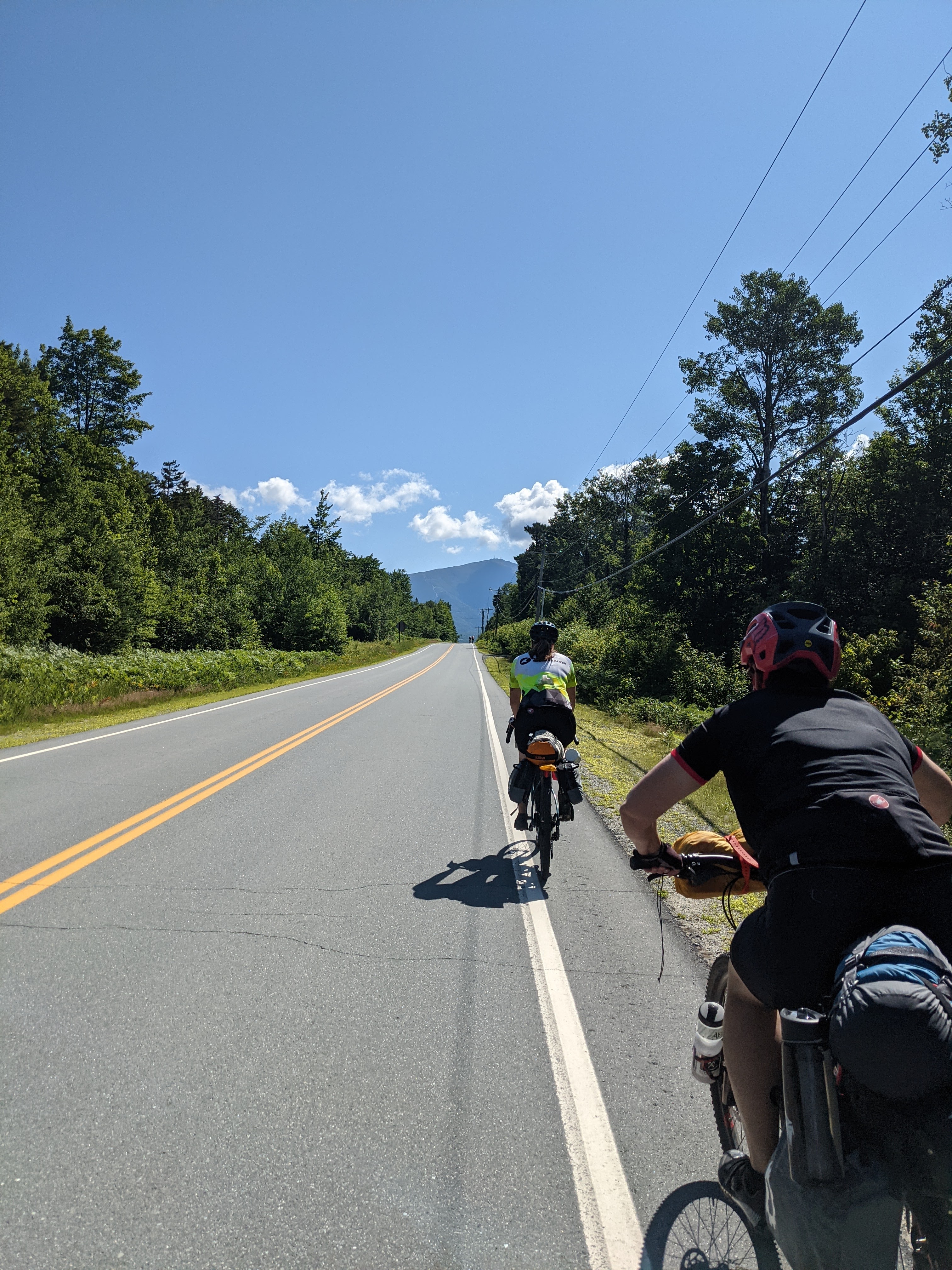
The Presidential Rail Trail alternates between crushed stone, rustic double-track, and mowed grass. The trail gently ascends from Gorham for about 10 miles before tipping down towards Whitefield. The gravity assist is most welcomed, as was the beautiful views of the Presidential Range from the trail.
if you are heading westbound, make sure you turn around every once in a while
The trail ends at the Mount Washington Regional Airport – from there it was a short ride to our room for the night.
Day TWO Whitefield, NH – Woodsville, NH 32 miles, 677′ climbing
Short day means more time. We decided on a late start and to relax at lunch. The first 7 miles out of Whitefield aren’t super fun – NH 116 is a paved highway with a nice wide shoulder, but logging trucks passing at 55 mph can be unnerving. There was a new section of rail trail going into Littleton, so we detoured off the highway and enjoyed 4.5 miles of scenic gravel doubletrack along a winding stream.
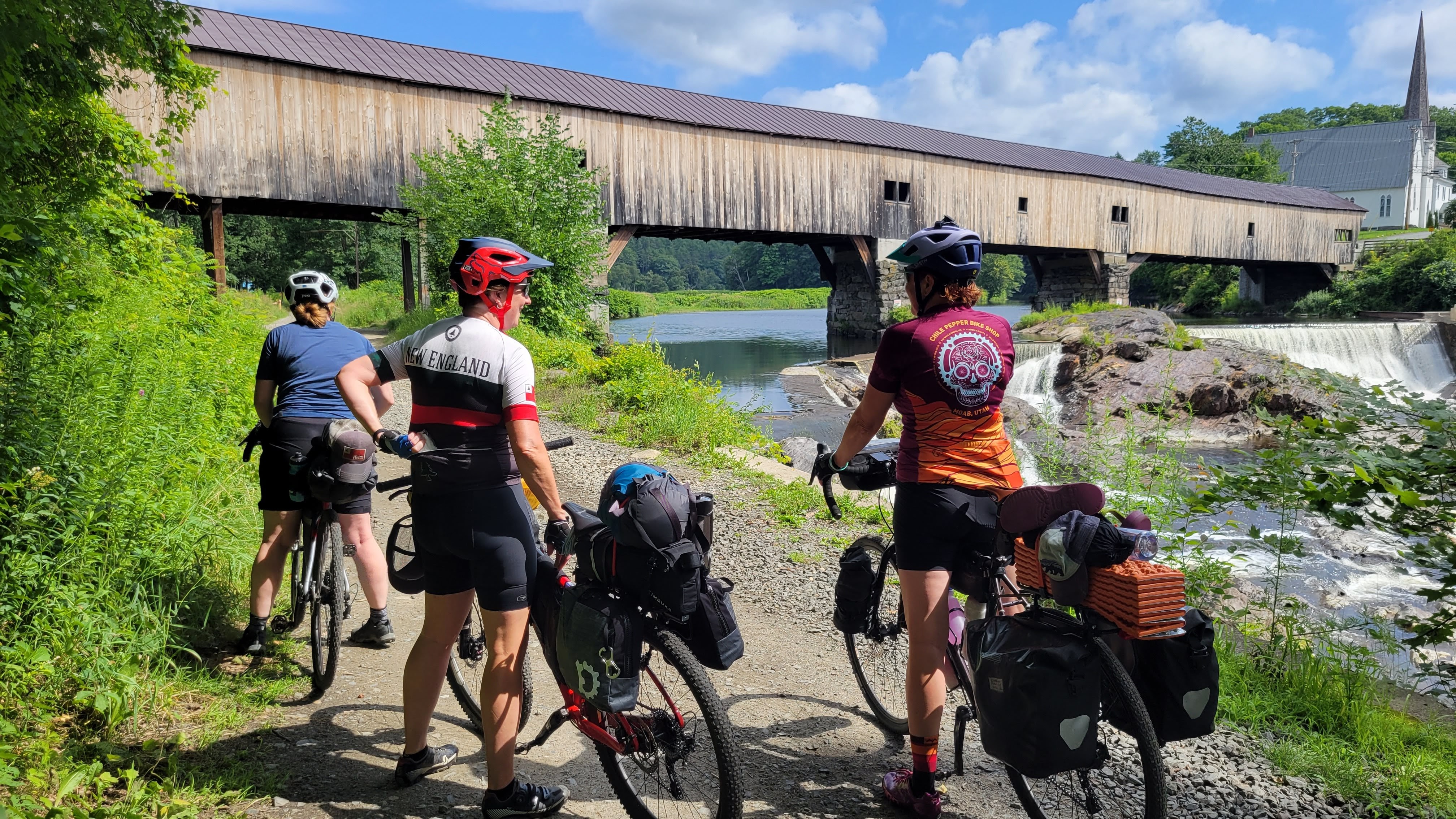
After a leisurely lunch on a patio, we continued down the trail. It’s all downhill to Woodsville, so we cruise through the rest of the trail. The trail here had a significantly higher number of ORV and ATV riders that were 100% courteous – but it was so dry that we were choking on dust after they passed. We stopped briefly at the Bath Covered Bridge before continuing on.
We arrived at our next room for the night with plenty of time to get cleaned up and walk to dinner. Walking after a day of pedaling feels nice.
But more importantly, we did it! We finished the Cross New Hampshire Adventure Trail!
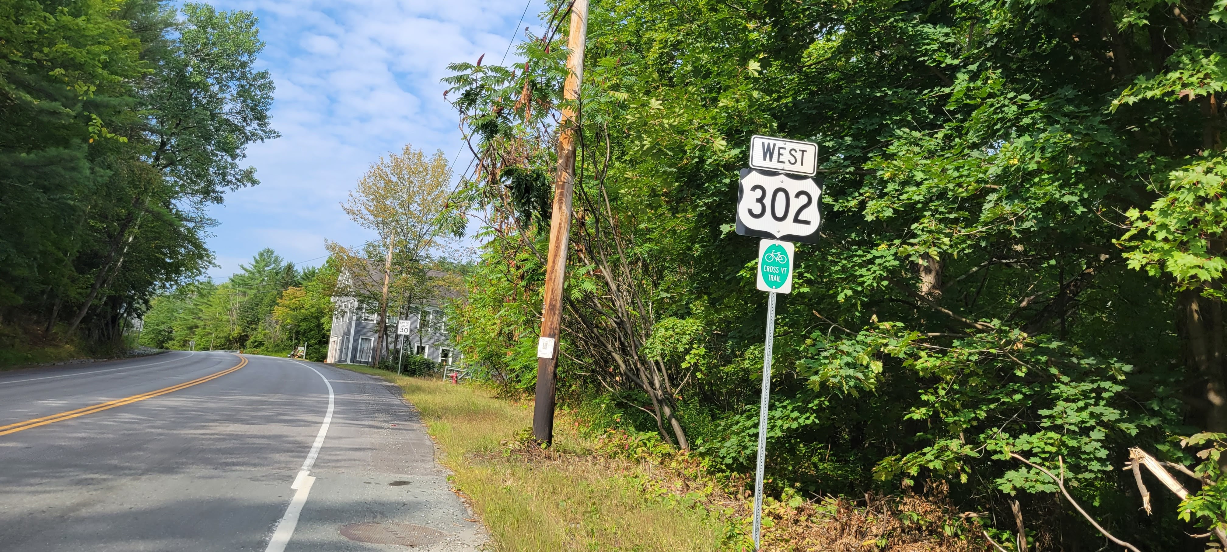
day THREE Woodsville, NH – Montpelier, VT 44 miles, 1,835′ climbing
The previous two days had been sunny with minimal to no detectable humidity, but day 3 was definitely muggy. We had a huge breakfast, filled up our water bottles, and headed out to tackle Vermont.
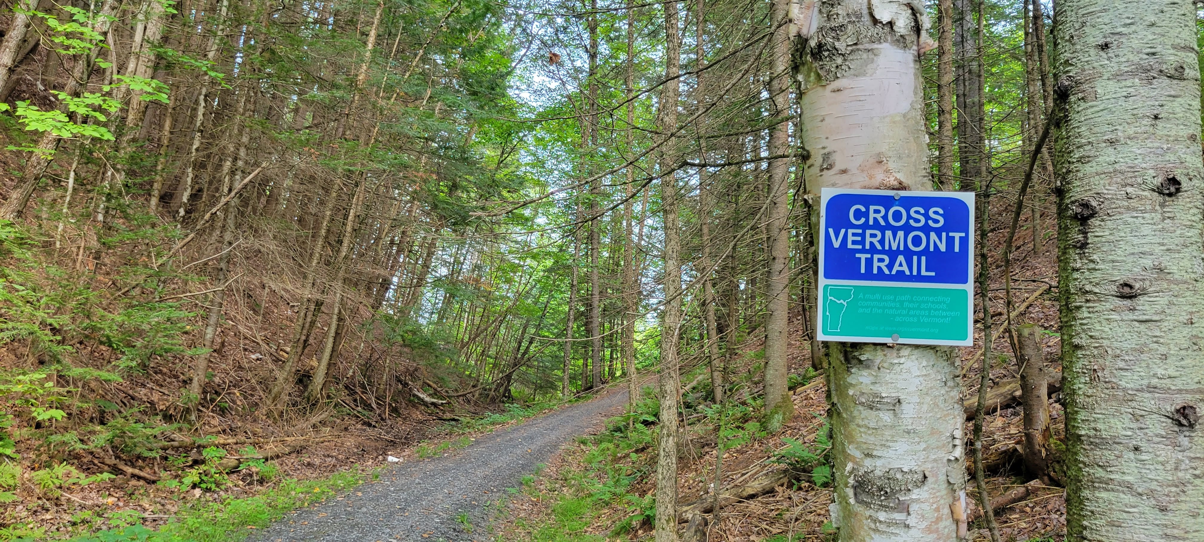
The Cross Vermont Trail is still very much in process of creating a contiguous off-road experience, in stark contrast to the Cross New Hampshire Trail which is mostly on snowmobile and ORV/ATV trails. It’s advisable to be comfortable riding on the road with cars.
It’s a short downhill to the river and then it’s back up again for a bit.
Starting the Cross Vermont Trail
It wasn’t very long before we detoured onto our first off-road segment.
yaaassssssss
From here we bounced between gorgeous forest trails and state highways to get to the next trail.
Brown Drive was a lovely dirt road that leads to the Pine Mountain Wildlife Management Area, which was amazing. A fellow bikepacker passed us while we took a short break, the first bike traveler we’d seen on the trip.
so peaceful
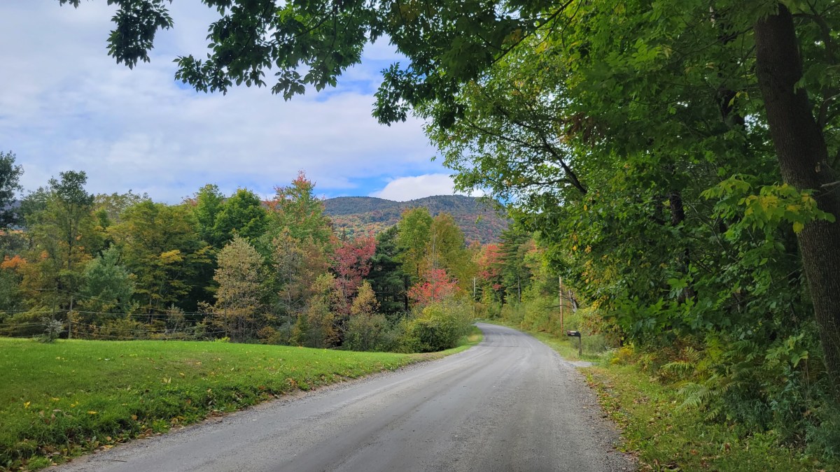
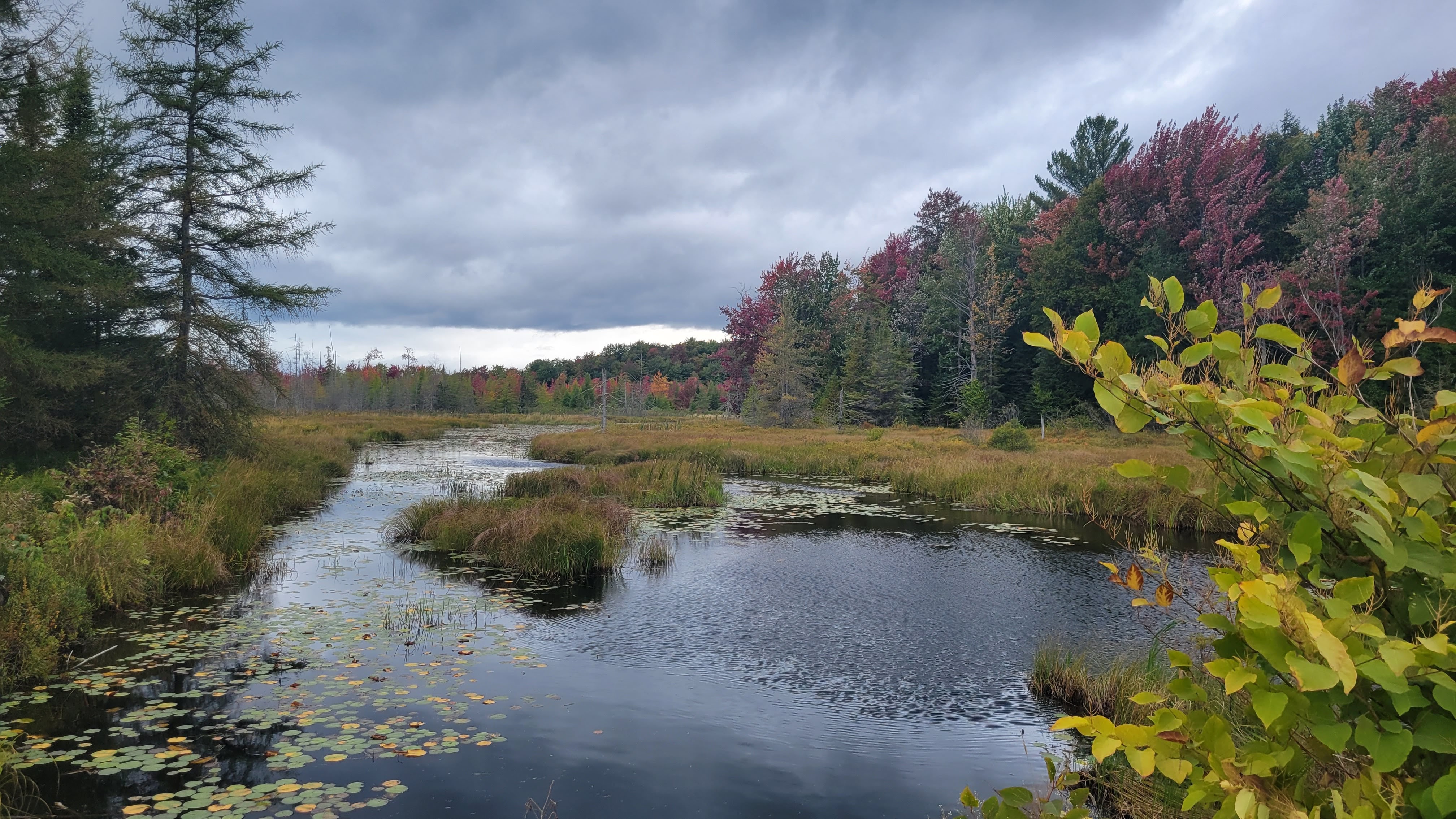
I am truly going to run out of synonyms for gorgeous on this section of the Cross Vermont Trail because it’s RIDICULOUS how stunning Vermont is.
And then we entered Groton State Forest. What a treat!! We refilled our bottles in the campground and enjoyed the gentle ascent to Mashfield.
At lunch, we saw the bikepacker who passed us previously. Ryan had started in Portland, ME a few days prior and was hoping to ride across the northern parts of the country, eventually getting to Washington State. It was cool to chat with someone else on an adventure and we wished each other safe travels as we departed.
The next several miles are on US Route 2, which had minimal shoulder and a 55 mph speed limit. My sister, kid, and I rode as a group to keep ourselves visible until we could get to the next side street.
quintessential Vermont
The next side street had the Big Hill of the day but put us on the most magical 2 mile trail through the woods near East Montpelier.
seriously, this was the gem of Vermont
More time on US 2 into Montpelier before hopping on the town trail and getting to our next lodging and dinner. Montpelier is one of my Top 10 Vermont Towns I Love, in no small way because it was the first place I visited to ride a gravel event (shout out to the Muddy Onion Gravel Grinder!)
DAY FOUR Montpelier, VT – BURLINGTON, VT 48 MILES, 1,952′ CLIMBING
Our last day of adventure brought much colder weather and rain. We picked up breakfast sandwiches to go in town and hit the road while the rain was still a light mist/drizzle.
We pulled over in Waterbury to eat our still-slightly-warm sandwiches before embarking on a long stretch on River Road.
This is where the rain came down in earnest. There is no redeeming value in riding your bike in the rain, it just sucks. Each mile just gets you colder and wetter, and you don’t want to stop and enjoy the surroundings because you’re cold and wet and just want it to end.
We pulled over in the parking lot of a brewery that we thought was closed, but upon seeing people go in, we sought a brief refuge of appetizers and hot tea (and a beer because, brewery). The rain ends and we embark on the last few miles into Burlington.
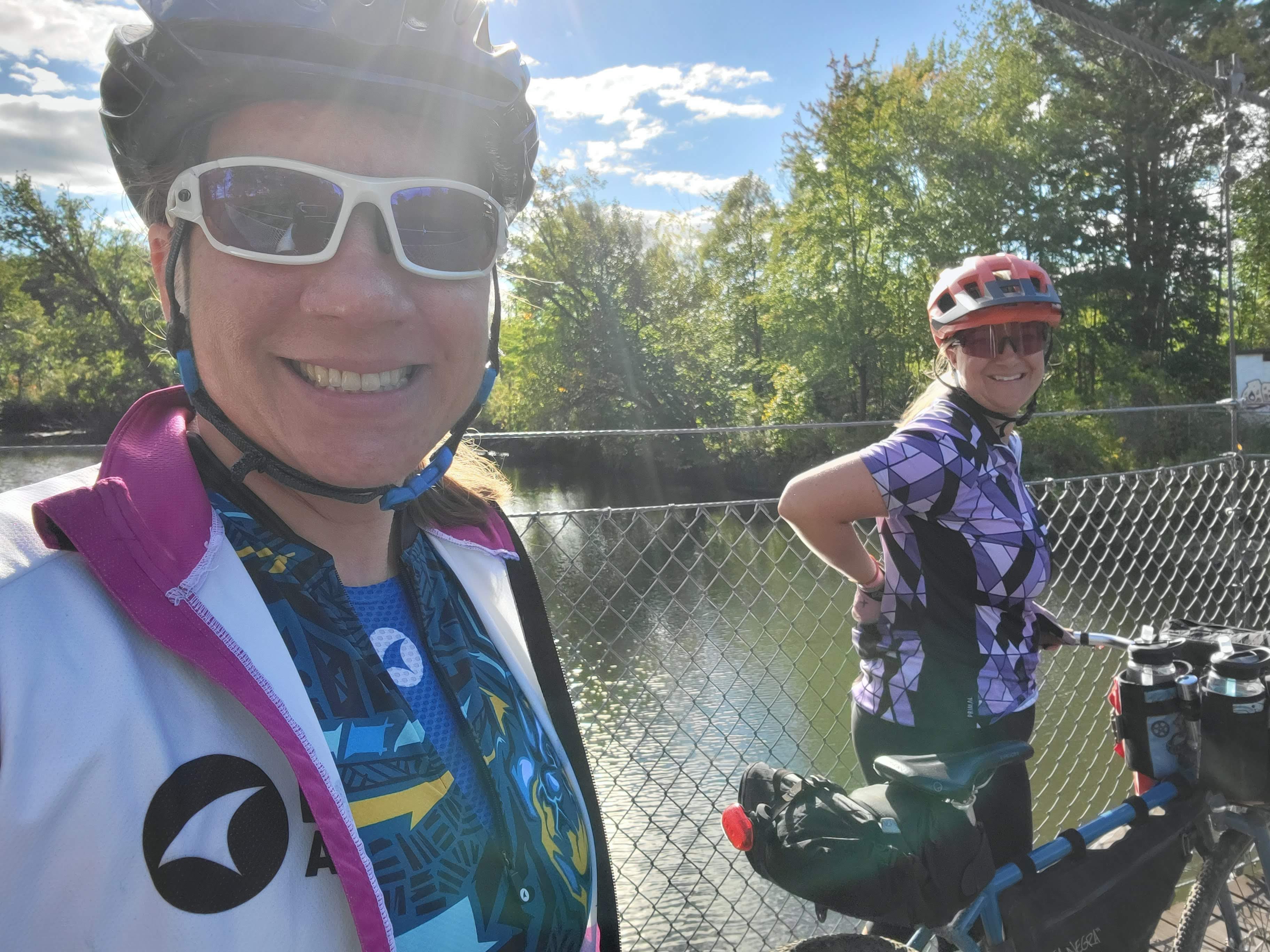
Arriving at the Burlington Bike Path, we took a quick celebratory photo before riding to our hotel room to clean up and get one last dinner together. My sister’s flight home was suuuuper early the next day.
EPILOGUE
While this wasn’t the most challenging trip, it was one of the most personally rewarding. My sister is an ultra-runner and my adult kid rides recreationally but has completed long-distance rides in the past. To be able to spend four days with nothing to do but hang out, eat, ride bikes, take goofy photos, and create inside jokes is time well spent.
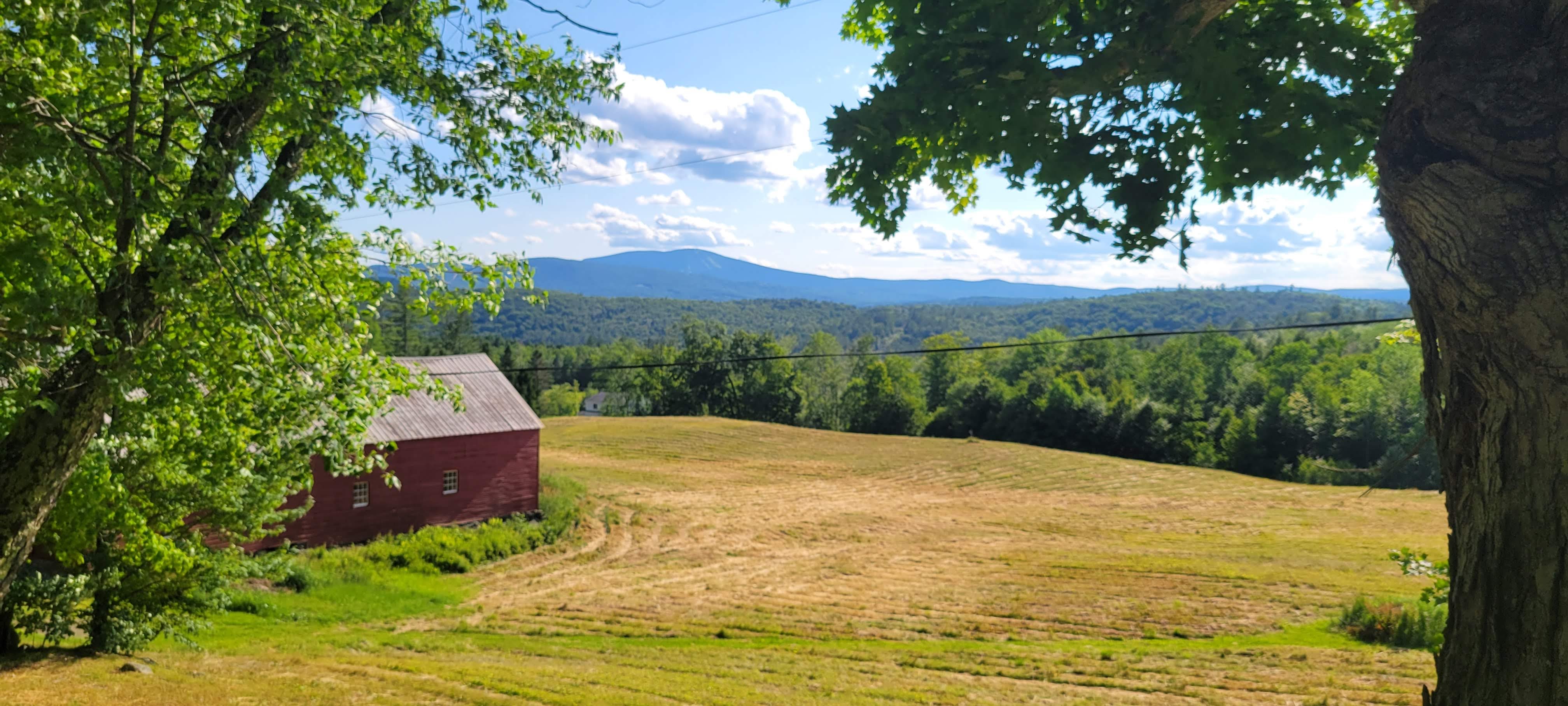
The terrain varies from pavement to very rustic singletrack, but the grades are gentle which lends itself to a more relaxed social pace. The scenery is gorgeous, reminding me that there’s still so much of my own country that I haven’t seen and deeply want to experience.
This route can be done with camping as well but that will add a few miles per day to get to a campground site. Some areas might allow primative camping; check with the land owners/managers before relying on that option.
We brought 2 32-oz water bottles each to always have an ample supply, but also brought my MSR TrailShot water filter. We did not run out despite temps in the 80s and the days getting progressively muggier (before raining).
Both the XNHAT and Cross Vermont websites are full of inside tips, resources, trail conditions, updates on connectivity, and more. I definitely made donations to each organization when I got home to honor our trip but also, help keep these trails available to all.
It’s early August. I’ve completed two multi-day bikepacking trips, including the beautiful and challenging Appalachian Gravel Growler and another spin Roundabout Brattleboro. I camped in 10* on my back porch to test out my new (obscenely expensive, expedition-weight) winter sleeping bag in anticipation of a back-/bikepacking winter overnight. I missed Toad Strangler due to illness and rode (a shorter route for) The Great North in cold, rainy conditions. I went cabin camping and mountain biking in beautiful New Hampshire and Vermont with my girlfriends (and Matt).
Yet, I haven’t even cracked 1,000 miles to date on my bike.
At some point this year, I decided to abandon my goal of 3,075 miles this year and focus on Doing Less and Being Less Intense.
I’m watching my friends train for epic events. I’m seeing friends discover new routes, new adventures, and regain strength after illnesses. It’s incredibly awesome.
But right now, I need to rest more. Embrace non-bike life more. Visit with friends, plan road trips, and yeah, even get the non-sexy things in life done – like cleaning the house and doing routine maintenance. Clear out the clutter and bring in fresh air and fresh space in my life.
I had two pretty big anxiety attacks earlier this year, which resulted in an increase in my Lexapro dose and a healthy step back in pushing myself to achieve new levels of awesomeness.
It’s really hard to not get caught up in the competition cycle of More Miles, More Speed, More Adventure, More Hard Core Adversity. But I encourage everyone to take a moment to think about why they are doing these things. There’s no right or wrong answer; only that if something isn’t serving you anymore, perhaps it’s time to try something different.
Because the reality is that I don’t need to prove myself to anyone. I’m amazing and awesome right now.
So I’ve been sleeping late, taking leisurely bike rides when I feel motivated, going to slow yoga classes (restorative and yin mostly), and hiking more. Turning off notifications on my phone and filling up my library hold list with interesting books. I’m walking my beagle every day, allowing extra time for all the sniffs and stops. I’m re-evaluating my volunteer obligations and deciding what fits and what needs to be set aside for now.
Living a slow life is kindof wonderful.
I have a car camping trip in a few weeks and then a four-day bikepacking (lodging) trip with my oldest kid and my middle sister. Beyond that, I don’t have many plans. Maybe going home at the end of November for a bit, see the fam and my nieces.
I’m looking forward to how the rest of the year pans out. Taking a break from constant adventure, constant “training,” and constant GO-GO-GO has been a huge relief. While it also resulted in a not-insignificant weight gain, I’m also evaluating my relationship with my body and how I can honor where my physical being is. I’m still strong, still resilient, still bad-ass.
After several events that sparked stress and anxiety spirals, including having to make a humane decision for the family dog, I was in deep need to get away from life for a bit and just be. Fortunately, I had planned to ride Roundabout Brattleboro with one of my best biking friends, Karen, and the timing couldn’t have been more perfect.
Logistically, we opted for lodging to keep things light and as stress-free as possible. Having a shower and a bed at night does wonders. We basically packed up overnight stuff and snacks and hit the road with nothing to do but ride our bikes all day.
You can read about last year’s trip here, where it rained 2″ in the first two days. Totally different experience!
Day 1 Photos
Day 2 Photos
Day 3 Photos
Where We Stayed & Ate
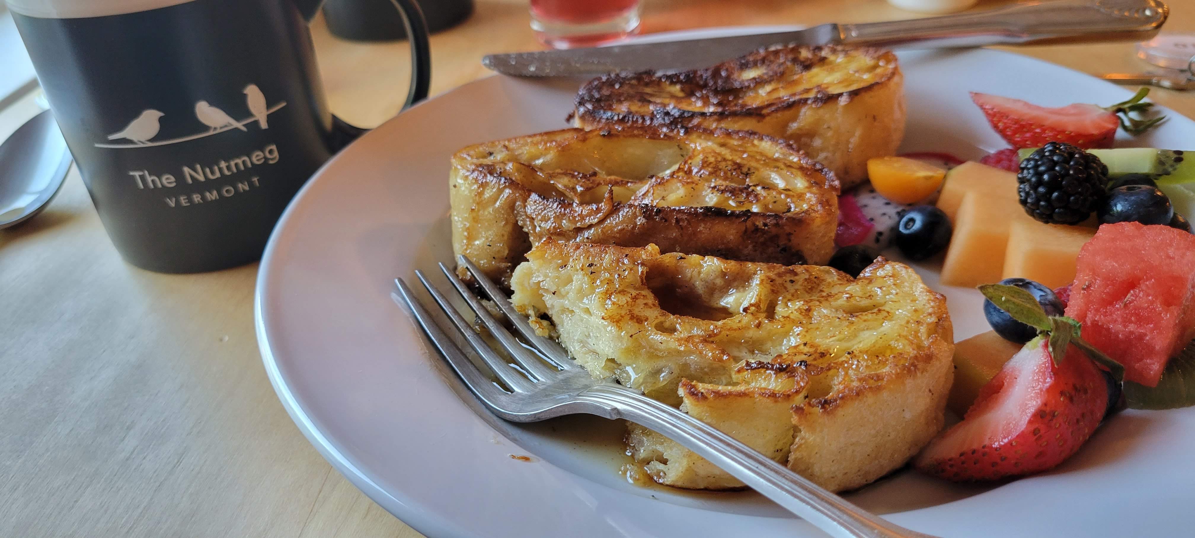
The Nutmeg BnB (Wilmington, VT) – lovely family-owned BnB a short walk or bike ride from town. The french toast is amazeballs.
Snowdon Chalet Motel (Londonderry, VT) – super cute vintage 1960s ski chalet with modern amenities (USB and lots of outlets). Light breakfast and coffee in the morning included!
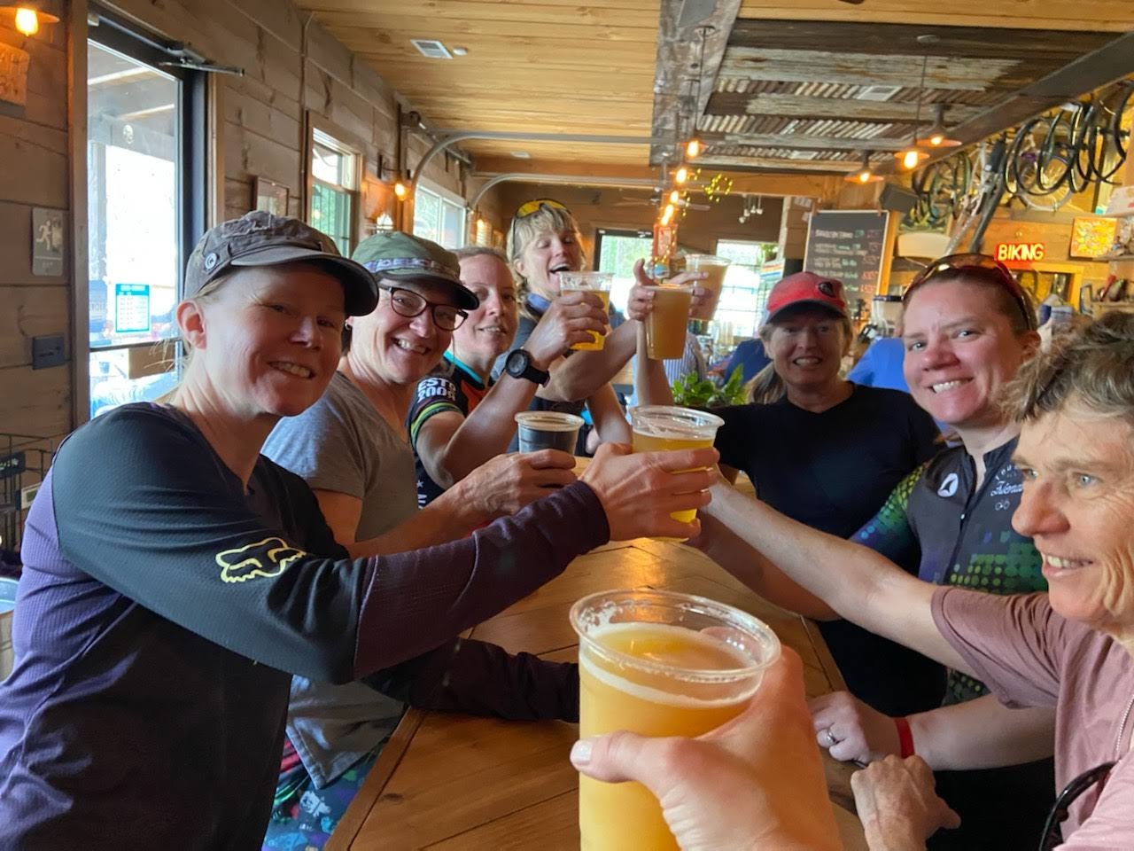
Sometime in late November 2021, the idea started to percolate around getting a few women together to head down to North Carolina to ride the Appalachian Gravel Growler (AGG) route off bikepacking.com. Jeannette’s son is going to school in Brevard so it’s a great excuse to go see him over her spring break. Jeannette and I rode together on the XNHAT and she was looking to expand beyond bikepacking overnights and 2-nighters.
For me, the breweries are a means to get others to join in the fun and six of our women friends who are brand new to loaded bikepacking signed on. As a non-beer drinker, I’m just here for the dirt, the views, and the joy of being out in the world on my bike.
This year I signed up for the AIDS/LIFEcycle Ride, supporting SF AIDS Foundation and Los Angeles LGBT Center. I chose to fundraise for this bikepacking trip to support ending the stigma around LGBTQ issues, HIV and AIDS support, and other life-affirming services. If you are interested in donating, please click here!
And true to not always making the best decisions in my life, I was one week into adjusting to a new SNRI for anxiety and scheduled to get an MRI when I got back for GI issues that have plagued me for the past 3 weeks.
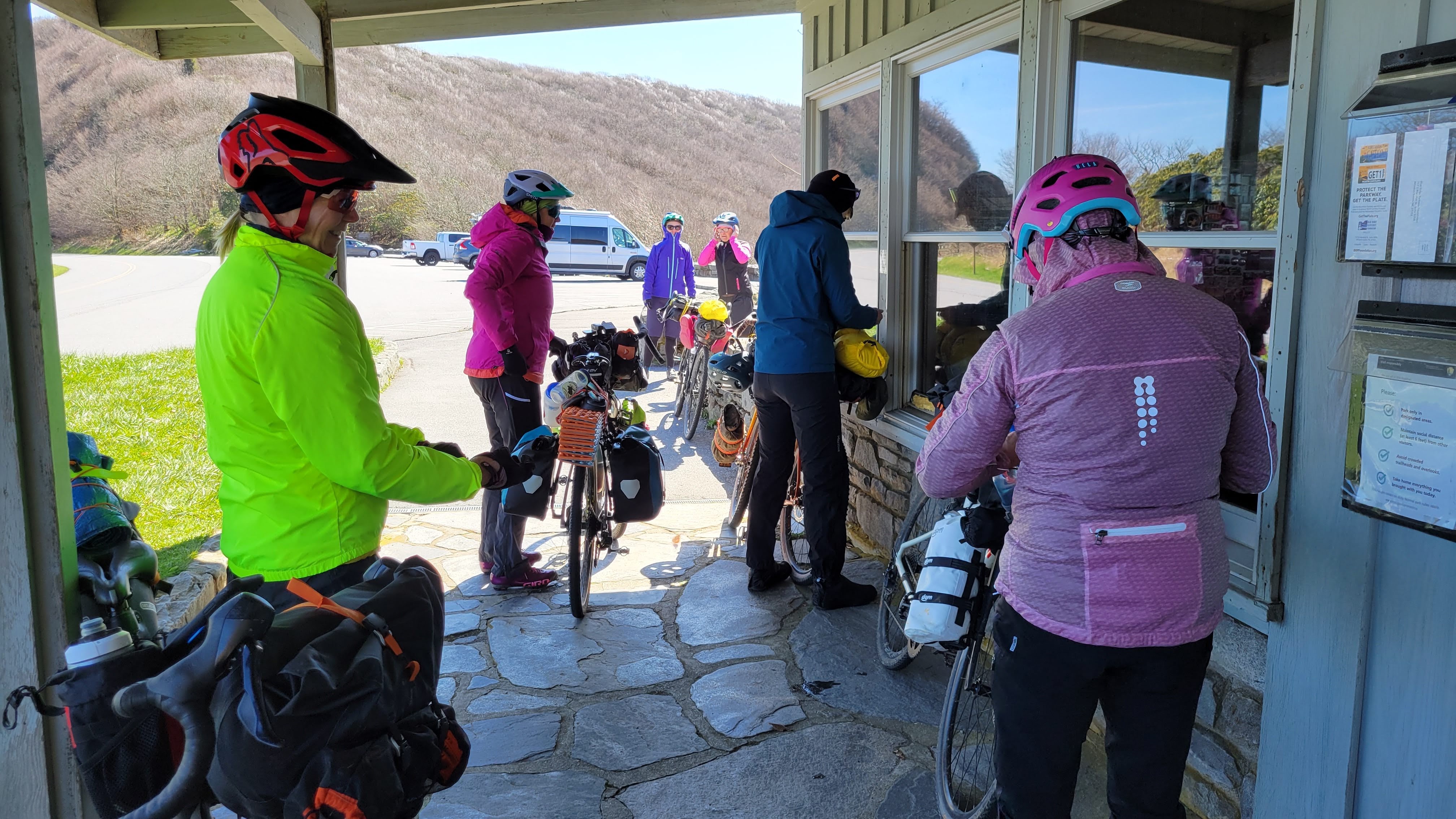
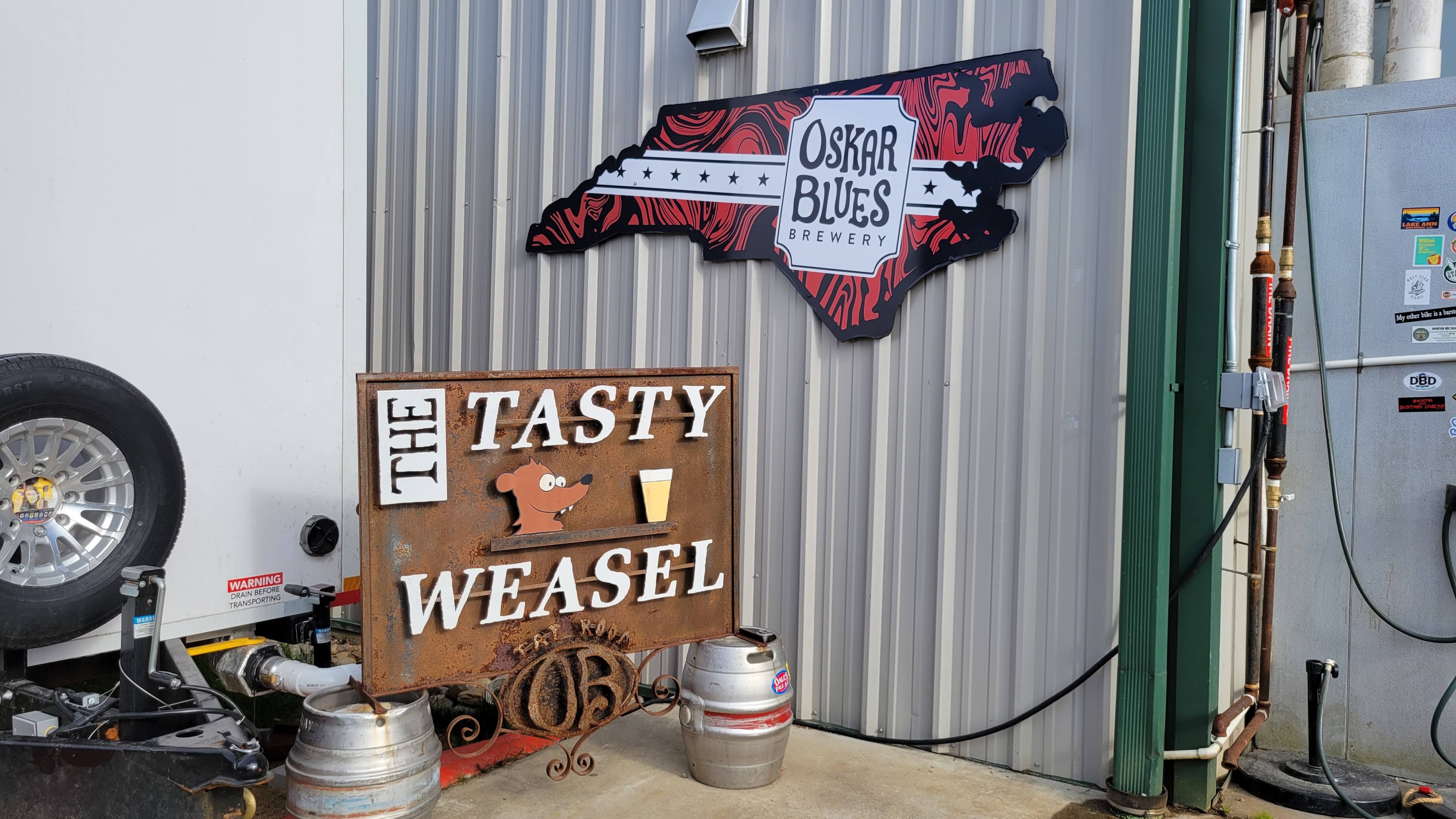
Designed to be a sister route to the Green Mountain Gravel Growler in Vermont, the AGG links iconic breweries on scenic dirt backroads that twist up and down the Blue Ridge Mountains. With 207 miles and over 20k feet of elevation gain in remote (i.e., limited or no cell service; limited small-town general store-type resupply and bail-out options compared to other routes; potential need for roadside/backcountry camping), this is not a route I’d ordinarily advise for brand new bikepackers nor early season riding … but our friends are strong of mind, body, and spirit. With that, we set out for an epic adventure, starting with an 11-hour drive from New York to North Carolina.
The Crew
You’re never too old to try something new.
Alta, mid-50s
Erin, low-40s
Jeannette, mid-50s
Kate, mid-60s
Laura (me!), mid-40s
Lisa, mid-50s
Mary, low-60s
Megan, high-30s
DAY 1: The Hottest Day
Rolling out under clear blue skies and mild temps (a welcome respite from the freezing cold and random snow and rain squalls we’ve had in New York), the mood is jovial. “You guys, I can’t believe we’re actually doing this!!” is regularly exclaimed as we make our way along the quiet river bike path and out of Morganton.
Loose Dogs are a thing in North Carolina
More exposure than expected on the backroads. It’s still early spring so not as much leaf cover to protect us from the blazing sun
But the scenery is lovely and distracts us from the climbing
Watching a local walk back down the road with a busted derailleur (yikes!)
more climbing
Lunch in the shade on a pull-out. A few locals stopped to chat while we ate
even more climbing
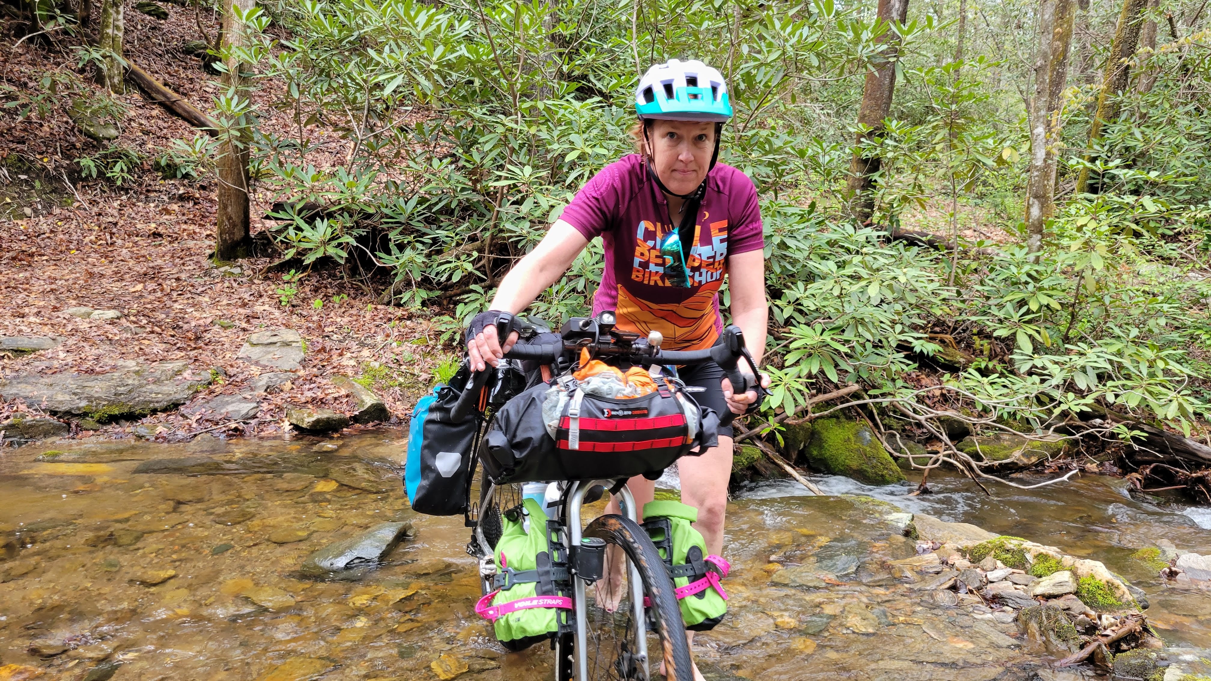
refilling water bottles from a stream (thanks Trailshot!) and dunking our heads in a waterfall to cool off
still more climbing
finally, consistent downhill!
Betsey’s Olde Country Store was closed when we rolled up just before 5pm- but we found someone who let us refill bottles and use the bathrooms at the campground behind the store
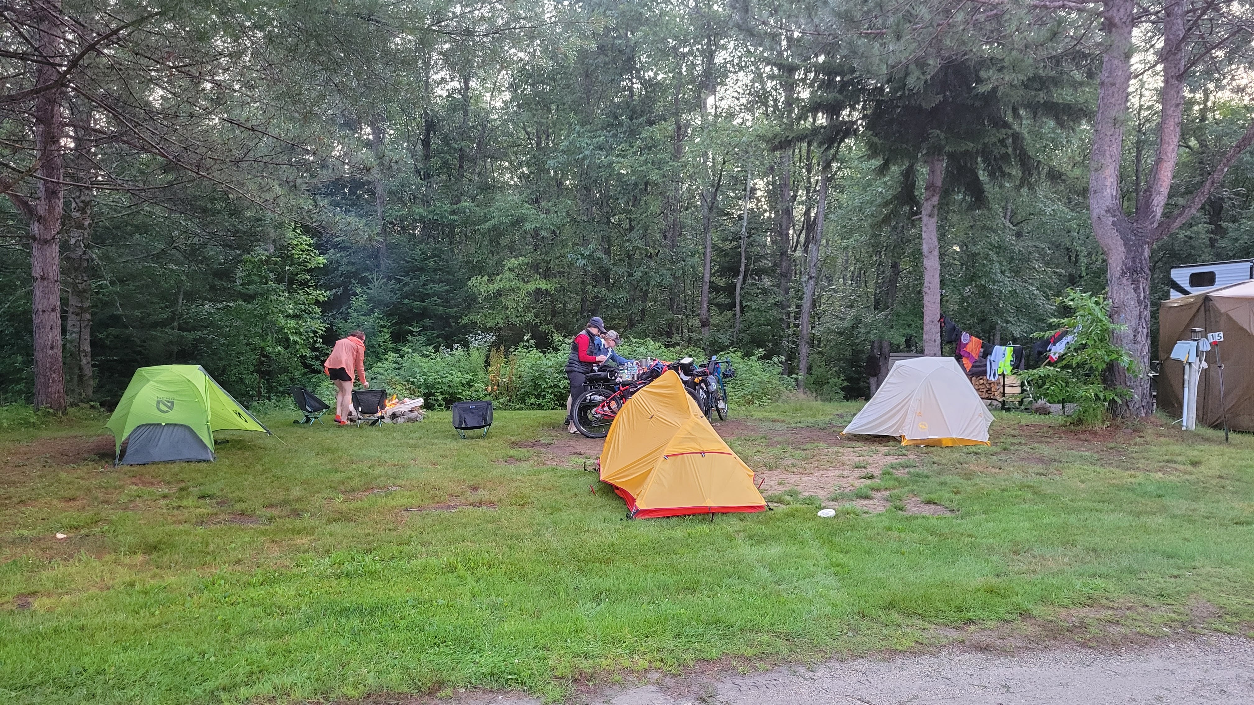
Deciding to stay at Mortimer Campground instead of continuing on because of impending overnight rain (around an inch of rain expected). The campground host let us use the picnic shelter for our bikes and meal prep; we pitched our tents a short walk away on Site 2. We put our food bags up in the rafters of the shelter as the campground is near a bear sanctuary
Falling asleep to the gentle sound of drops on the rainfly
DAY 2: THE COLDEST DAY
The steady sounds of the rain continued into the chilly morning, making it mentally hard to want to leave my warm, dry sleeping bag in my tent. But because we stopped early last night and the rain wasn’t expected to stop until early afternoon, we had more than a few miles to make up today.
Using the picnic shelter to make breakfast, plan the day, and repack everything up
Forgetting to pack a belt for my ill-fitting rain pants
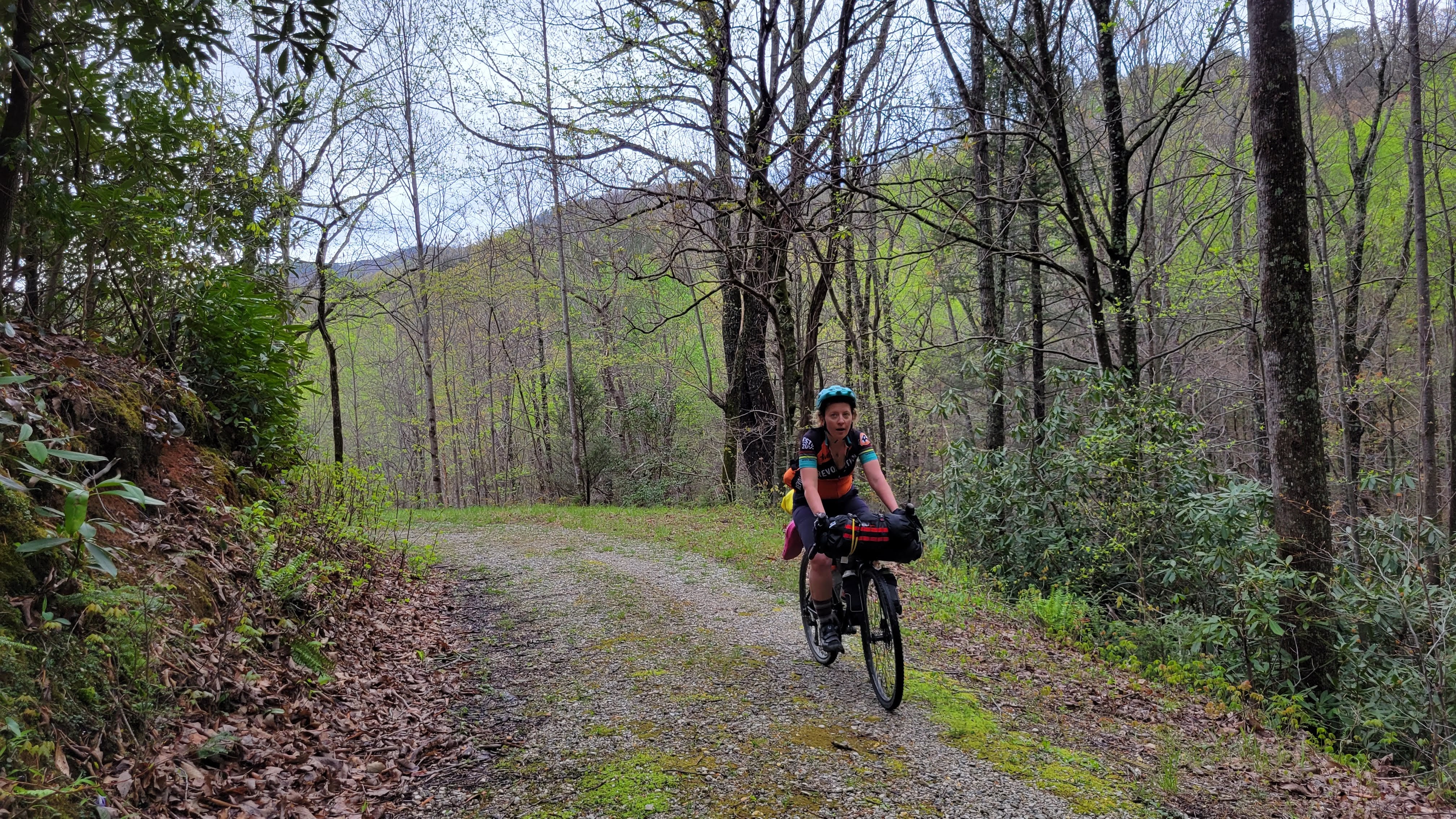
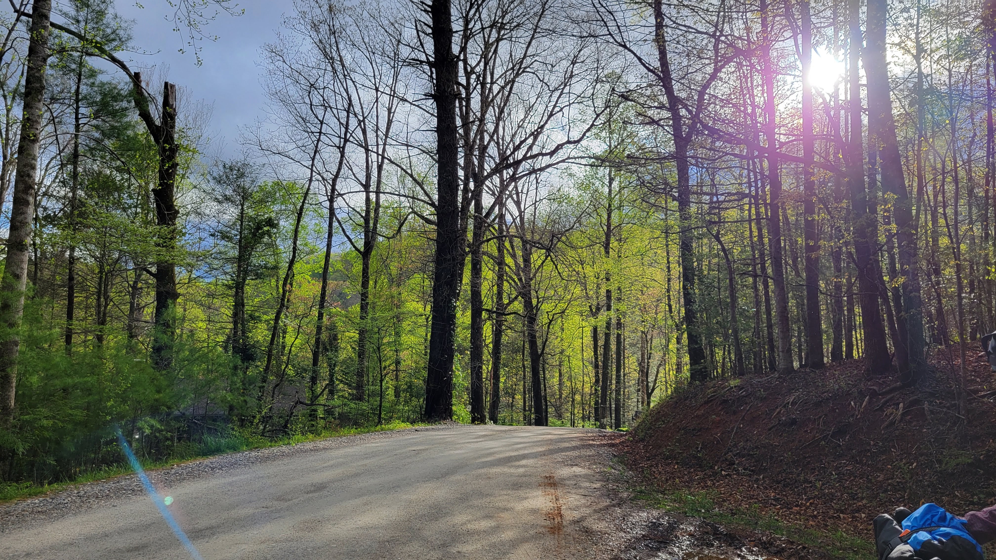
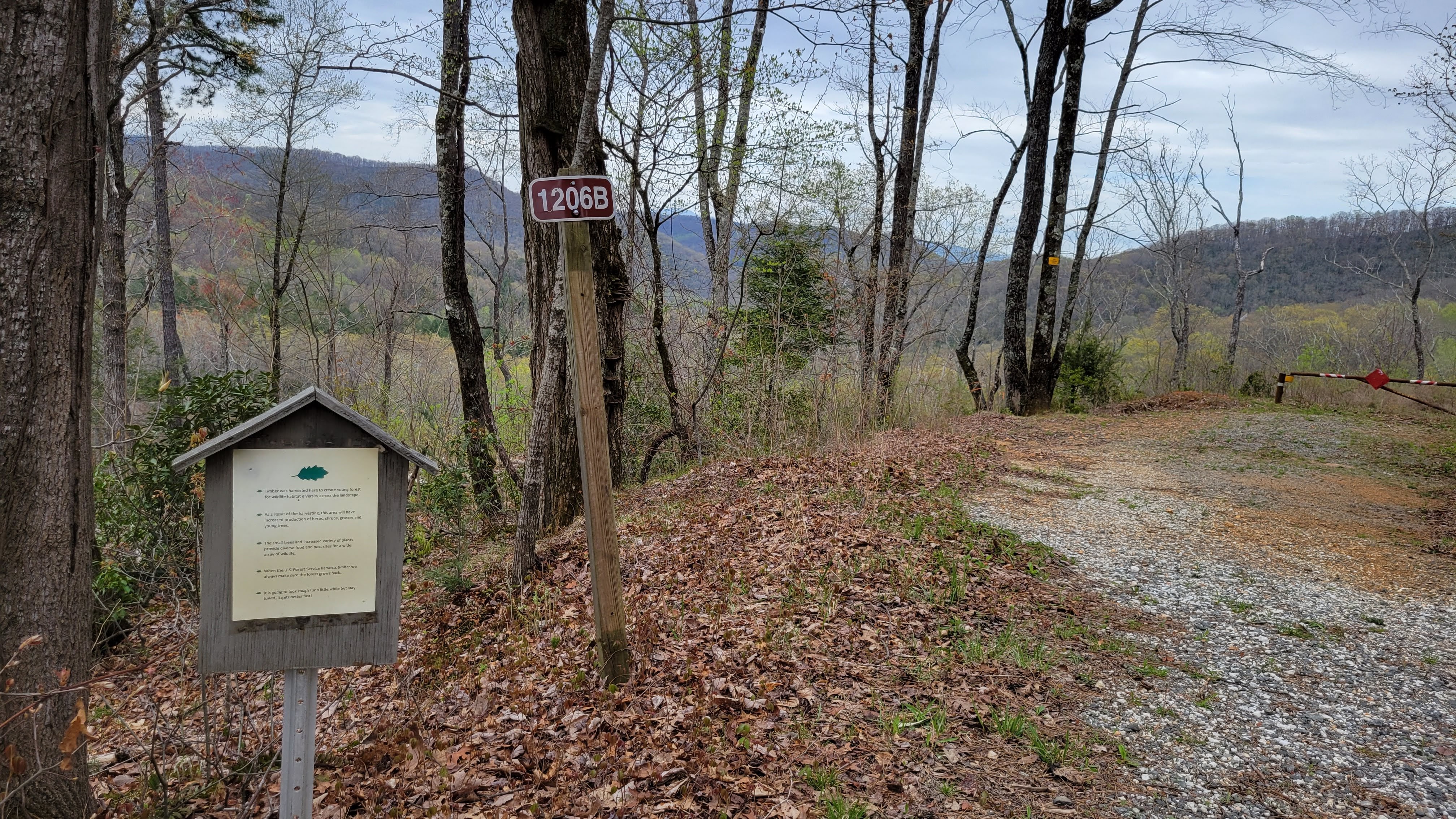
nearly 10 miles of climbing on a noodling dirt road right out of the gate
passing the roadside camping and being thankful we had a shelter to use this morning
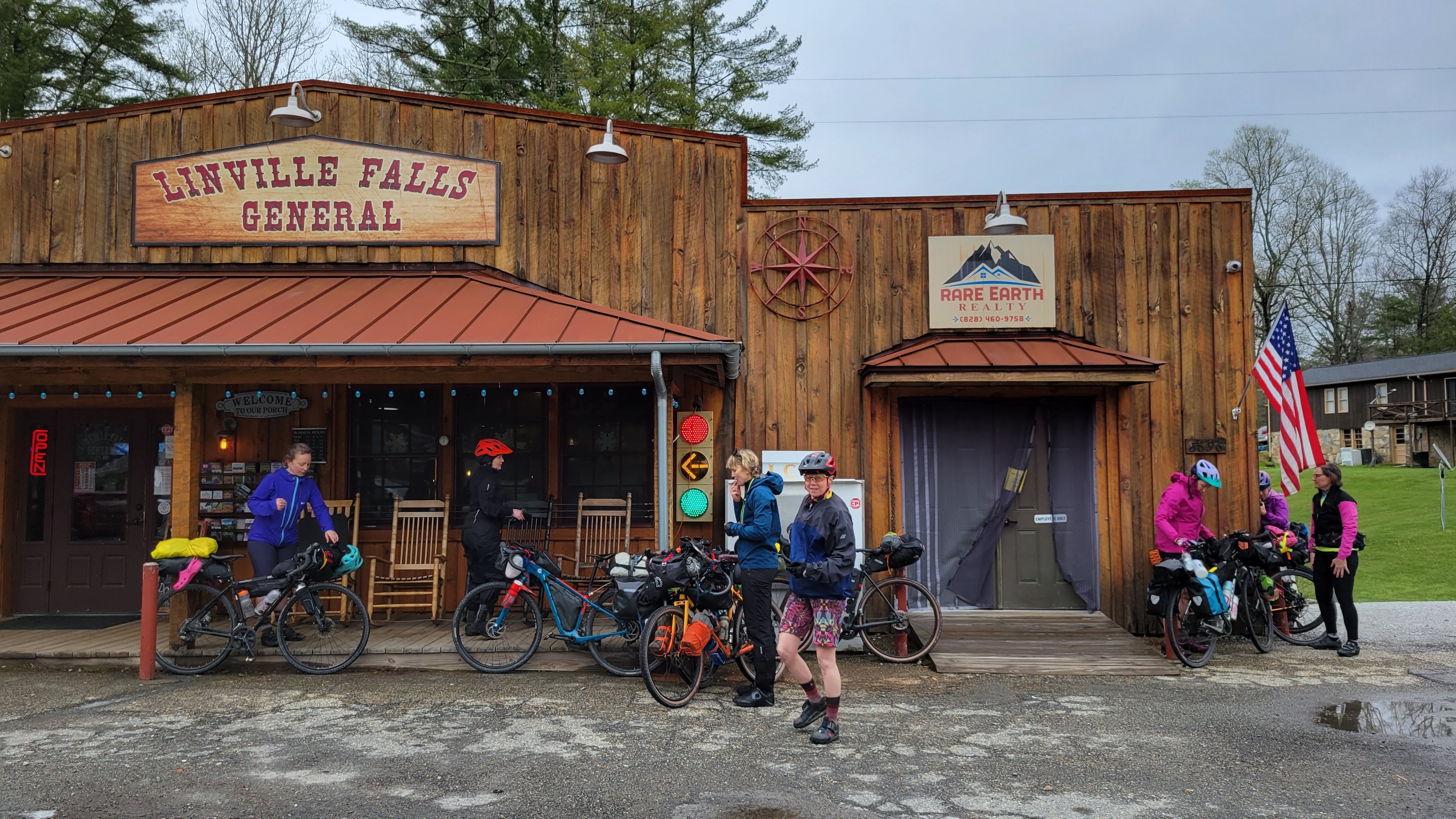
Warming up with coffee and pizza at the Linville General Store for lunch
Deciding to descend on the pavement instead of taking the dirt road and powerline cut to make up time
Passing where we would have come out on the powerline cut and being thankful we made up time
The sun is coming out and we’re shedding our rain layers when we roll into Woodlawn and decide to ride the next dirt section
Suprise double and singletrack
Rolling up to Hillman Brewery for burgers and beverages just after sunset
Finding two guys with a truck to give us and our bikes a lift to our campsite for the night
Setting up and figuring out where the bathrooms and water pump are in the dark. We use the bearproof trash cans as a bearproof locker for our food.
throwing extra layers in our sleeping bags because it’s expected to get down near freezing overnight
DAY 3: THE HARDEST DAY
A cold, crisp sun greets us on the third morning and we’re a little slower-going. Today is the biggest climbing day and our legs are already feeling the subtle stiffness of the previous three days. Today is expected to be a few degrees warmer and sunnier, and we are optimistic to get to Craggy Gardens for lunch.
Climbing 2,200′ in 6 miles is B O N K E R S
Peeks of the Blue Mountains between the trees are lovely
shedding layers quickly
Turning onto the Blue Ridge Parkway and knowing we still have 2 more miles to ascend around 800′ (but at least it’s paved)
SO WINDY but mercifully partly sunny. Icicles are dripping on the protected northern rock outcroppings.
Stopping for lunch at an overlook in a sort-of protected place from the wind
2 mi descent is over before it feels real, then back to climbing for the next 6.5 mi
Another 2.5 mi descent that goes by too quickly, then the final 2 mi ascent to Craggy Gardens
It’s so cold and windy the tops of the mountains frosted in ice
Getting to the Visitor Center 30min before it closes. Warm ourselves by the fire, buy water for our bottles, and put on every layer of warm winter clothing we have for the 13mi descent.
Dodging falling ice from the rock outcroppings as the sun warms and melts the base
Rolling through Asheville’s cute downtown and onto the beautiful bike path
Arriving at our AirBnb for the night and celebrating with showers and well-deserved beverages
DAY 4: THE LAYOVER DAY
We enjoy a leisurely morning with ample electricity, hot water, and four walls around us at night. Jeannette’s son had dropped off groceries the day before so we enjoy coffee and cook breakfast in the kitchen. Two of Kate’s local friends arrived and took us downtown for a day of wandering around.
Splitting up, my group and I decided to eat lunch at Early Girl (Mark was an excellent server) and then make our way over to Wicked Weed. More wandering and a Hemp Fest stop, our group split up and I headed back to the AirBnb with Lisa while Erin, Megan, and Jeannette went for a few more beverages at Burial. We grill dinner and relax because our final day is upon us.
DAY 5: THE LAST DAY
Eager to complete our epic early-season journey, everyone is up and ready to go before our 9am wheels-down start time. Let’s do this!
Pro Tips from the Crew
“Find yourself the most amazing gnarly girls to share the adventure with!” – Kate
“If you get your period, share it!” – Erin
FINAL THOUGHTS
Be mindful of group size. While it was amazing and fun to spend time with so many friends, a group of 8 is pretty big. Megan said it best – “it’s gonna be like herding cats.” We strung out and regrouped without too many issues.
Prepare for the trip. While it’s generally going to be OK to show up for a group ride without looking at the route or doing much planning – that can be a big issue in bikepacking. We had several Zoom meetings to talk about logistics, the routes, packing, gear, food, and expectations.
Use a Navigation Device to stay on course. Make sure everyone who isn’t running the route on a bike navigation device or phone is with someone who is. That being said, the investment of a bike navigation device like a Garmin or Wahoo is worth it if you are looking to do more bikepacking with camping. Running Ride with GPS on phones was not as accurate and ate through batteries
Secure your load. Thankfully we recovered everything that found it’s way off someone’s bag or rack. Periodically check your straps to make sure everything is secure, especially when heading into the singletrack.
Align on expectations and priorities. It’s never fun to be the person who’s priority is different that everyone else’s – whether it’s choosing more dirt vs making up time on pavement or going to the brewery before or after getting out of your chamois.
Everyone finished safely. Which was really my biggest fear and goal for the trip given the number of people who had not done a fully loaded overnight, much less one with this much climbing and gear for camping. I am confident this trip worked well because everyone is a very strong rider and has some level of experience with gravel and mountain biking and backpacking. We communicated well, looked out for each other, and had a blast spending 5 days together exploring the textures of western North Carolina.
2021 clearly became the Year of Bikepacking. Including overnights, I jammed 7 bikepacking trips in 5 months. Bonkers! It was incredibly rewarding and I learned a lot, which has streamlined my Go Kit and made it super easy to say YES to adventure (especially snack adventures).
But now that I’m in the chillax portion of the Bike Year, where I don’t feel like I need to “train” for “that big ride I want to do” anymore and I can just go sloth around in the woods on my fat bike, grinning like a kid.
My brain is always running around in the clouds though, dreaming of my next adventure. I’m pretty terrible at remembering things I haven’t written down (usually literally – in a notebook, on a post-it note, or as a Calendar event) here’s what I’m thinking about for 2022:
THE PLAN SO FAR
March
Frozen Apple Ride (Peekskill, NY) <- hoping we can finally run the event!
For the past year, I have tossed around last year’s GMGG ride over and over in my head. What I would do differently, how would I feel at certain parts, and ultimately … could I finish the route successfully? Reading so many other ordinary riders complete the route only deepened my self-imposed shame over not having finished the ride last year.
This year’s goal, while not overtly stated, has been Improving Bikepacking Skills. Starting with an impromptu local overnight in April, I worked in several bikepacking overnights and an early-season 110 mile ride to get pizza for lunch. I used these trips to dial in nutrition strategy, and noticed I tend to not eat as much when I’m climbing a lot. That’s an easy fix – stop occasionally to eat and let your body process for a few minutes before moving on!
Curt is always up for adventure, which makes it very easy to dial in planning and develop a Go Kit. The Go Kit has been key, as I have everything I need in one location and have two sets of packing lists based on if there is camping or lodging (or both) involved. I can then focus on picking multi-purpose items to minimize weight and maximize comfort and safety. This helps minimize panic-packing.
This year my friend Jessica flew out from Colorado to do the trip with me. She had never been to Vermont before but knew THIS was the route for her. After talking about camping, we decided to make packing simple and book lodging. It also helped with dialing in her flight, as we could pick dates without having to worry about weather for camping. I shared my planning spreadsheet with her so we could have a central “source of truth” for notes and such. It’s also handy to share with loved ones back home so they have an itinerary of where you should be each day and an estimated route.
Even better, neither of us drinks beer so the ride became less about stopping at iconic Vermont breweries and more about experiencing the best Vermont dirt.
Monday was our travel day – I picked Jess up at the Burlington Airport, got dinner, and settled in for the night. Weather for the week was mid-70s, mostly sunny, with potential for rain and cooler temps mid-trip.
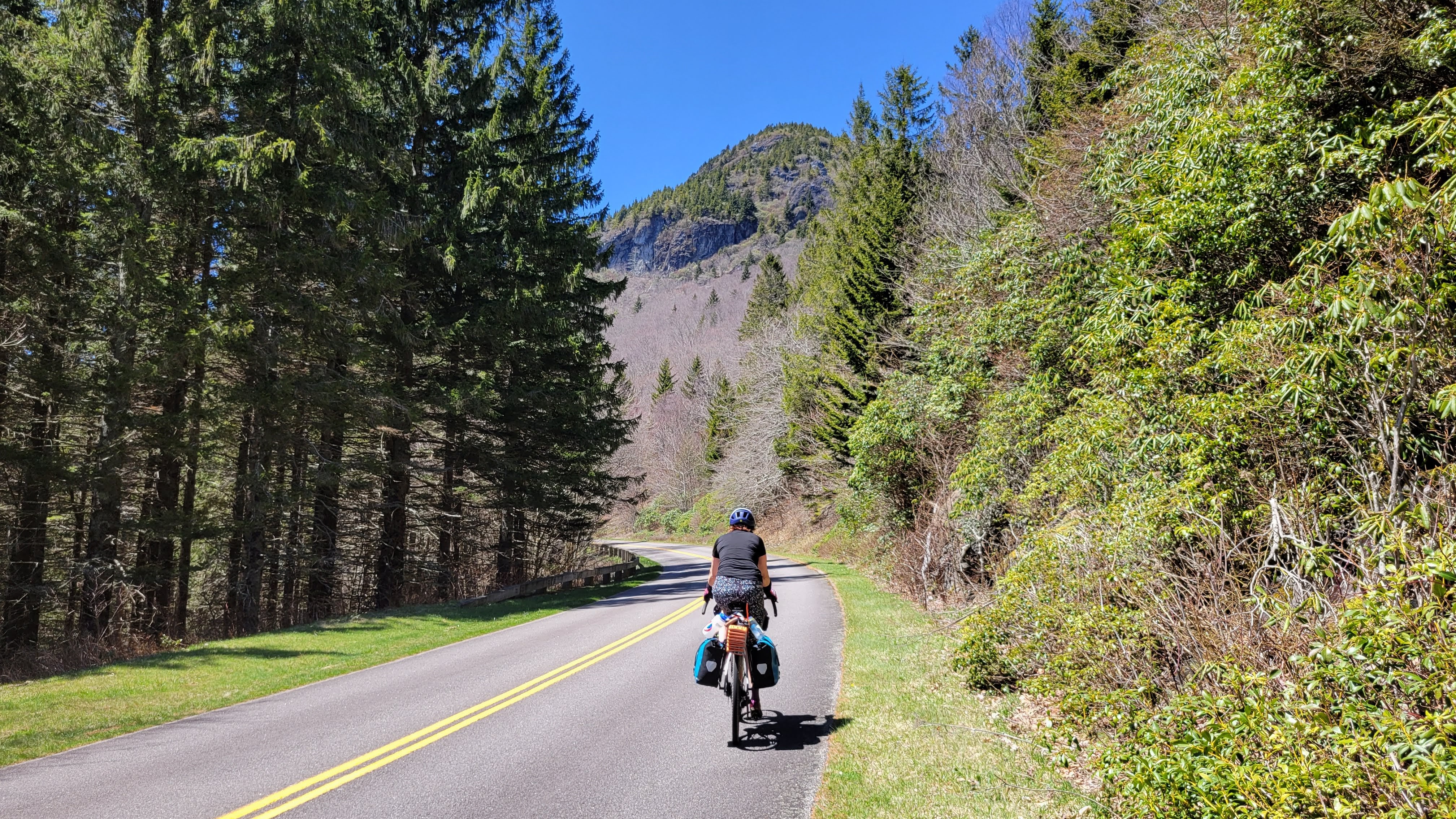
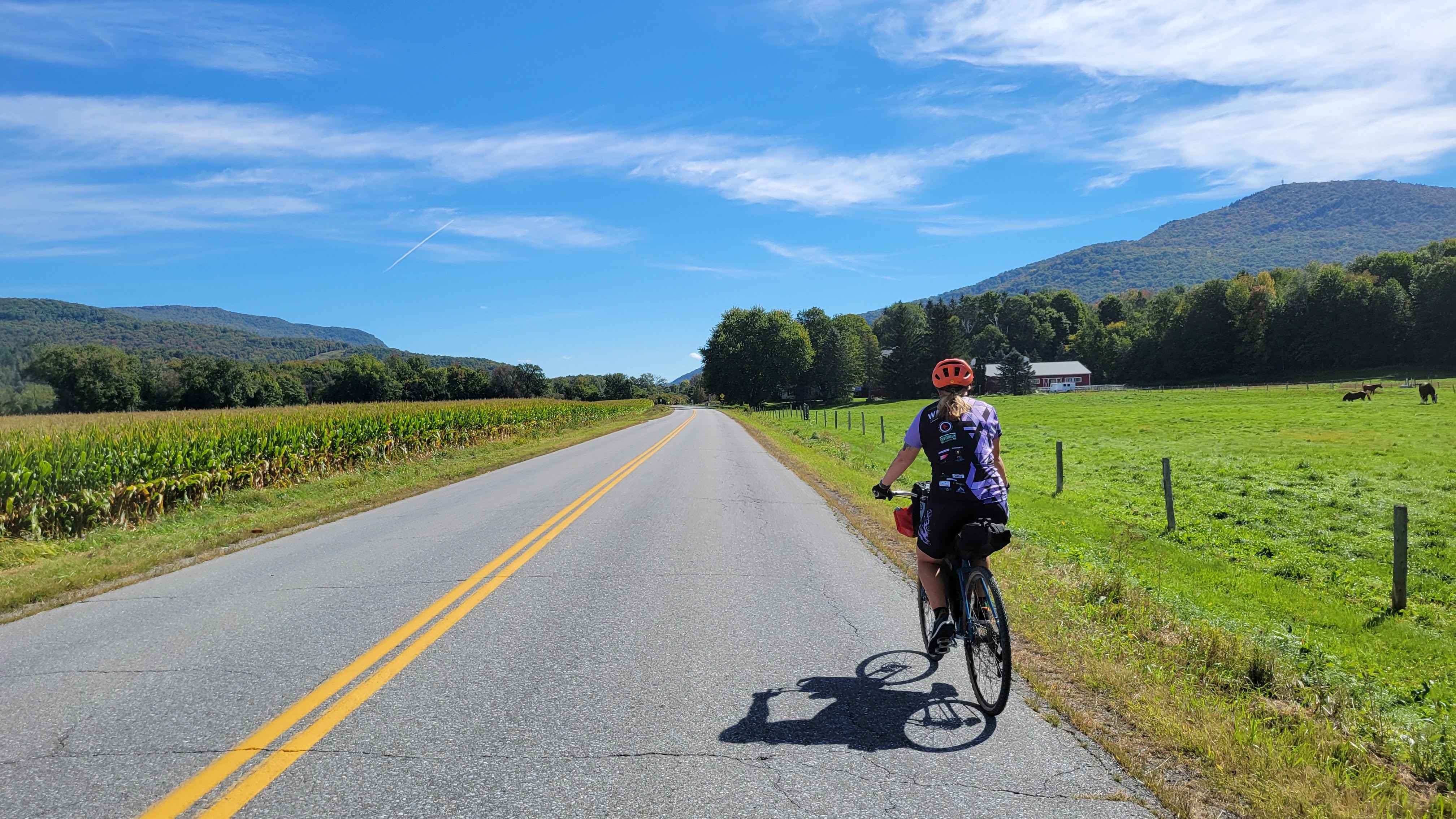
DAY ONE: Burlington to Stowe
The hardest part of this day is honestly getting out of Burlington. The urban flavor for the first few miles is mentally stressful due to the volume of cars – but once we were on the backroads, we could relax and settle into an all-day cadence and talk. Our first detour of the trip took us back onto a busy road with construction for a mile or so.
This was also the beginning of many, many “WOW!!!”moments emanating from Jess. She’s a seasoned traveler, going on multi-week trips with her husband and daughter to snowboard, ski, mountain bike, camp, and hike … but Vermont was a whole new world of lush greenery. The leaves are just starting to change and it was such an honor to be part of these first experiences of the Northeast. I couldn’t help but smile and laugh with every “WHOA,” and “LOOK AT THAT RED,” “WE’RE GOING INTO A TREE TUNNEL,” and “WOW!!!!!”
We arrived at Stone Coral well before they opened so we decided to eat lunch in Waterbury. We knew Prohibition Pig wouldn’t be open either, but we were confident we’d find a market or deli. The roads to Waterbury are flat to trending down, which paired with the winds was delicious. Lunch at Subway on the far side of town (four chickens joined us at the patio table) and then onward to the hills.
Hills are different depending on where you live in the country. Jess was coming from Colorado and had trained by riding up and down the steepest hills in her area as often as possible. But Colorado also believes in switchbacks while roadbuilders in the Northeast tend to just have the road go UP. Maybe you get an S-curve near the steepest part. So we adopted a strategy of Slow & Low & Breaks – slow speed, low gear, and taking breaks as needed. This allowed us to conserve energy that we knew we’d need for more than just today.
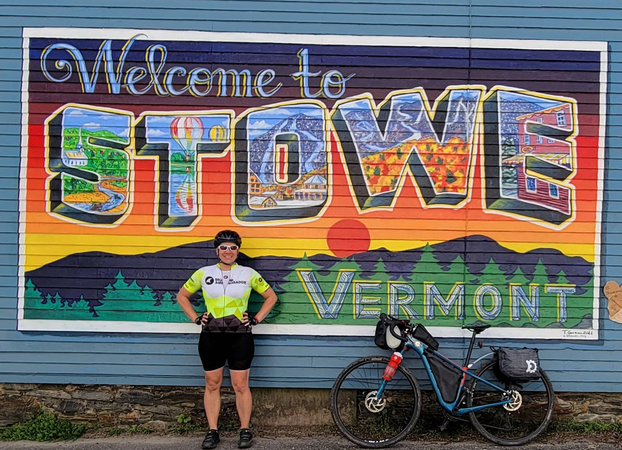
We paused at the top of Stowe Hollow and a local out on an afternoon ride stopped to chat with us. We dropped down to VT-100 and opted to skip the hill up to Von Trapp Family Lodge, cutting a few miles of significant elevation but getting us into Stowe in high spirits. Got cleaned up at the Stowe Inn before walking over to Ranch Camp for burritos on the patio.
DAY TWO: Stowe to Hardwick
The morning air was vaguely humid with ominous clouds surrounding us as we pedaled up the road to breakfast at Stowe Bee Bakery. A stiff breeze welcomed us head-on, much to our amusement. We sat on the patio with lattes and scones and breakfast sandwiches made with biscuits (the ONLY way a breakfast sandwich should be made, IMO) and talked about the route for the day. We knew we had big hills to tackle early on and agreed yesterday’s Slow & Low strategy would be good for today as well. It’s 9am and we’re already sweating just sitting outside.
We got to Morristown too early to have lunch at Lost Nation, so we popped into town to take a break and get more water and snacks at a gas station before heading back out into the hills. We decided to get lunch in Craftsbury, a short detour off the main route. The further east we pedal, the higher in elevation we are and the more foliage surrounds us. The colors pop against the cloudy skies and it starts to sprinkle as we roll into Craftsbury. We stop at the Village Store for sandwiches, enjoying them on their covered patio. Jess gets a maple cree-mee, a Vermont specialty.
Since we aren’t beer consumers and with weather to the east looking decidedly wet, we decide to skip the hills out to Hill Farmstead and follow the dirt hills more directly to Hardwick. We found a lovely road that rejoins the original route just in time for the epic descent into Hardwick. We roll up to the Inn by the River and are greeted by Frieda (she recommended we call next time to take advantage of direct-booking discounts). She also allowed us to keep our bikes in the locked office overnight.
A short walk into town for dinner at the Village Restaurant and then back to relax by the river to soak in the day.
DAY THREE: HARDWICK to WAITSFIELD
Hands down the hardest but my all time favorite day of the route.
We got breakfast to-go from Connie’s Kitchen (yes, I got pancakes) that we enjoyed in the shade by the river before kitting up and heading out to Hardwick Market for extra water and snacks.
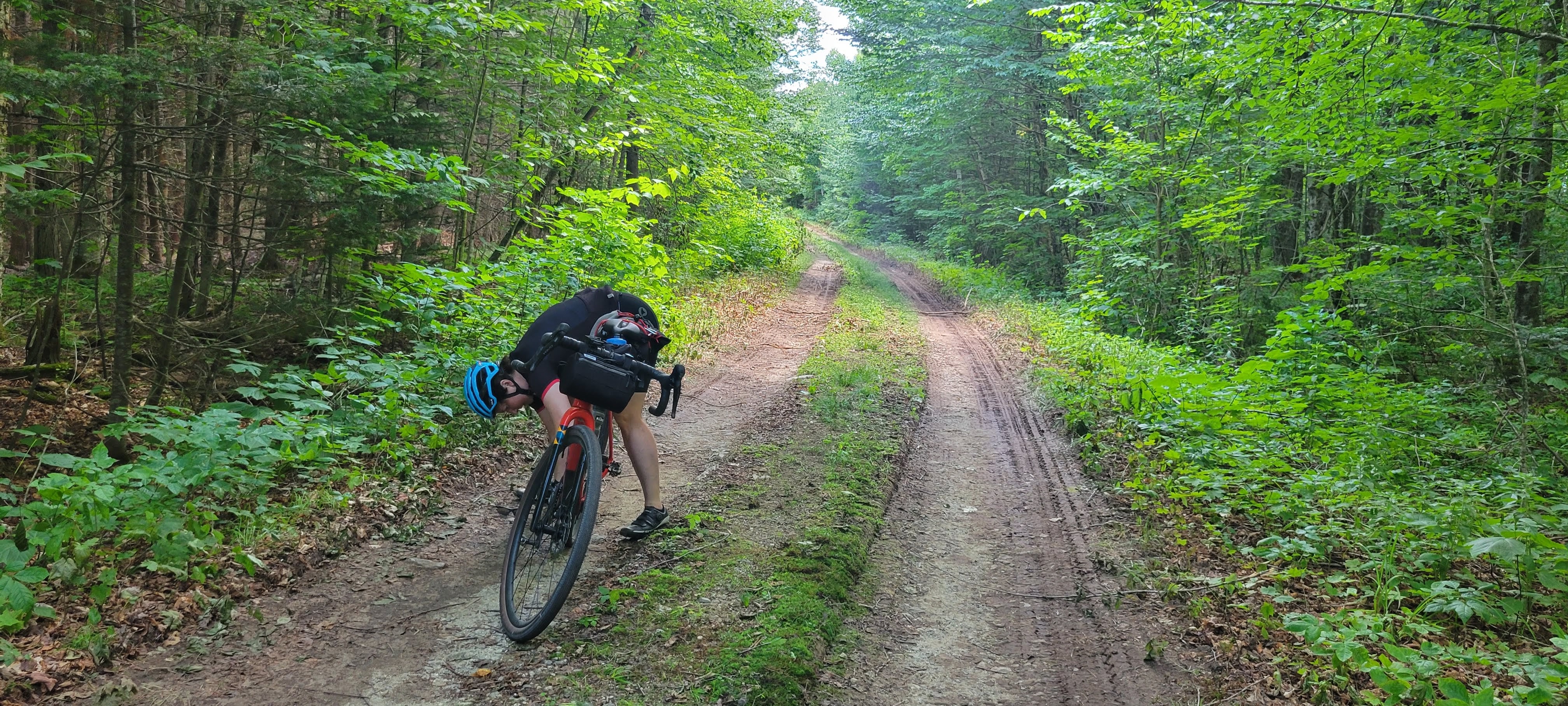
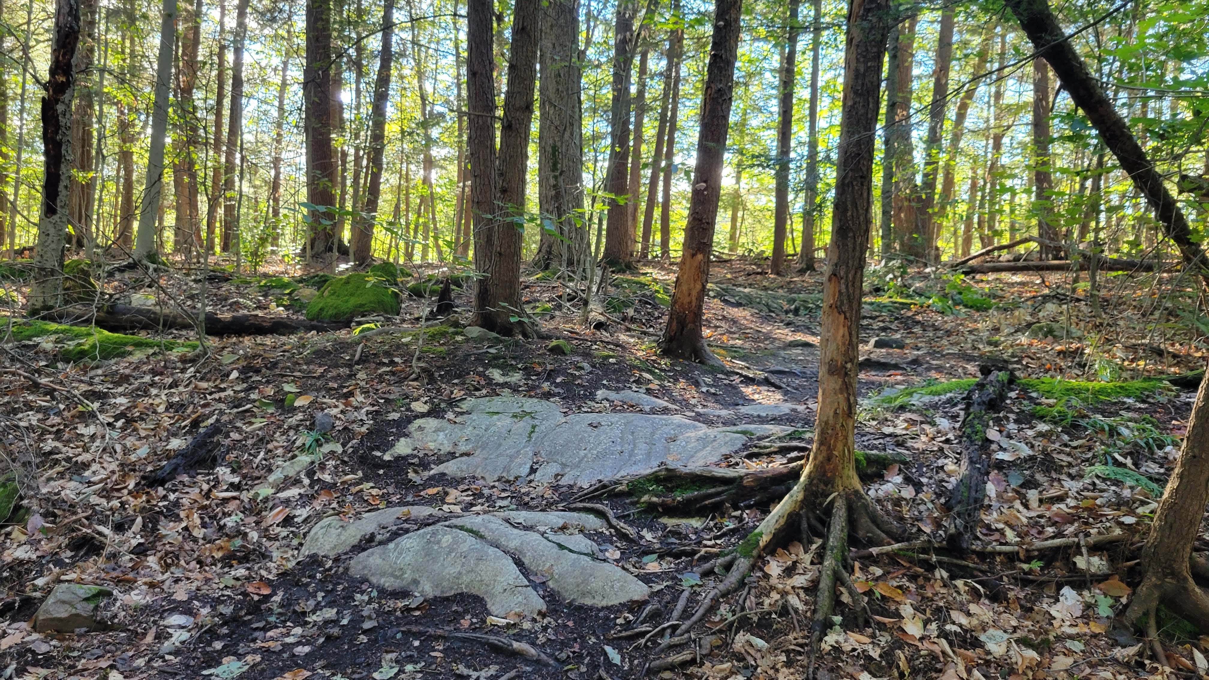
Buffalo Mountain Road was in surpringly great shape and we were able to ride the steepest parts before hopping off for a bit to walk where it was much chunkier. Riders who prefer to not hike-a-bike will not love this 12 mile section of the route, but we had a blast. It’s truly the gem of the route and a road that should be savored, not skipped.
We rolled into Montpelier for lunch at 2pm, enjoying the low-key energy of late lunch on the patio at Three Penny Taproom. Looking at the route, we decided to skip Hill Rd in favor of the more moderate climb up Northfield Rd. Unfortunately, this also put us on a very busy Northfield Rd that wandered along the river with a tiny shoulder. Jess wasn’t psyched about East Coast drivers and how little psychological safety is afforded cyclists so we pulled over to figure out options.
For reasons unclear to me, my RideWithGPS app wasn’t functioning correctly for my off-line route and I couldn’t zoom in to where we were to see options. My Garmin was telling me we had a right turn in about 2 miles, but we weren’t sure if that was trying to reroute us back to Montpelier or get us back on-route. But we did know if we turned left, we’d be able to get back on -route on a quiet dirt road.
Rowell Hill Rd is a 1 mile dirt connector street that averages 11%+. We laughed as we pushed our loaded bikes up the steep s-curves, taking breaks along the way to catch our breath and keep going. We agreed we probably should have just taken Hill Rd and stayed on-route. Once we got to the top, we still had the same amount of distance to our next turn …. which was the same road from before we pushed up this monster hill. We laughed pretty hard about this as we enjoyed the descent on the backroad.
Arriving at Northfield Falls, we opted to turn right onto Cox Brook Rd instead of continuing south on the main route. The official route was recently updated to remove the Waitsfield Gap, which is technically a class 4 road, due to erosion and private land rights – rerouting riders from the south back up to the Moretown Gap. It’s already late in the day, we’re tired, and there isn’t a reason to add the additional southern miles so we head up the Moretown Gap, which was a very pleasant ride along the river.
VT-100b was also very busy so we popped onto Pony Farm Rd and were rewarded with quiet, rolling hills on dirt. We chatted with a woman walking her dog at the top of a hill while refueling. The skies have cleared and the wind is still ever-present, but the sun is shining for golden hour. We roll into Mad Taco for to-go dinner before setting in at the Waitsfield Inn for the night. Vickie and Jon were phenomenal hosts, providing us with access to their shed for our bikes, ice for my knee, and a clean, comfortable room.
DAY FOUR: WAITSFIELD TO BRISTOL
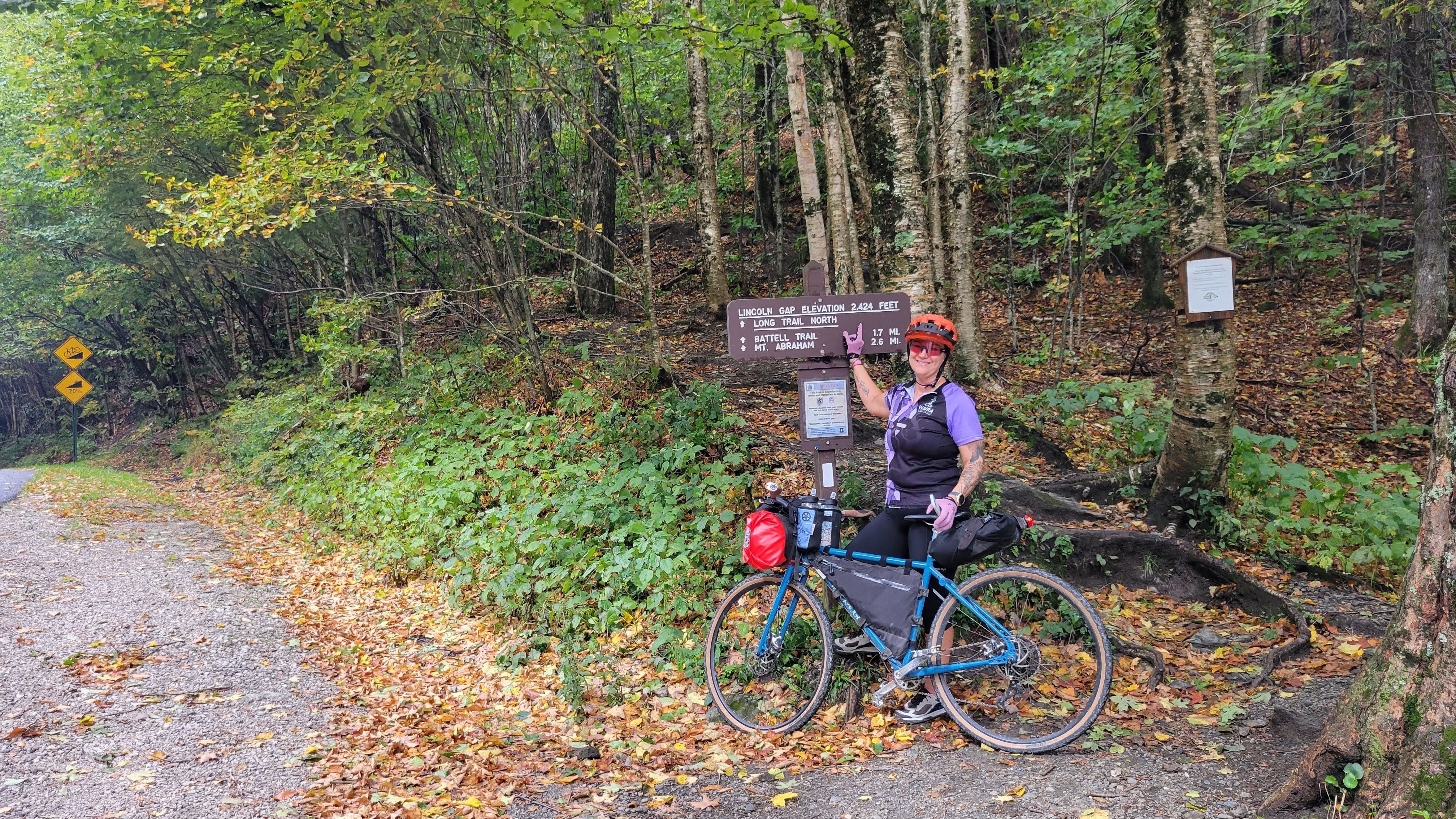
The Lincoln Gap Day. The day that broke me last year. So much trepidation and anxiety was about to culminate. Would the Gap break me again?
Although if I’m being fair and honest with myself, a lot of things contributed to last year’s failure. Mostly not being fully recovered from surgery, wonky digestion, not eating enough throughout the days leading up to day four, and pushing an overloaded bike with 2.2″ tires as hard and fast as I could to keep up with Curt. That’s not on him in any way – we all have to ride hills at our own pace and I needed to be more proactive and protective of my energy levels.
The weather reports had been changing every day and settled in on 100% chance of rain with up to an inch of precipitation depending on where one was in the state for the day. We woke up to pouring rain, already well over half-inch already fallen overnight. We tucked ourselves into a separate dining room, drinking coffee and eating breakfast (oatmeal, scrambled eggs with cheddar and chives, and toast with jam and butter) and talking about the day’s strategy. Temps in the upper-50s/lower-60s meant pulling out the wind vest for the morning.
The rain abated by the time we rolled out, around 10am. Peanut butter roads greeted us and we conserved energy by soft-pedaling up the hills. There was a much bigger fish to fry today. Descents were soft and littered with wet leaves, requiring focus and a lot of braking. We dropped into Warren and stopped at the Library for water and quick bathroom break.
Our legs slightly stiff from the previous three days of riding meant gentle pedaling up the first 2.5 miles of Lincoln Gap Rd. We stopped for photos and talked to an elderly local who told us “it gets steep up there” and “most bike riders push their bikes.” We wished him a great rest of his day and pedaled onward.
Jess managed to pedal a bit further into the steep part than I did, but in the end we both pushed our bikes up to the top, taking breaks for a few moments along the way. Amazing what a significantly lighter bike and a much cooler day will do for stamina! It was very windy at the top and we pulled out our arm warmers while we ate a snack and took photos at the top. It was such a 180 from how I felt at the top last year. We descended carefully as the dirt was still peanut buttery and leafy. As we turned south, the sun came out and the dirt was drier.
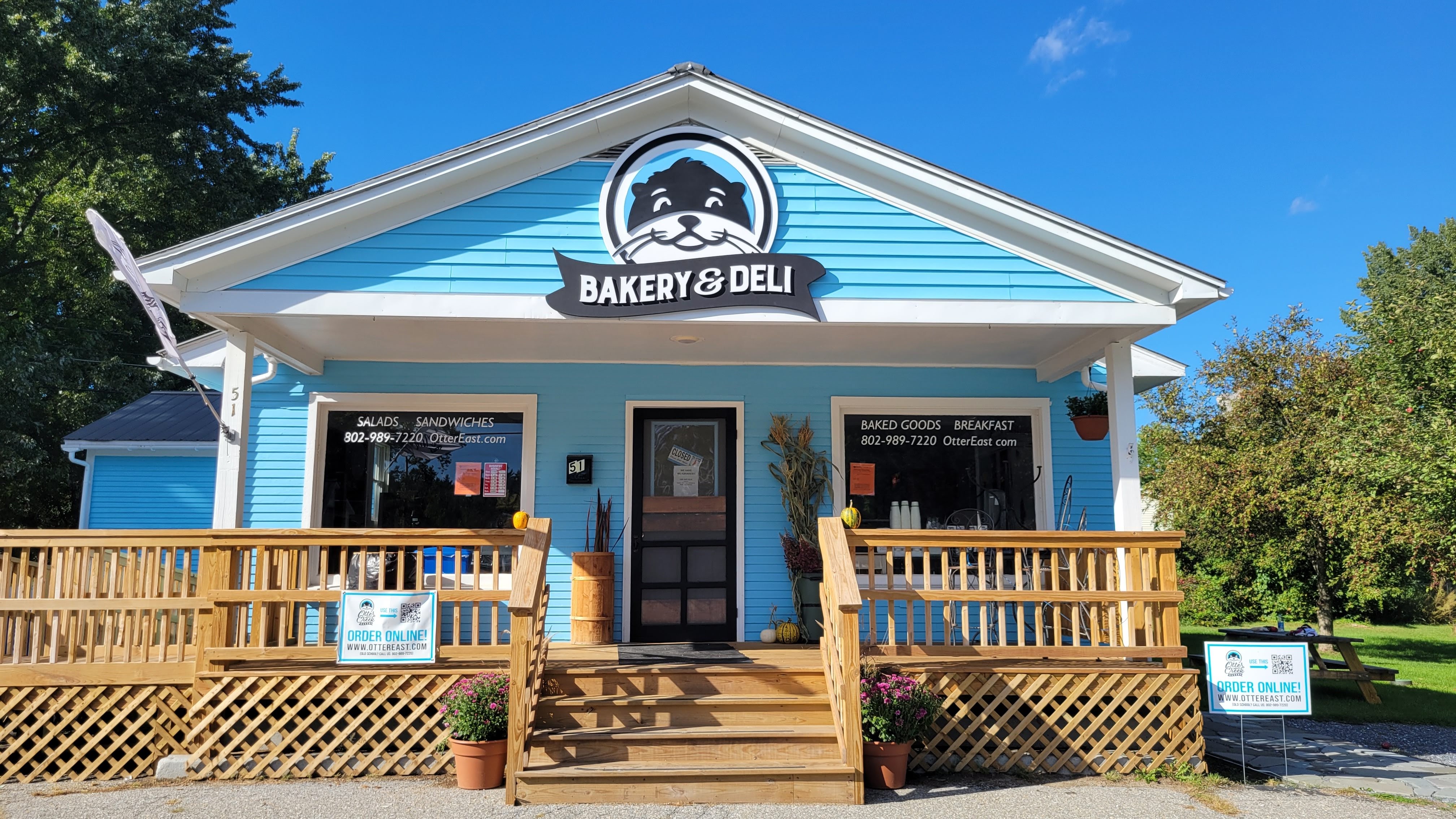
We decided to skip the last climb and take the dirt road descent directly into Ripton. The Ripton Market didn’t have sandwiches so we swooped down VT-125 into East Middlebury, rolling into Otter East Bakery & Deli 13 minutes before they closed for the day. We got our sandwiches and sat under the deli’s apple trees to enjoy a well-deserved lunch.
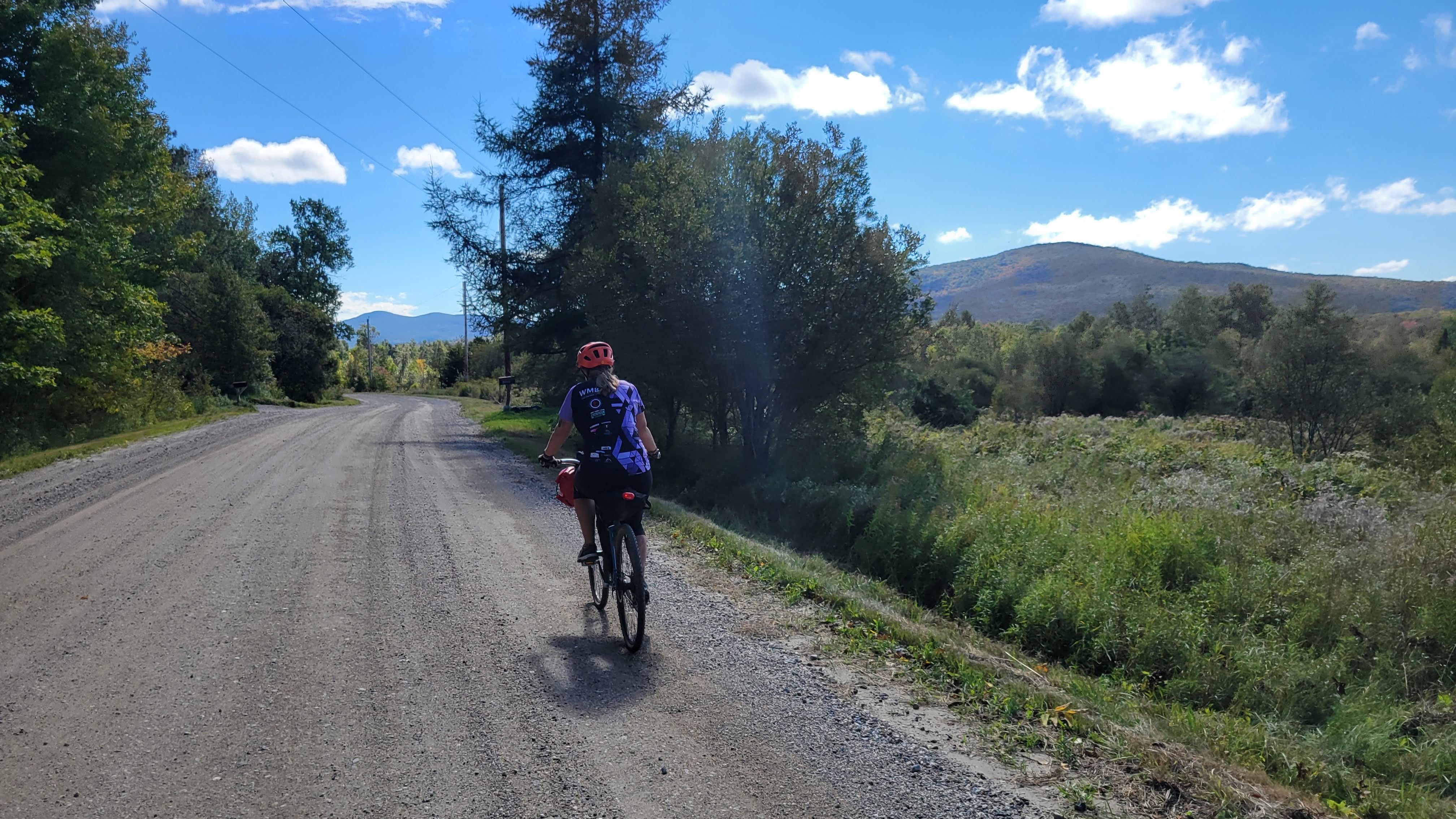
The rest of the day was flat to gently-rolling dirt roads and trails through farmland into Middlebury and then up to Beldens. The 5 miles from Beldens to VT-116 was gorgeous farmland and the backroads up to Bristol were quiet. Got to the Bristol Suites and hauled our bikes up three flights of narrow stairs to our room. Cleaned up, take-out from Bobcat Cafe & Brewery, and slept well after another tough but rewarding day. Hard to believe there’s only one more day left!
DAY FIVE: BRISTOL to BURLINGTON
Take-out breakfast from Bristol Cliffs Cafe (latte, oatmeal with dried fruit and maple syrup) and walked over to the park to enjoy. Last year the park was empty but this year it was bustling with energy as the community was setting up for the Harvest Festival.
We noticed bikes on the back deck of a second floor suite and ended up talking to the group before departing. They were also riding the GMGG, but stopping at all the breweries. I can’t imagine drinking a few times a day and trying to get to the next town – but they couldn’t believe we were just out to enjoy prime Vermont dirt roads. To each their own!
The phrase of the day was “hey look, another hill!” as we pedaled north through farmland. As we crested one early hill, we could see Lake Champlain with the Adirondacks as a backdrop. Stunning!
A few miles and hills later, we rolled up to Monkton Ridge Orchard, a tiny orchard on a side road no more than a quarter mile from a clearly larger and more “professional” apple orchard operation. We stopped for cider donuts and a glass of fresh cider before continuing on.
Jess marveled at how a regular dirt road would turn into these single-lane rustic roads and back on the same “road.” Part of the charm and texture of Vermont dirt!
We stopped for lunch at Folino’s Pizza in Shelburne before the final few miles into Burlington, splitting a large margherita and guzzling lemonade. The Burlington Bike Path has rolling closures so we ended up having to detour. This detour brought us to Lake Champlain Chocolates, which Jess had been hoping to find again before she flew home. The detour was clearly kismet.
Rolling up the Burlington Bike Path along Lake Champlain was a perfect end to our trip.
TOTALS
226 miles
19,305′ of climbing
5 days (just shy of 24 hours total ride time)
THINGS I DID RIGHT
Focus on FUN. Having done the route before, I knew what to expect and could offer options when we had opportunities to make adjustments. As cool as it would be to show Jess the Von Trapp Lodge, the dirt climb to get there is soul-sucking. Better to get burritos and have something to look forward to next time.
No need to rush. I am exceptionally proud of my “second fastest time” notes on Strava throughout the routes. I was able to finish strong and with plenty of energy each day.
Pack Light. Lodging lightened my load by about 8 pounds, to a total of 16 pounds of gear. Which is still MUCH less than the 30 pounds I hauled around last year.
Nutrition. I was constantly eating a bite here and there, a few gummies every few miles. Fueling the ride meant more days feeling stable, solid, and ready for the day. I also focused on carb-centric breakfasts like scones, oatmeal, and pancakes with bananas and eggs to complement.
Modifications to the route. We made changes to almost every day, whether to remove unnecessary miles/hills or to get off heavily trafficked roads. All edits were made to maximize the FUN part of the ride – and since we didn’t have a need to get to a brewery for a beer, we were free to check out other local attractions. We took the main route as a set of options and chose the ones we wanted to do.
THINGS I CAN IMPROVE
Packing. I brought an entire nano panier of food (probably 5-6 pounds) and came home with 3.5 pounds of untouched food. Psychologically it was a safety net and I always had something to eat – but yeah, can definitely pack lighter there.
(I’m sure this will get updated as I think of more things to do better)
Packing List
total gear+supplies weight – 16 pounds bike weight estimated at 25 pounds
So I’m leaving tomorrow for a second shot at the Green Mountain Gravel Growler, an epic adventure in north-central Vermont. My brain alternates between “you got this, girl!” to “wtf are you doing?”
Readers may remember last year’s ride, which was deeply influenced by a few key factors:
Limited bikepacking experience (it was my 4th bikepacking ride)
overpacking (27-30 pounds of anxiety packing)
Not eating enough quick-energy snacks on the hills
digestive issues, directly related to …
having major abdominal surgery 3 months prior
While I had an amazing time on the ride last year, I’ve been pretty hard on myself for calling a taxi 18 miles from finishing the route. I have zero regrets about this, as I remember how deeply bonked I was, and used this vulnerable moment to inform my adventures this past year … but I also feel I have unfinished business with the Gravel Growler.
My girlfriends tease me about being a Finisher, but there’s an element of truth there. I want to finish what I started last year.
This year I spent a lot of time working on my bikepacking skills, starting in April with a local overnight and culminating in late July with the Cross-New Hampshire Adventure Trail: how to pack lighter, how to decide what to leave at home, how to dispersed-camp, how to know your route enough to know where other options are when your plan A doesn’t pan out.
I did another local overnight in August but have been focused on just riding and keeping the legs prepped. I have spent hours pouring over the map, dialing in contingency plans and writing down notes in case cell service is absent when we need it most.
This year, my friend Jess is flying in from Colorado to join me on this trip. To keep things light, we decided to shift from camping to lodging along the route. I think this will be a key benefit, as the weather forecast has two days of steady rain in the middle of the ride. If Brattleboro taught me anything, it’s having a warm shower and bed to sleep in is amazing after a day in the rain.
That and bringing spare brake pads in case we need to put in fresh ones after a rainy, dirty day.
I just weighed my bags for the trip … 16 pounds. A good chunk of that though is quick-energy snacks for the whole trip plus a few extra. Understanding this isn’t totally necessary as we can stop along the way to get food at convenience stores and local markets, it’s giving me psychological safety. And the load will get lighter over time.
Bottom line, I have three goals for this year:
Have fun, one day at a time
eat the damn pancakes
finish the ride happy, healthy, and feeling accomplished
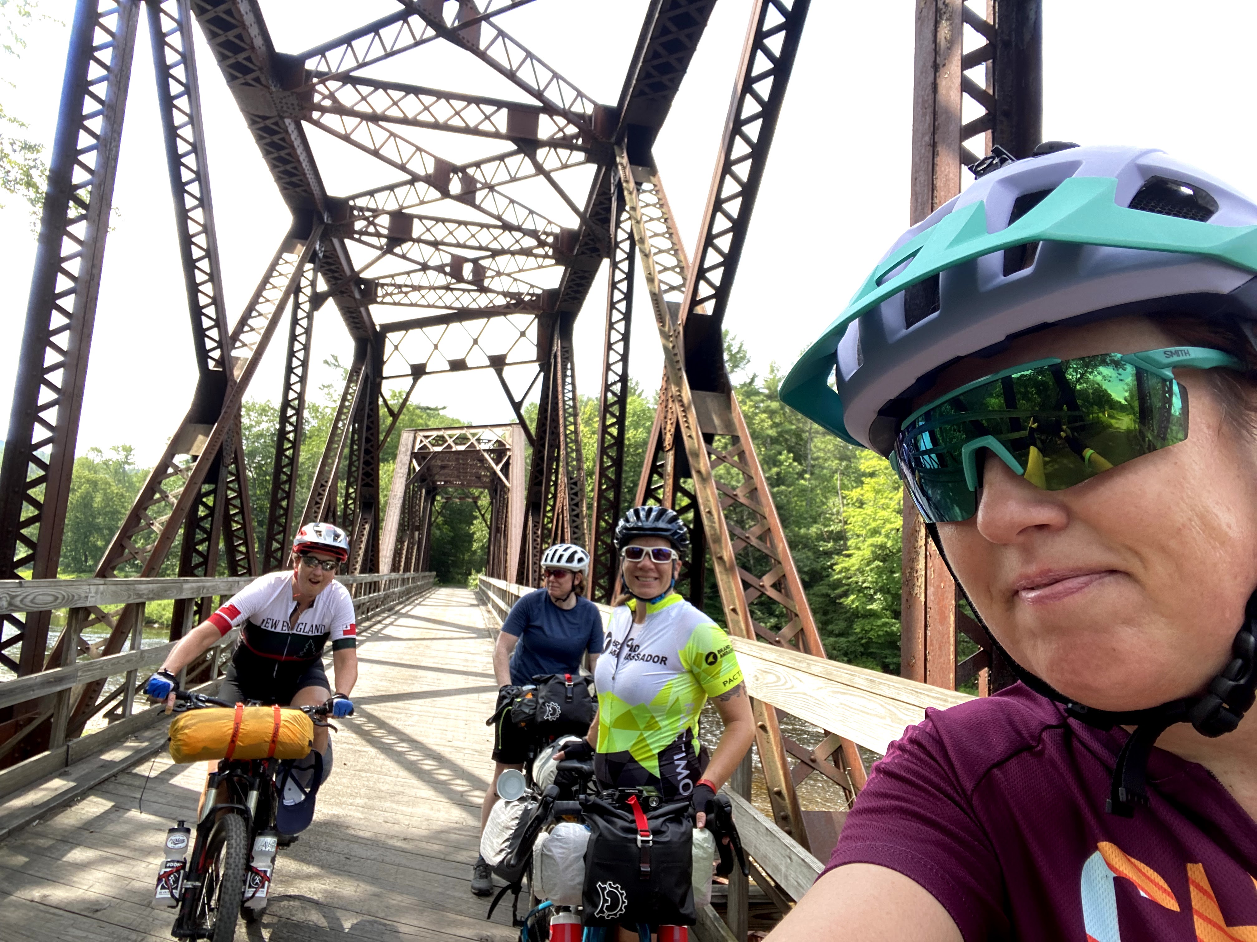
A low rumble sounded. I’m pedaling up Old Cherry Mountain Road into White Mountain National Forest, enjoying the stunning forest gently hugging the dirt road, squarely centered on being fully present in this moment. My friends are out of sight behind me, but not worried … we’ll all regroup at the top.
That’s interesting, I didn’t realize there was a logging operation nearby.
A short distance later, the low rumble sounds again.
That’s not loggingoperations. That’s a thunderstorm. We need to set up camp NOW.
A few years back my friend Karen sent me a website for the Cross New Hampshire Adventure Trail (XNHAT). At the time, there wasn’t a lot of information other than a Map My Ride link and a few pages with trail conditions, including that ATVs had chewed up a section of the rail trail pretty badly. We put this in our back pockets for a future adventure when more information was available – but it was appealing because of the gentle rail trail grades, lots of dirt, and biking across New Hampshire.
Earlier this year I saw the Northern White Mountains Overnight Loop (NWM Loop) on Bikepacking.com and immediately wanted to do the ride for the scenery. But with a 6 hour drive to the start, I needed a bit more to make it worth the drive.
Karen, our friend Ashley, and I originally planned to ride the Brattleboro Loop from bikepacking.com but as the year progressed and the weather was persistently rainy, we decided to find something more in line with a Type I fun trip.
Enter the mashup of the XNHAT and NWM Loop: start from Woodsville, NH (a mere 4 hours from my house) and ride to Maine and back with the scenic NWM Loop hooked in on the eastbound ride over 3 days (2 nights). My friend Jean also joined us.
Day One Highlights
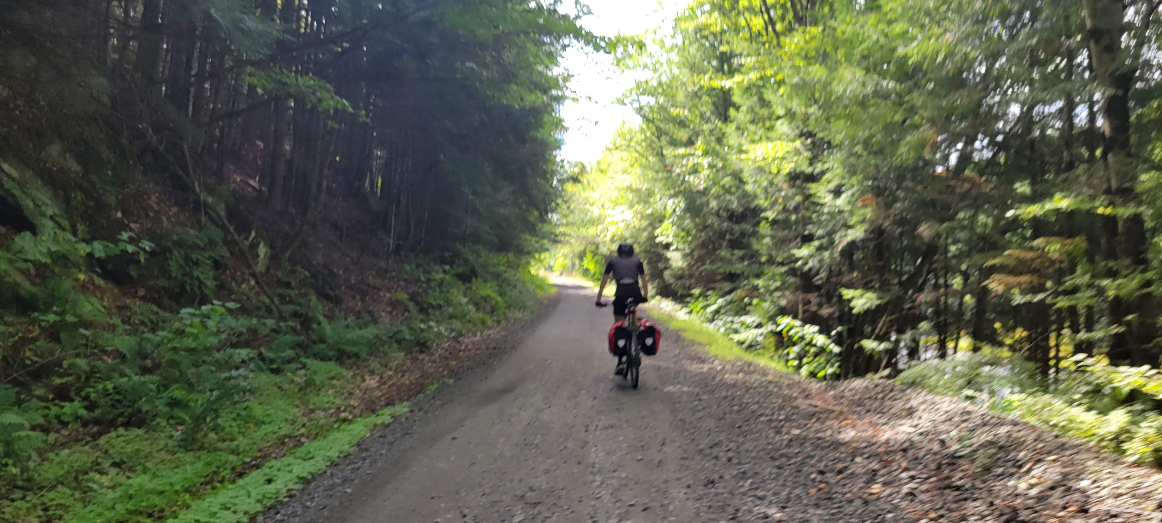
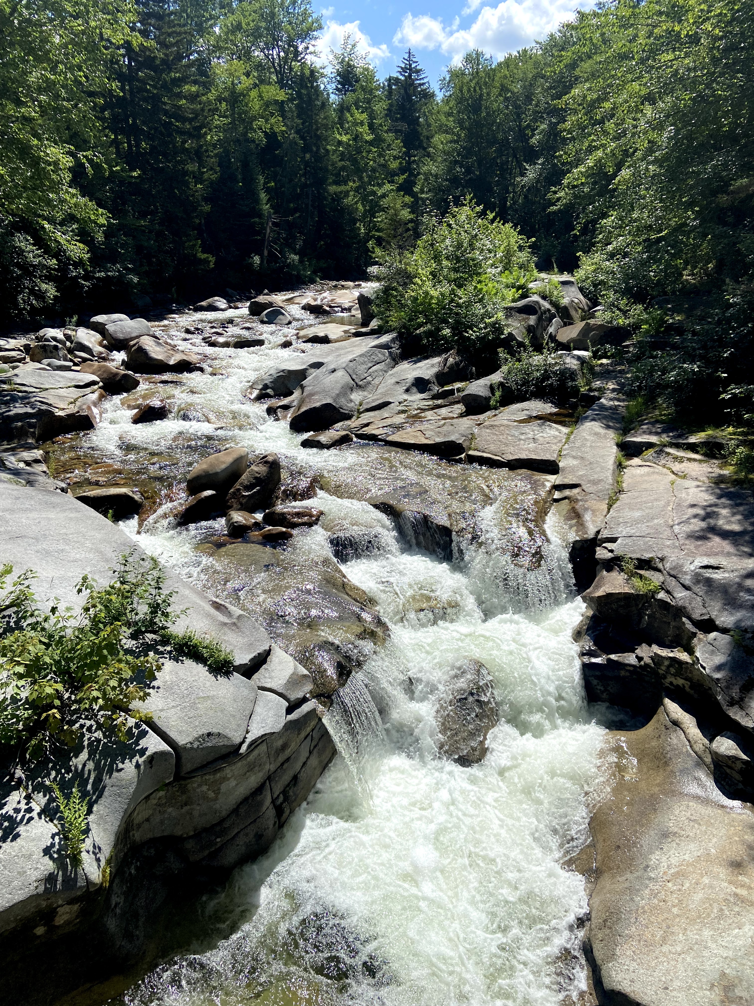
The Ammonoosuc Rail Trail isn’t your typical rail train in that it allows OHRV/ATVs. The gravel can get deep and chunky at times as well as significant washboarding. Wider tires help, but our hands were continually going numb from the vibrations.
The bridges and trestles are wide and well maintained, offering stunning views along the river
Seeing a buck running through the river. We watched for a bit to make sure a bear wasn’t chasing it before continuing on.
Covered Bridge at Bath
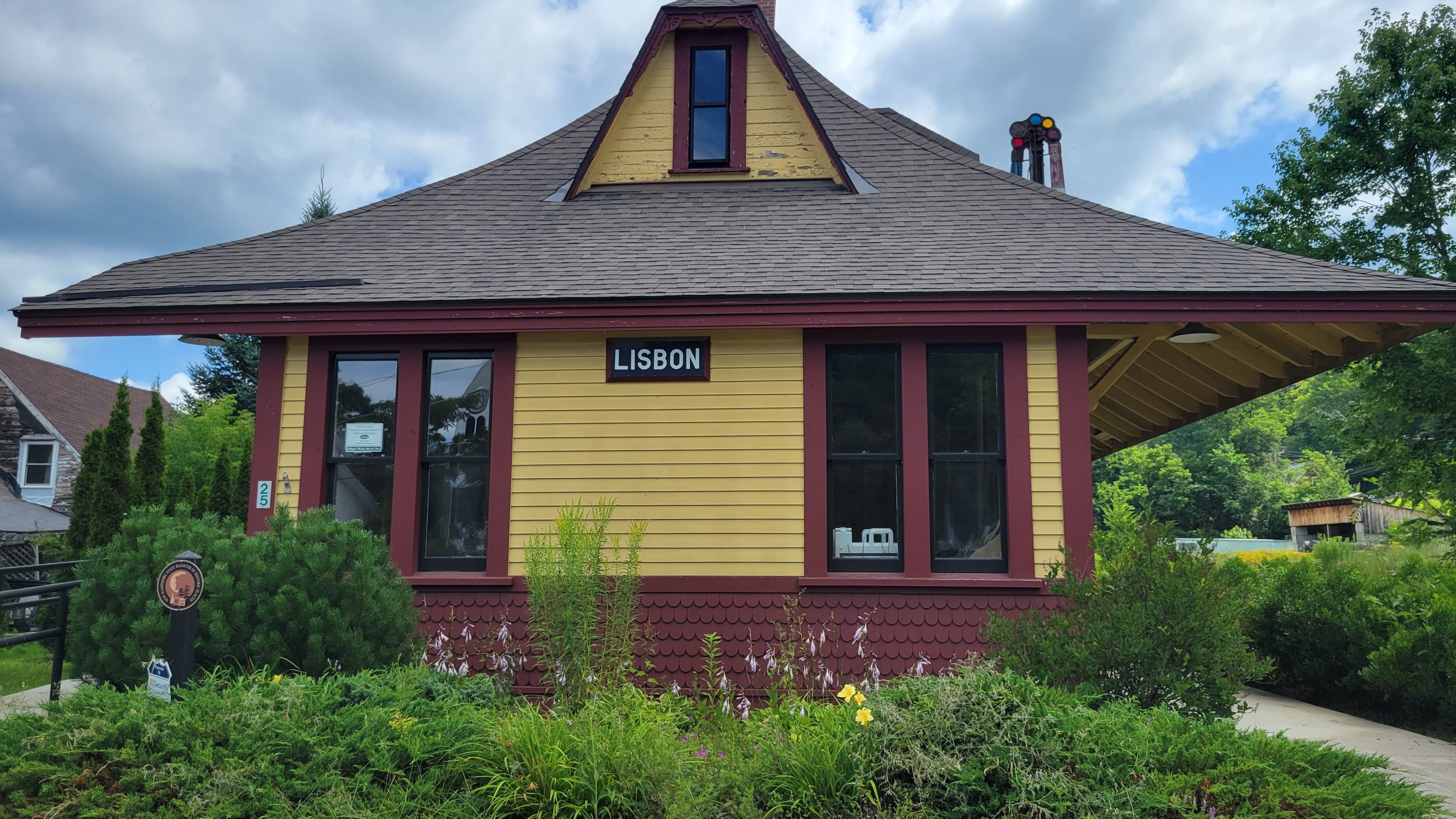
Old Train station in Lisbon
Lunch at Littleton Diner
Getting caught in a pop up rain storm leaving Littleton
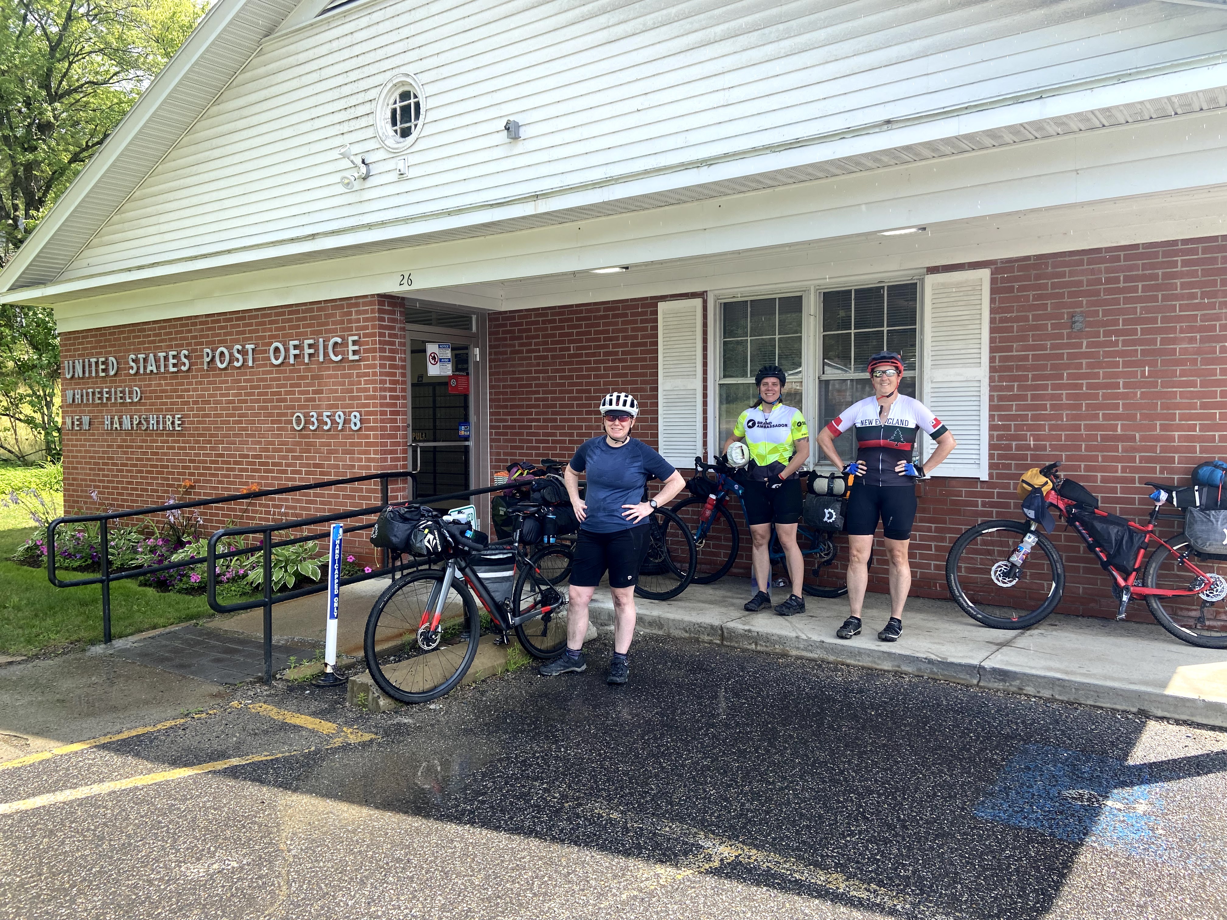
11 miles of exposed pavement (Route 116) from Littleton to Whitefield is by far the least enjoyable part of the journey.
The shoulder is wide, but it’s a busy road with lots of logging trucks and virtually no shade or opportunities for shelter when weather changes
Deciding to pick up extra water in Whitefield since we intended to dispersed camp in White Mountain National Forest
Getting caught in another pop-up rainstorm as we leave Whitefield. This has got to be a record year for rainfall in the Northeast.
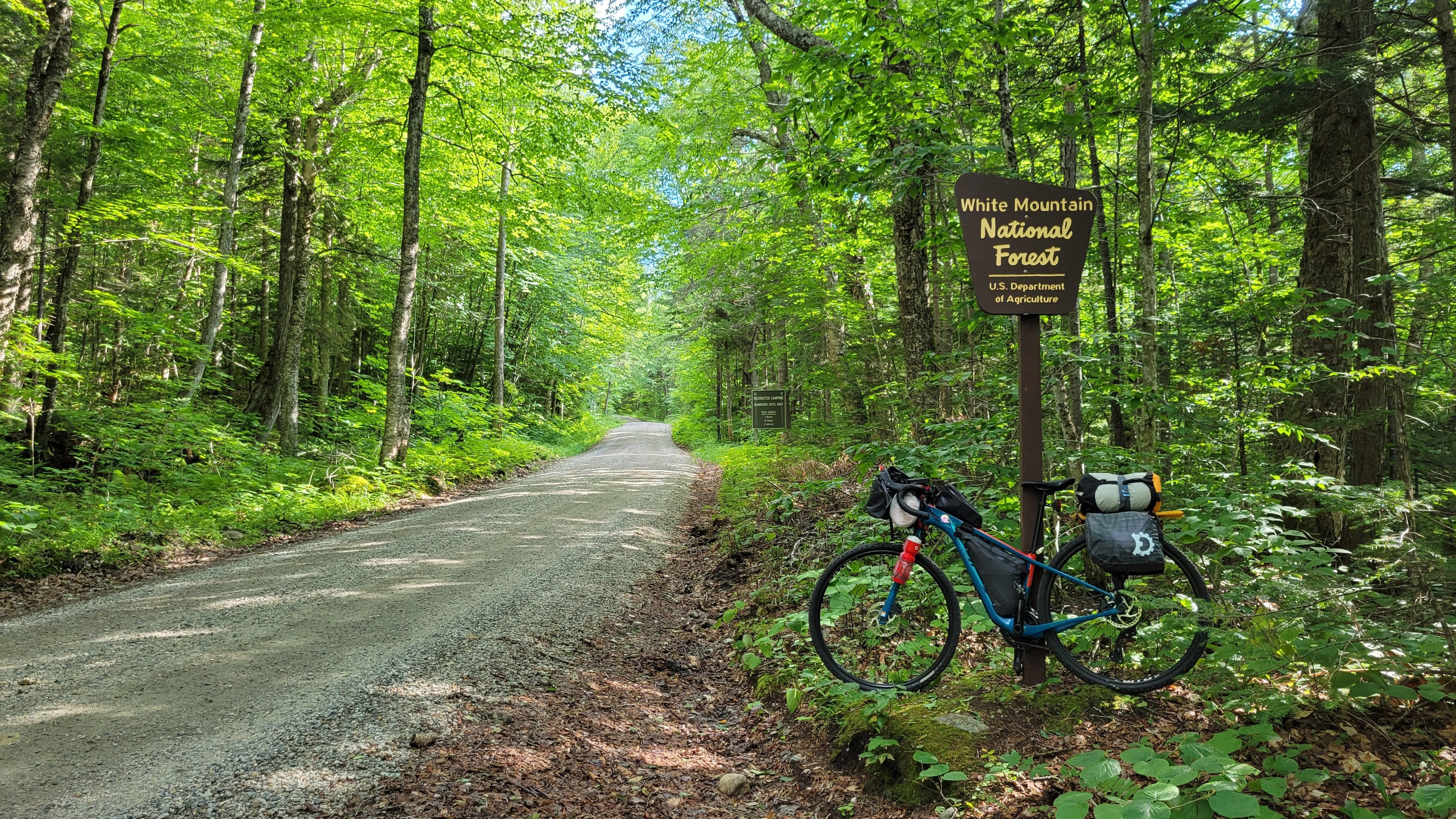
Back on quiet backroads and the start of actual climbing, not the gentle rail trail grades we’ve been enjoying so far
Old Cherry Mountain Rd is a fantastic climb into White Mountain National Forest
Thunder!
checking dispersed campsite after campsite and finding them all occupied. Feeling disheartened, but also that we need to get set up quickly because a thunderstorm is approaching.
Recalling there is a campground at the bottom of the descent … and going up to the front door of the house to see if we can get a site …. quickly
Spending the next hour on their covered front porch while thunderstorms form, merge, and then move south … while another forms in its place and dumping lots and lots of rain.
Fortunately the campground had hot showers for the coldest among us … and the owners brought us firewood so we could have a fire
Setting up camp, enjoying dinner and laughter by the fire
Helinox chairs are worth the weight when it’s been raining!
Finishing the day at 50 miles
Day Two Highlights
Everything is somehow still wet from overnight – but the temps are rapidly rising and drying things off
checking the weather forecast and realizing Sunday is 95% chance of .5″ of rain and by heading westbound, we won’t see any tapering off. Sunday is our longest day, an expected 65 miles on the Presidential Rail Trail, Route 116, and Ammonoosuc Rail Trails.
Making the decision to finish the NWM Loop portion of the route and then head back to the cars for a total of 57 miles for the day.
It’s hot. We take frequent breaks in the shade
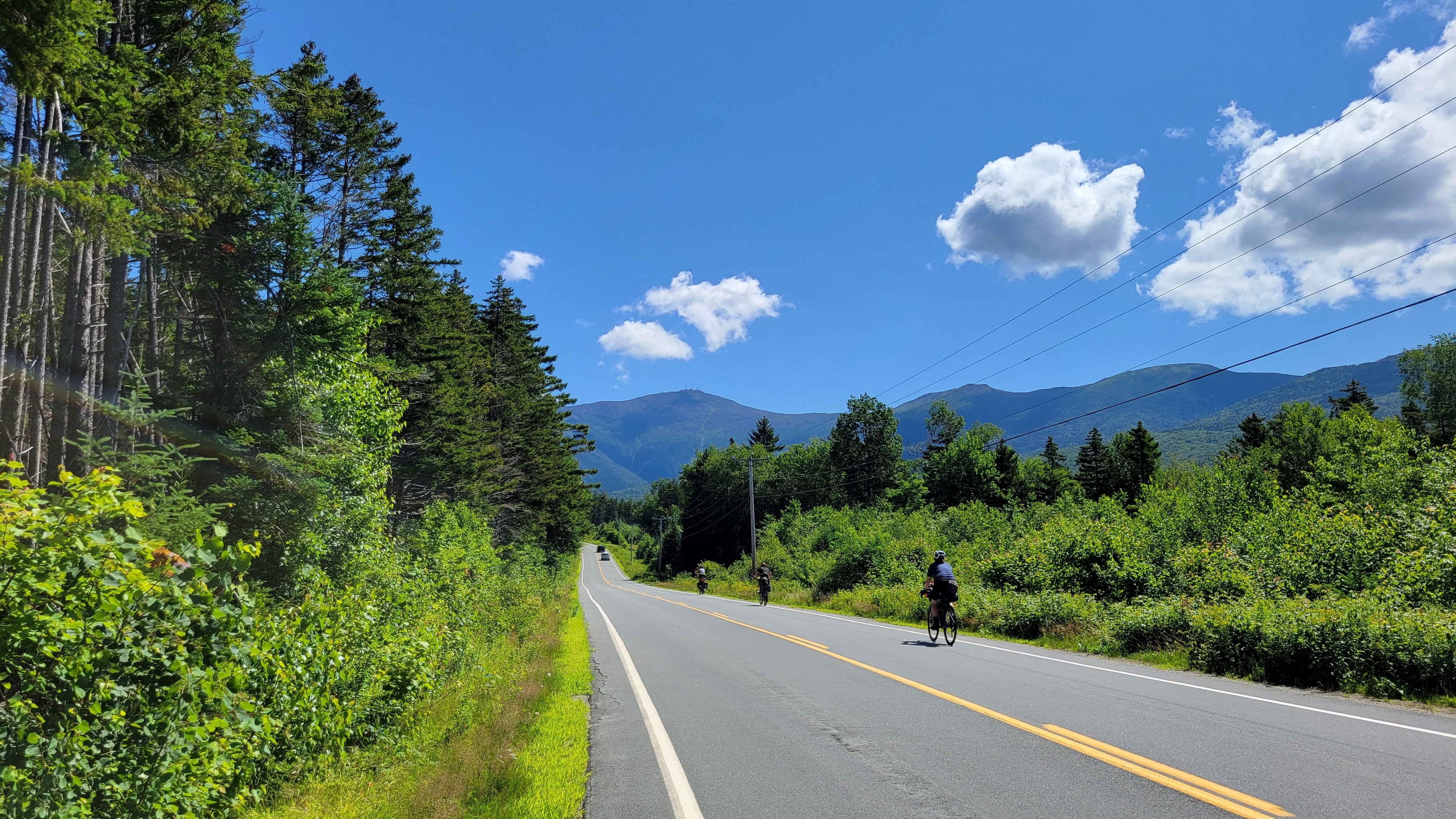
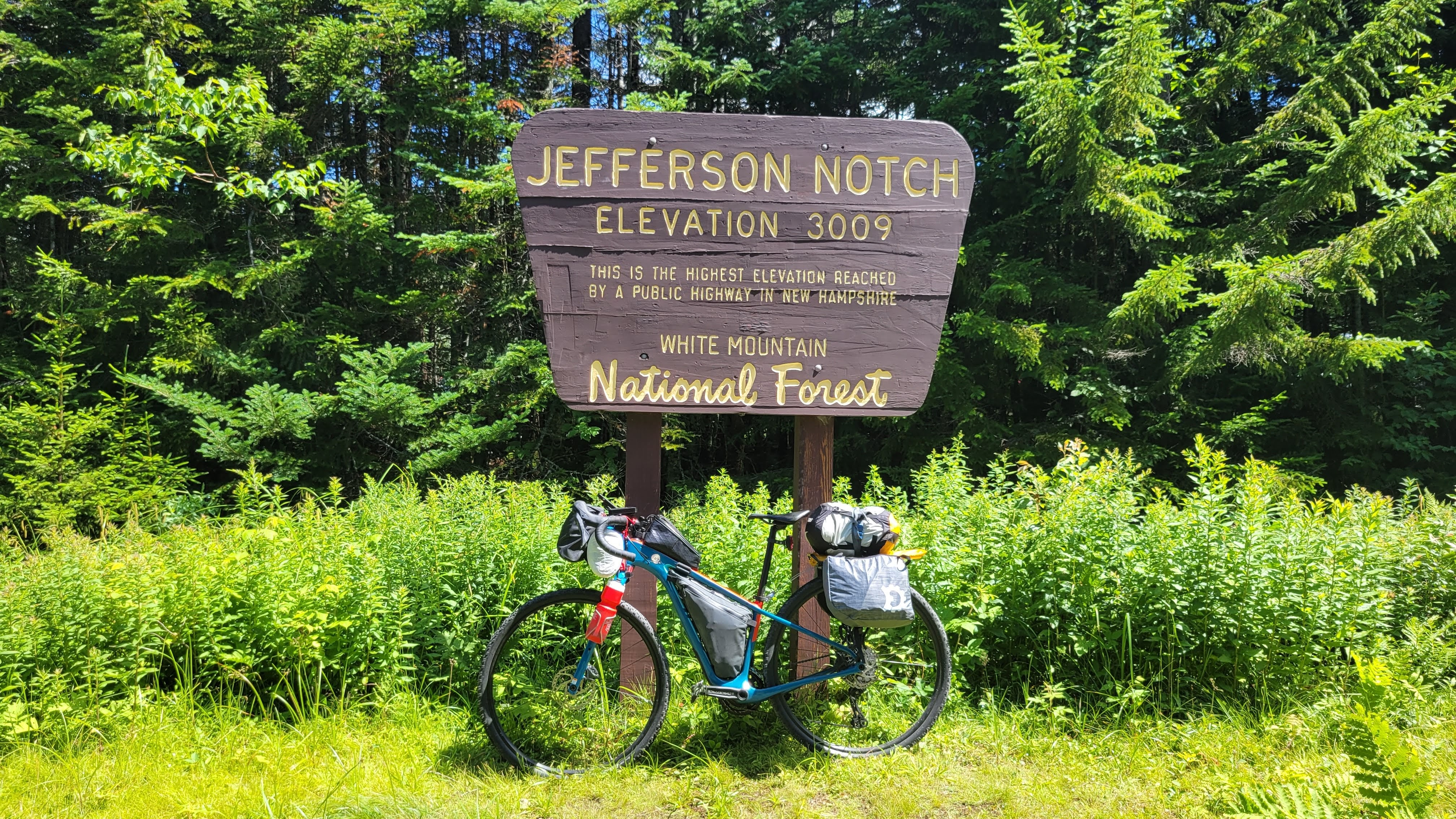
Turning left onto Jefferson Notch Rd and feeling relieved to see it’s a gorgeous shaded dirt road
Everyone taking the climb at their own pace
SO HOT at the summit!! Photos, food, quick break in the shade, then 6 miles downhill
Learning the Presidential Rail Trail is significantly more rustic than the Ammonoosuc Rail Trail. But the views!!
The heat is starting to get to some in the group so we start taking frequent breaks in whatever shade we can find
Whitefield Market for food and time in the A/C
lunch in the shady grass at the center common park was peak bike adventure happiness
Back on Route 116, which is still really exposed but now really hot as well
Arriving in Littleton and deciding to head to the river and put our feet in
GAME CHANGER! The river was so refreshing and cool.
It’s all downhill from here, with gravity gently pulling our bikes a little faster
Arriving back at our cars tired, dirty, sweaty, and happy for the overnight adventure with girl friends
Pro Tips & Takeaways
Align expectations prior to the start. Want to stop for photos and ice cream? Prefer to heads-down hammer between resupply stops? Be open and honest about this. Not everyone knew each other on this trip and talking over dinner about what we hoped to get from this trip put us all in the same mindset so we could have an amazing time together.
Be sure to “train” and acclimate. If you’re a regular reader of this blog, you know “training” generally means finding something similar to what you’re about to do and doing that a few times before the trip. If you prefer a training plan, knock yourself out.
This includes in all kinds of conditions – hot, cold, rain, exposure, shade. Know how your body reacts and how to adjust on the ride. And if the situation goes sideways, always prioritize health over schedules or expectations. Do not put yourself in a dangerous place for whatever perceived “glory” you’ll get from the trip.
Planning is essential for any adventure – know options and have back up plans.
We expected to camp at the dispersed campsites but they were already claimed with no one around to ask if we could share the site. Thankfully we had scoped a campground on the planning map that had room for us for the night.
Also changing our plans due to weather. Much easier to consider because we knew where the route option points were and distance between towns/resupply.
Prioritize packing for health and safety on the trip. Literally putting out legs in the ice cold river helped relieve the heat of the day and provided a nice respite.
Creature Comforts are important too!
Box Wine was worth the weight while around the campfire the first night
As were the Helinox and Z-chairs. The deluge had made everything at the campsite completely soaked – having a dry place to sit and warm ourselves by the fire was amazing
Rail Trail grades are appealing – but know the energy consumption increases as the surface gets progressively more rustic. Long stretches at a 1-2% incline can also sap energy reserves! Fuel appropriately and consider tire choice before heading out.
Not every adventure has to be EXTREME. Be safe, have fun, pick two.
Packing List
total gear+supplies weight estimated at 24 pounds bike weight estimated at 25 pounds
The Bike & The Packs
Salsa Cutthroat GRX600, size 52 modifications: 11-40 cassette Teravail Rutland 42mm <– very pleased at the low rolling resistance and good traction in the chunk Salsa bolt-on framebag Revelate Designs Pronghorn Harness w/small drybag <–no impediment to shifters and minimized overpacking Revelate Designs Egress Pocket Revelate Designs Nano Panniers Revelate Designs Gas Can Topeak Explore MTB rack Sea to Summit eVent waterproof compression sack, Medium (14L) 26oz water bottles, mounted to fork 17oz collapsible Platypus bottle for extra water on Day 2