Two months ago we landed in Colorado and began the process of Unpacking and Setting Up The House. I haven’t been on my bike since October at this point – so long ago TrainerRoad knocked my FTP down to a level I have never seen. (To be fair, I only have a power meter on my trainer, so while I may have been at this level before, I’ve never *seen* it)
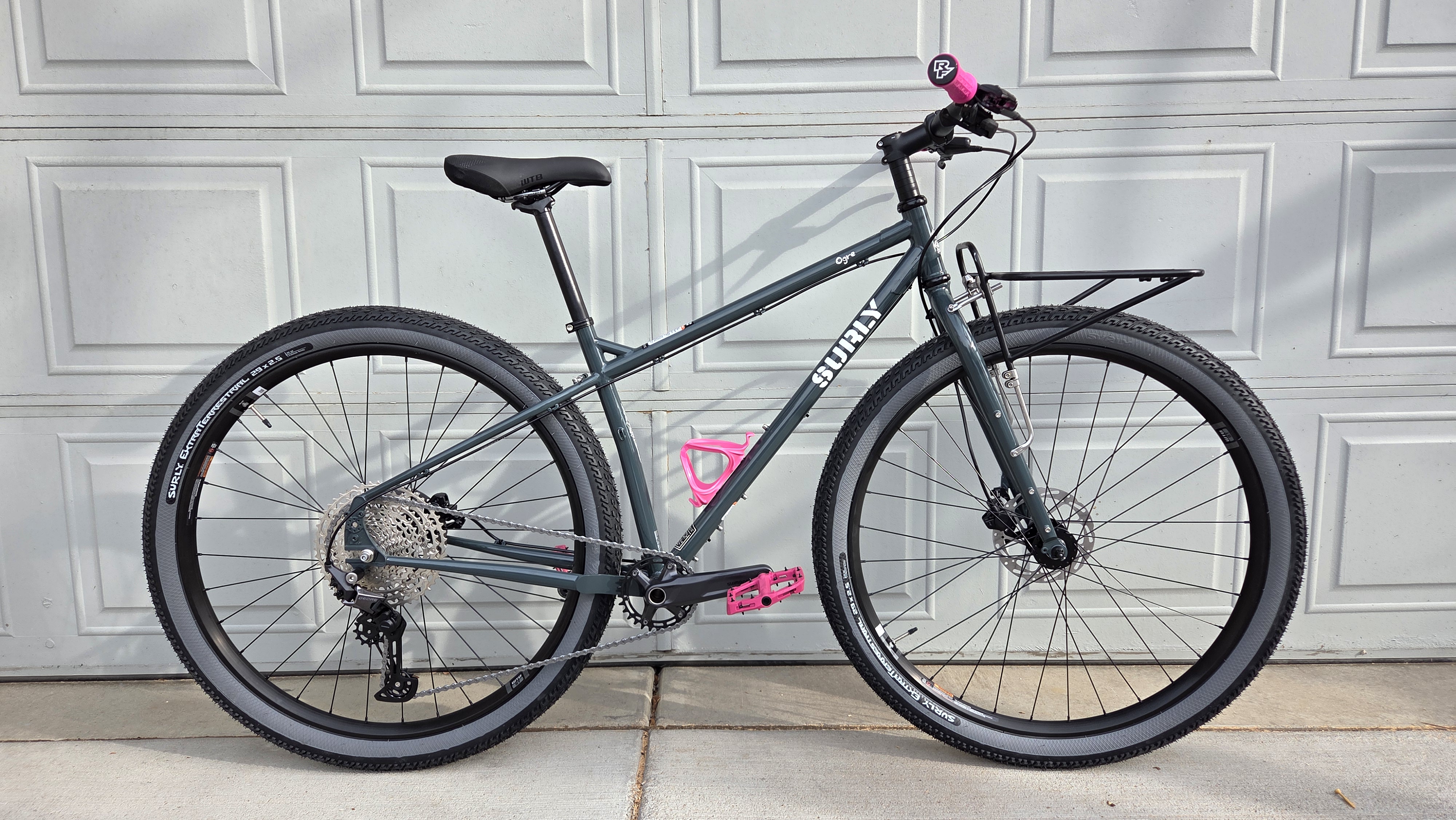
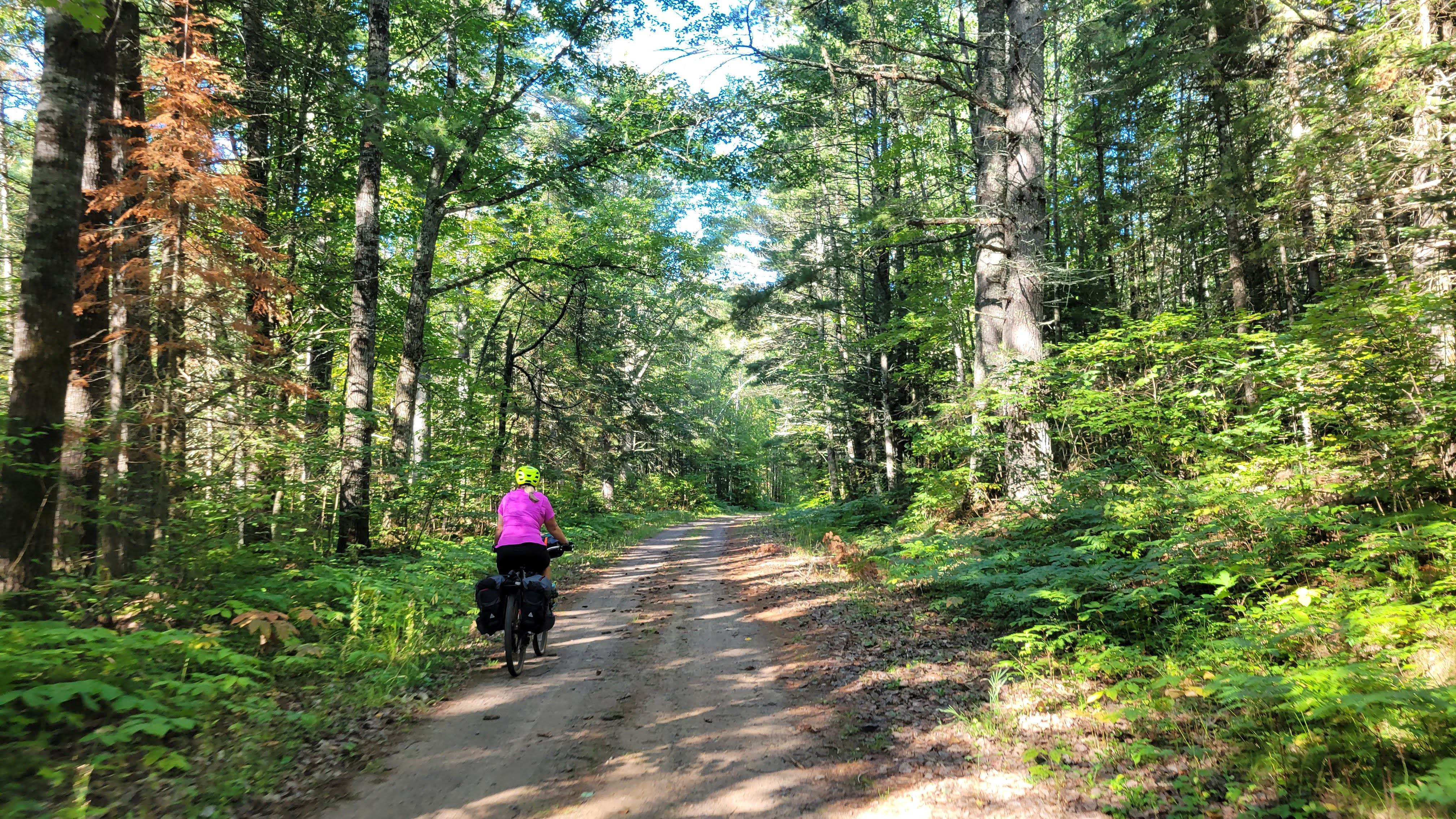
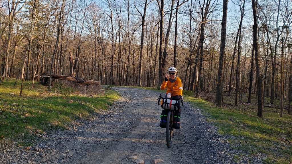
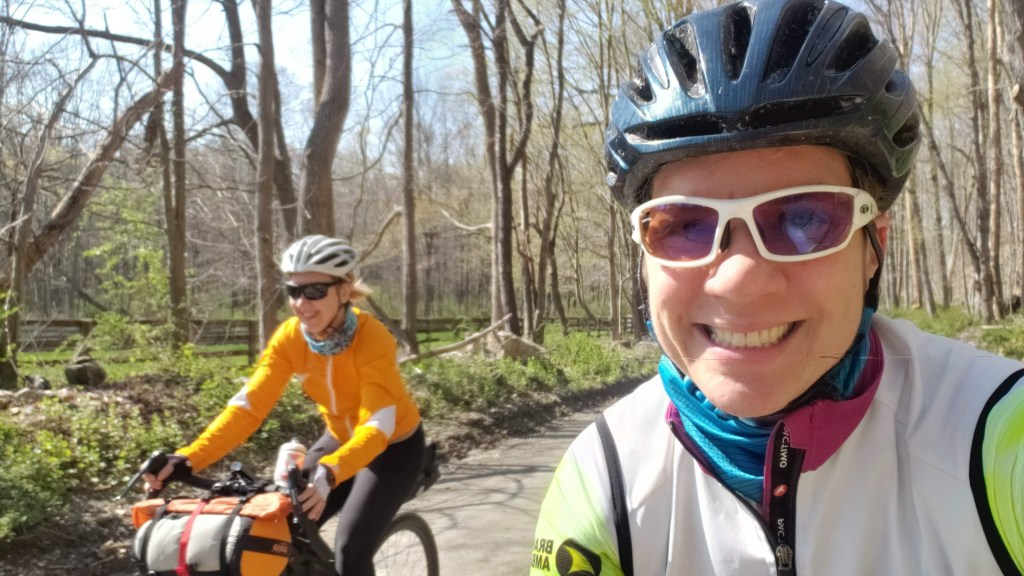
Our new location is stupid convenient to everything, so I decided to buy myself a dedicated About-Town bike. Look at this beauty!
I’m not usually a Pink Girl but it looks so good next to the green-grey frame
(For fellow bike nerds, she’s a 2025 Surly Ogre in Orlock’s Shadow with a Surly first-gen 24-pack front rack. I recently added a Waald 139 half-basket. Why a first-gen? Because I can move it to my Wednesday for bikepacking, should I find a suitable fatbikepacking route locally)
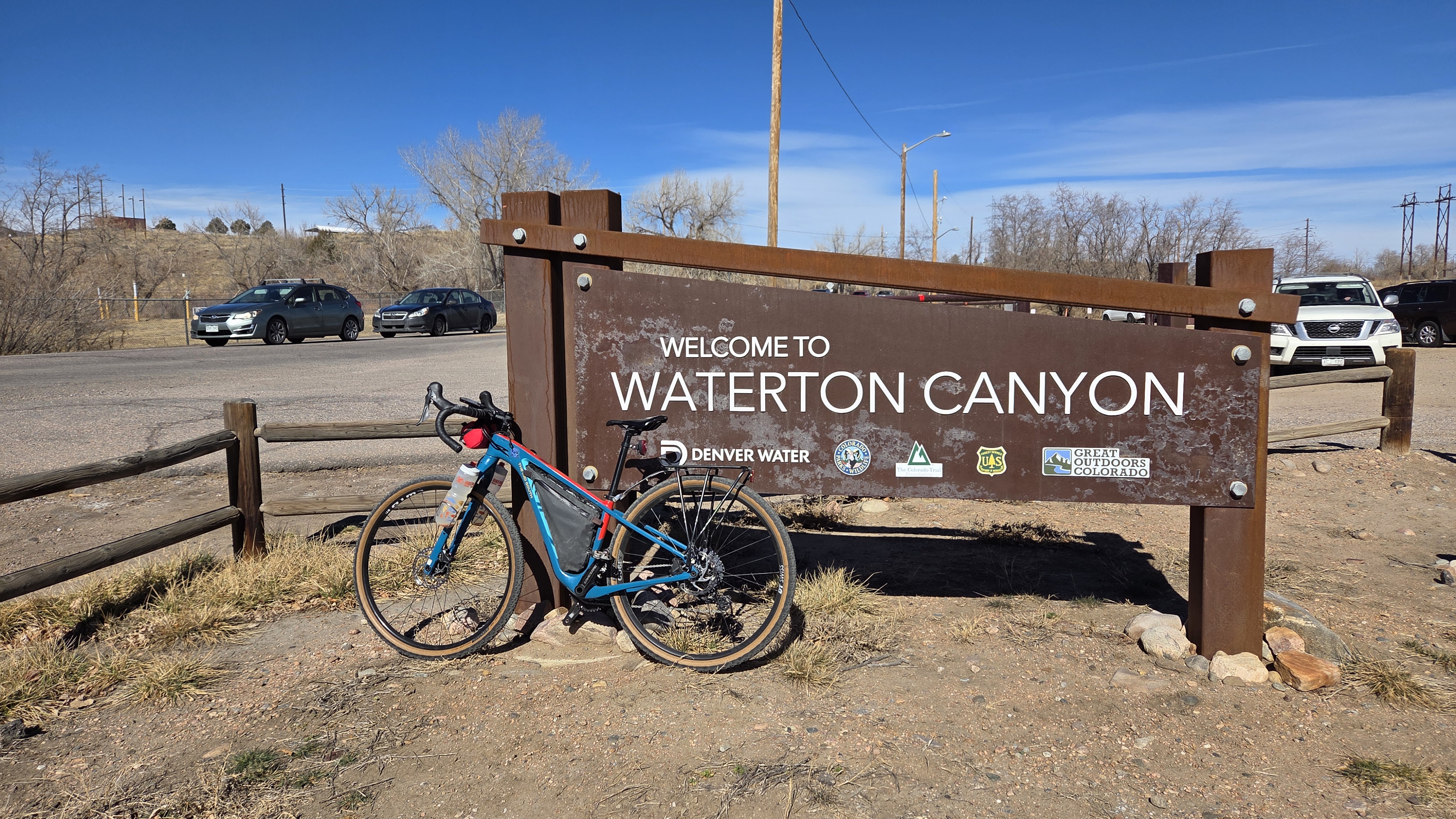
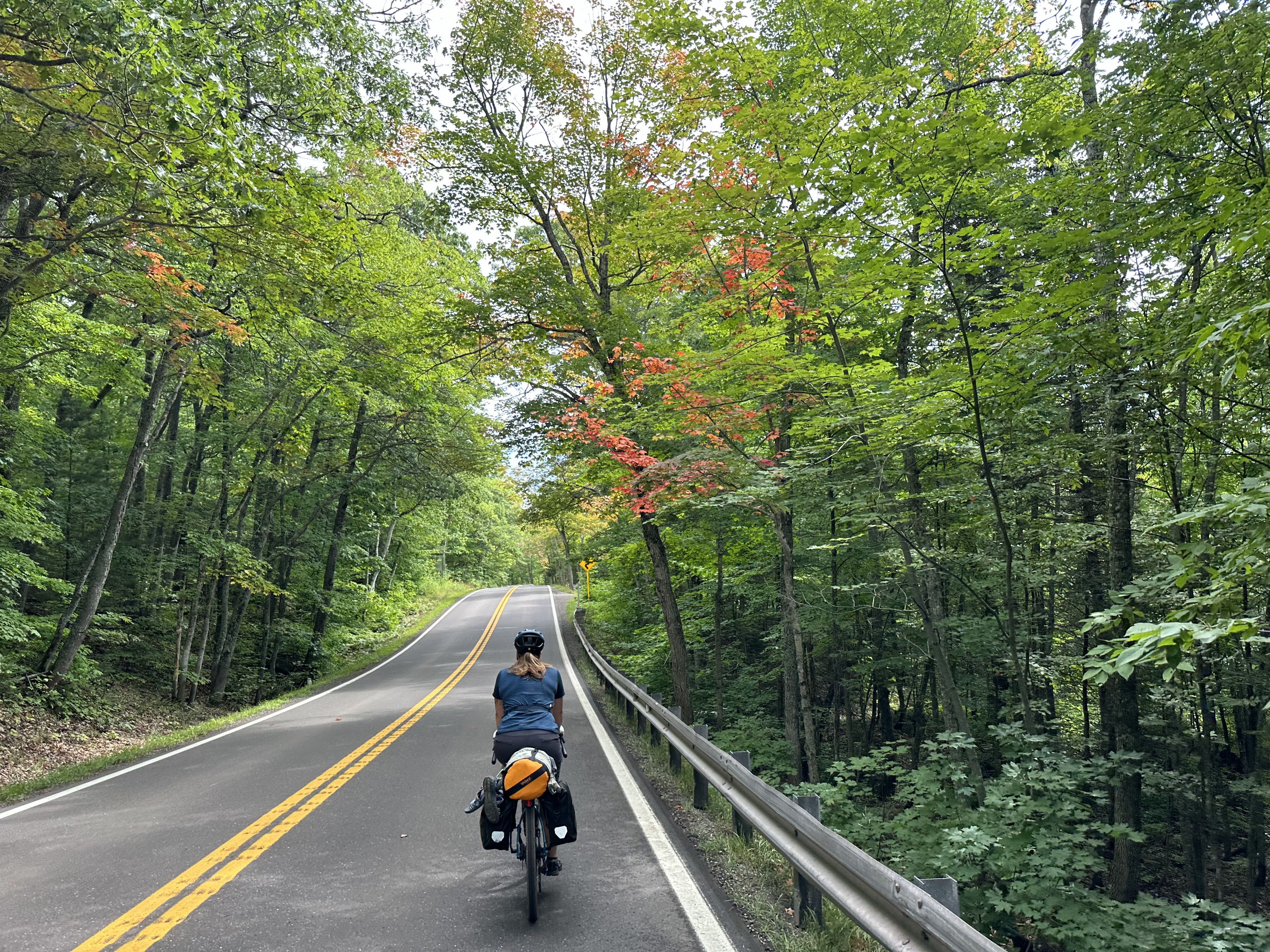
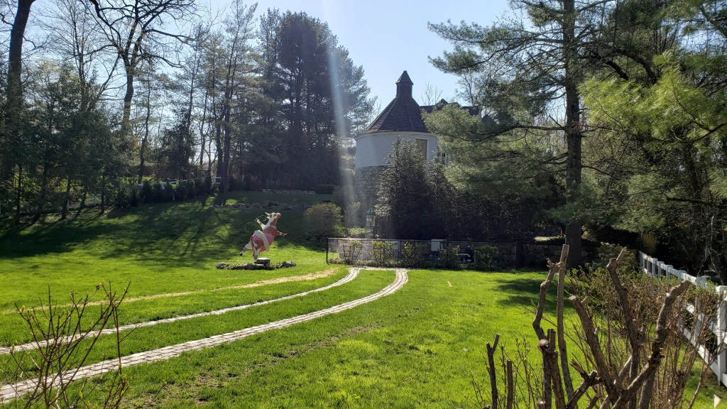
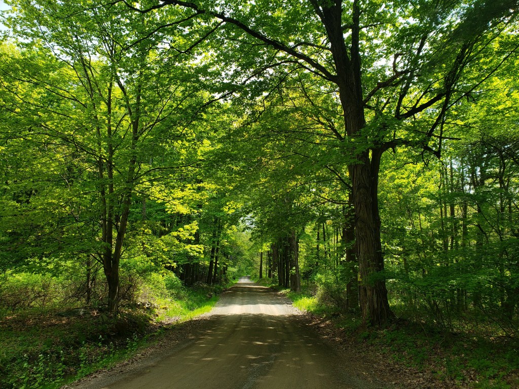
Anyway, we are deep in a Climate Change Winter here. We had a cold snap a bit ago, but overall it’s been very pleasant. Sunshine, blue skies, jeans-and-a-t-shirt weather. Yesterday, the temps were expected to be in the upper 60s, so I decided to try a route I found on Gravel Bike Adventures – Dirty Chatfield & Waterton Canyon. Waterton Canyon has been on my To Do list since I moved to New York and discovered a love of dirt roads.
(full disclosure, the two lonely routes in New York are mine)
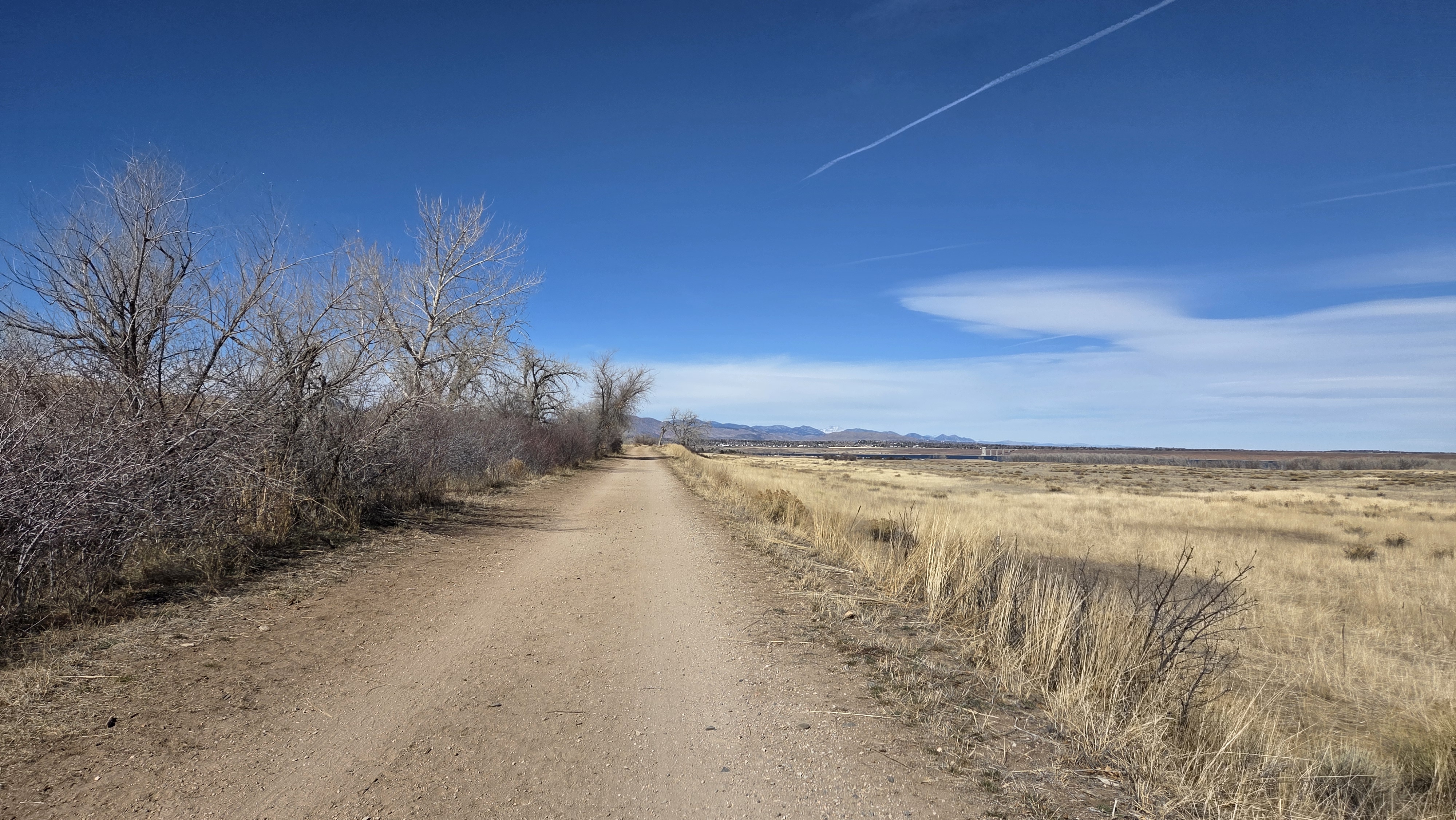
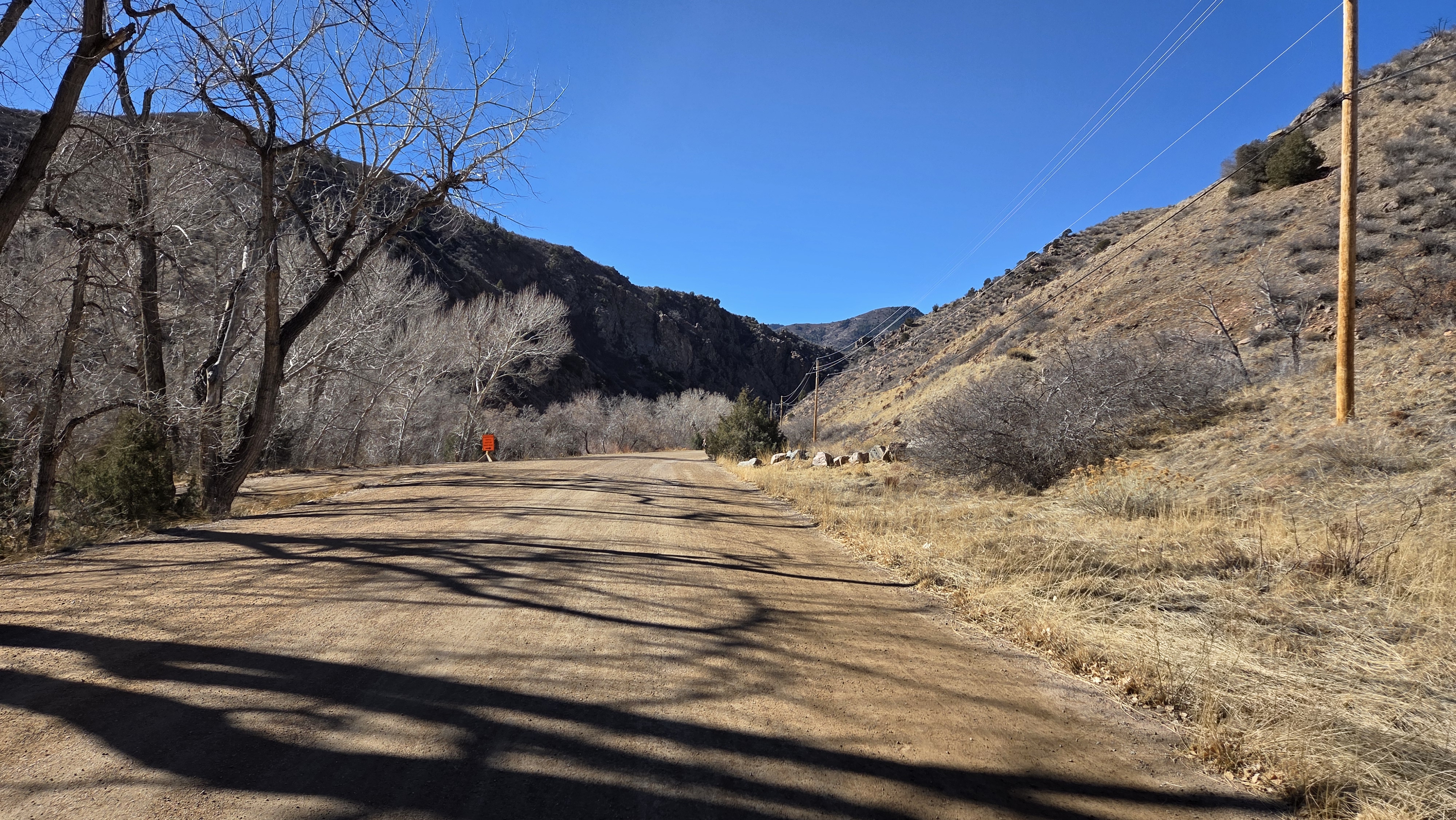
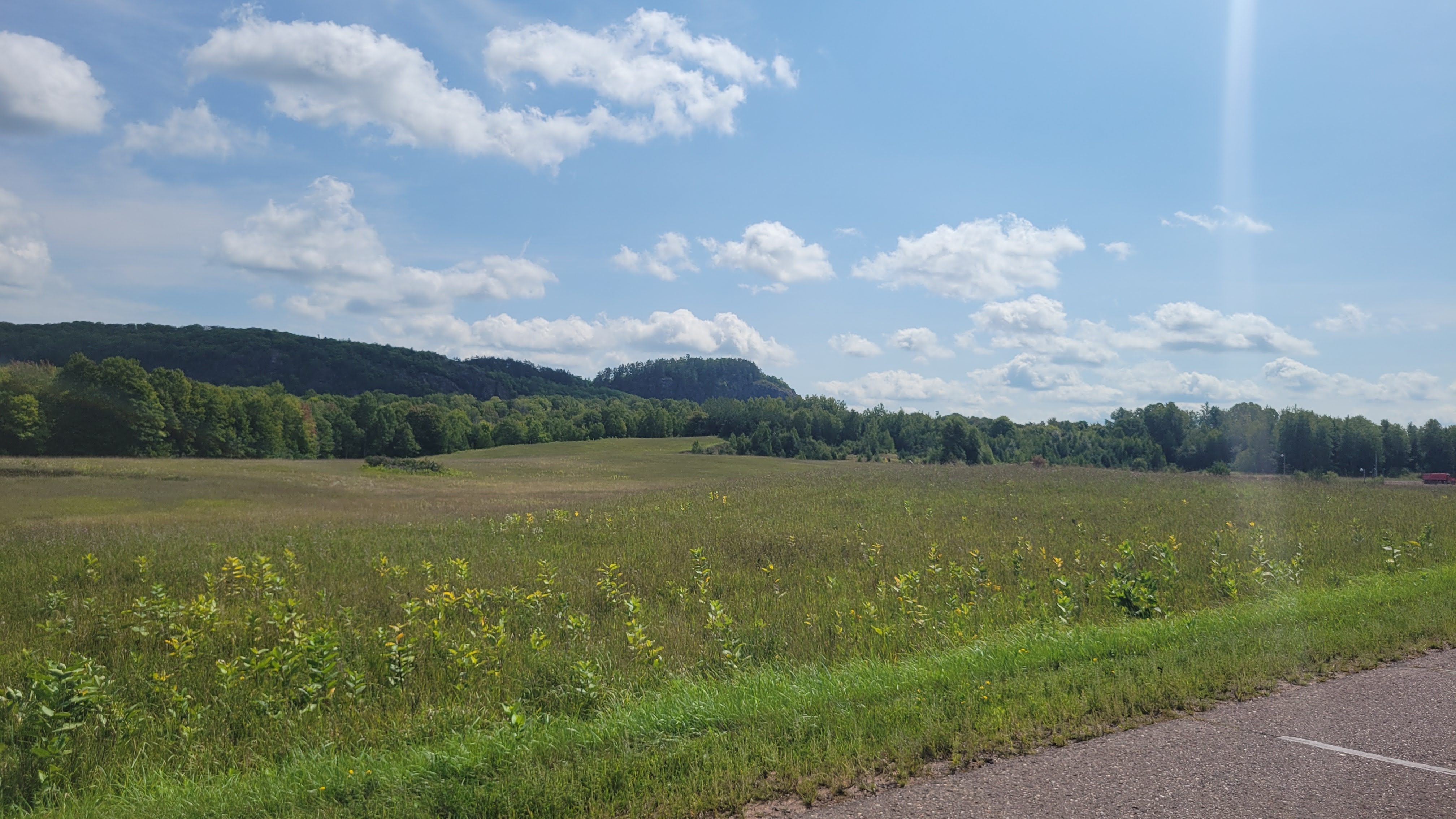
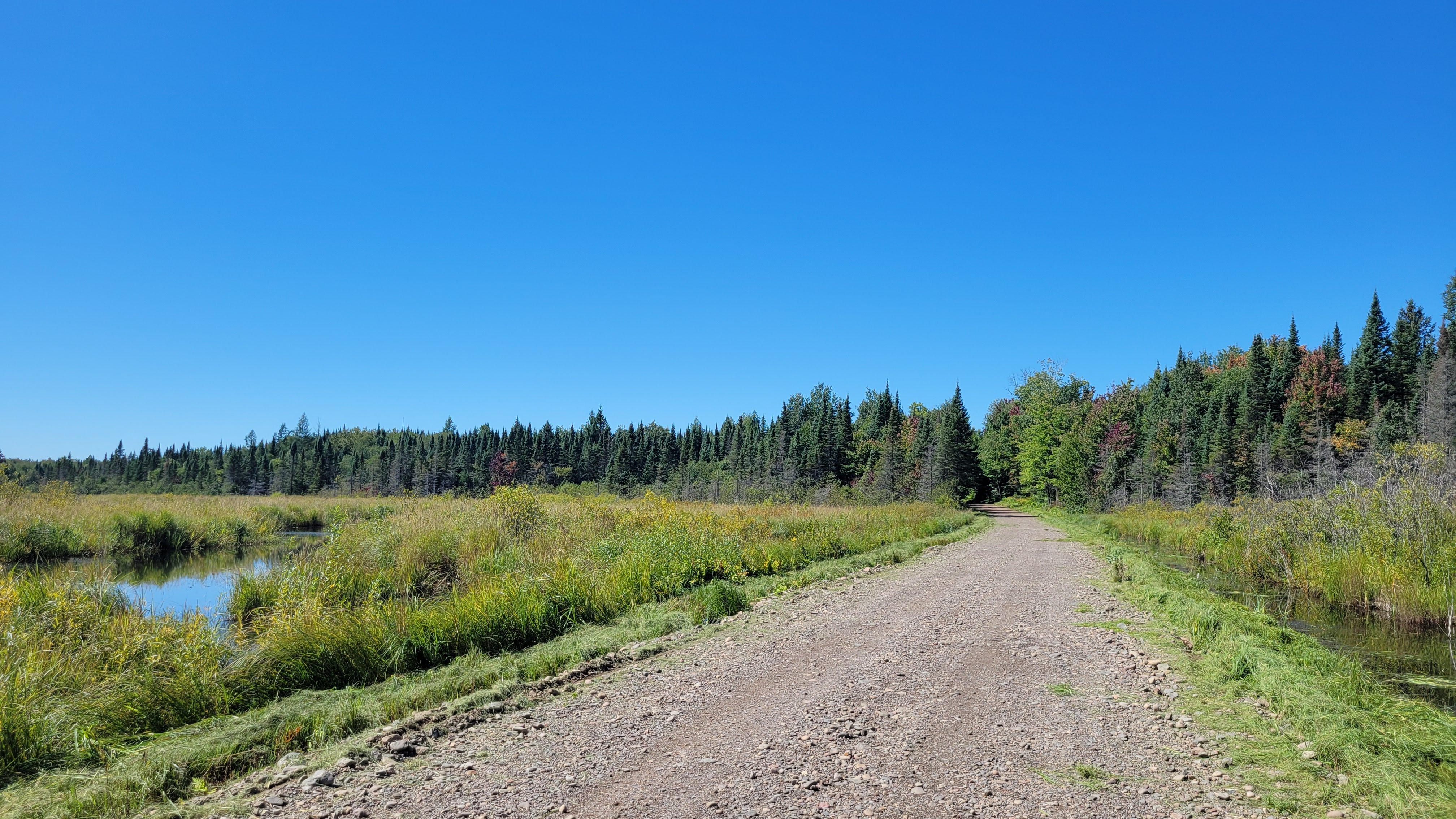
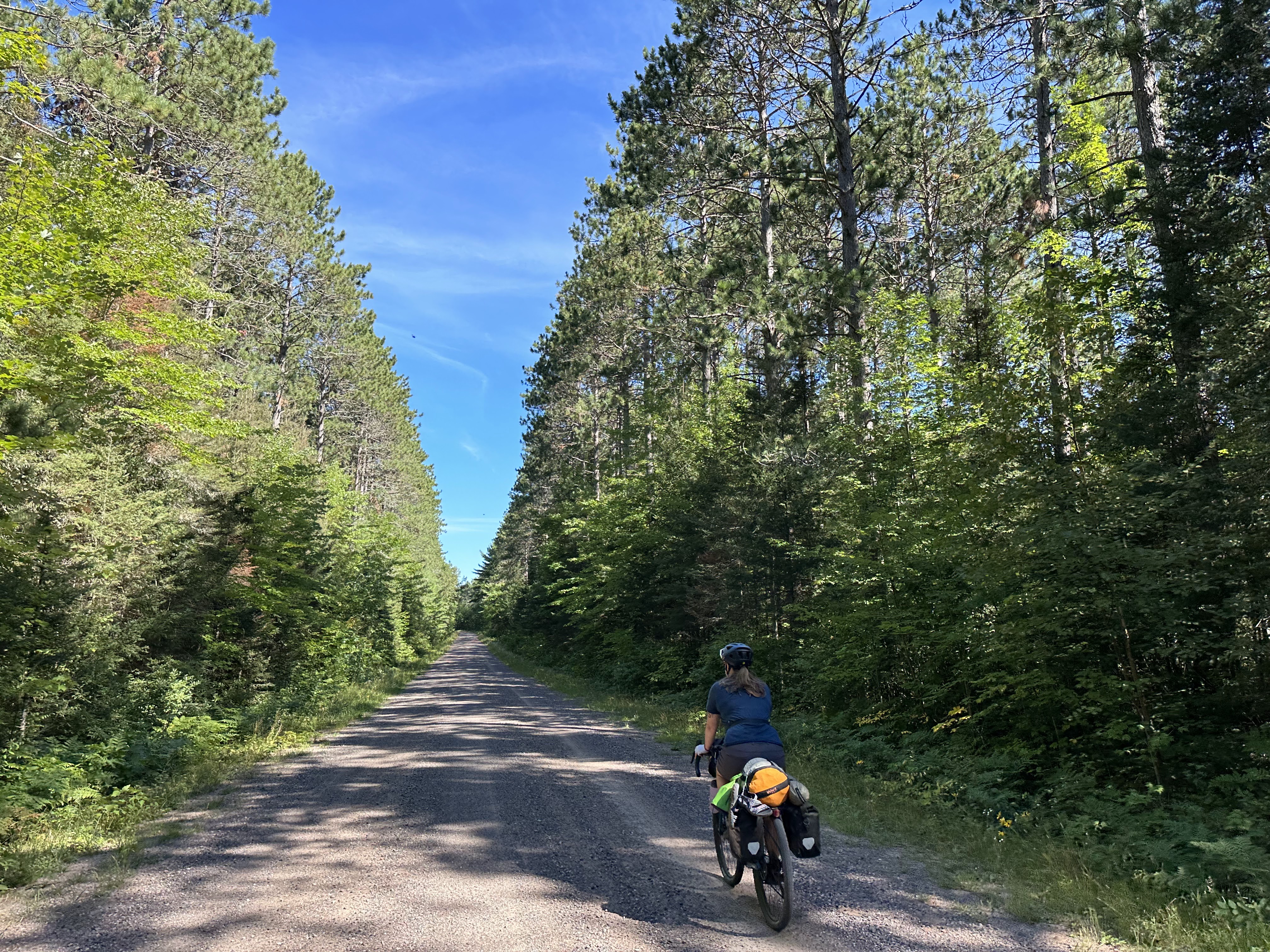
Within 3 blocks, I was on the local multi-use trail. The one thing I – didn’t really forget so much as haven’t had the ability to take advantage of – are the abundance of off-road multi-use trails. In the Denver metro area, it’s very possible to bike 100 miles – maybe more – without meaningfully being on a road with cars. This also means not a ton of hills in the traditional sense. Noting I’ll need to seek out hills to regain my climbing prowess.
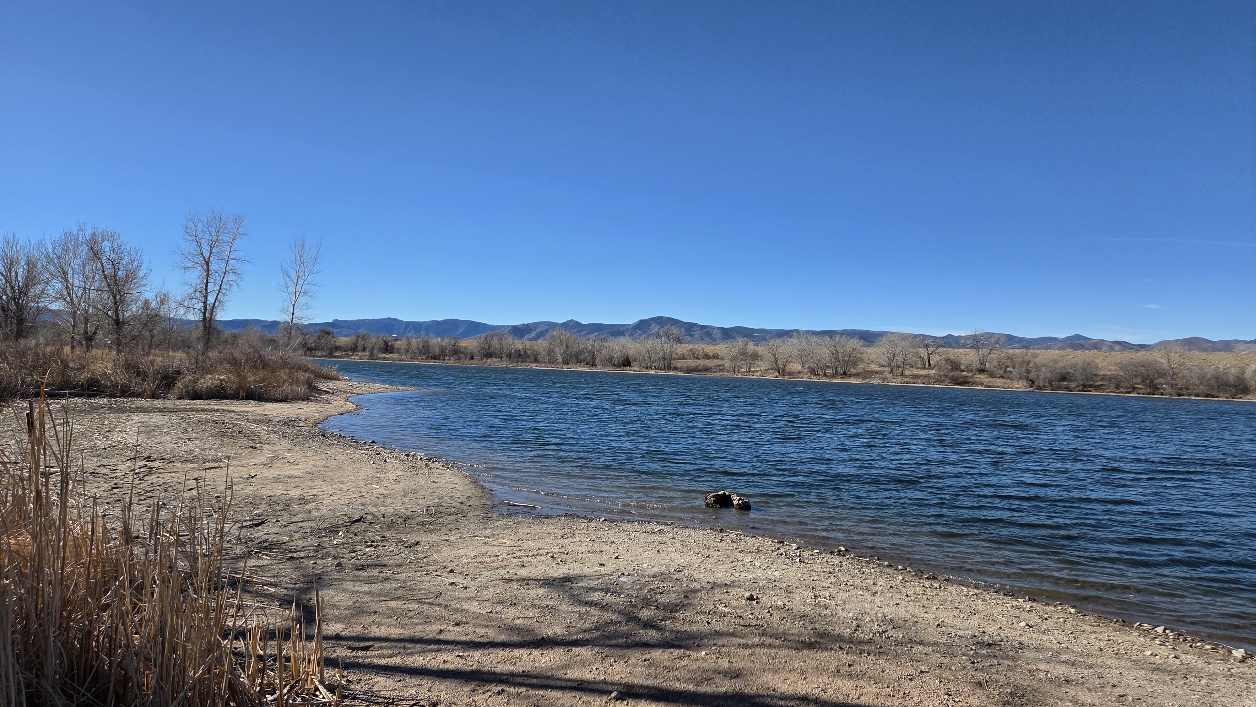
Being a beautiful day, the trails were busy with families, people on bikes, people walking their dogs, and plenty of anglers in the Platte River. As I got closer to Chatfield Reservoir, more roadie cyclists appeared.
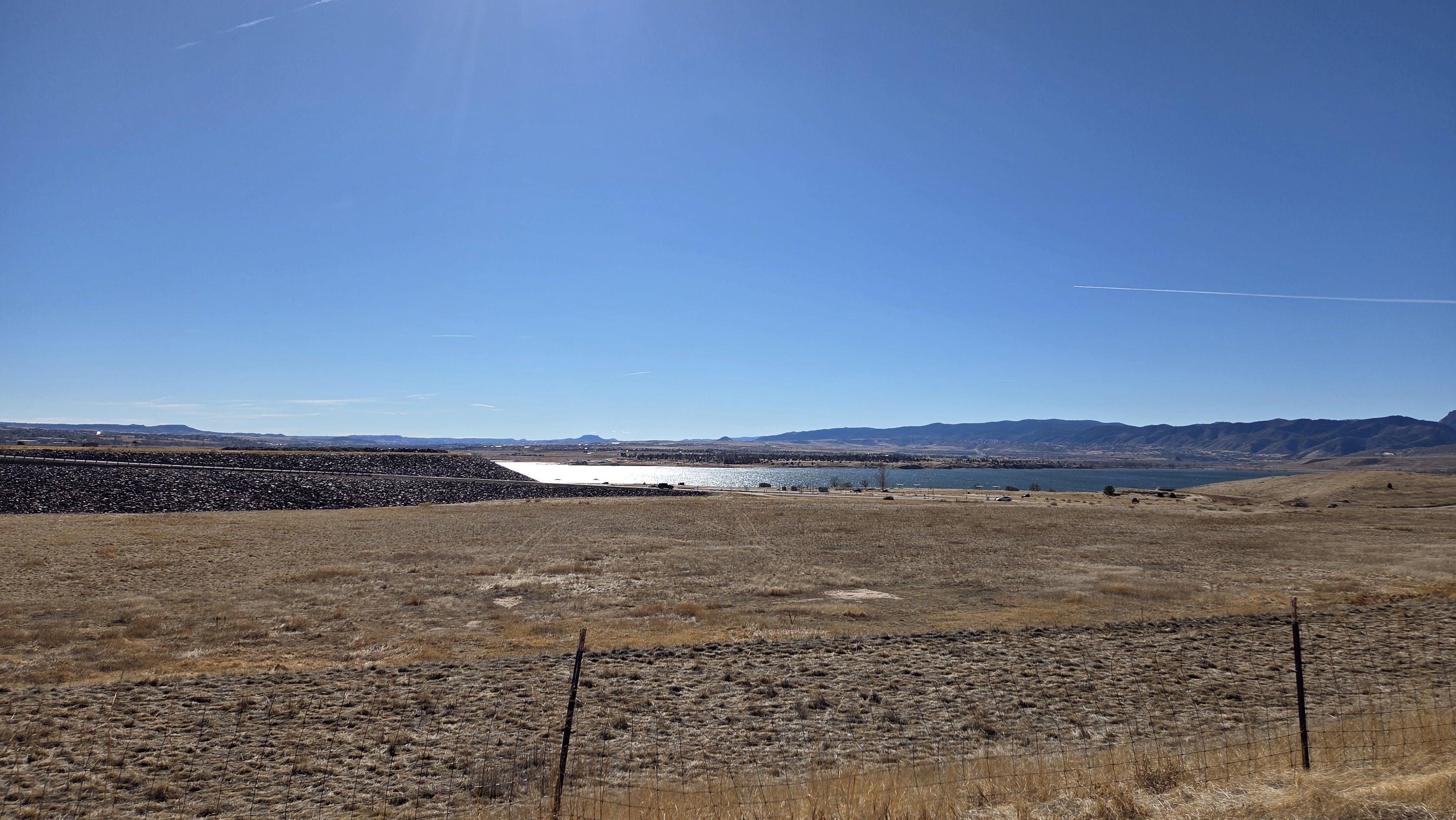
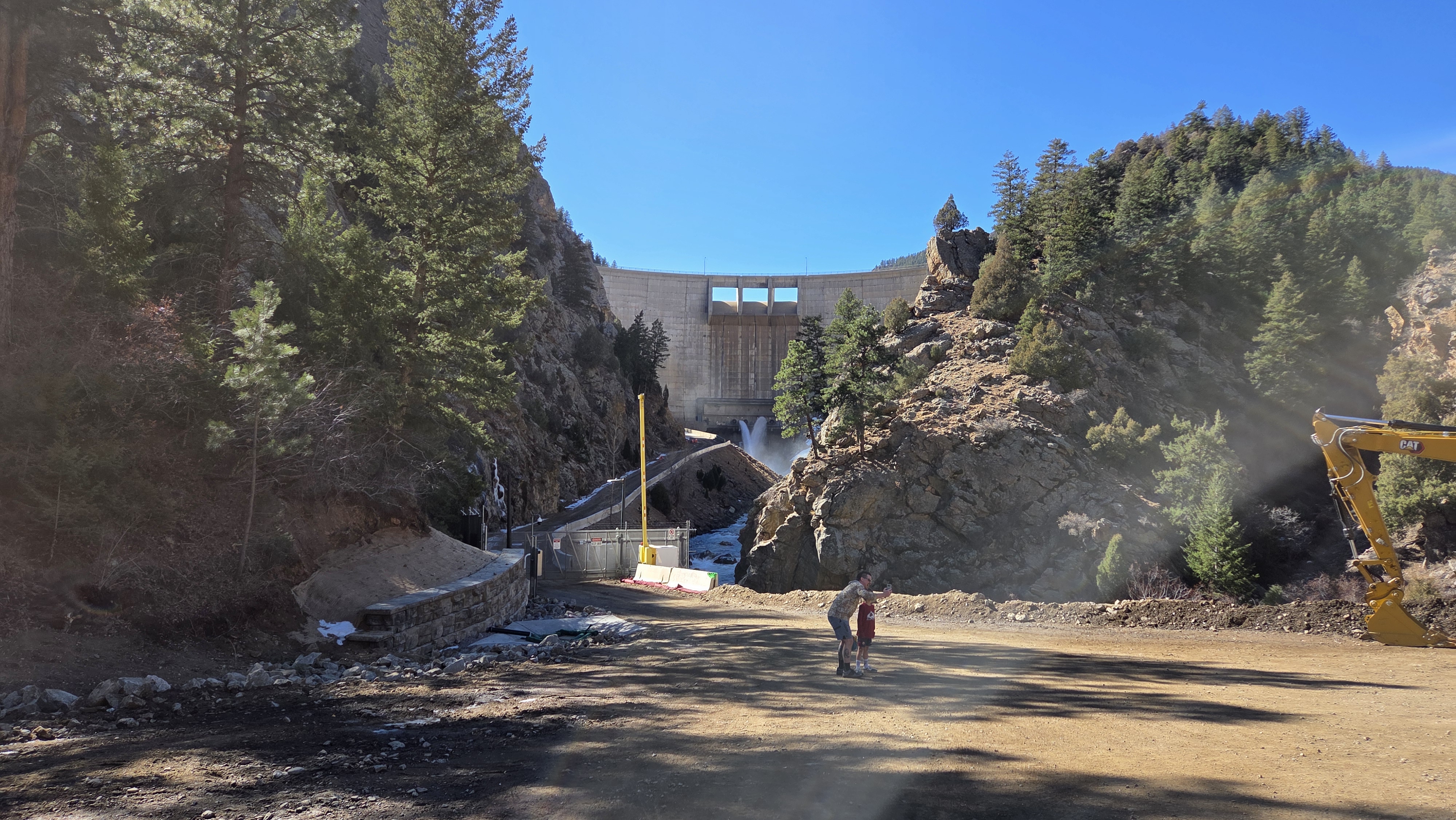
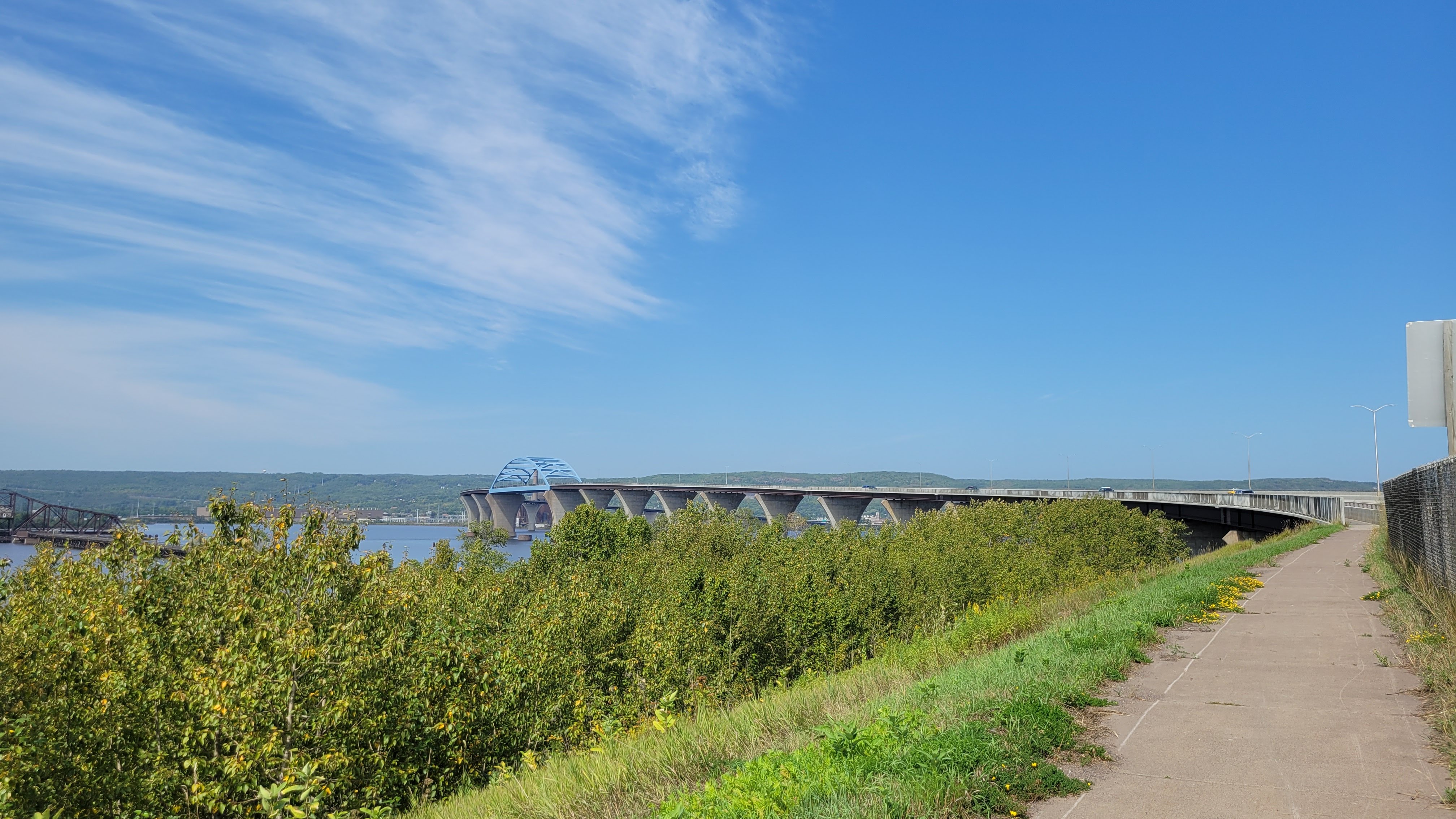
Platte River north of ChatfieldA view of the reservoir and dam
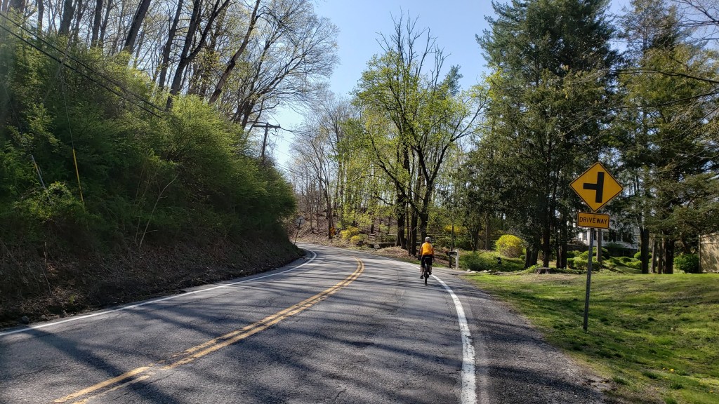
I climbed up the dam, a gentle half-mile at slightly-higher than railroad grades, and crossed the top of the dam. Another thing I didn’t really forget so much as didn’t have to deal with was the wind. You can see a million miles – and the wind will always find you. As I headed southwest, the headwinds and sidewinds prevailed – so I reduced my speed to avoid burning through energy on the flats.
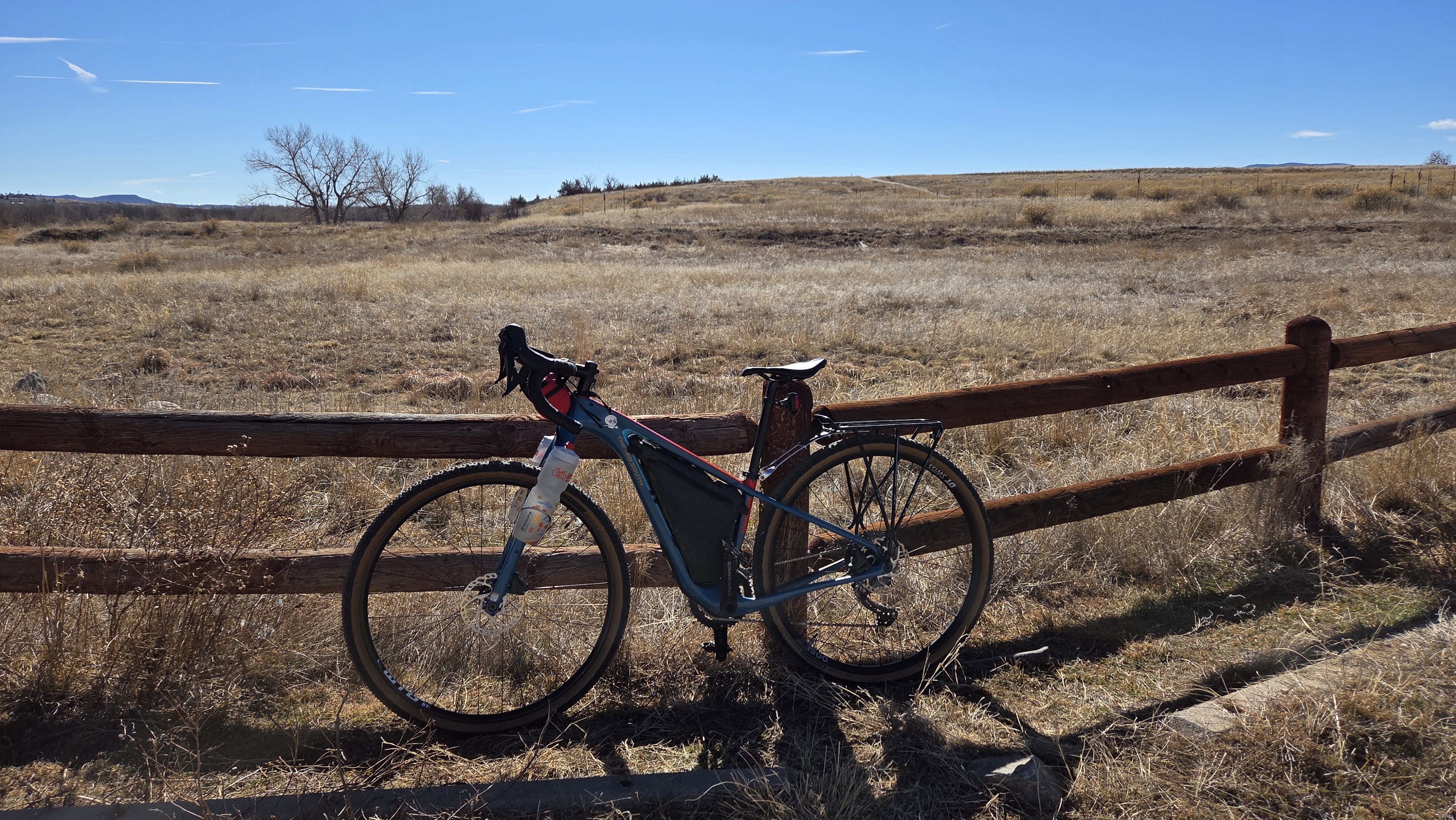
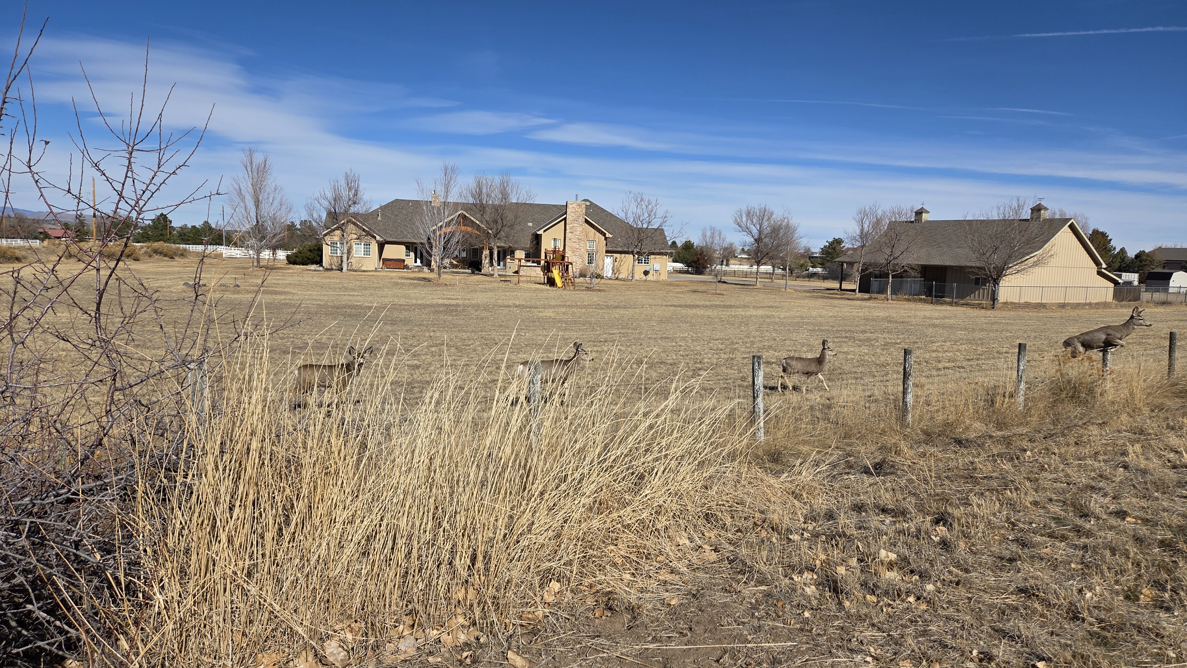
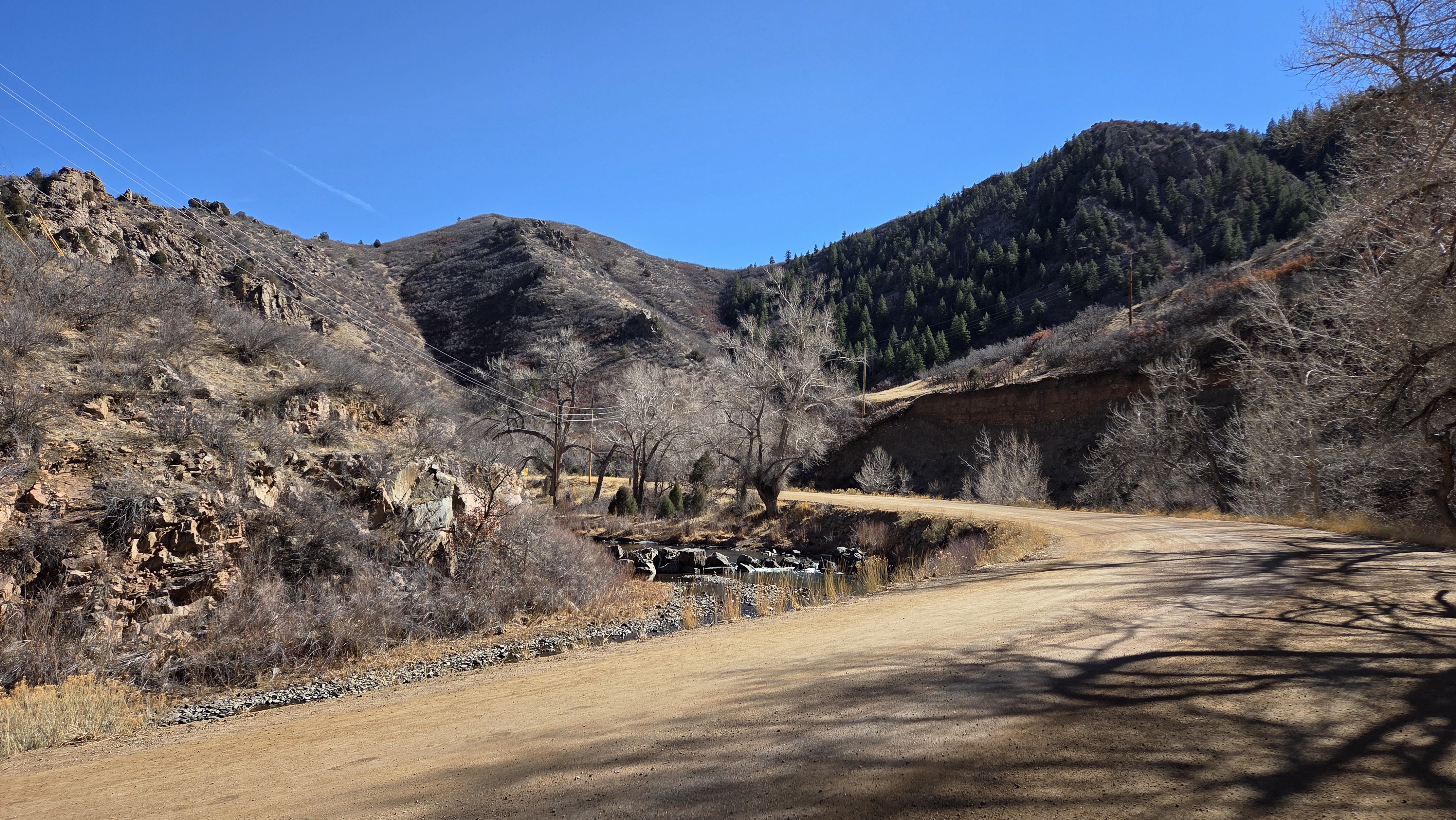
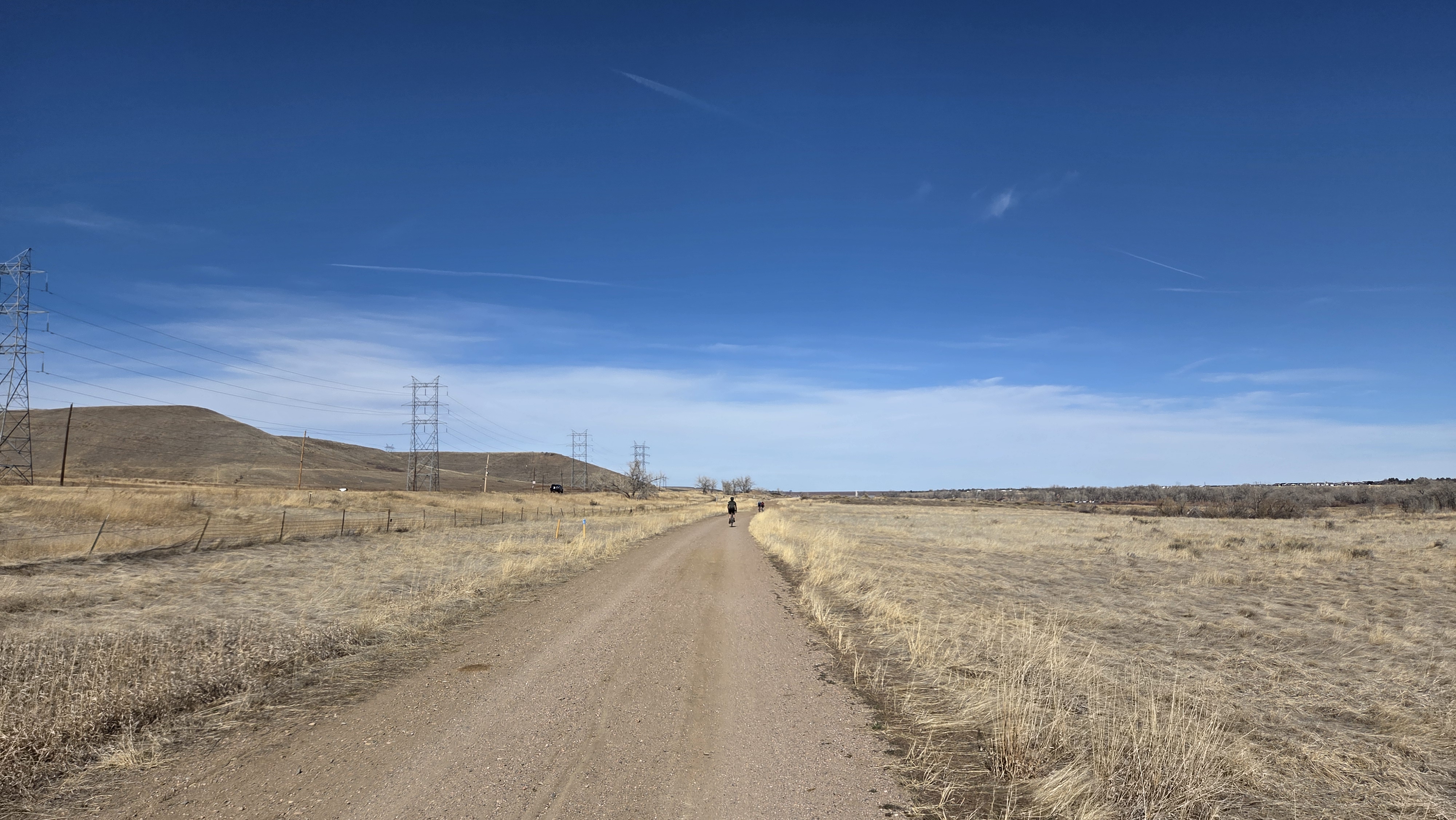
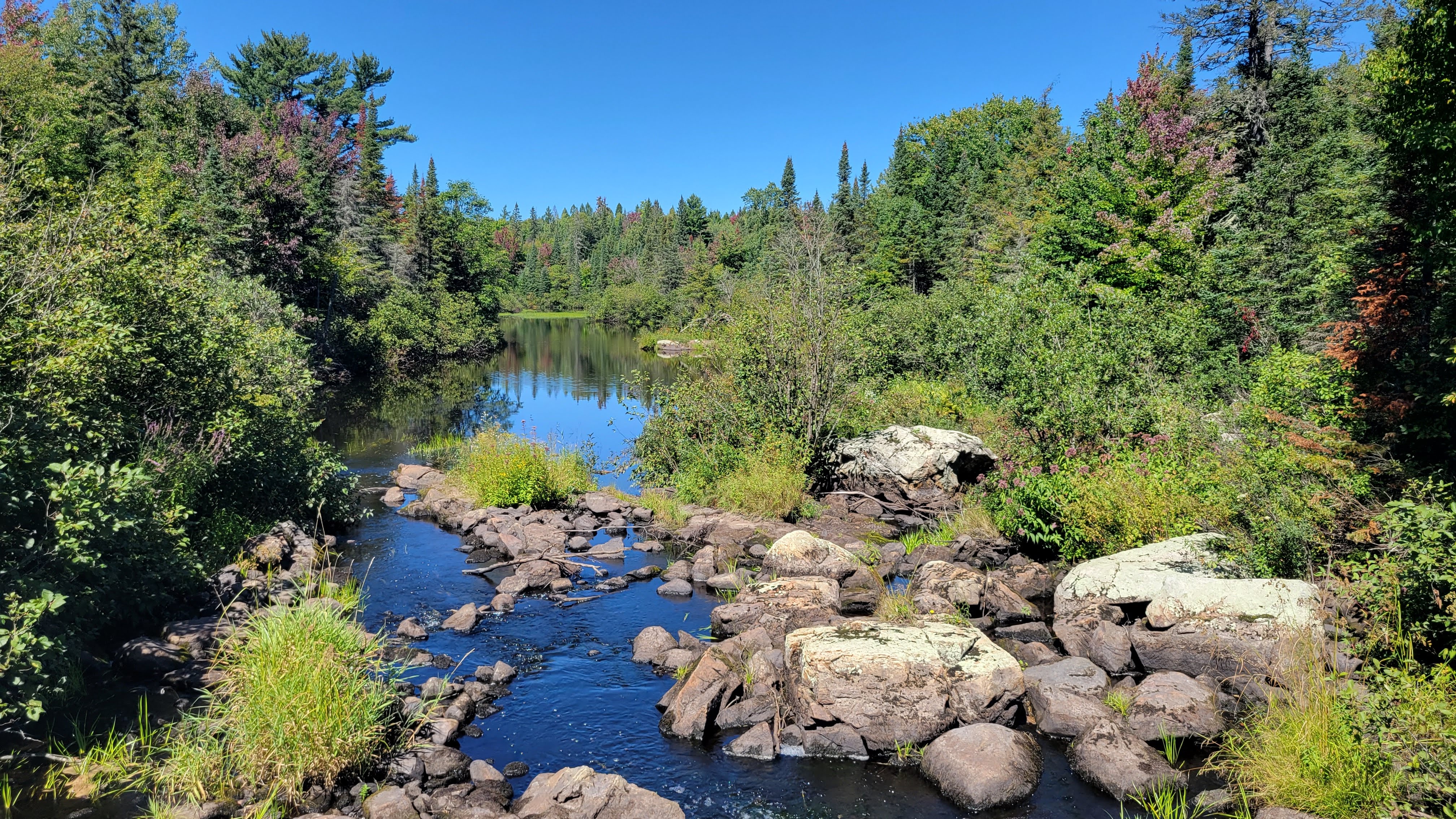
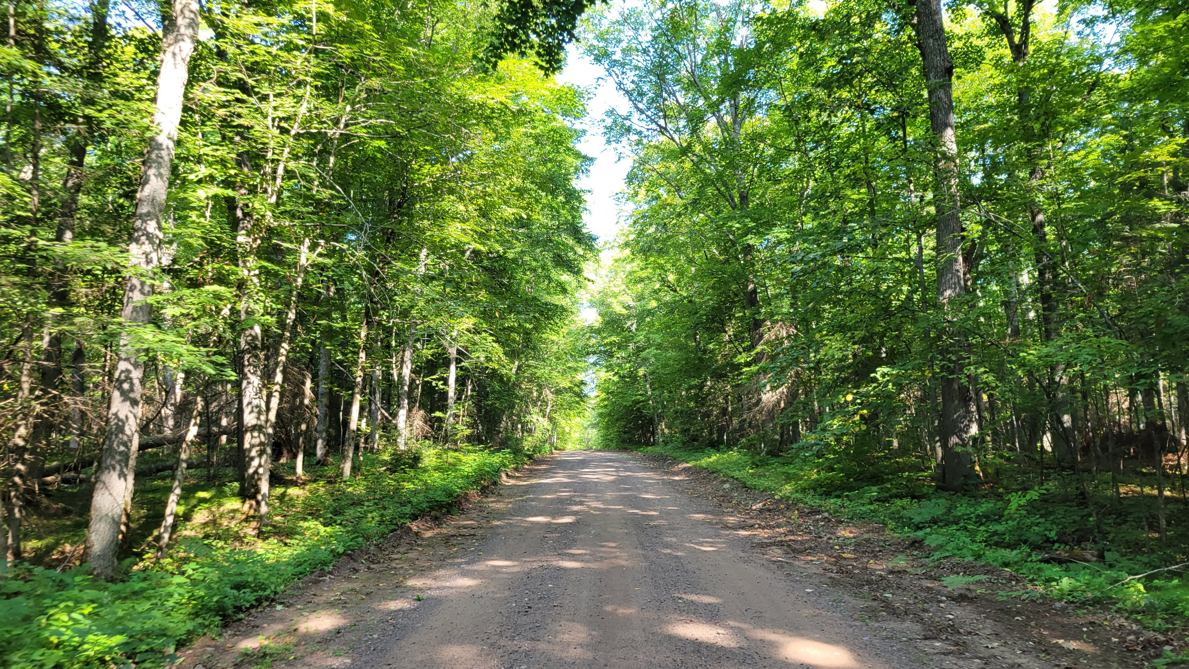
Dropping into the southern trails in Chatfield was a treat. I didn’t see another person for several miles and enjoyed the rustic Western beauty. The route took me southwest onto the High Line Canal trail, winding its way through the plains and into new housing developments south of the park before pushing back into working ranch territory.
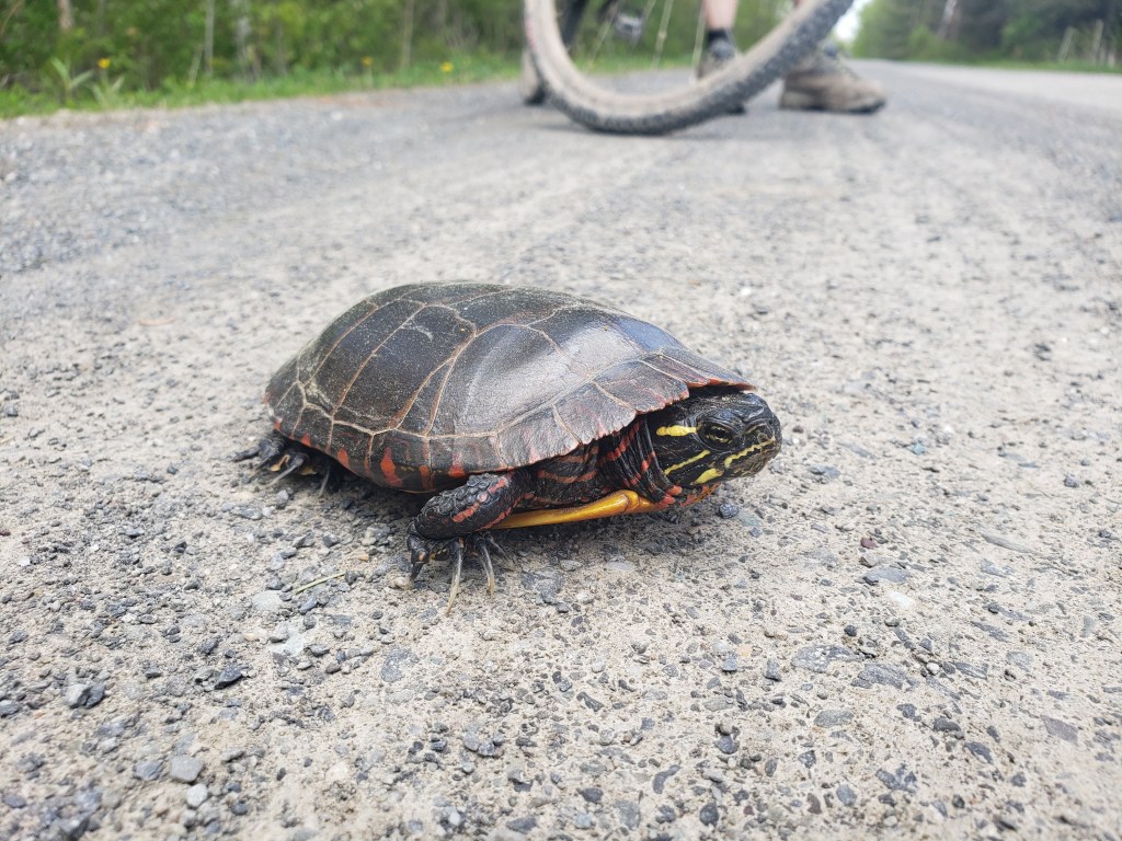
A right turn onto a road led me to the Waterton Canyon trailhead, which was swarming with people of all ages and abilities. Notably no one had their dogs, which is prohibited due to the wildlife in the area. Sadly, I did not see any big horn sheep – but I did see a pack of mule deer!
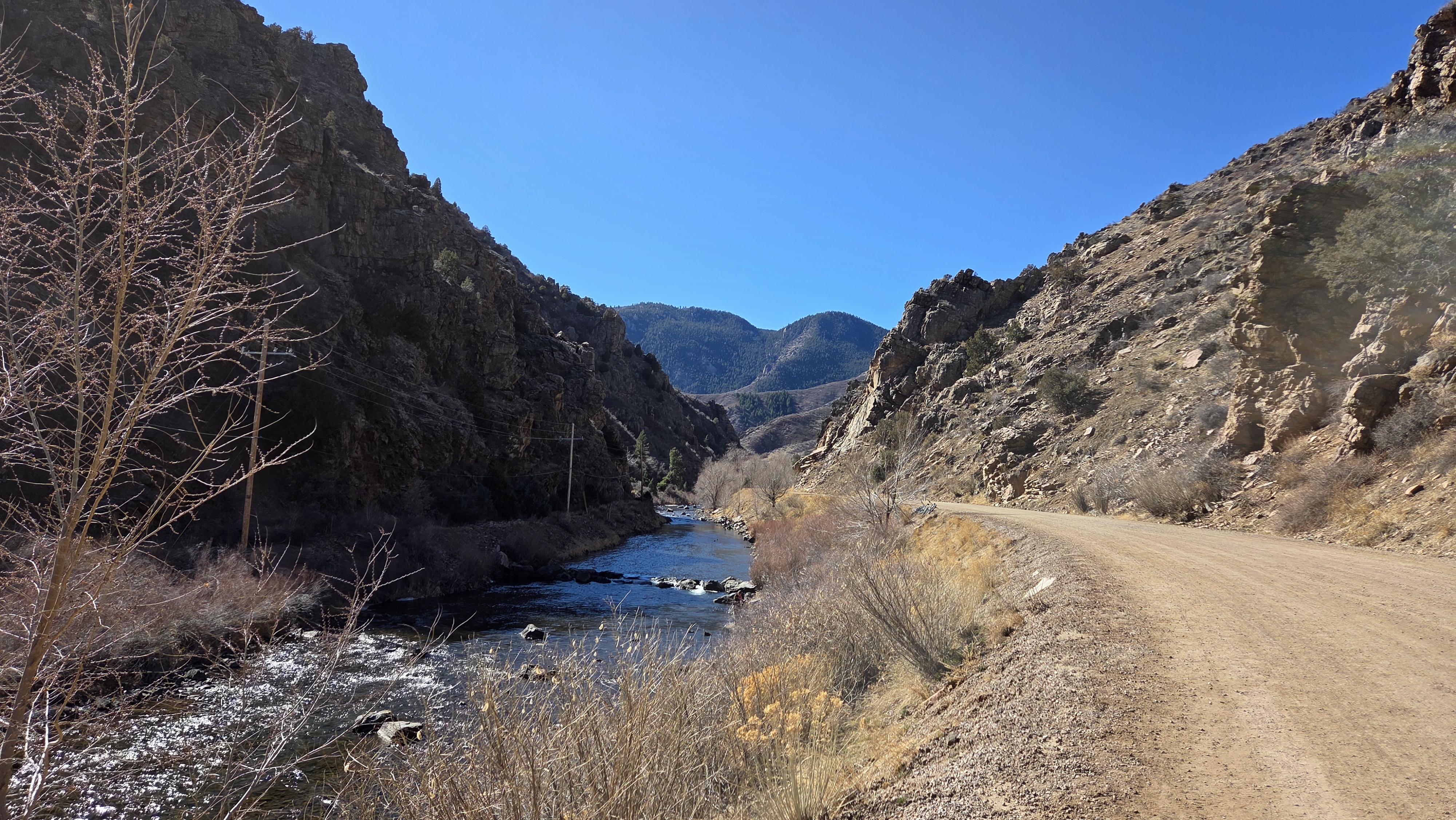
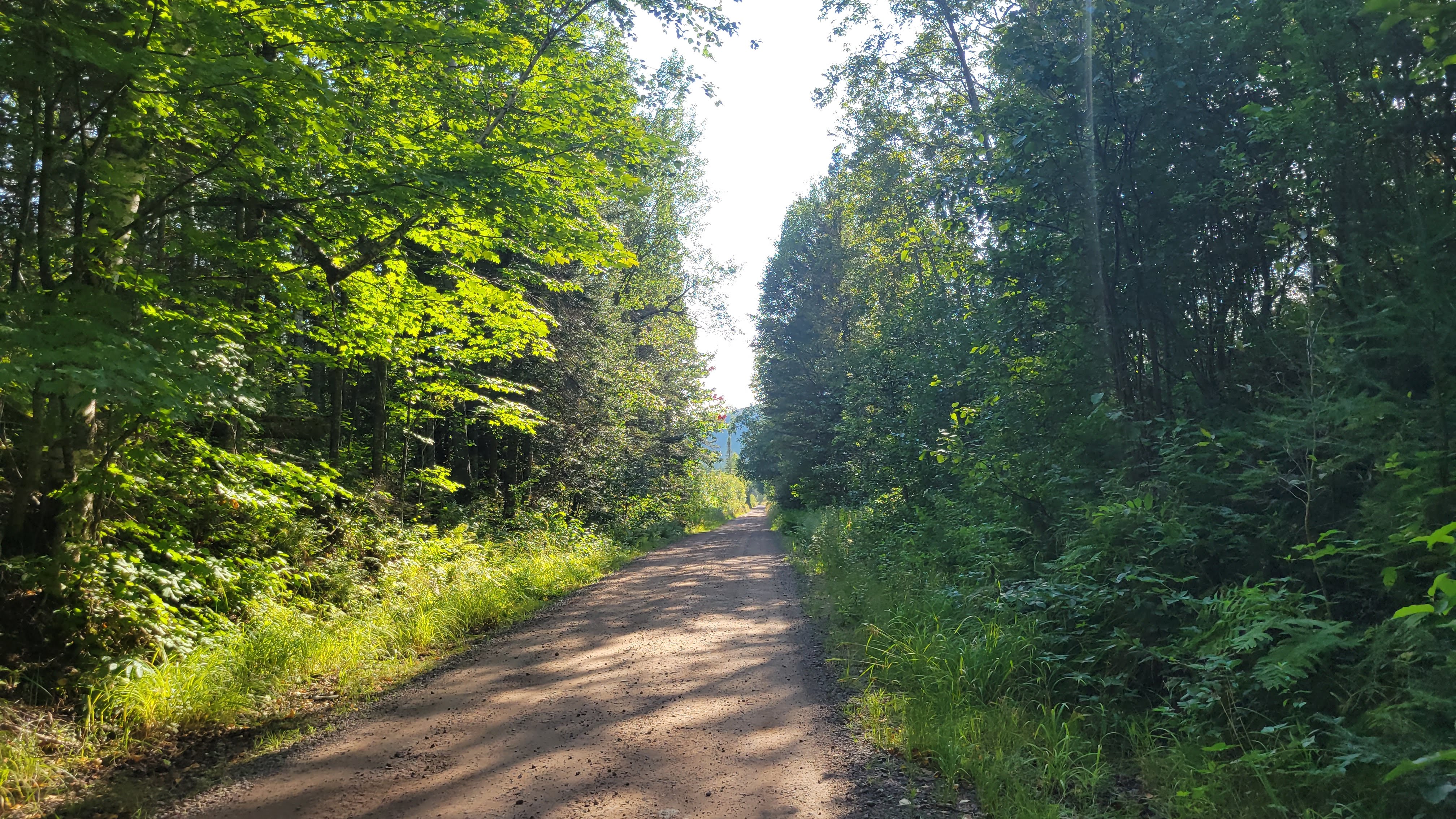
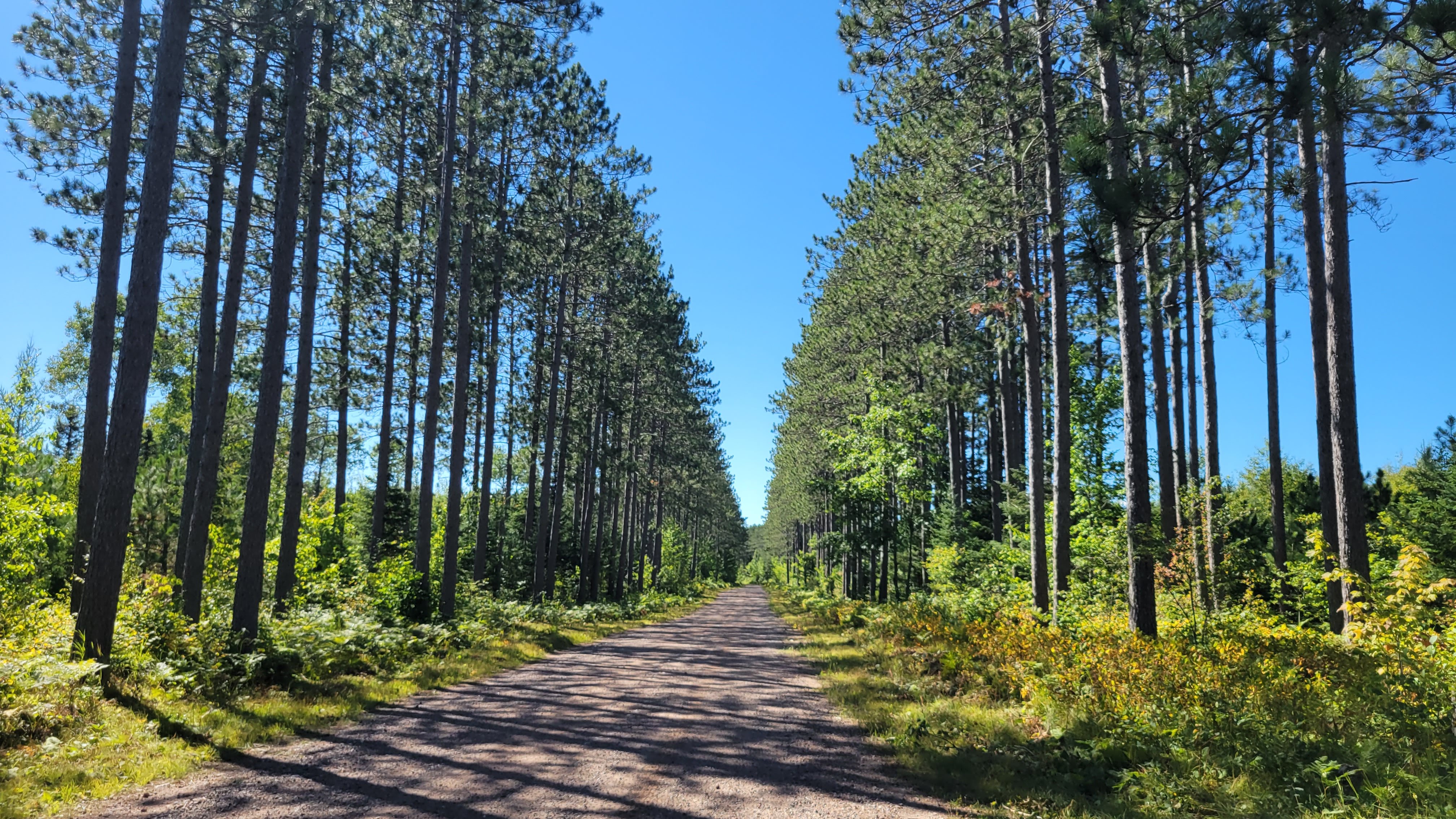
The climb itself is very, very accessible. The lower portions were more heavily trafficked, and the farther up the canyon, the fewer families and more cyclists, hikers, and anglers. 6.5 miles at a steady 1-2% grade on a wide, hardpacked road. Around every corner was another stunning view of the soaring mountains surrounding the valley. There were also plentiful pit toilets, picnic areas, and trash/recycling receptacles. Literally no reason to not Leave No Trace.
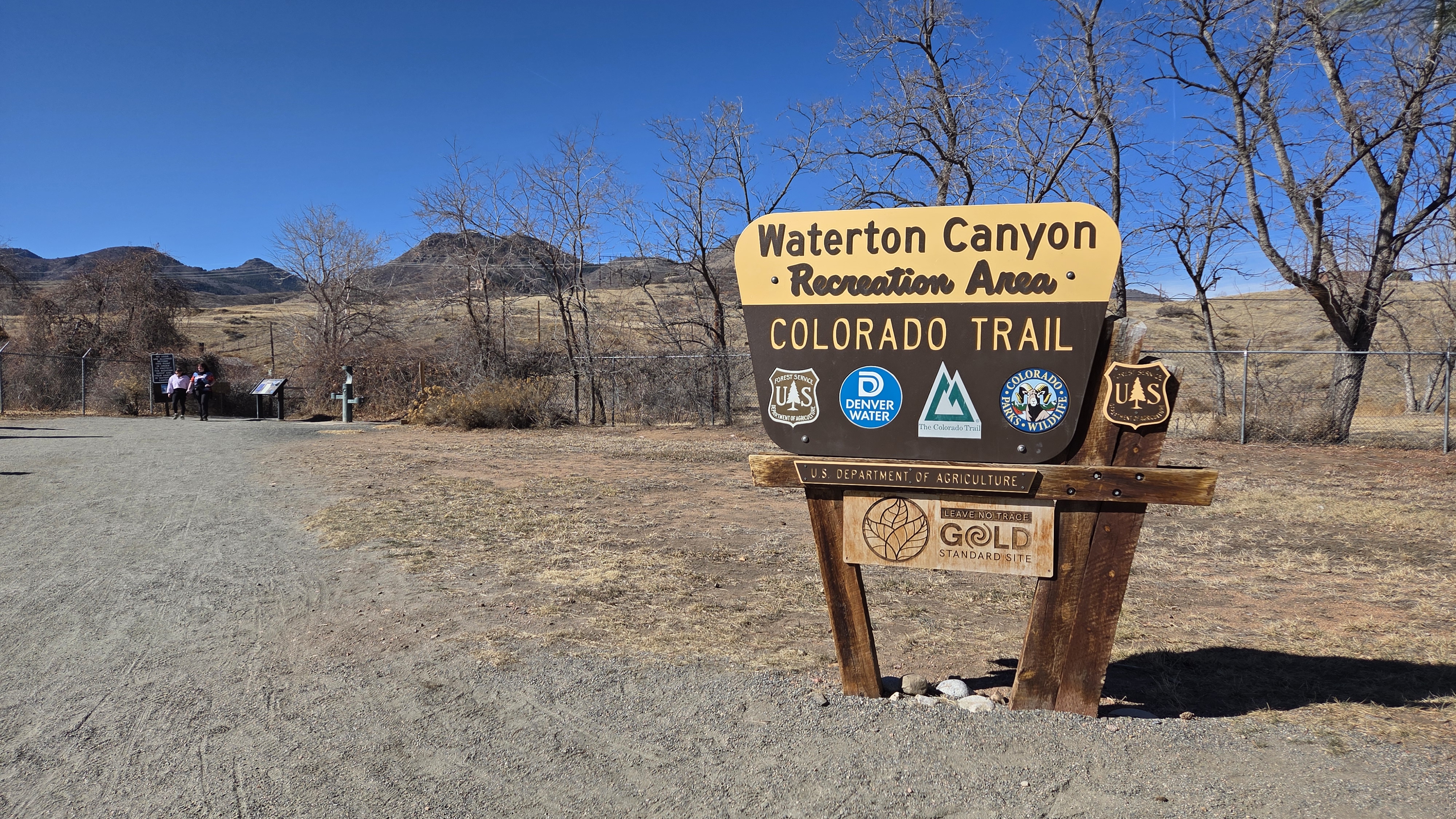
why yes, there is ice and snow in the shade
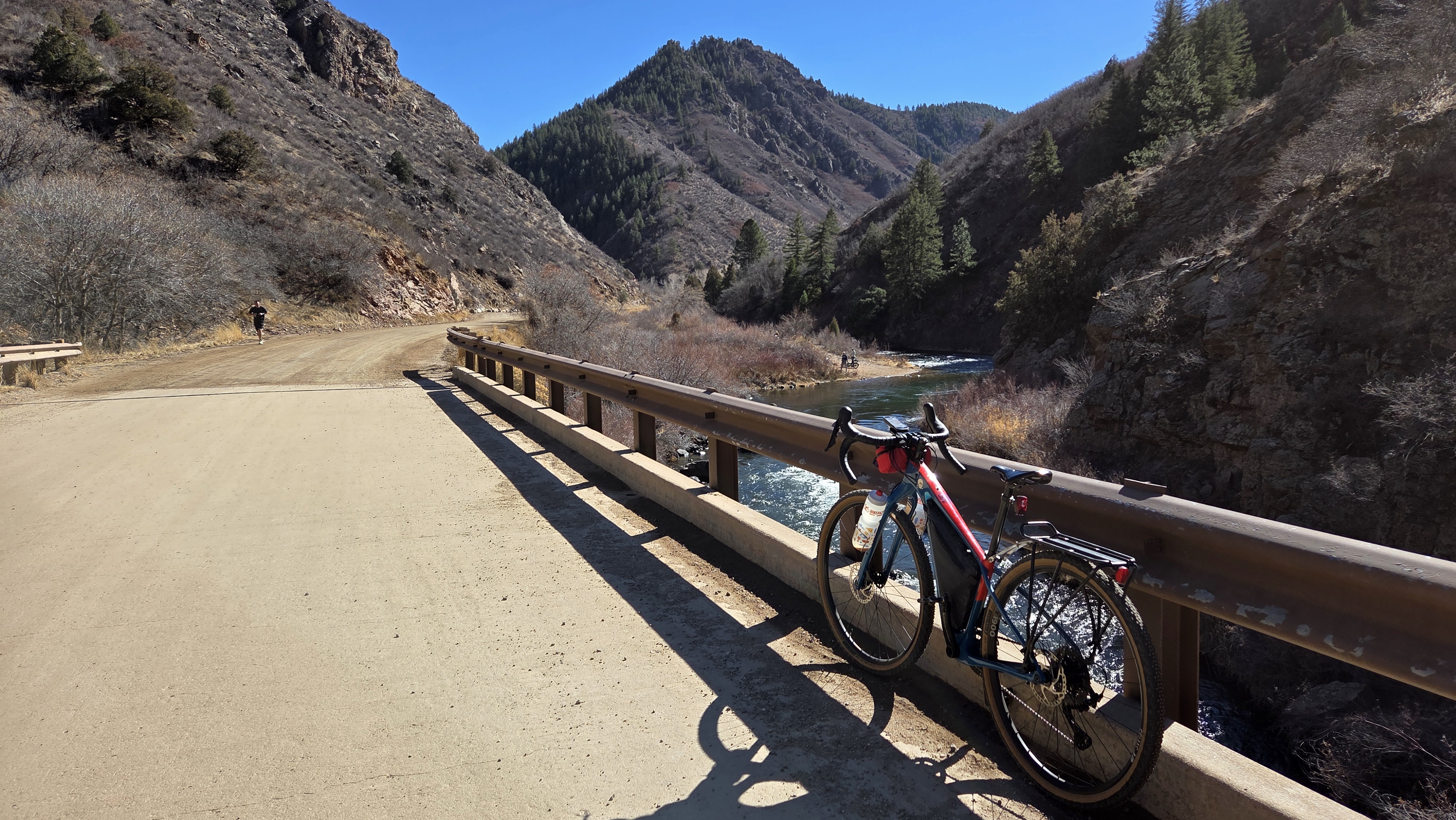
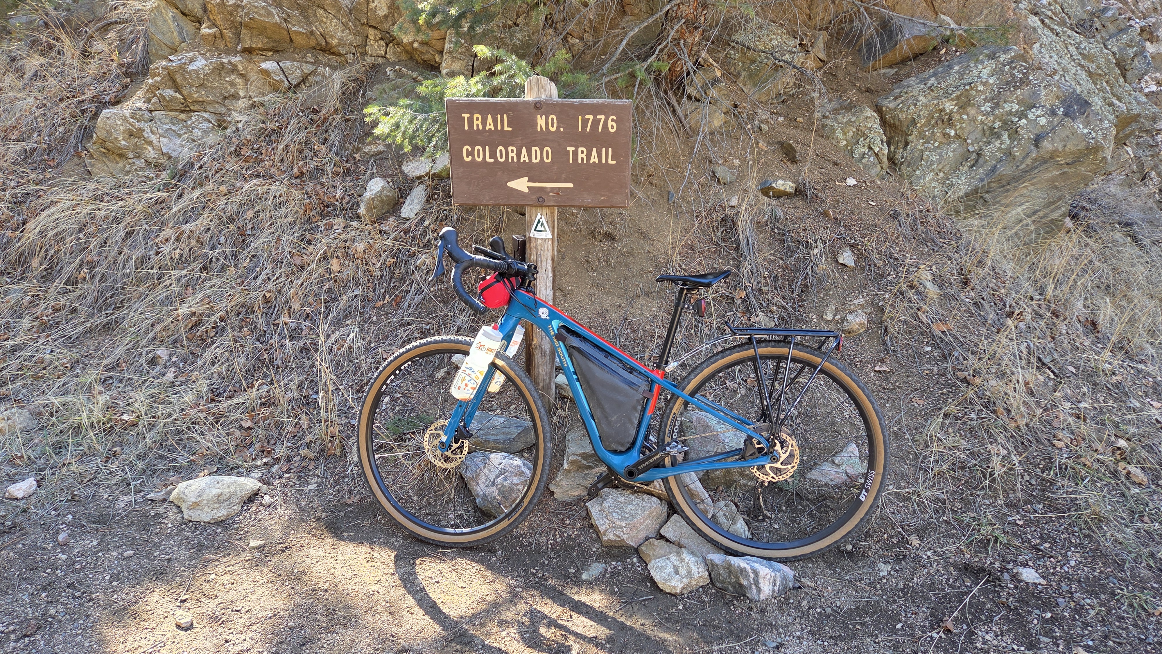
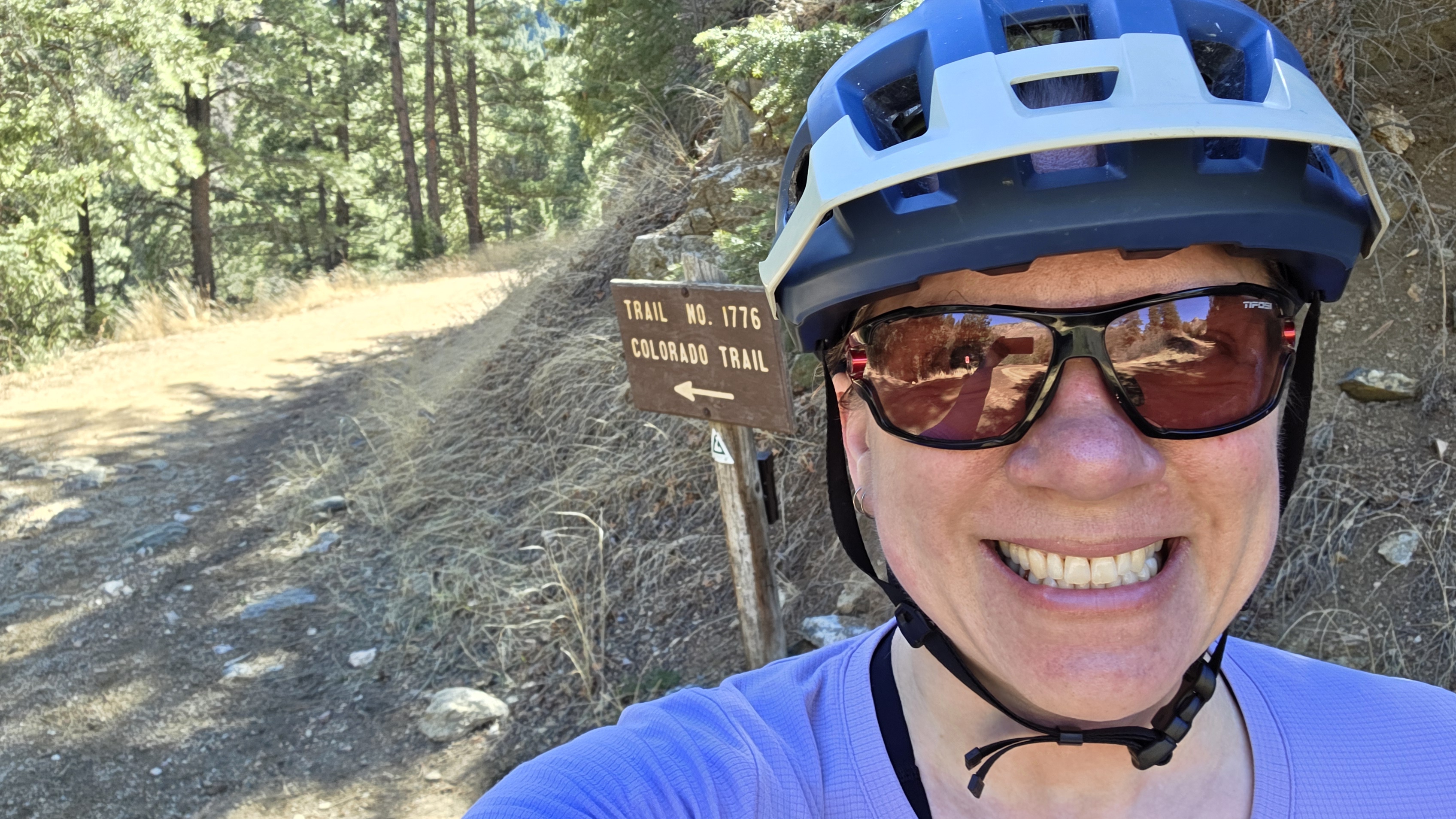
The hardest portion of the canyon is the final 4/10 mile past the dam, which takes you to the Colorado Trail. I took a short break to catch my breath and have a snack before gliding back down the canyon and heading towards home on the western trails in Chatfield. I ended up leap-frogging with a group of groadies (gravel roadies, a term for gravel riders on high-end, aero gravel bikes meant for racing with a background in road racing).
As I descended the Chatfield dam, and noticing all the roadies and groadies, and wondering if I’d find my people. I was on my Cutthroat with my bottle mounted out on the fork – a decidedly Not Aero position for them but highly convenient when bikepacking – just noodling along when I saw …
Tall, thin guy, tattooed arms and legs, old-timey mustache, flared bars … and bottles on the front fork.
My People.
I pedaled the remaining miles up the multi-use trail smiling, feeling seen, and that I will eventually find my people. I’m already in contact with Front Range Overnighters to get more involved in the local bikepacking scene, my goal being to not only figure out bikepacking Out West for myself, but also help lower the barriers of entry for others to try bikepacking.
Thank you to Gravel Bike Adventures for the core route – it was very enjoyable! Looking forward to exploring more of their routes locally.
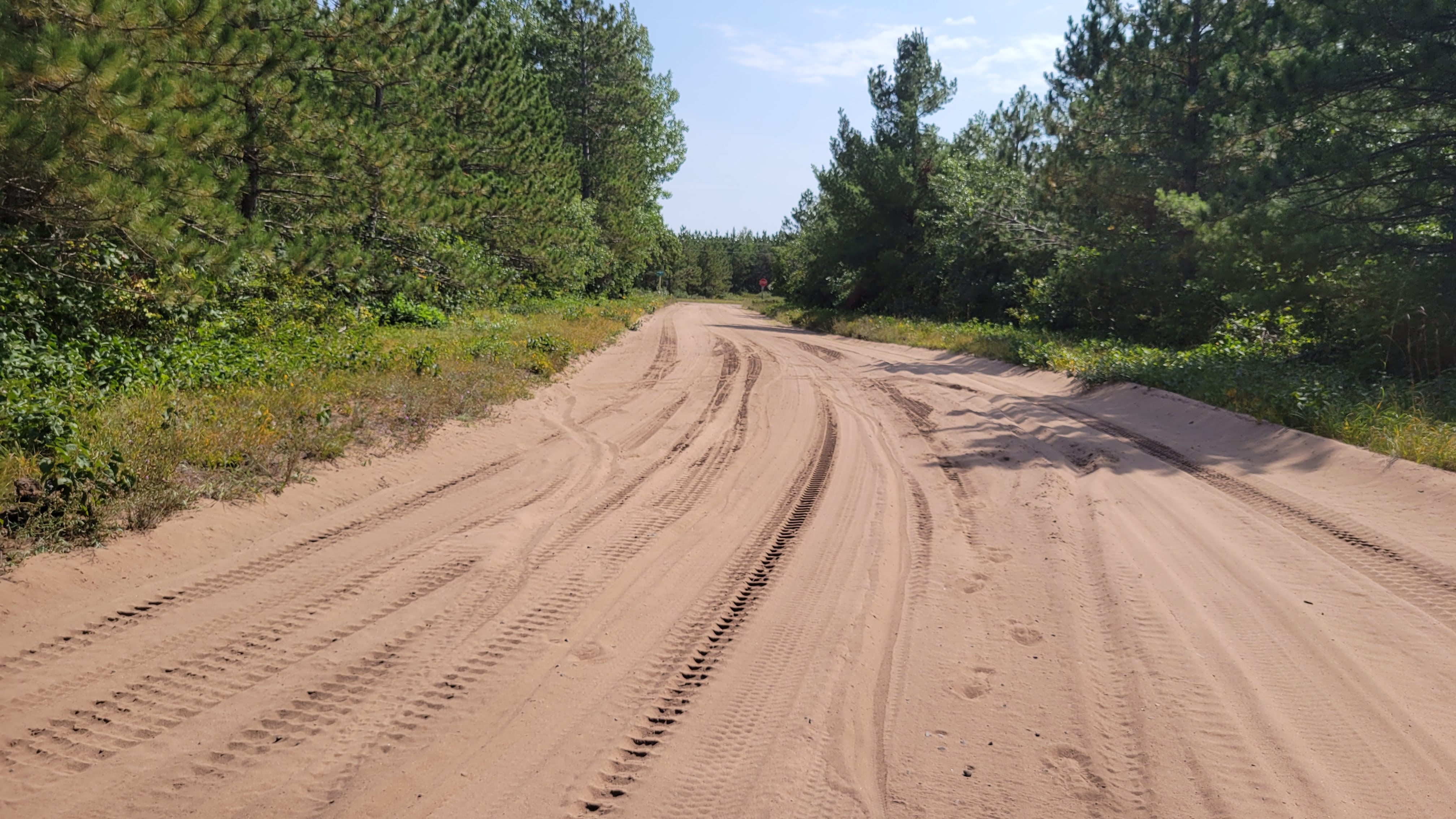
I’m still basking in the incredible sense of accomplishment and pride in completing the Northwoods 600 – a 600+ mile bikepacking route that circumnavigates the western portion of Lake Superior through Minnesota, Michigan, and Wisconsin. It was nothing short of an epic journey and a test of mental and physical grit.
The Northwoods 600 was created by Bikepacking Roots, a non-profit dedicated to promoting responsible bikepacking and welcoming bikepackers of all races, genders, sexual orientations, and abilities. The route showcases the stunning, rugged beauty of the Northwoods and Michigan’s Upper Peninsula and traverses the traditional lands of the Anishinabewaki people.
Buckle up – this is a long post!
Prologue
Shortly after my friend Jess and I completed the Green Mountain Gravel Growler in Vermont, we started thinking about the Northwoods 600. The original plan was to look at 2022 but the timing didn’t work out so we shifted the plan to 2023. We settled on the last two weeks of August to capitalize on the long Labor Day weekend, cooling temps, and hopefully, fewer bugs. We decided camping would keep costs low and give us more flexibility given some sections were in very remote areas.
Over about 9 months, we collaborated on planning in a Google Sheet – breaking the states down into reasonable mileage days, mapping out campgrounds and resupply locations, and other interesting things to look for. We donated to Bikepacking Roots to get the physical guidebook and the PDF version, which we brought with us on the trip for on-the-fly information gathering.
To be sure, this 2- week adventure was out of our collective comfort zones. Neither of us has done a bikepacking trip of this length, much less with most of the accomodations as camping. Camping adds a layer of stress above the usual miles and load – survival is at stake. Setting up camp, making a meal, cleaning up after the meal, making sure everything is bear proof/bear safe … it’s a lot of psychological stress.
I assumed we would be without cell coverage for at least part of the route, but there were a surprising amount of times I didn’t have cell service. I picked up a Garmin Messenger tracking device, which was really helpful in letting friends and family see where we were, we could message them through the device to let them know we were OK, and even get weather forecasts.
Two weeks before our scheduled departure, my youngest adult-aged kid, who lives at home, contacted Covid, which, fortunately, my husband and I did not contract (she isolated in her room and had her own bathroom) but made for a bit of anxiety around how quickly illness could change all our planning. It might have been overkill, but I rapid-tested daily until departure day to be sure.
I made a playlist of the songs that ran through my head over the course of the 2 weeks, in order of the days. Most of these were used as names for my Strava uploads. Mental music helps the miles tick off faster whe we weren’t talking.
Minnesota (Days 1-4)
While Duluth has a regional airport, it was cheaper to fly into Minneapolis/St Paul and rent a car to drive north. We had timed our flights to arrive within an hour of each other, but ultimately my flight was delayed 4 hours – which wasn’t a great way to start the trip but was a bellwether for things to come.
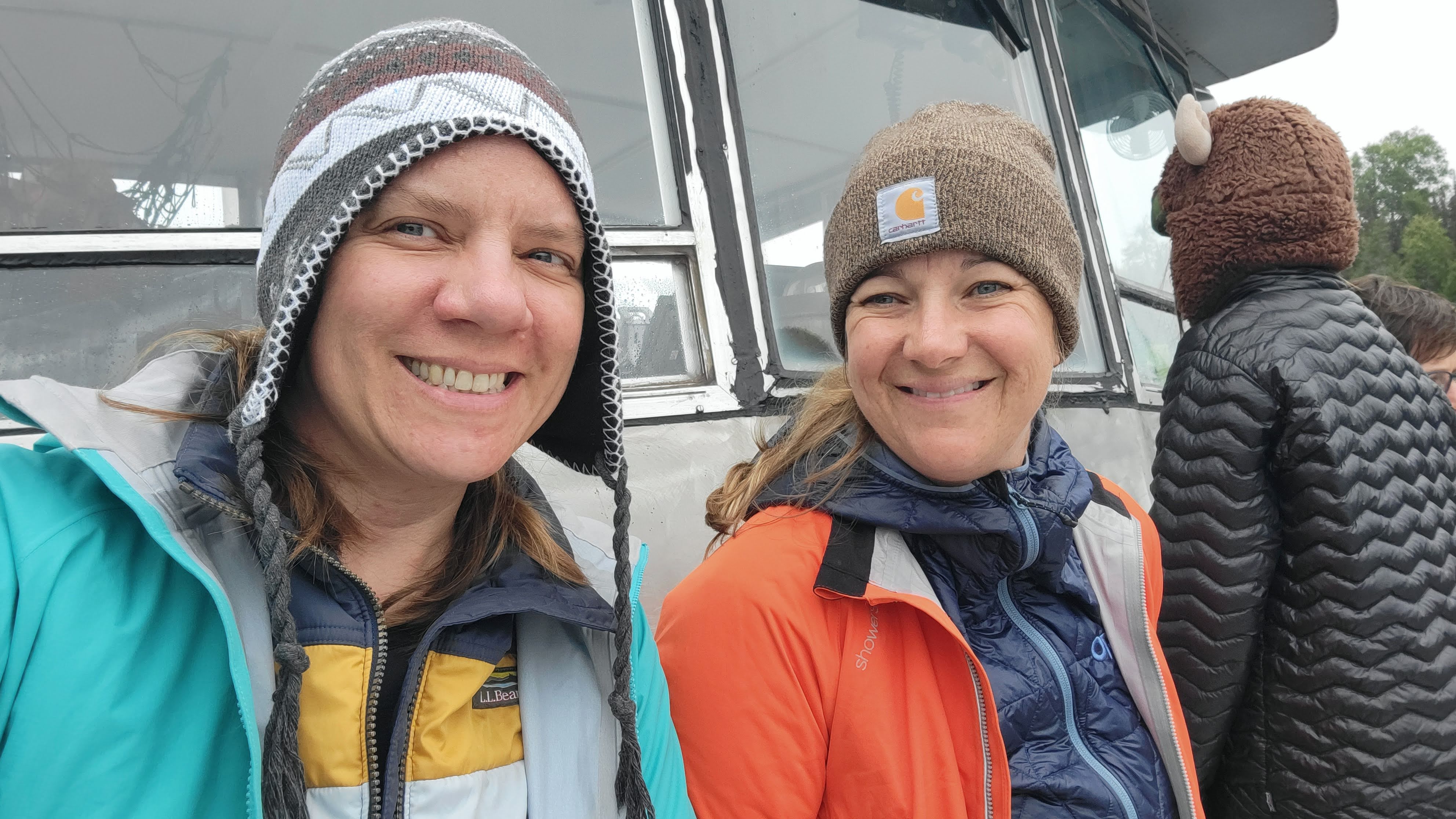
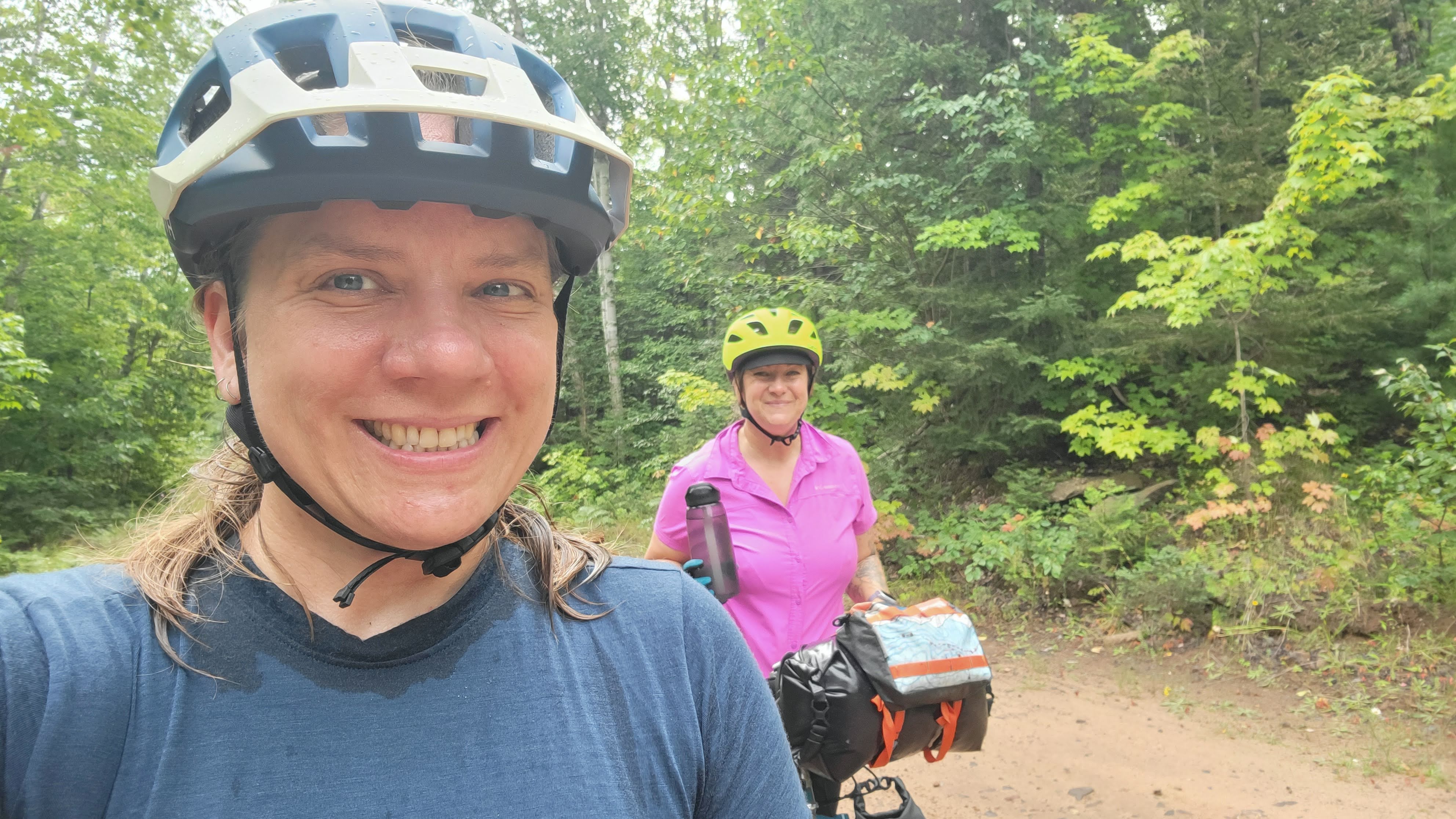
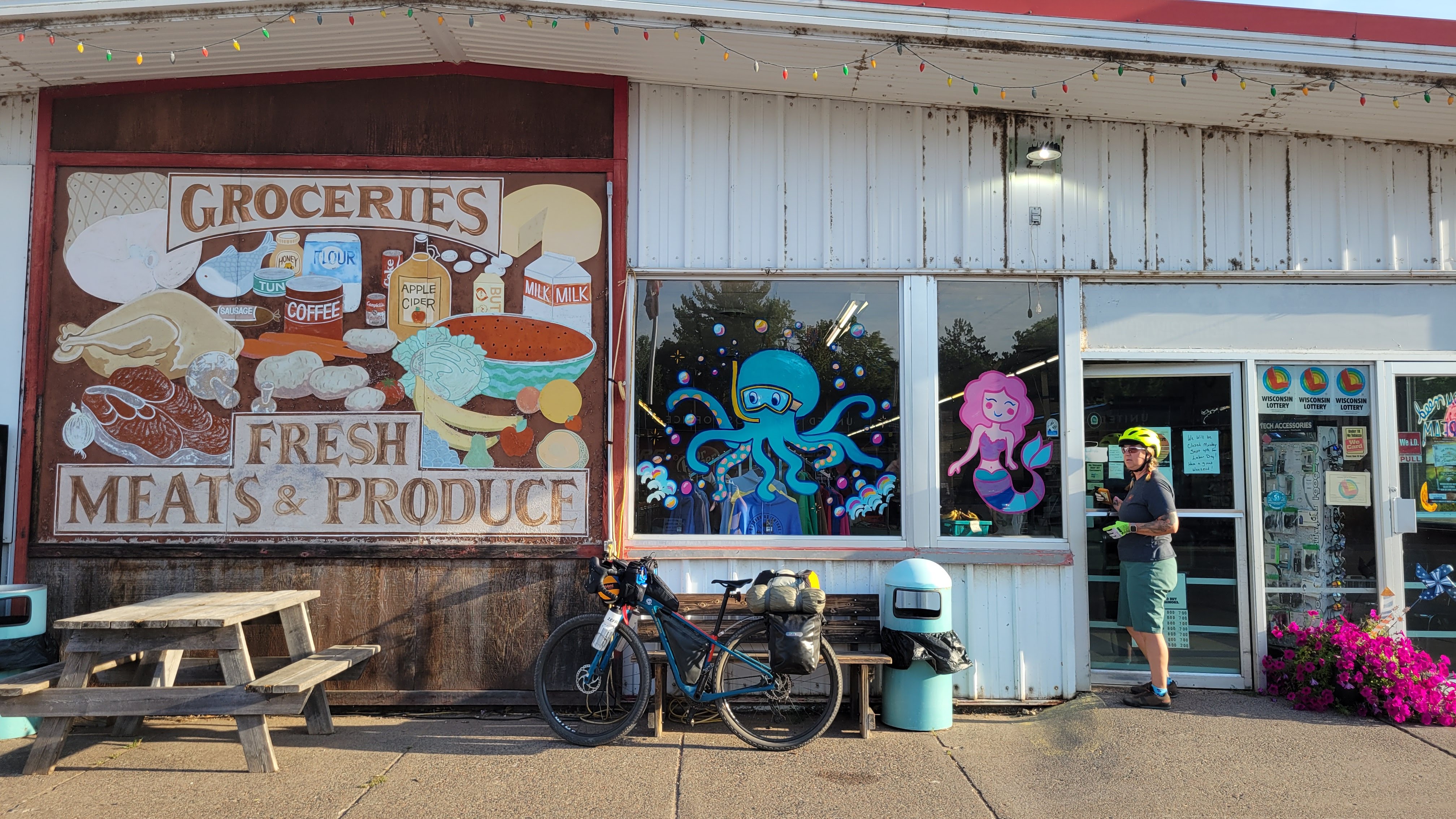
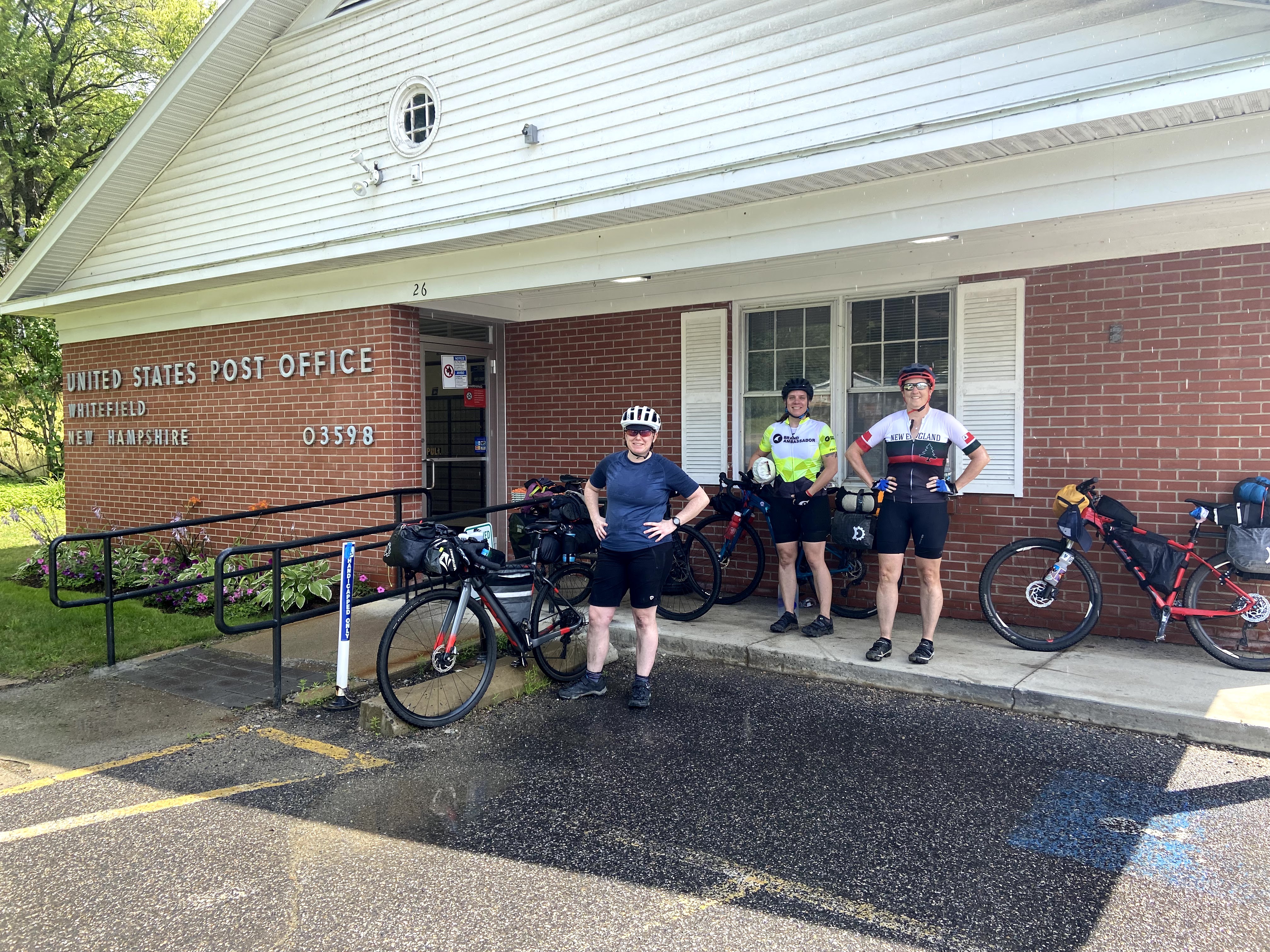
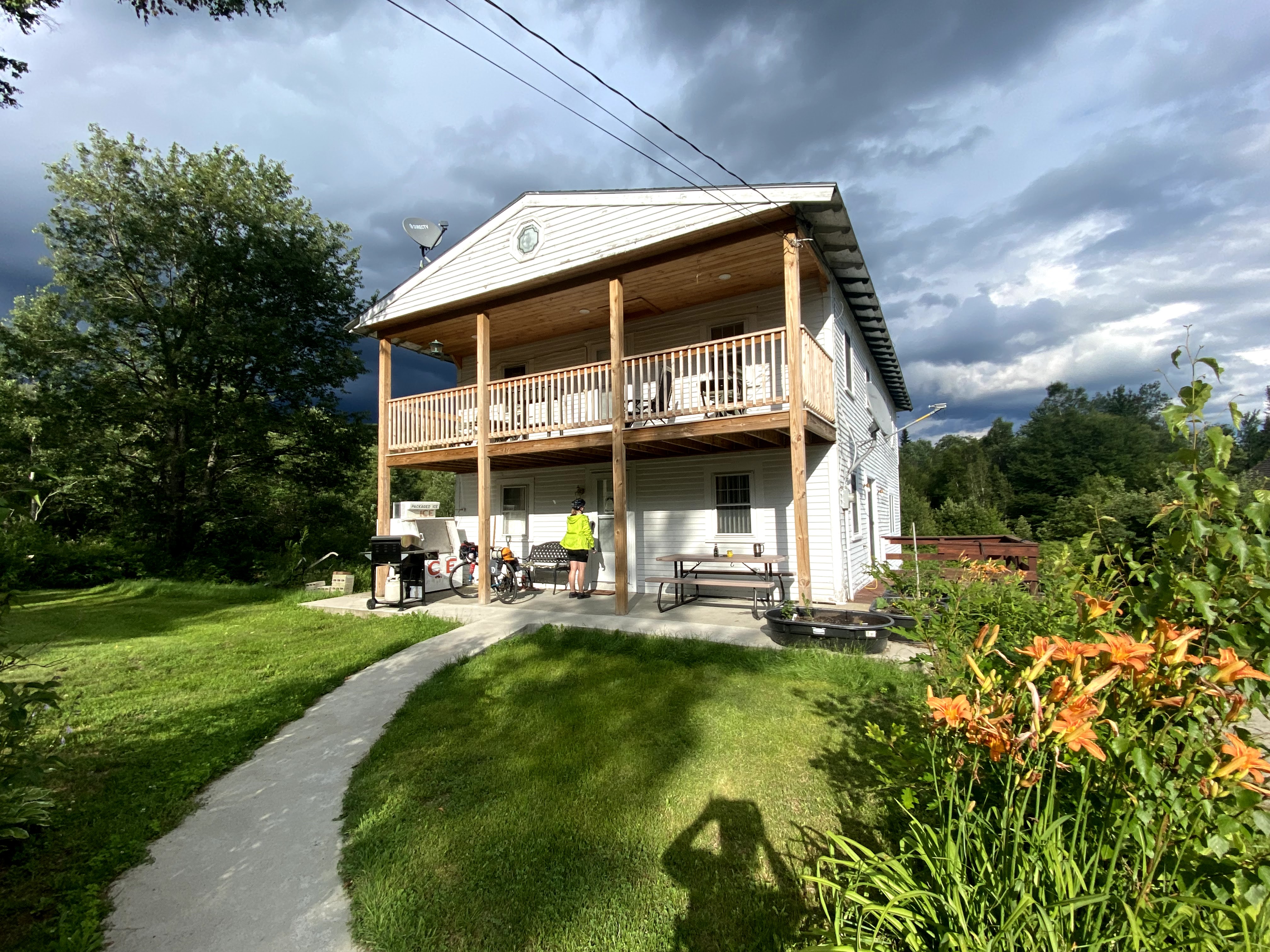
The next morning we had to get our bike bags and suitcases stored. We had arranged with the local bike shop, Twin Ports Cyclery, so we walked our bike bags up to the shop (Denis, the owner, was there and had spent time living in Colorado Springs, which we all bonded over) and then walked to Whole Foods Co-Op to pick up last minute snacks and lunch. All this meant we got a much later start than intended. And …. it was hot.
walking our bike boxes to the bike shopthis shop rocksme, Jess, and Denis the owner
In the late morning, we set our way through Duluth on the Cross-City Trail, which led us to the heavily populated Canal Park. The bike path was lovely other than the multi-use path over I-35, which was absolutely terrifying to ride across.
It’s scary because you can see all the way down to the speeding traffic
Then we began to climb out of the Duluth area and the ride started to feel real. The roads were fairly exposed with little tree cover, so we stopped a few times to cool off, drink water, and eat snacks. The climbs overall were never onerous – relatively nice 2-3% grades for no more than a few miles – but when hauling 40 pounds of gear on your bike, it is more of a marathon than a sprint.
highlights from Minnesota
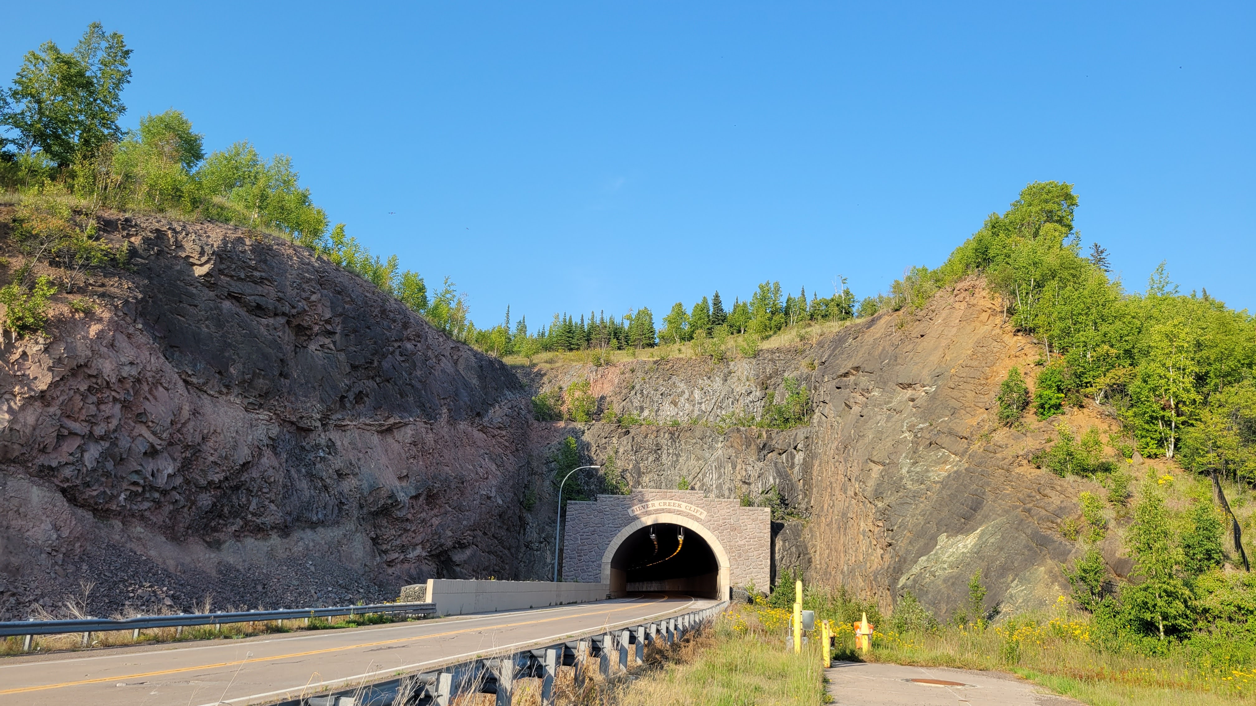
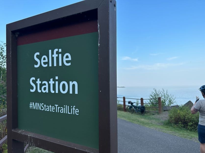
eating in the shadedidn’t expect exposed roadswhen you forget your beanie, you get one at the gas stationSilver Mine Cliffs TunnelOH HELL YEAHWOO!time to find a place to camp for the night
Exposed Roads that made the heat of the first two days tough. Lots of taking breaks in the shade to cool off, drink fluids, and have a snack
Routing into Two Harbors for food and more water, as we’d already drank the gallon each we were carrying
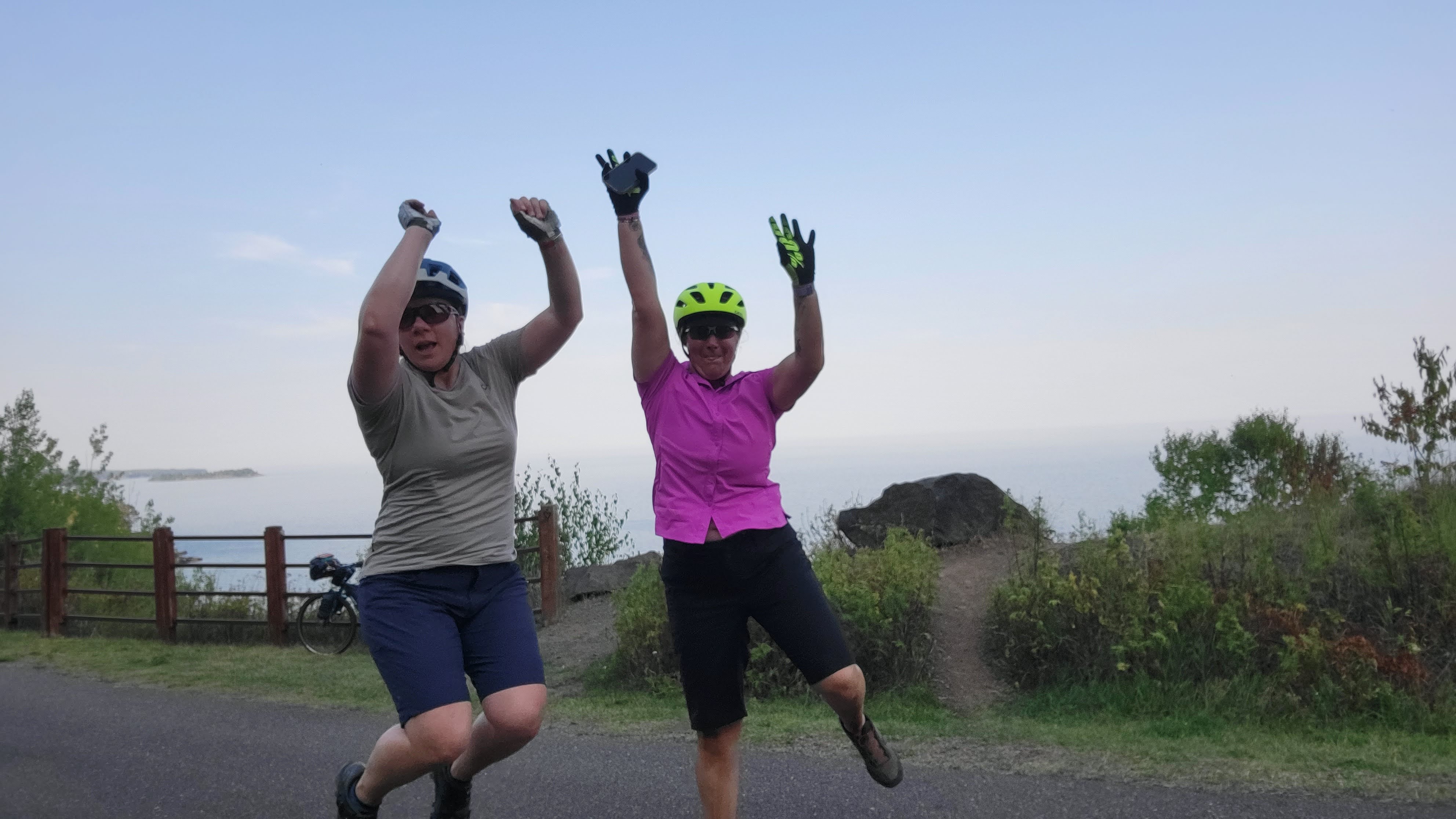
Finding a selfie station on a trail around a tunnel, and of course we had to take a jumping picture. It took several tries to get it right.
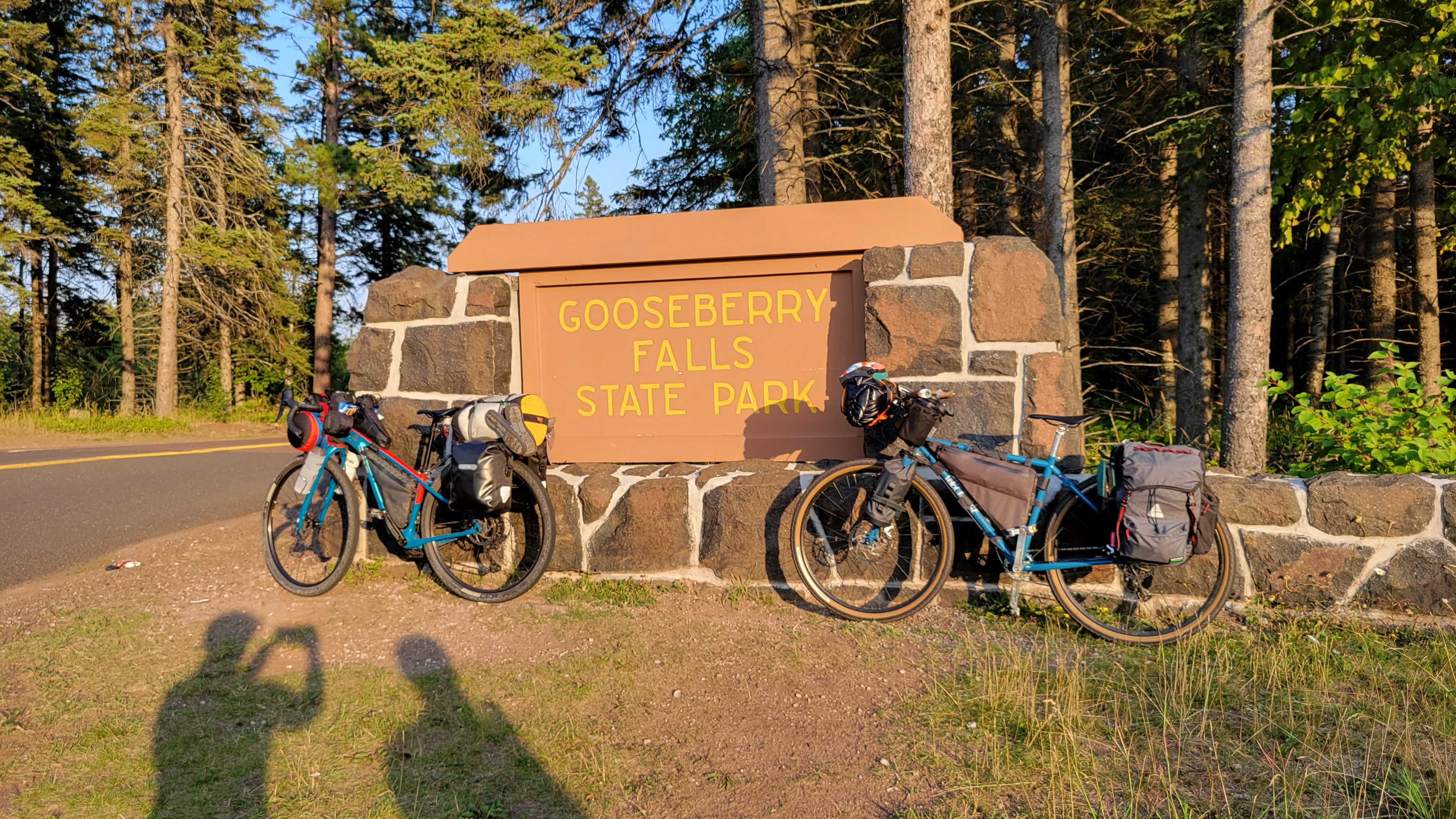
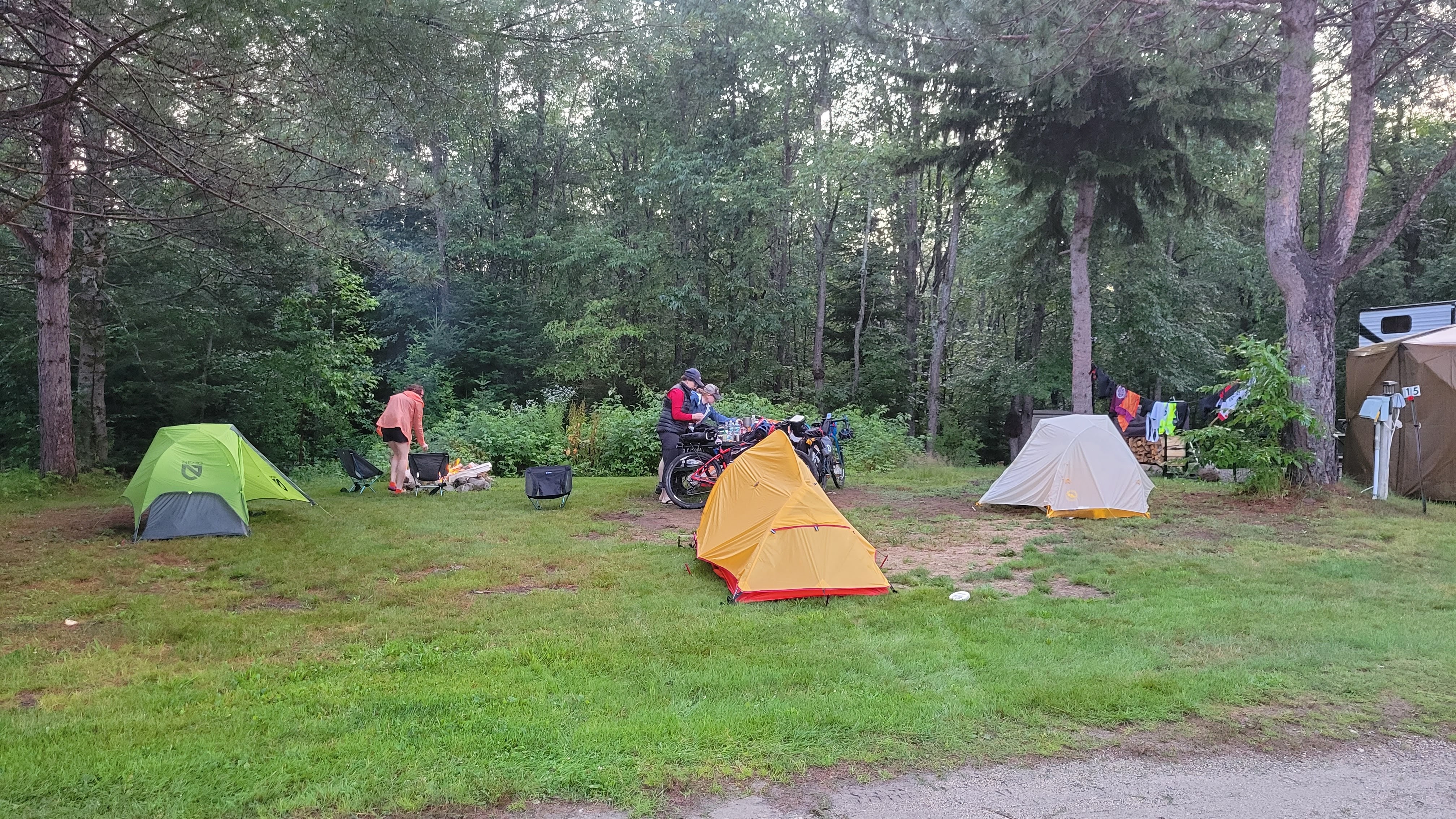
Rolling into Gooseberry Falls State Park 7 minutes before the ranger station closed and scoring the only available place to put us, which happened to be the best spot in the campground. (Minnesota, Michigan, and Wisconsin have a No Turn Away policy for bicycle travelers who need accommodations at campgrounds even if they are full.)
I break one of my tent poles. Thankfully, Big Agnes includes a pole splint.
sunrise over our campsite – Lake Superior in the background
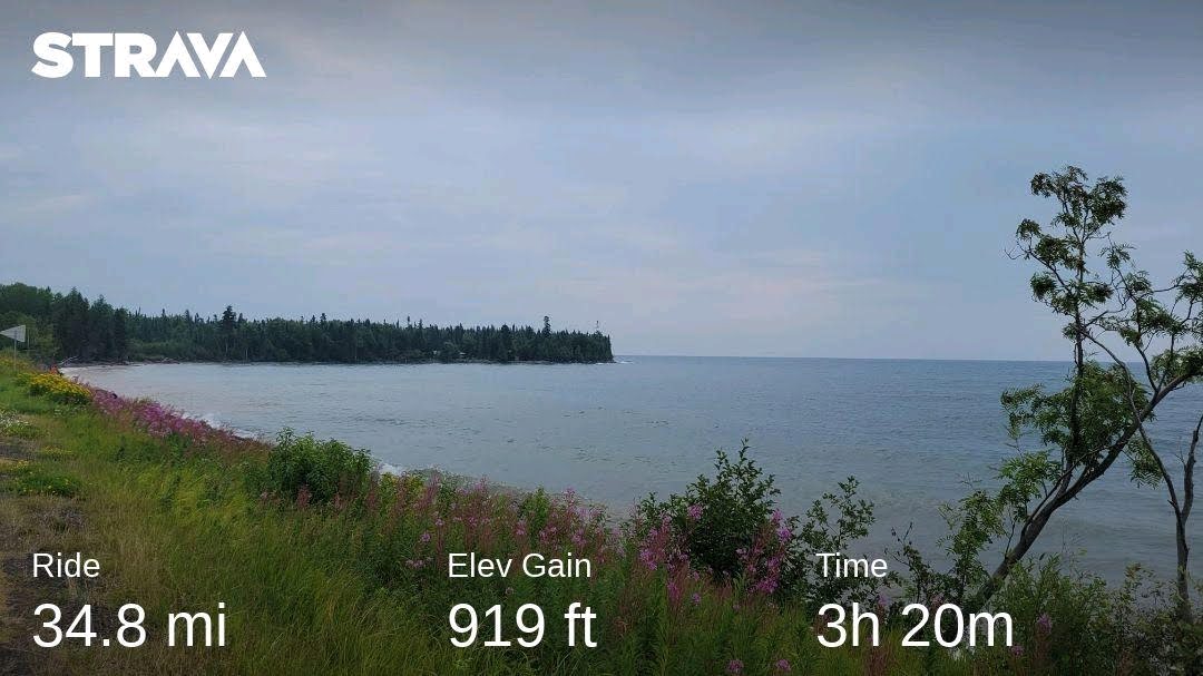
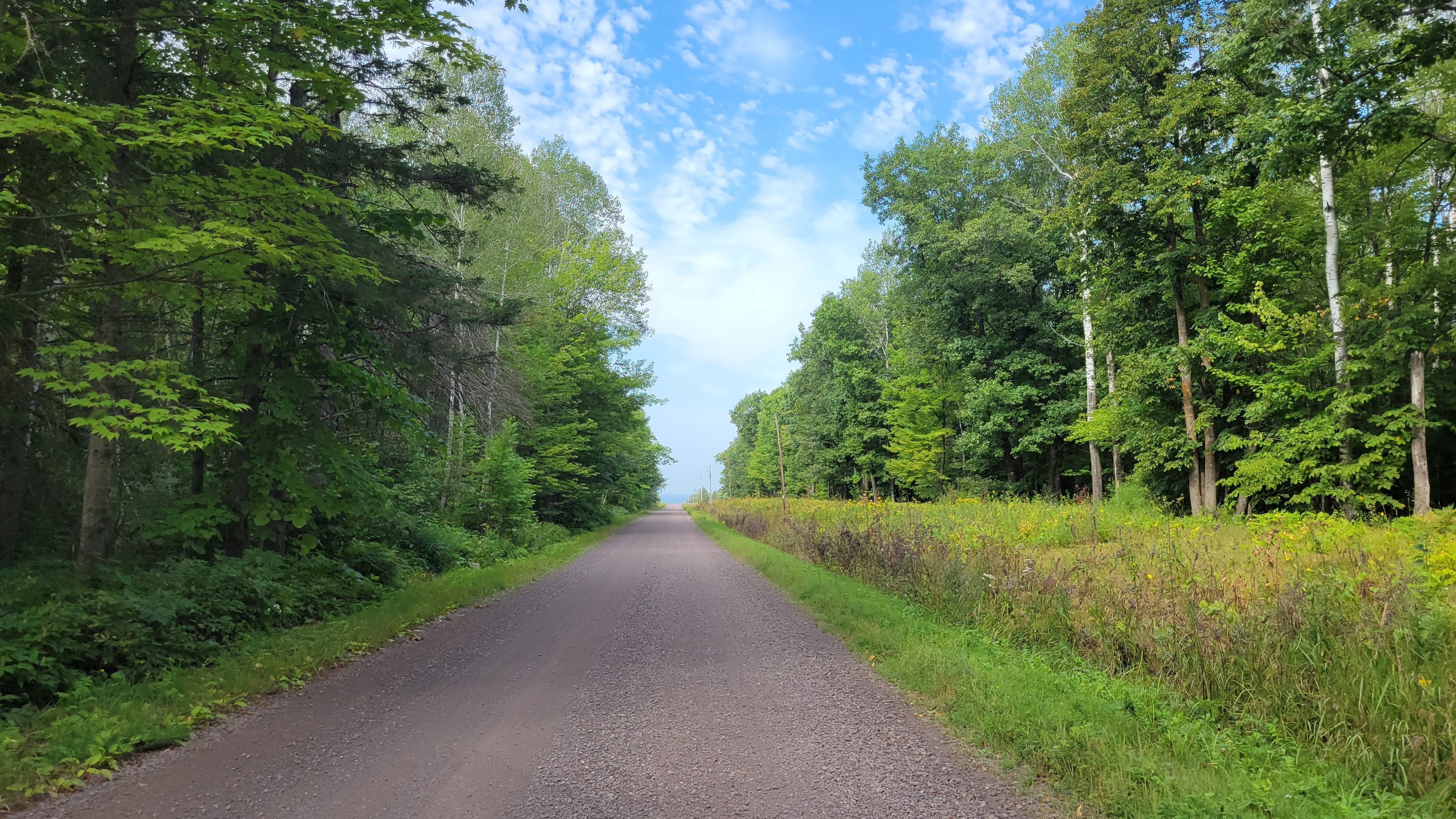
the Gitchi-Gami Trail is a GEM of a paved bikepath from Gooseberry Falls to Silver Bay
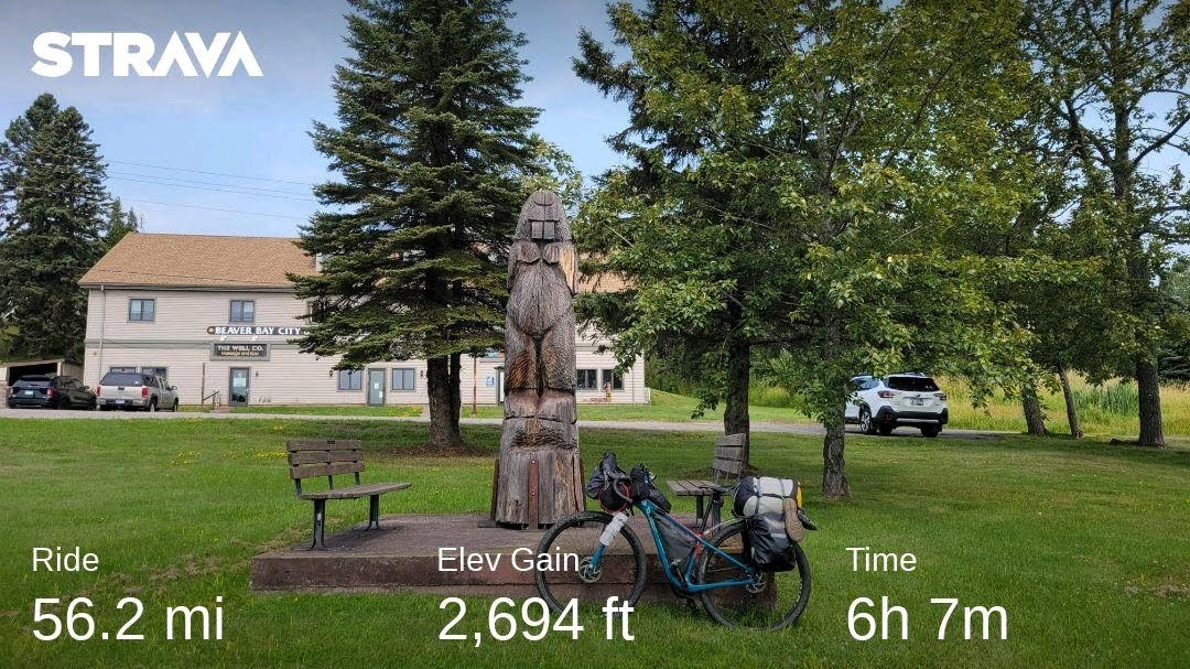
Stopping in Beaver Bay for snacks and more water, relaxing in the shade by a giant beaver statue
More exposed paved roads = so hot
Stopping a few feet into a driveway to rest, eat, and drink in a small spot of shade. A little old woman comes out of her house – we think she will offer us water or some other comfort in the heat – but she yells “PICK UP YOUR SHIT AND MOVE ALONG.”
Stopping a mile or so later at the Lax Lake Resort to rest in their driveway and chat with the proprietors, who assured us that woman was like that to everyone
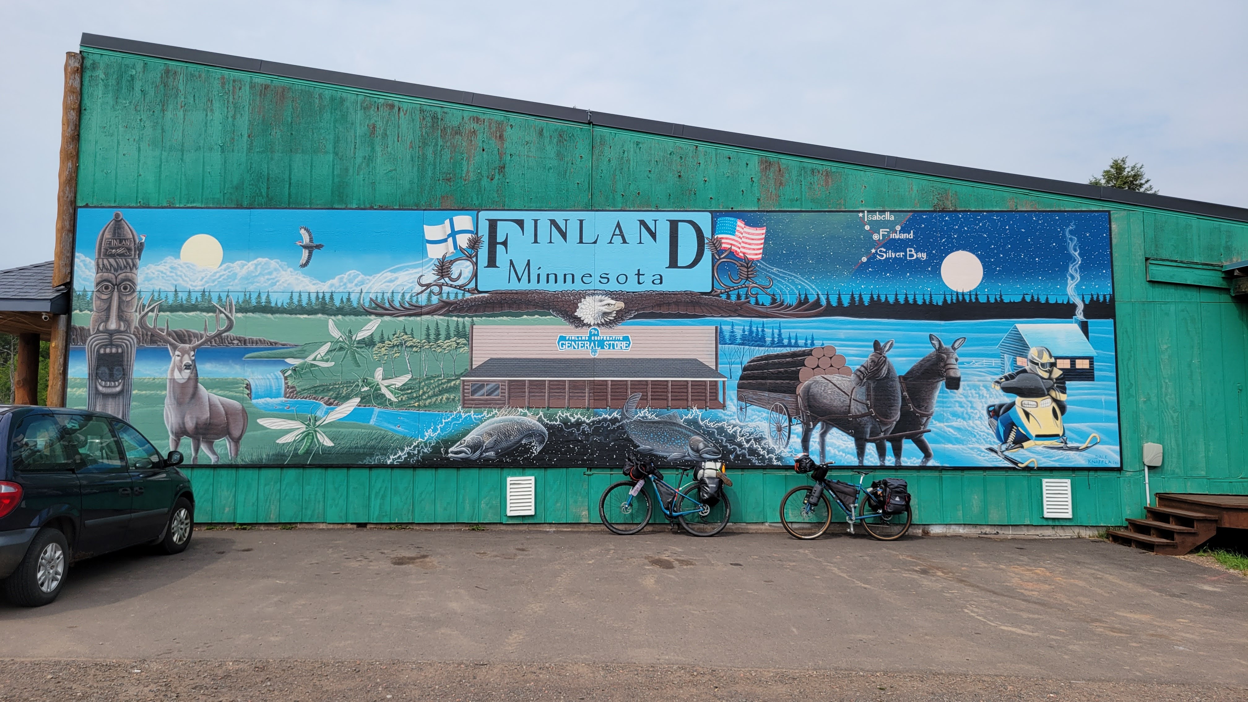
Getting to Finland, MN and buying a lot of food because it was our last resupply for 70 miles (we were still 30 miles from our intended campsite)
watching a beaver play in a pond full of lily pads
getting the last open campsite!!
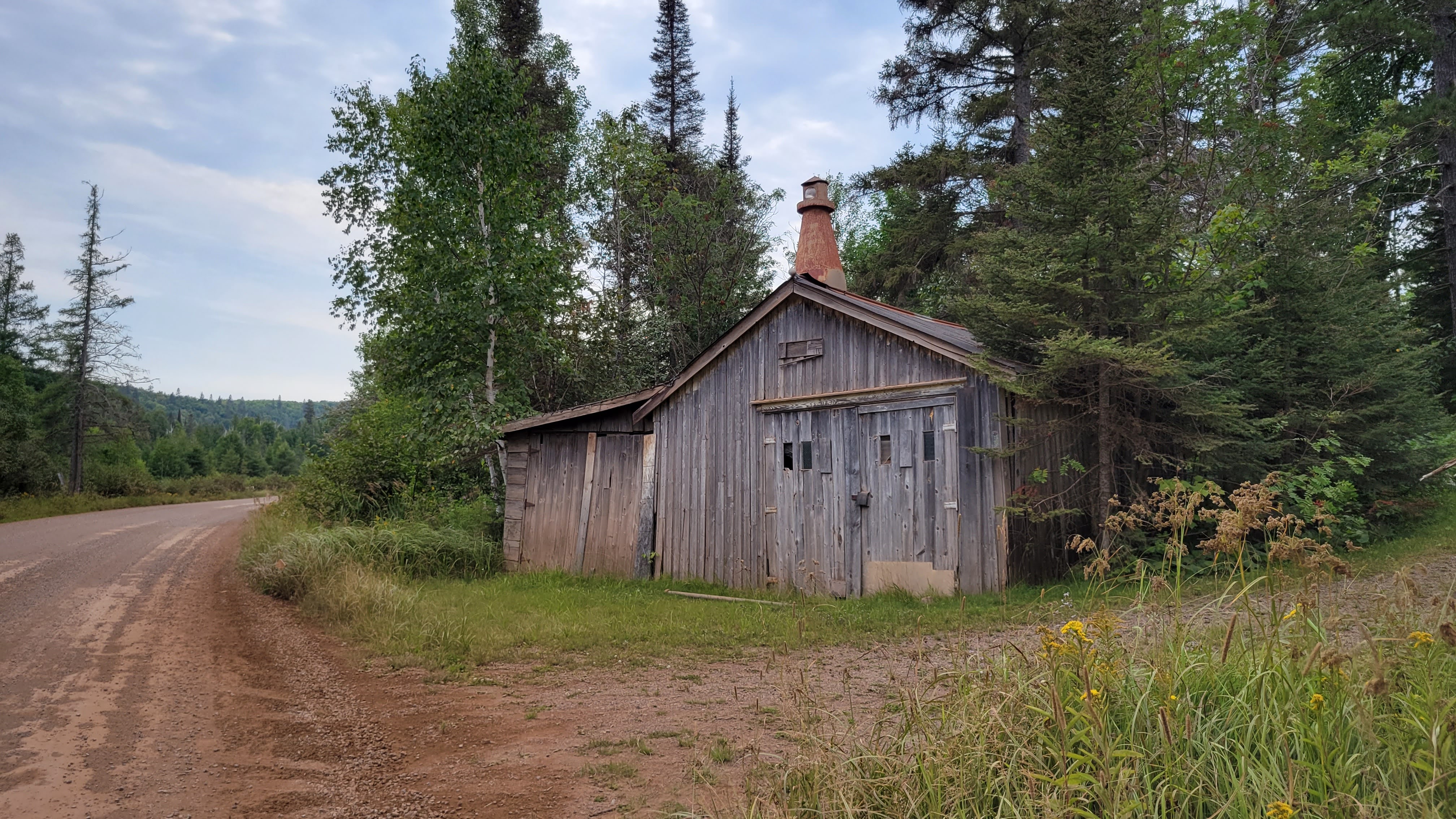
Gitchi-Gami TrailBeaver Bay, Pop 120long lonesome roadsneat raodside stuffFinland, our final resupply for 70 milestaking pics while ridingthis is what I took a pic ofbeaver! rusticmore long, lonesome roadsLast campsite available!!the lake near camp
RAIN overnight. The first of a few days where temps were getting cooler and every night was soggy. Fortunately, our tents kept us warm and dry; although I realized I had neglected to re-waterproof my rainfly before the trip.
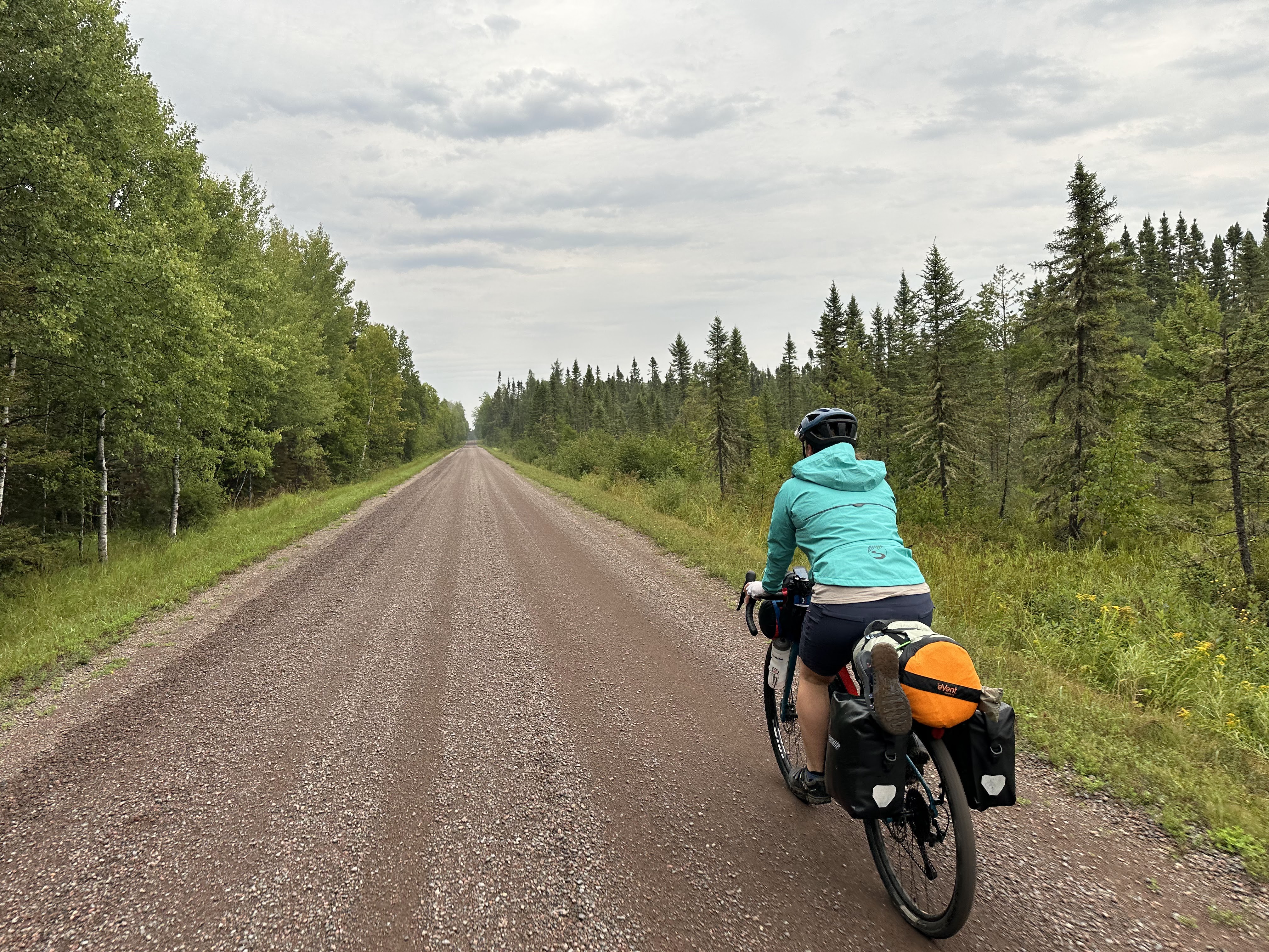
Roads are two-tracks and trails are roads. It didn’t make sense. Regardless, there were a ton of mosquitos. BUGGINS Performance insect repellent kept them at bay (mostly)
Shorter day but no resupply until we get to Grand Marais for the night
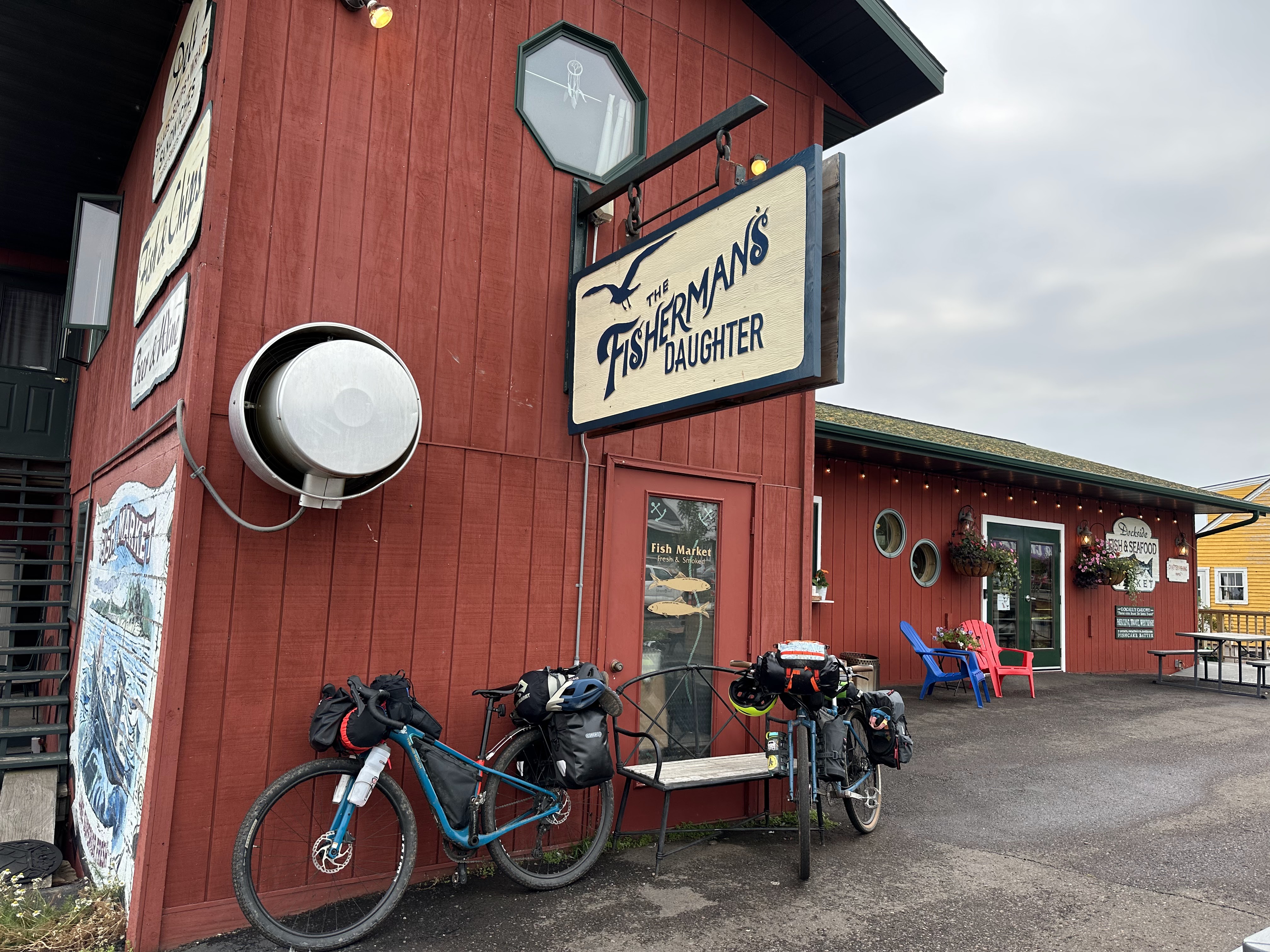
OK lunch at Fisherman’s Daughter, then off to our campsite, dinner at Voyageur Brewery
cooler temps and rainrice lake road is a trailwith big puddlesCaribou Trail is a roadJess looking bad asslunch!camp for the night
RAIN AGAIN. The forecast looked super gloomy with severe weather overnight. We opt to have breakfast in town (Java Moose), and skip the “most remote and rustic” part of Minnesota to ride up the coast on MN61.
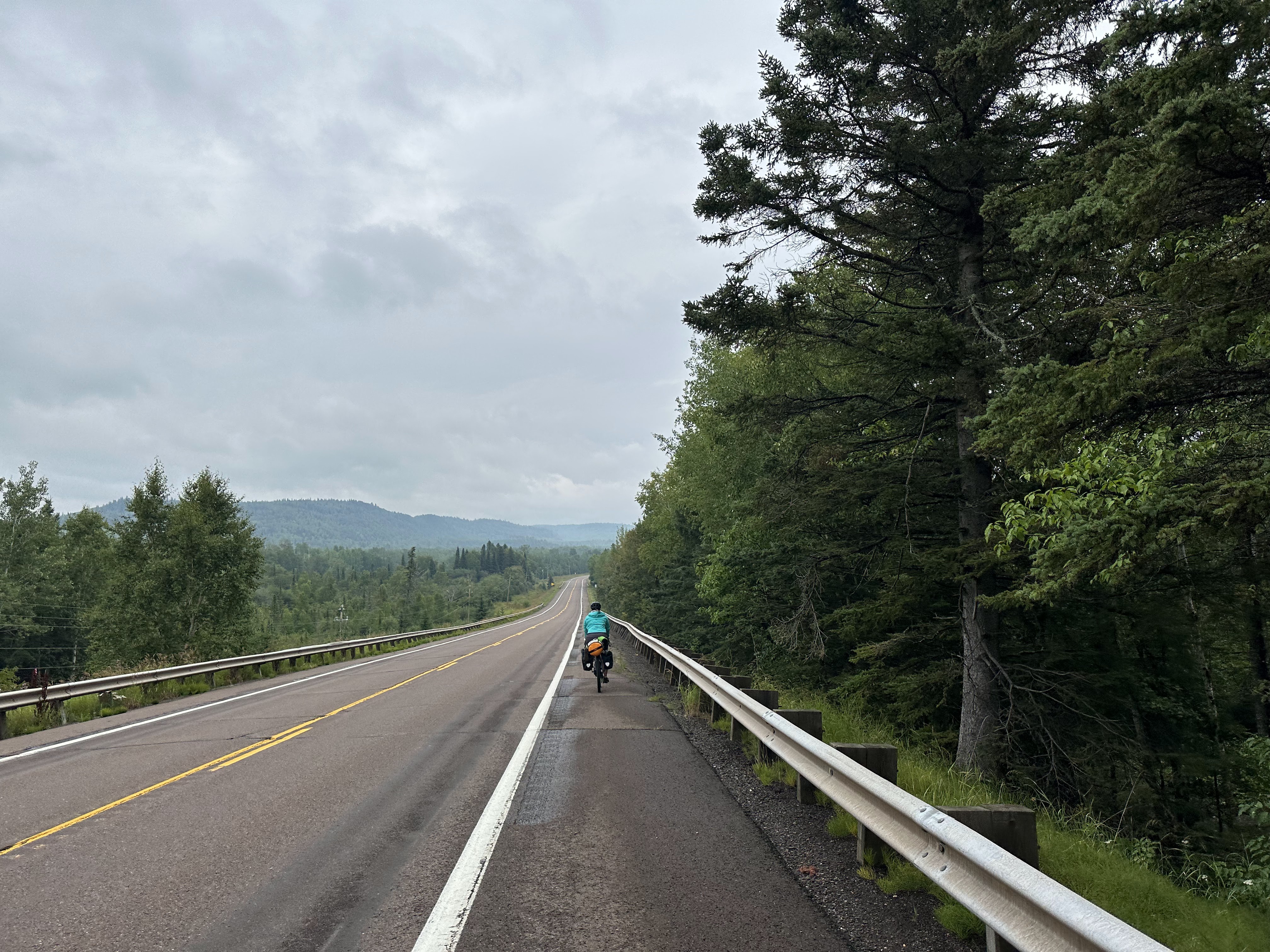
Wonderful views of Lake Superior as we ride on the wide shoulder
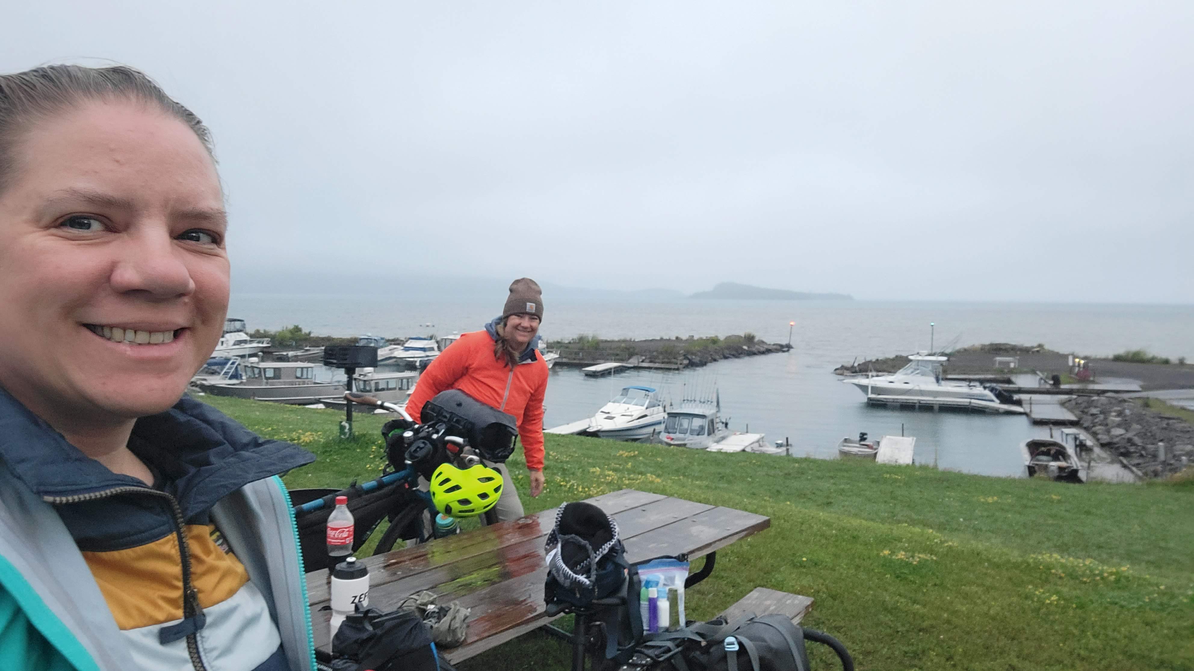
Setting up camp at the Grand Portage Marina, which feels like the edge of the world, especially with the strong winds coming off the bay
Someone giving us fish caught earlier in the day. They didn’t know we don’t eat fish, especially from strangers. We ate in the casino restaurant instead.
No severe weather overnight, but the WIND was so intense
still smilingdamp dayscenery is UNREALheading into the reservationgetting supplies at the Trading Postsetting up camp in the windfeels like the edge of the world
Isle Royale National Park (Days 5-6)
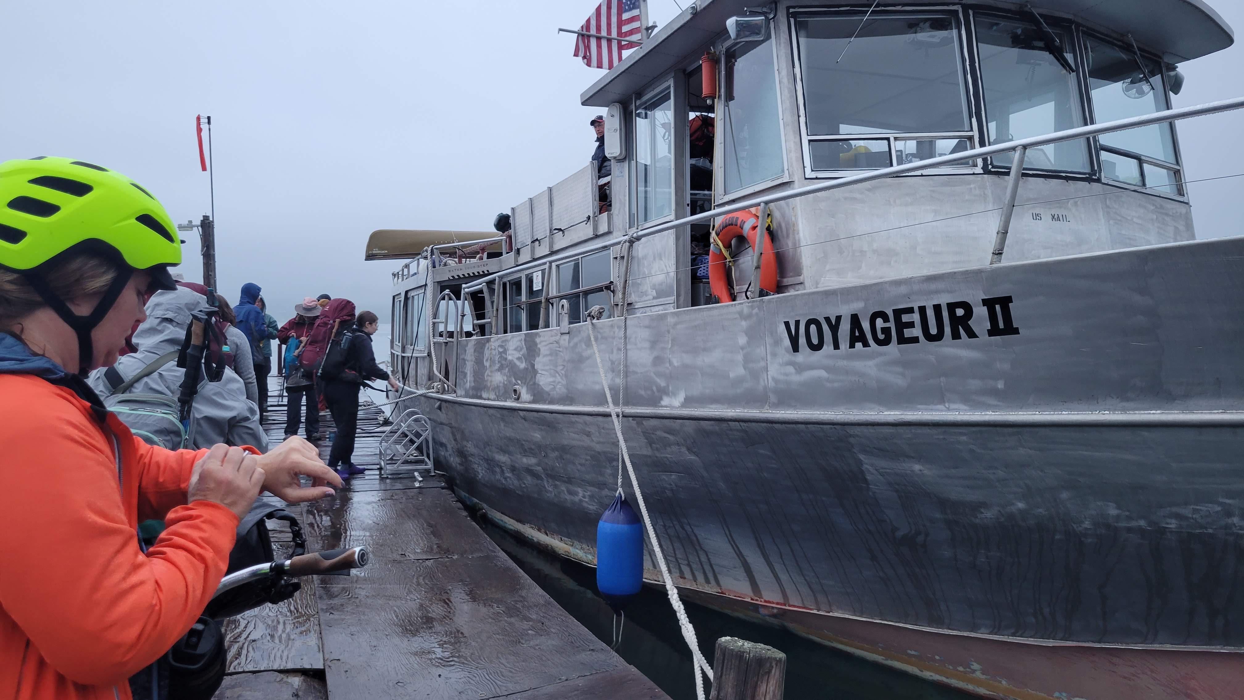
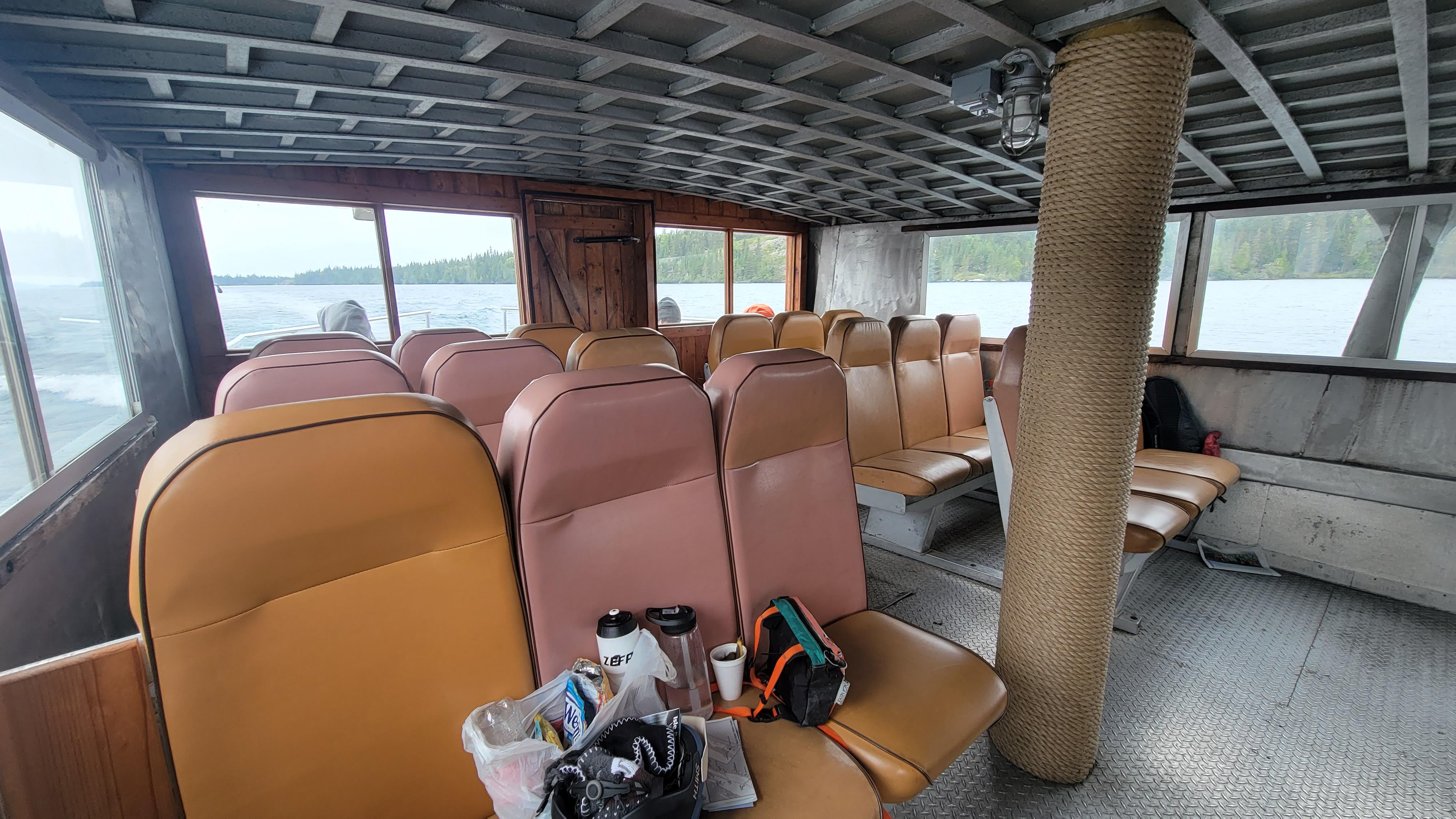
Early the next morning, we packed up our stuff and rode over to the ferry to Isle Royale National Park. We booked our spots on the Voyageur II, a US Mail Boat specifically designed for operation on the Great Lakes. We pre-gamed with Dramamine because the weather has been so iffy.
Sure enough, Lake Superior was in a fine mood and we both felt nauseated despite the anti-motion sickenss meds. A steady stream of Gin Gin hard candies kept things down for us (but others were “feeding the fishes” off the back). Two hours later, we pull into Windigo dock for our park orientation.
Our boatour bikes were hoisted and strapped down on the roofLake Superior MoodWindigo Dock
Back on the boat for the 6 hour trip around the island to Rock Harbor, where we would be staying overnight.
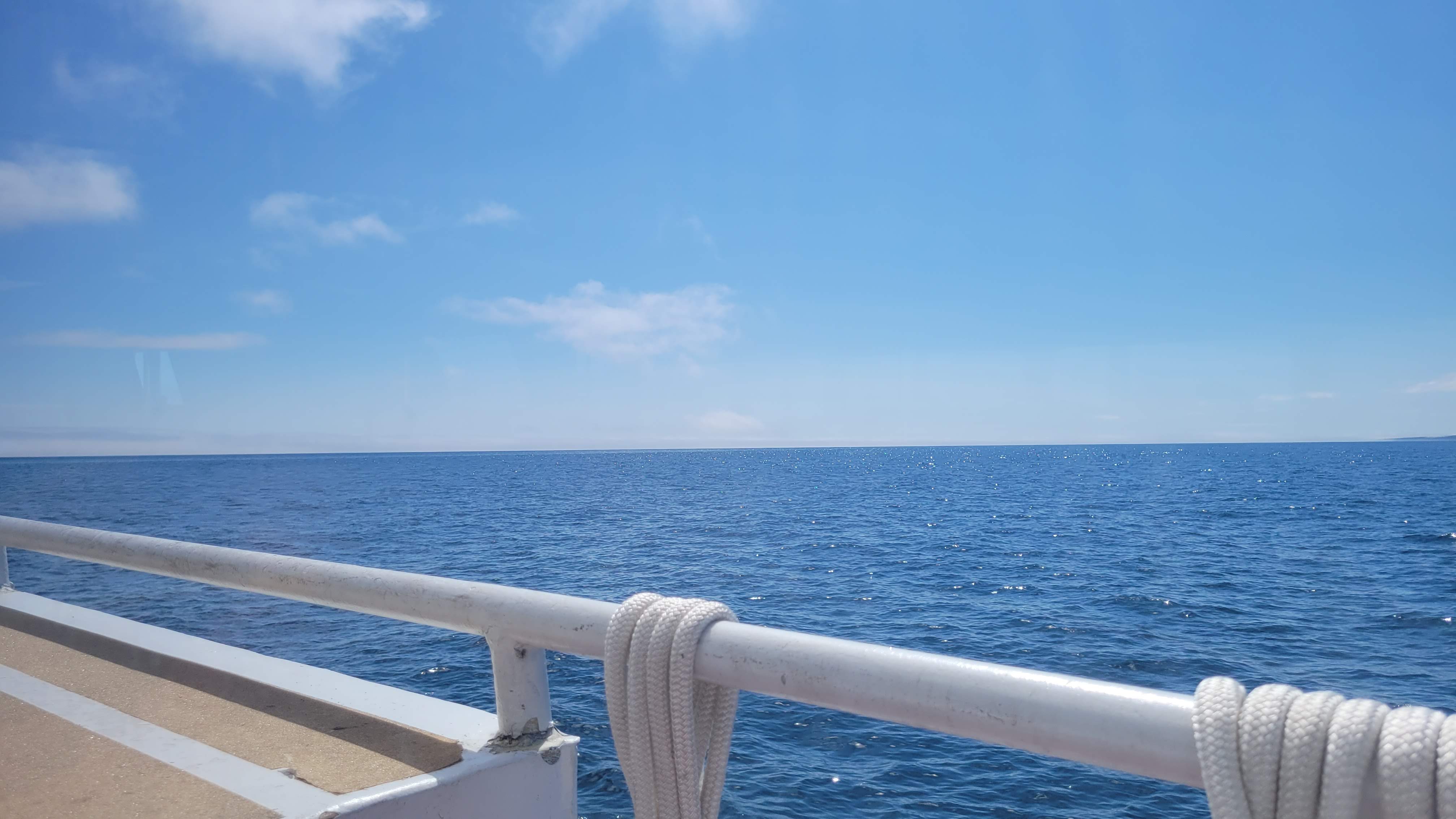
The first 5 hours of this portion were lovely – calm waters as we sailed the smooth water along the western coastline of Isle Royale. We had a pick up at one of the remote docks and sailing in McCargoe Cove was absolutely magical. (Excuse the noise – we were sitting in or directly behind the engine room)
engine room seating in the engine roomJess and I on the bowMcCargoe Cove
As we rounded the northern end of the island, things got … interesting. The waves were getting larger, the boat listing a bit more from side to side. Then the doors to the engine room where we were sitting started banging open and closed. The boat listed so hard at one point it felt like it was at a 45* angle and everyone was bracing themselves against what was surely going to be a rollover.
In that half-second, my brain calculated that there wasn’t enough time to grab life jackets and that our bikes were surely headed to the bottom of the lake.
Fortunately, our captain was All Pro and navigated us safely around the island and into the calm waters of Rock Harbor with a jovial “Well, THAT was fun!” Jess chatted with him as our bikes were being unloaded – he said the 10-foot waves we were in were relatively mild compared to how it can get on Lake Superior. Yikes.
The only words on my mind are RESPECT. Respect for our captain and crew and for the raw power of nature.
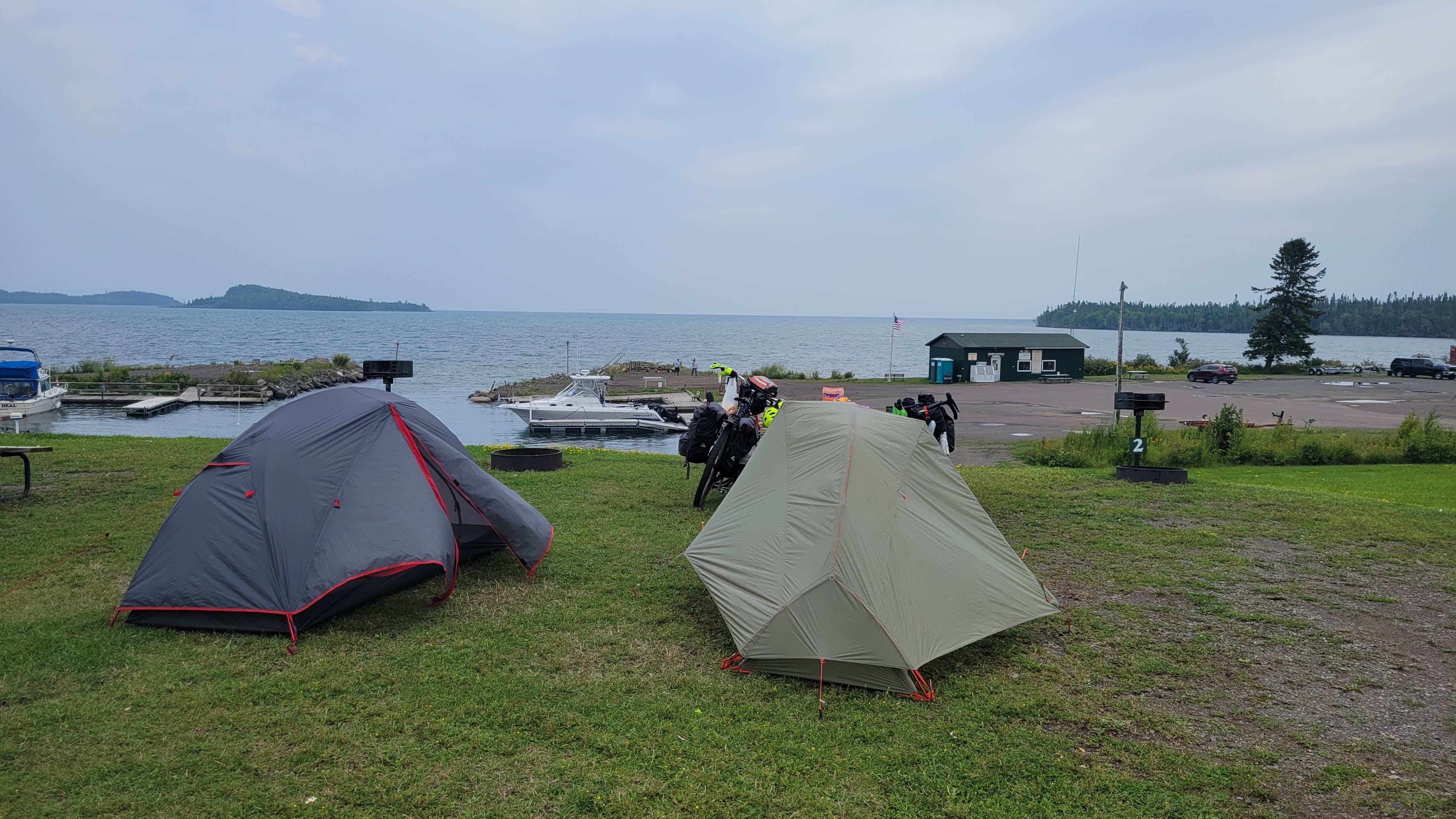
We got our camping permit, locked our bikes to the racks at the docks, and walked our bags to a campsite to set up and eat some food before retiring early.
I had to walk back to our bikes to get some items we left and on my way back on the trail to our campsite, I noticed a medium sized black dog with pointy ears trotting towards me. My first thought was “oh, someone’s dog is loose!” – but immediately recalled that dogs are not allowed on the island. This is a fox. I stopped; the black fox stopped to observe me, decided I wasn’t a threat, and trotted off into the brush.
No photos, but it did happen! I felt so lucky!
The next morning we slept in late, as our next ferry wasn’t until afternoon, and we had a relaxed breakfast before packing everything up and reloading our bikes. We wandered around the dock, had lunch on the restaurant porch, bought souvenirs and snacks, and then spent a few hours just looking out over the lake. It was nice to not do anything for a bit. We took a short hike to the America Dock and saw the ferry we would take coming in. It was at least three times as large as our previous ferry, which relieved us that the trip to Michigan would be much smoother.
When it was time for the Queen IV ferry to load our bikes up, the crew was astonished to learn we were carrying a gallon of water each on our bikes. We did – every day. While we had water filters, Minnesota is marshland and we opted to just fill up in the morning and as needed along the way. They made us remove some gear so they could get the bikes up and secured on the roof.
The 3.5 hour ferry to Copper Harbor, Michigan was smooth and uneventful. We chatted with a few couples who had been stranded on Isle Royale for a few days because they had come over on the sea planes, which weren’t flying due to weather/fog. Sea plane visitors are at the mercy of the ferries back to the mainlands having space.
welcome to Rock Harborour campsiteAttn Bikepackers: You gotta leave your bike at the docksQueen IV ferrySittin’ on the dock of the Bay …
Lake Superior Moods
Let’s Talk about Copper Harbor
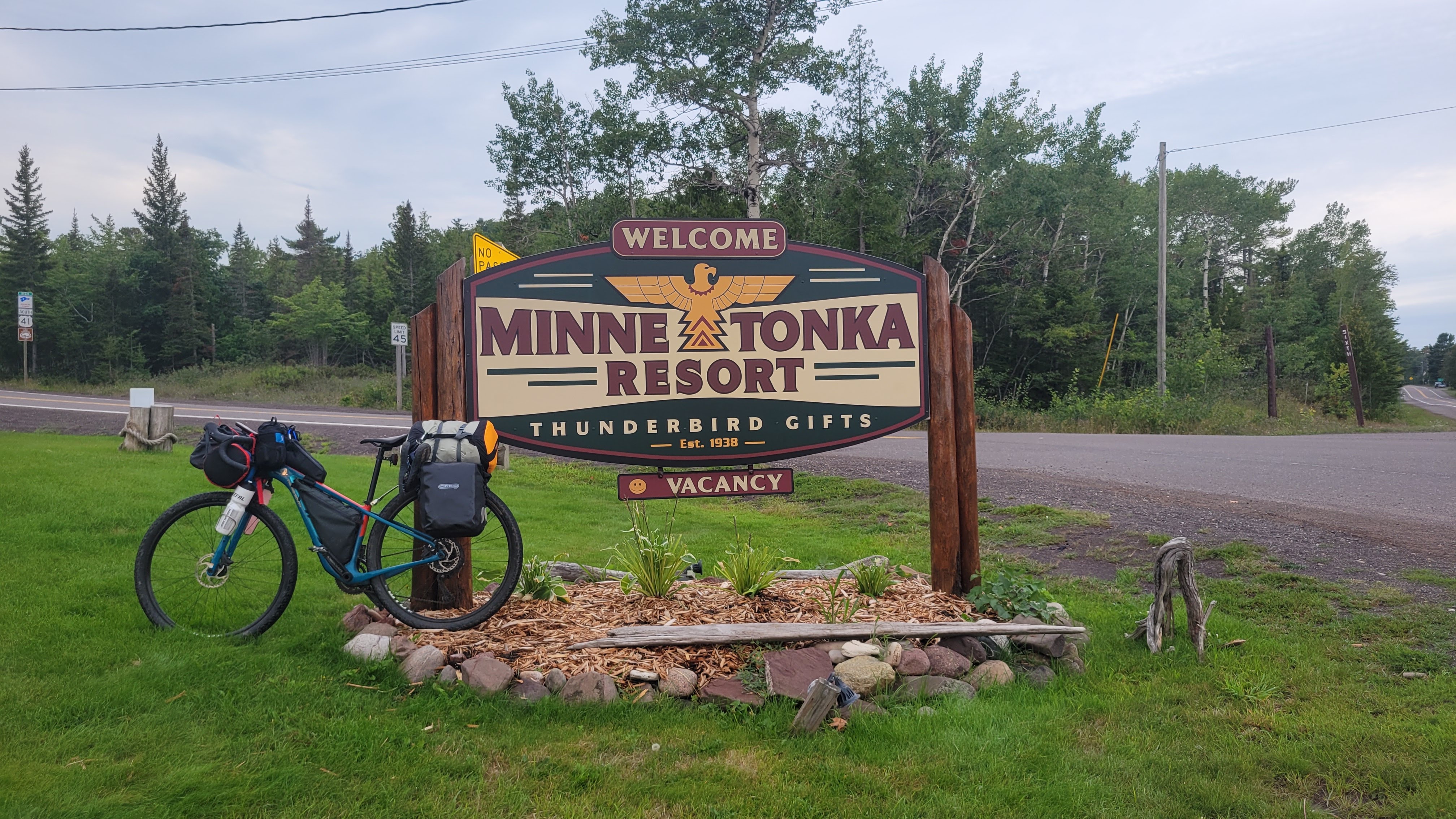
We landed at the dock and got our bicycles and gear from the ferry. Somehow my fork had been loosened and it wasn’t lining up with my handlebars – but we were only two blocks from our cabin at the Minnetonka Resort for the night so we walked up there, got the keys, and tightened up the fork.
After taking a shower, we decided to walk down to Mariner North to get a pizza and cheese curds.
While waiting for our pizza to be done, a woman walked up to the bar where we were standing and told one of the servers “I can’t figure out how to make my television work.” (the restaurant is also a lodge). The server excused themselves and soon an older man who appeared to be the manager came over. She explained she couldn’t figure out the TV and quipped “This is the strangest place I’ve ever been.” to which he replied, in the most Wisconsin accent ever, “Oh-KEY” You could see his brain working on how to respond to this woman’s issue when he blurted out “Right now. We can do it right now. Right now, or in an hour and a half.” The poor woman was bewildered and agreed to go now to get her TV set up. We left with our pizza and cheese curds laughing the whole walk back to the cabin.
That night as we chatted in the softest, most cloud-like beds ever slept in, we started a list of all the catch phrases so far:
… but did you die on a boat?
Then pick up your shit and move along!
This is the strangest place I’ve ever been – Oh-KEY.
Michigan (Days 7-10)
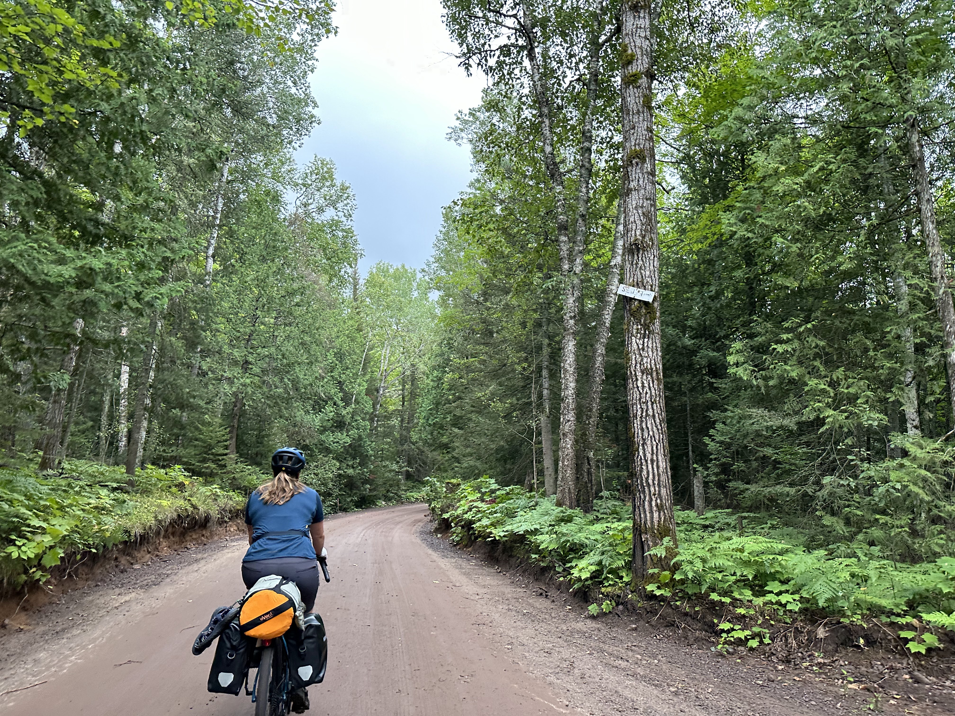
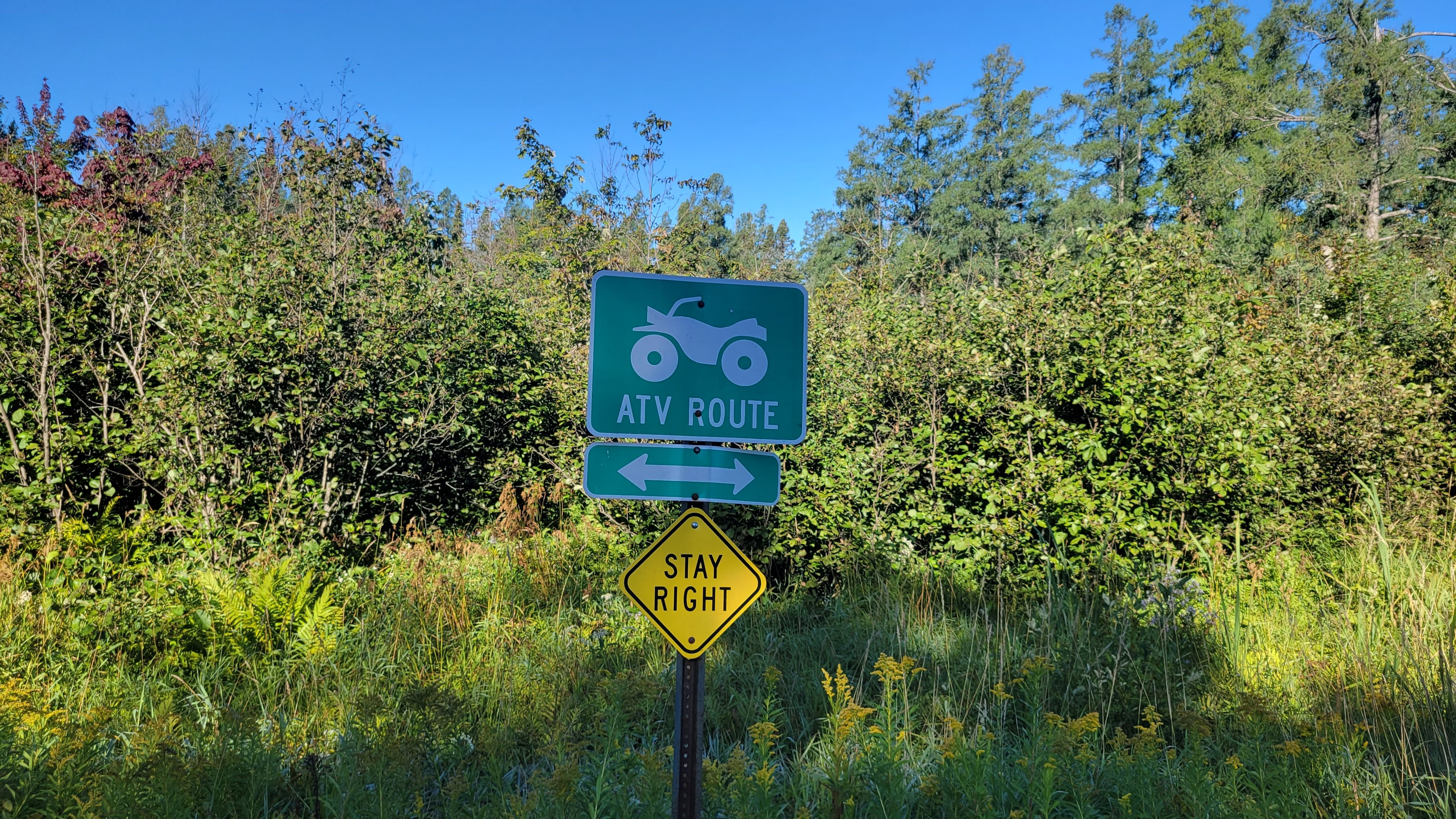
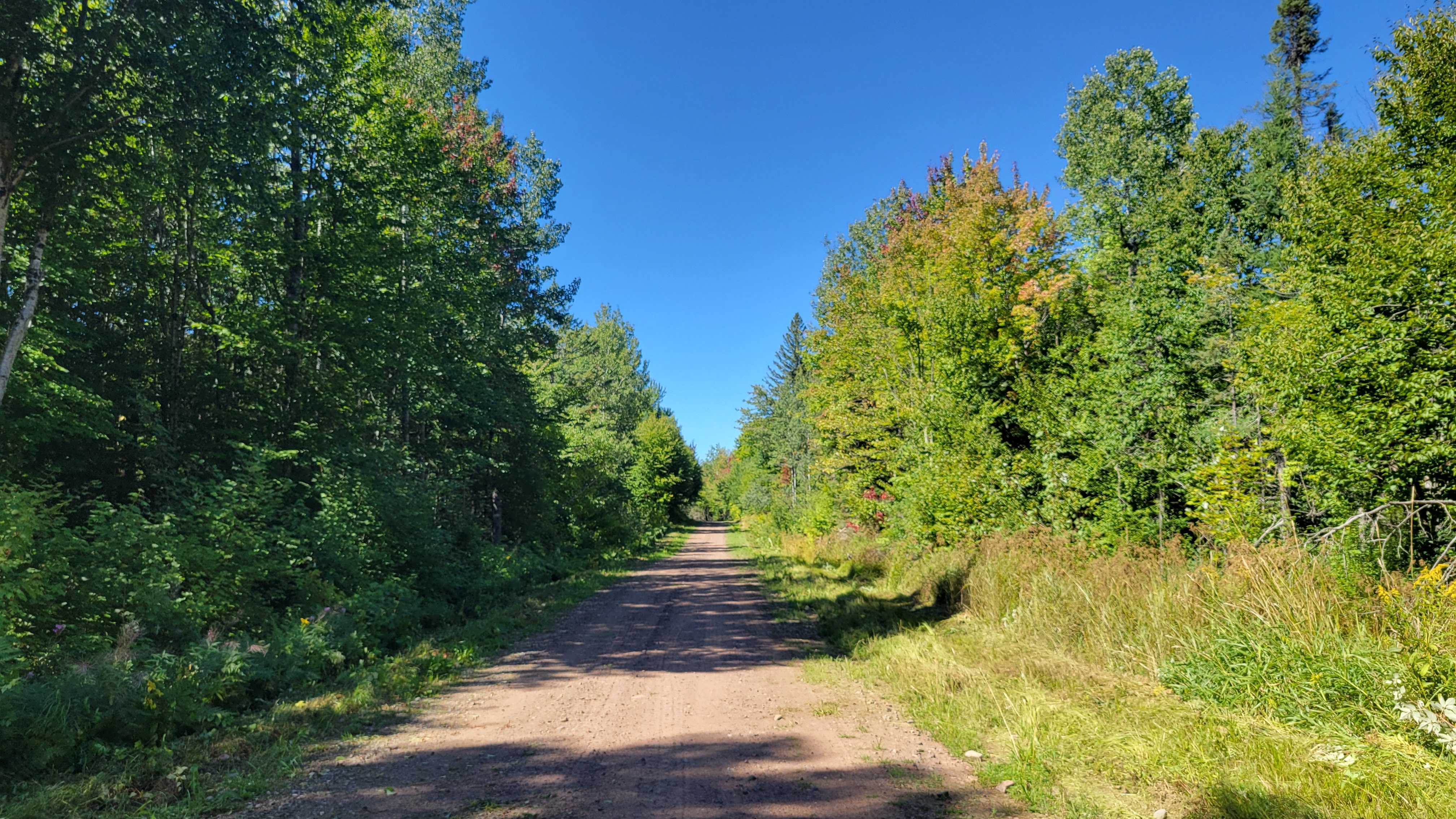
Copper Harbor is a tiny tourist town at the very tip of the Keweenah Peninsula (which, isn’t actually a peninsula; it’s an island because the canal in Houghton is natural) that is home to some of the best mountain biking trails in the Midwest. It’s also home to an extensive network of ATV trails, which we learned very quickly. Michigan was a tough state, and we adjusted the route almost every day for various reasons (mostly, the ATV roads were rocky and sandy, which sucks energy and speed).
highlights from Michigan
Tightening every bolt on our bikes before leaving town
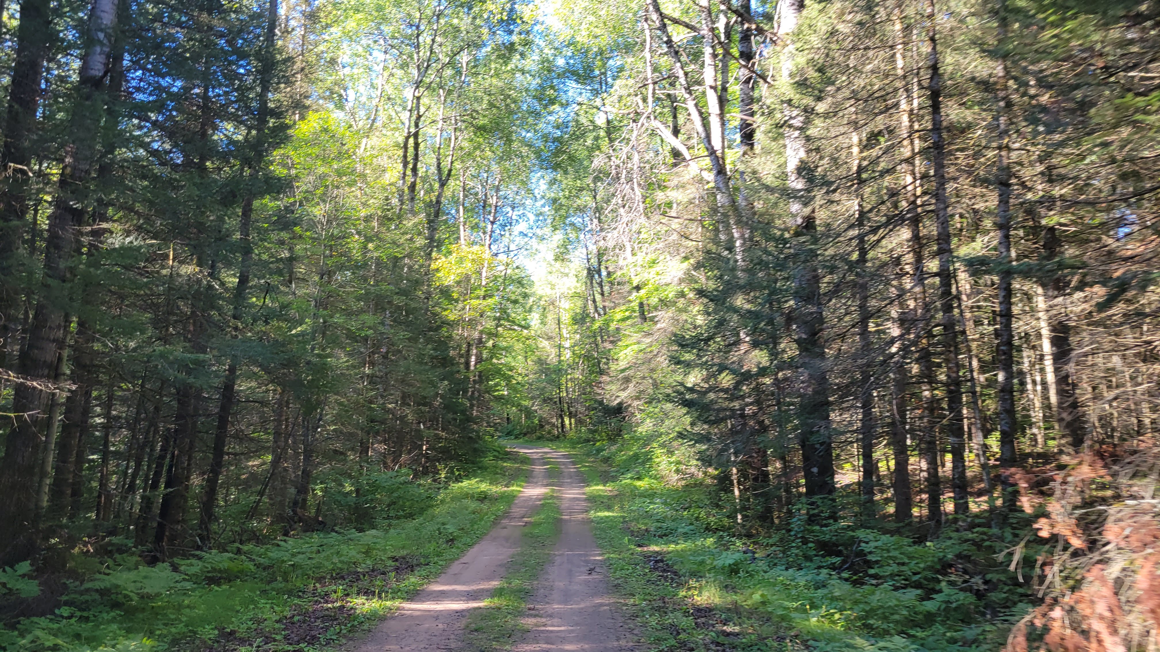
Climbing out of Copper Harbor on quiet, gorgeous dirt roads
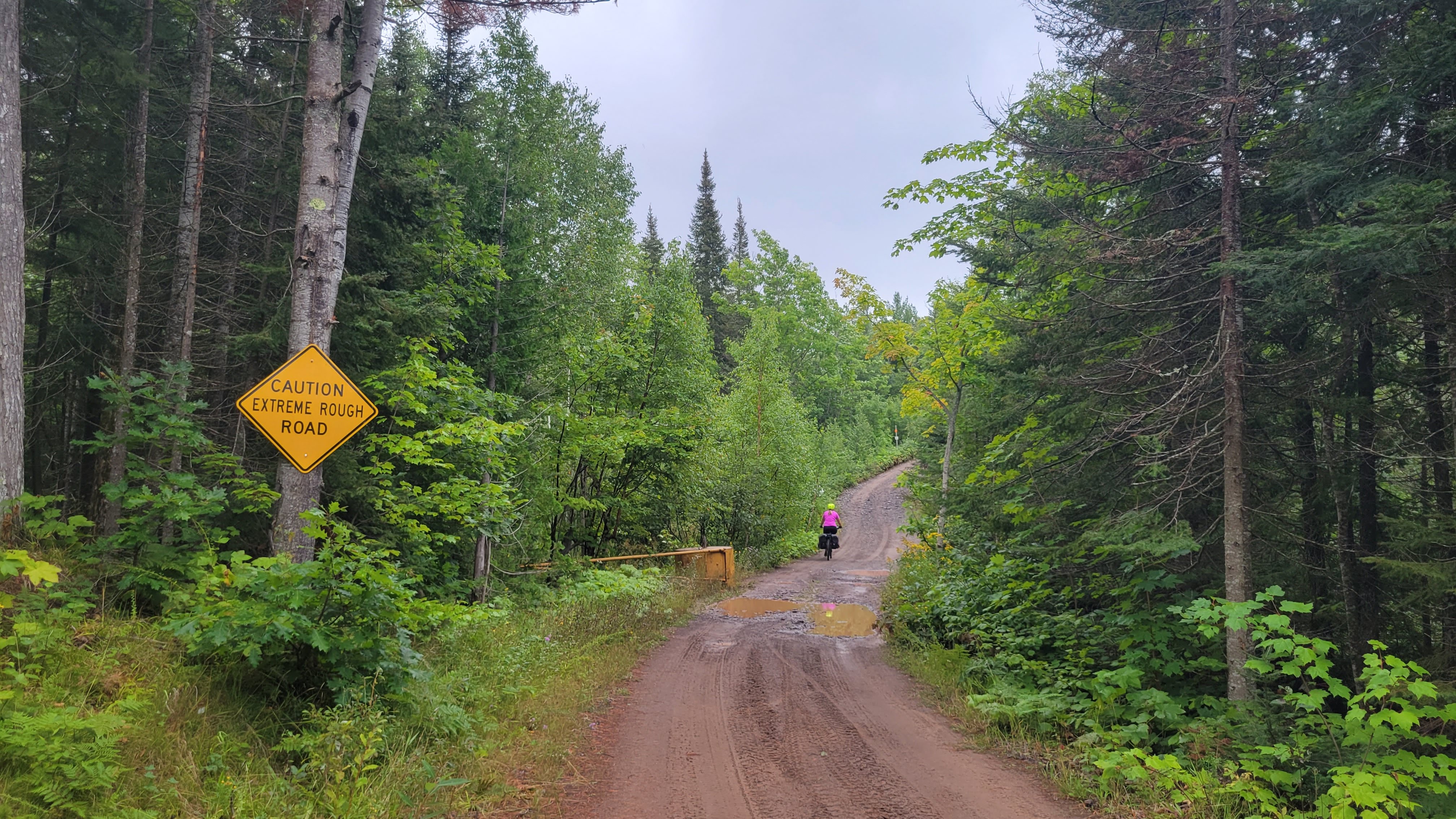
Turning left and seeing “Extremely Rough Road Ahead”
Ending up on very rugged, rocky ATV roads – making another turn and it’s been freshly graded with a few inches of loamy red dirt. For the next several miles. We pushed our bikes a lot up hills
Bye, cabinpeaceful scenerygorgeousso magicalstill smilingbeginning of the chunkfreshly groomed loamy red dirt ATV trails
Putting too much power through my pedals to get up a technical uphill trail when I hear a ka-CHUNK. Get the chain back on the cogs – but Jess notices the smaller front ring is loose. She tries to tighten the bolts but they won’t tighten. And two of them are missing. We put it the chain on the big chainring and I delicately pedal (and walk) the last few miles to the road.
We stop in a parking lot of a marina before deciding to ride back to Copper Harbor’s bike shop. We’re in 15 miles, it’s been 3 hours, and we have a 15-mile ride back on the paved roads. I pedal as gently as I can. US41 is beautiful.
Losing the two spacers we had at some point, Eric at Keweenaw Adventure Company McGuyver’s my small chainring together so I can finish the ride. I am eternally thankful.
As soon as my bike is fixed and recombobulated, we get a Squall Warning and take shelter under the bike barn to wait out the rain
We decide to just ride US41 to where we would have picked up the trail and take that in to camp.
riding back to Copper Harbor Sqall!back on ATV trailsmore trailsstill more trailsour tiny campsitethe eponymous copper mine
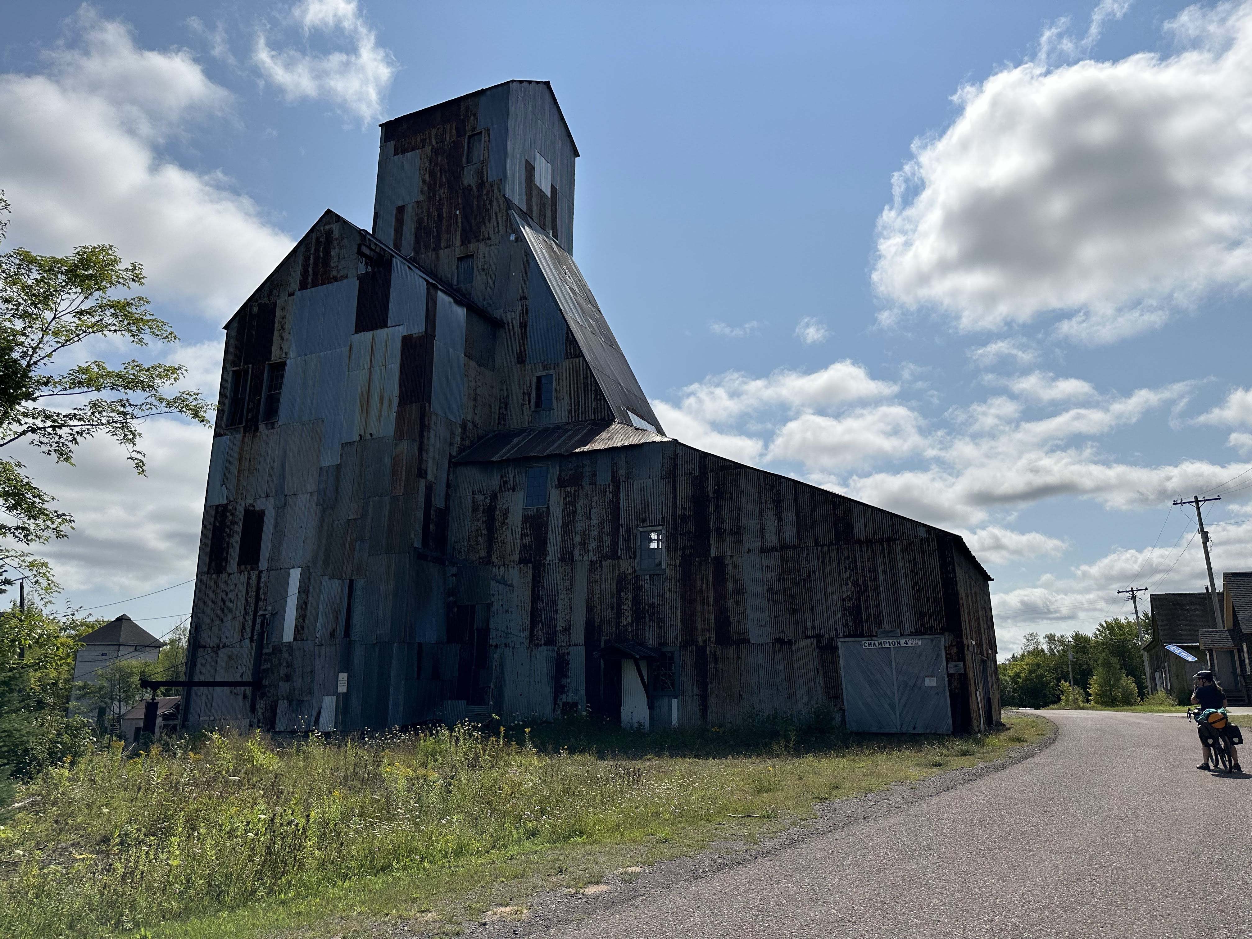
Feeling a bit tired from the extra long day, we decided to reroute to a more direct way to our next campground. We found some nice quiet dirt backroads, spent some time on US41, crossed the bridge at Houghton, and enjoyed lunch by the canal before climbing out and making our way to the Bill Nichols Trail. It has moments of hardpack but far more chunky loose gravel, random sand pits, and abundant shade.
Champion Mine was a nice surprise to check out before continuing on.
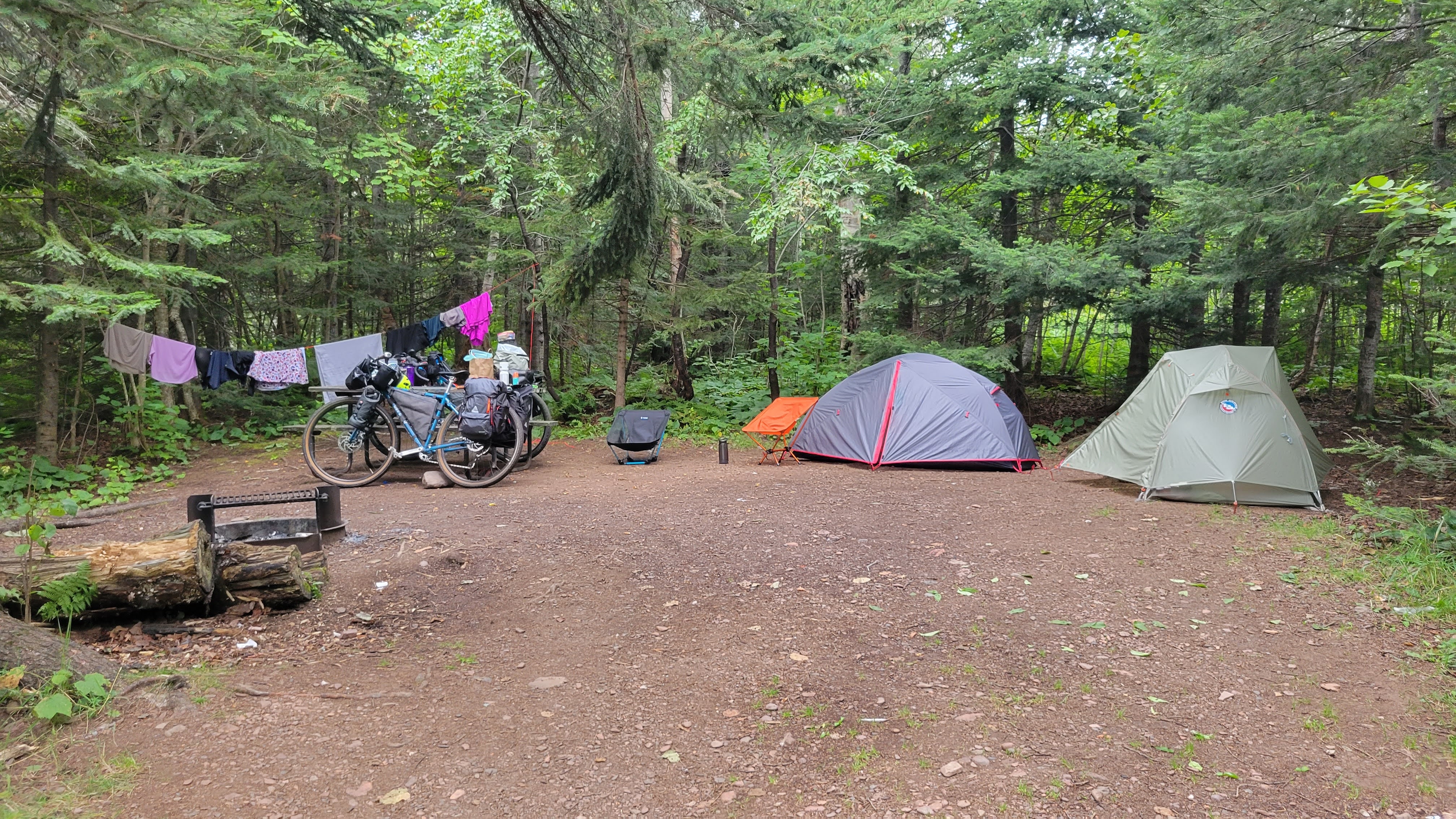
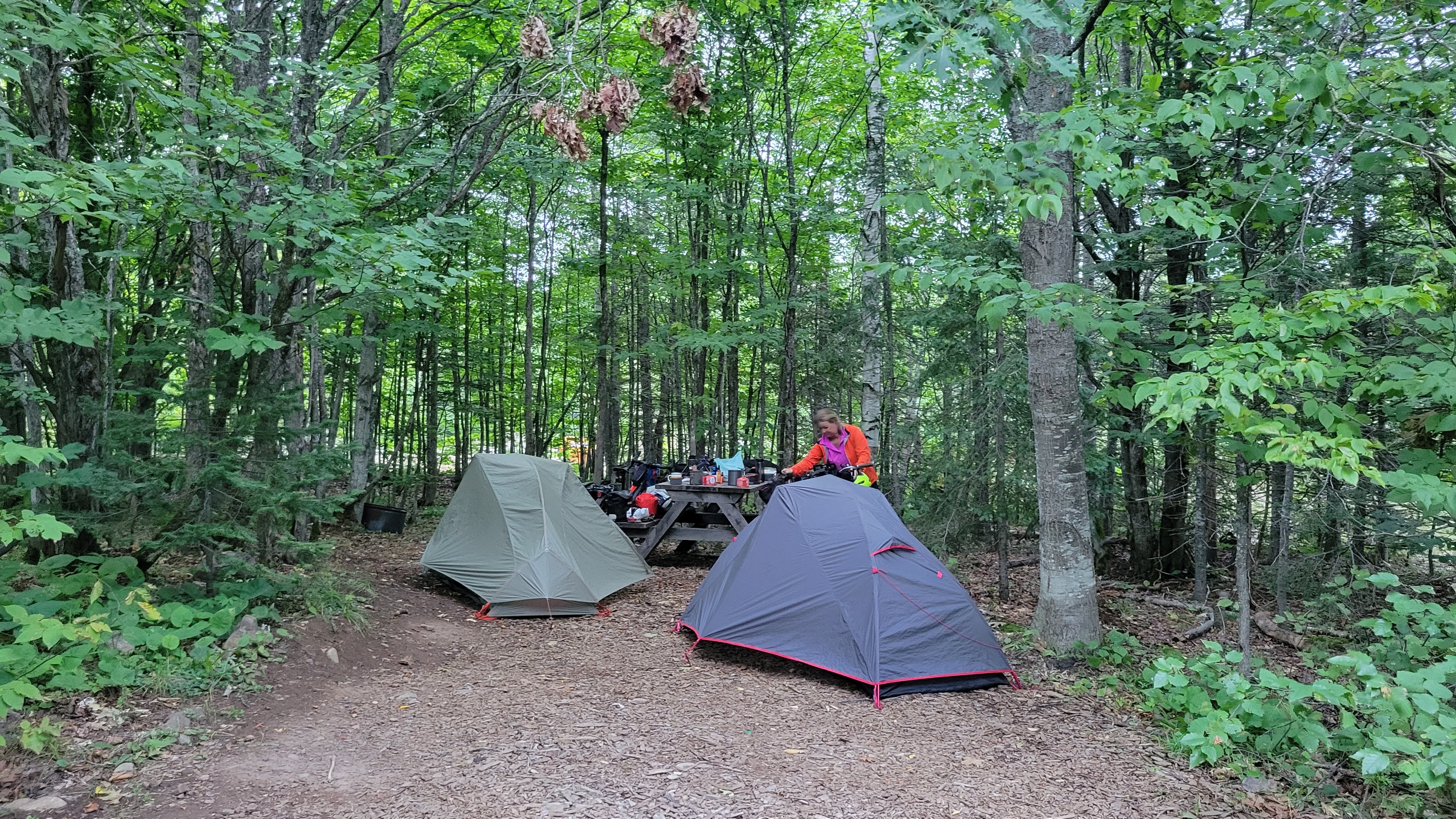
We originally planned to camp at a dispersed campground, but as we passed Twin Lakes State Park, we noticed it was open. We scored an amazing site with lake views.
beautiful sceneryflowers outside Pat’s Foodslunch time!Champion Minethis part of the ATV trail had been freshly scrapedTwin Lakes Campgroundview from my tentJess enjoying coffee in the chilly morning air
We settled in for the night, thrilled with our luck at finding a site that had bathrooms, showers, and an electric hookup to charge our devices. As the night wore on, it felt colder than it had been at any point in the trip. we piled on more layers in our sleeping bags, and cinched the hood over our faces to keep warm.
My alarm goes off at 7am and it’s cold. We pop out of our tents to agree that 36* F is not something we want to try to do anything in – and went back to sleep in our sleeping bags until 8:30am, when it was in the 40s.
We pre-rerouted Day 3 in Michgan because the intended route would have been 70 miles and we’re starting to feel tired from hauling 40 pounds of stuff on unforgiving chunky roads. We followed the route until Mass City, which we then jumped on the road and headed up to Ontonagon, along Lake Superior, and into the Porcupine Mountain Wilderness Area.
Mass City is the poster child for poverty in rural, small towns. The market didn’t have much food so we went to the gas station for lunch. Two kids on dirt bikes were brapping around; an older guy was providing alcohol to younger girls; the gas station ladies were smoking pot in the bathroom. It was a bit depressing to be in a depressed area.
The Porkies were great! We had a site with ample distance between our tents and our cooking area. We stashed our bear bags in the bear-proof trash container for the night.
how much more of this sand?logging roadssky tresslesJess is braver than meLake Superior in the backgroundof course we had to take a picalmost to campawesome, large campsite
Pedaling out of the Porkies the next morning and making our way to our layover in Ironwood.
A really big hill that we had to take a break at the top. Our legs are definitely feeling the previous days now.
Overgrown two-tracks that had us dodging babyhead rocks and tree branches – and a culvert crossing with super steep banks
Beautiful scenery into Bessemer
Iron Bell Bike Path was a welcome respite.
We came out of the woods to this viewstill smiling! steep culvert washoutmore time in the woodsso nice and shadythe road to our layover
Layover in Ironwood, MI (Days 10-11)
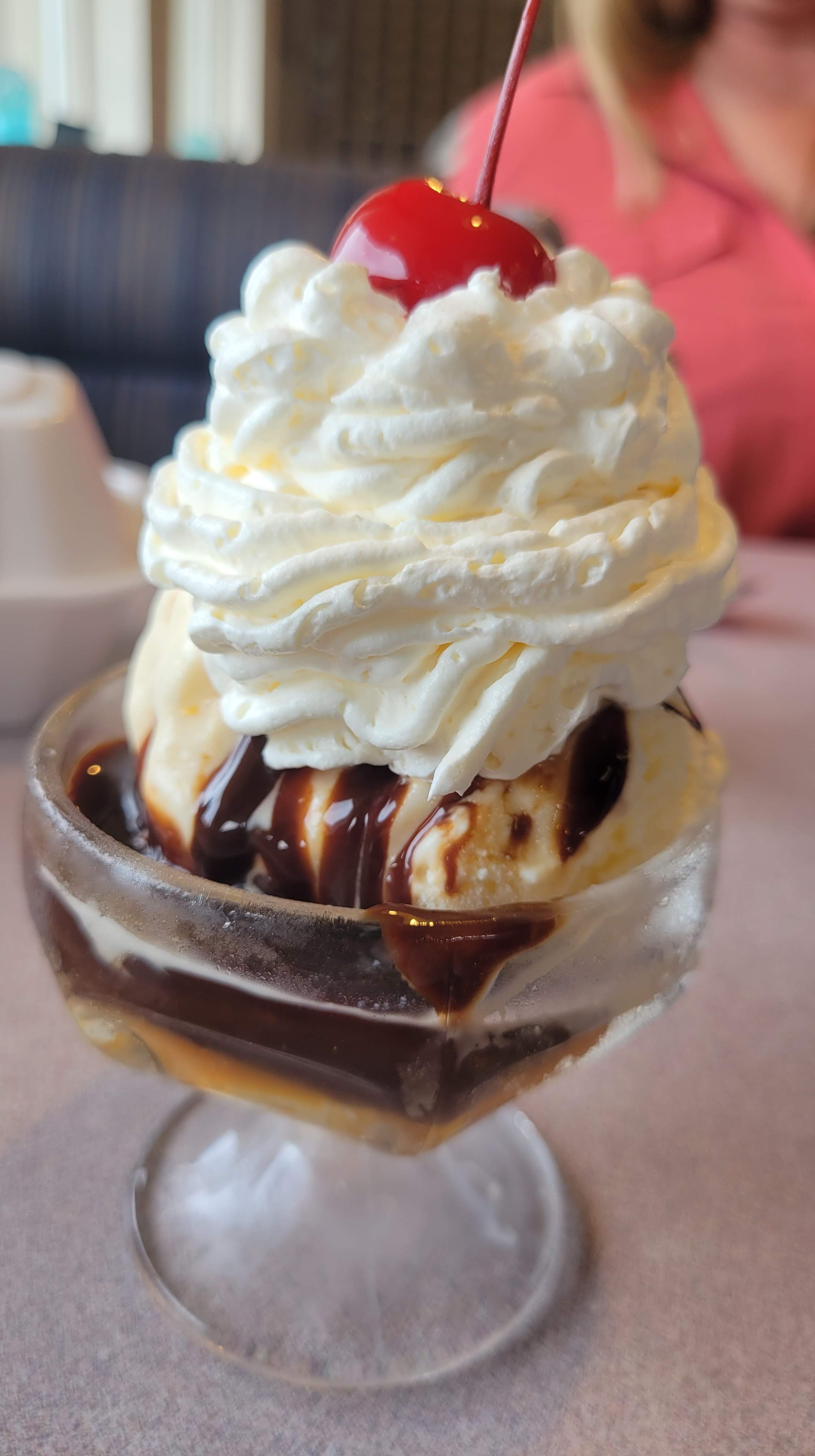
We deeply craved a day off to rest, shower, do laundry (last time we cleaned our clothing was in Grand Portage), and eat. We walked a mile to the laundromat and then had lunch next door while we waited for the washer. Real food tastes so good now, and we ordered the World’s Smallest Sundae each to celebrate how far we’d come.
World’s smallest sundae
The next day we took a taxi to Walmart to pick up everything we would need for our final four days across Wisconsin, as all four days would be mostly without any resupply options. It felt good to sleep in a bed again.
With access to cell service and internet, we were able to connect with out families and started to really miss them. The weight of being gone for so long was hitting hard.
Wisconsin (Days 12-15)
We knew this state was the least amount of total miles but the most remote. The route doesn’t pass through many towns, so it was important to have what we needed each day. Our lunches have consisted of BumbleBee Chicken Salad To Go kits on the side of the road, supplemented with whatever beverage we bought at the last gas station we saw and maybe chips or a ClifBar. We basically eat like college kids again – and eat a lot, all the time.
Unfortunately, the route maps indicated most of the roads were paved; we discovered quickly that most of the roads were loose gravel or worse, sand. This was incredibly disheartening as we labored through another 20-miles-in-three-hours day.
highlights from Wisconsin
Leaving Ironwood, we stop at the Hiawatha statue in a town park
Within a few miles we are in Wisconsin without fanfare – no sign or obelisk to denote the passage.
We are missing our families, tired, and annoyed at every small incline on loose gravel. It’s a mentally tough day.
But Wisconsin is a different kind of beauty than Minnesota or Michigan – and we enjoy the changing landscape – even if we are on ATV roads for the rest of the route.
We get to our Forest Service campground and have the most magical site
the road cut through a lakebasically where we rode every daythe rocks show the lake is down pretty lowmore loose gravel roadsmore sceneryheading into the woods againso much waterthere were definitely moments we thought we were the Ding Dongs in the areapedaling in the shadesuper cool line of trees on the way to our campsitehome for the night
The next morning we go out little too fast because I just want to get to the next campsite and relax again. By lunch, Jess is chugging a RedBull and I’m realizing I haven’t eaten enough and don’t have anything with caffeine to fuel the afternoon. OPE
Getting to a turn onto singletrack and NOPE’ing it. We ride the rustic road up the the County Road and head west on the pavement.
We see a sign for the campground we’re looking for and take the shortcut.
We score another great lakeside spot and refuel before turning it in early. The next few days are expected to be hot.
real and true photo of the lake just after sunrisevery lovely two-trackit was a joy to ride onhey look -still smiling!my passenger for a few milesshady roads are my jamspoilers: the rustic roads did not endhome for the nightour site!
Jess captured this sunset
It’s the final two days! I want to tell you that there was some poetic moment of bittersweet emotion about this, but the reality is we were super ready to finish, finish strong, and go home.
We stocked up at the local General Store and headed to Solon Springs on quiet dirt and loose gravel roads.
At some point we popped out of the forest and found ourselves on an exposed, loose gravel road that was a series of rollers. It was hot and we stopped in the shade for a bit and chat with two hunters who had just finished setting up their stands.
Back on ATV “roads” what were mostly sand. Deep sand. Jess floated through it while I struggled to keep my bike upright. We both nearly crashed several times though – the deepest sand would grab the wheels and pull them in whatever direction it wanted.
We get to our final camping site in a town park after what felt like the longest day of our lives.
It’s hot, we’re sweaty, and gross. So we shower in the bathhouse, but the water is sulfered, so now everything smells vaguely like rotten eggs.
It’s 80*F when we crawl into bed at 8pm.
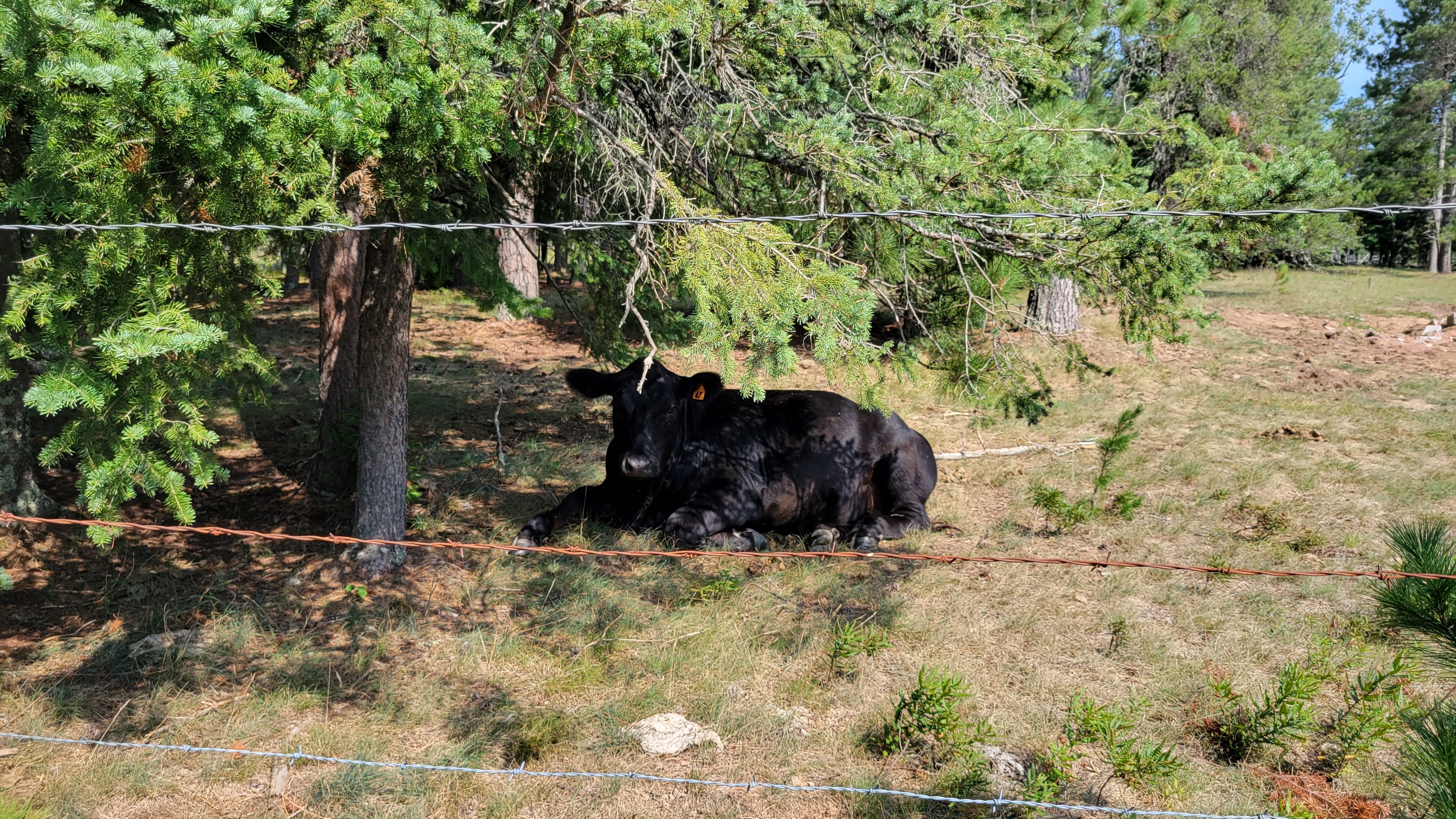
well stocked general storesmooooth pavementback in the woodsfreshly scraped!STILL SMILINGcow in reposethe road curves left – but you end up going straight ahead up the hillJess capturing me spinning up a hilldeep sand for a few milesour last campsite for the trip
Our last day and it’s going to be a scorcher so we get up early and head out by 8:30am to get water from the grocery store.
Oh look, more loose gravel backroads!
We were chased or approached by aggressive dogs three times before we decided to reroute to more main roads for a bit.
Soon the forest gave way to open farmland
We saw a flock of turkeys and they scattered as we rolled up – some flew away, some ran under the fence. But one smaller turkey was near a part of the fence that didn’t have an easy way to duck under – and the poor thing just kept running into the bottom of the fence frantically, trying to get to the other side.
Superior, WI is remarkably flat
One mile before we get to the bike path on the bridge to Duluth, a woman stops at a stop sign and then proceeds even though we were entering the intersection and have the right of way. Her passenger is yelling at her to “stop, bikes!” She does, in the middle of the intersection, but then starts slowly rolling towards us as we pass in front of her. I yell at her “YOU CAN STOP NOW. YOU CAN STOP.” Literally 2 miles from the end of our epic adventure and we are almost hit by a careless driver. We were certainly in more danger in towns and cities than we were out on the country roads.
last minute water and snacksearly start due to expected heatthis was the third dog to chase or be aggressive towards usthe route had us crossing in-service railroad trackslast bits of forestquintessential Wisconsinthe bridge back to DuluthSTILL SMILING 15 days later
Epilogue
When we rolled up to our hotel in Duluth, an undenyable sense of accomplishment and pride engulfed us. The sheer intensity of biking and camping and adjusting on the fly; broken bikes and flat tires; creepy campgrounds and freezing temperatures; WE DID IT.
before we could get cleaned up, we had to walk to the bike shop to get our bags, which had our clean clothing for going home
We celebrated with a restaurant meal, doing two loads of laundry, repacking our bikes and bags, and going to sleep in a bed again. The next morning I had Dwarf King taxi take me to the airport to pick up the rental car.
Upon sitting in the driver’s seat I had to think for a minute about how to drive.
We loaded up our bike bags, hit the road to Minneapolis, and eventually our flights to our respective homes.
so good to be home
Overall, I would definitely do this route again with a friend. Jess and I were exceptionally well-matched as adventure partners, making the whole trip so enjoyable. Our focus was to have fun, and we certainly did despite challenges along the way.
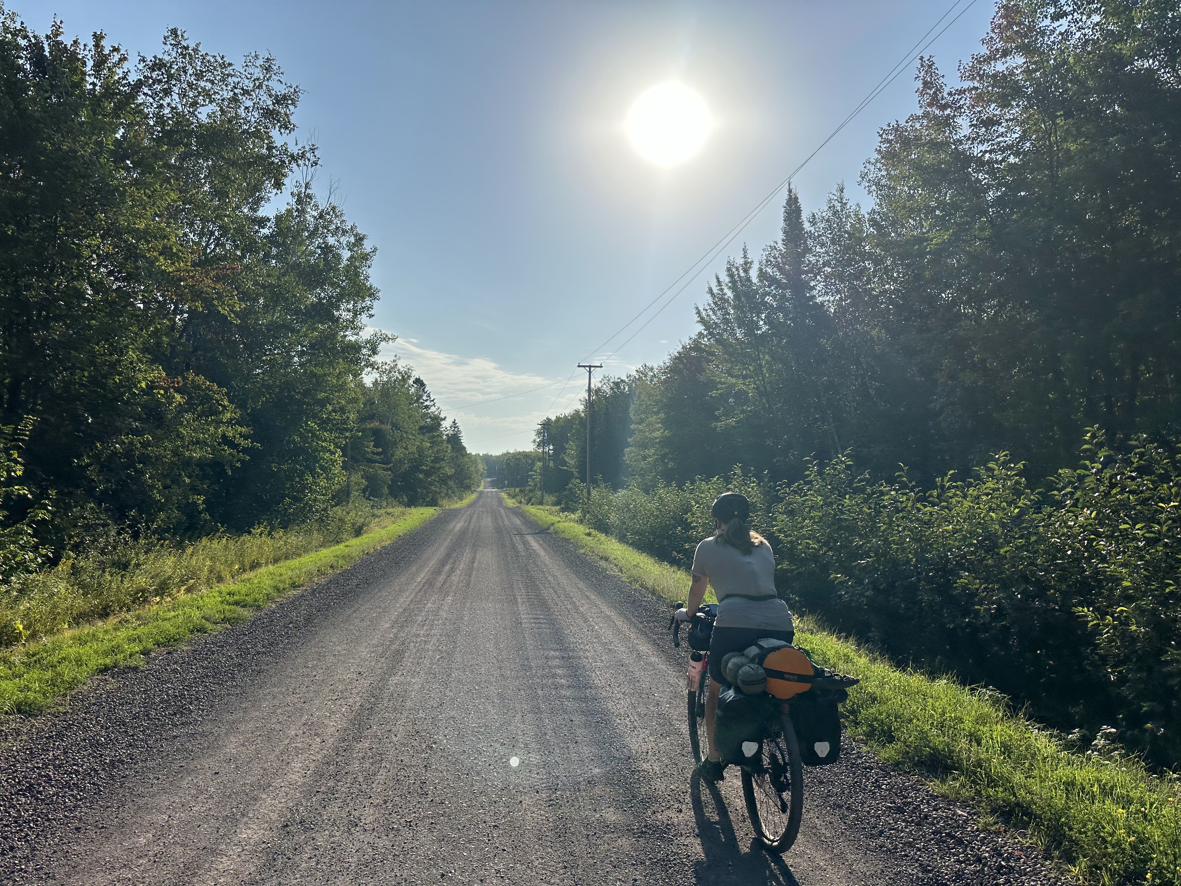
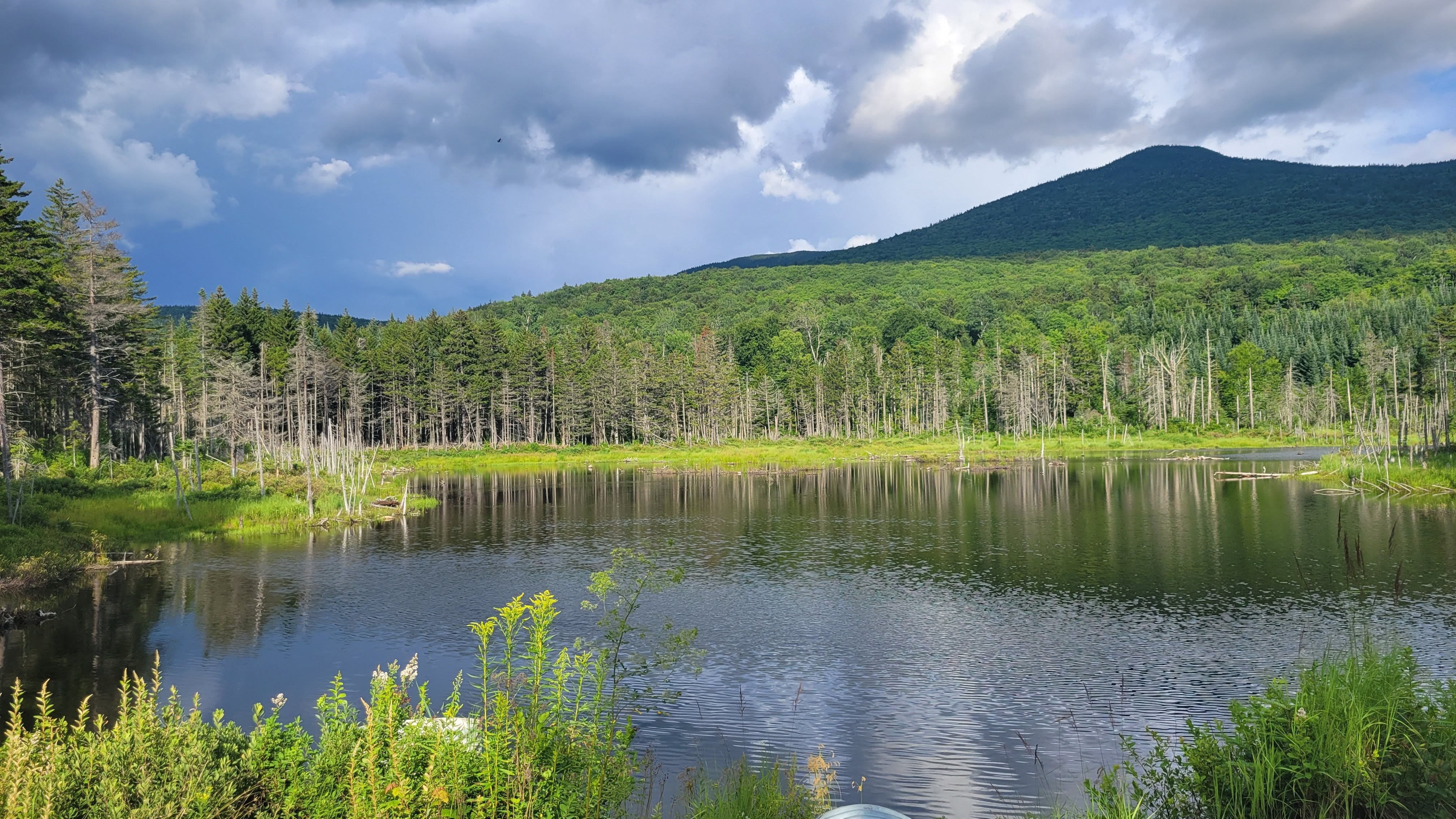
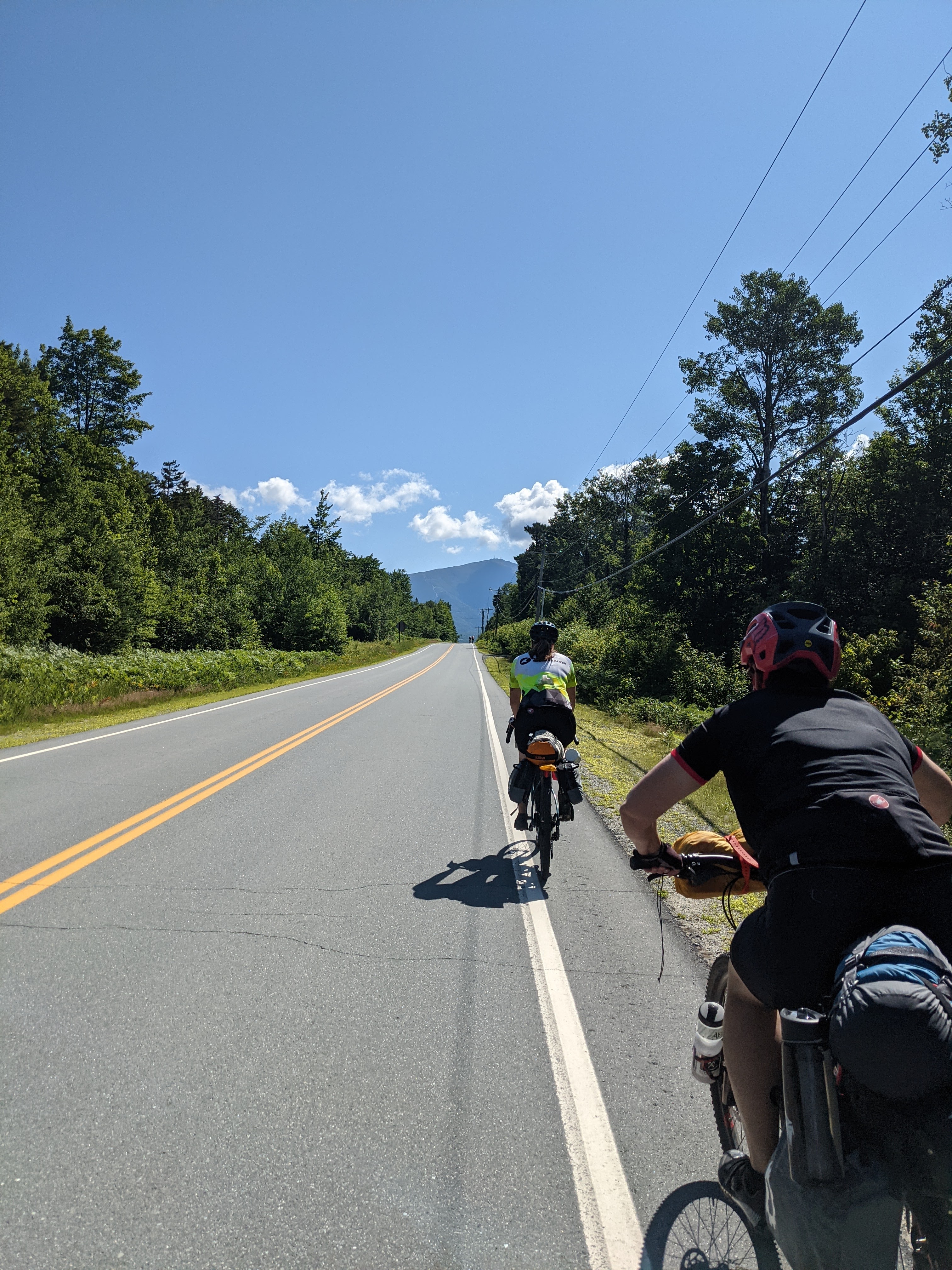
A low rumble sounded. I’m pedaling up Old Cherry Mountain Road into White Mountain National Forest, enjoying the stunning forest gently hugging the dirt road, squarely centered on being fully present in this moment. My friends are out of sight behind me, but not worried … we’ll all regroup at the top.
That’s interesting, I didn’t realize there was a logging operation nearby.
A short distance later, the low rumble sounds again.
That’s not loggingoperations. That’s a thunderstorm. We need to set up camp NOW.
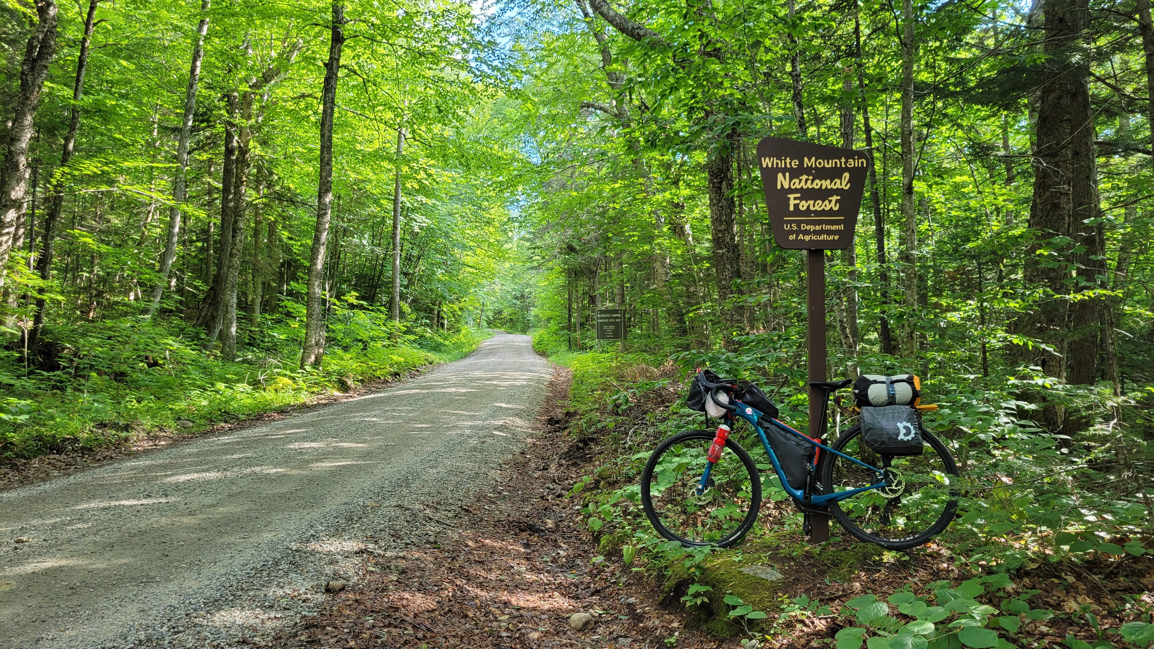
A few years back my friend Karen sent me a website for the Cross New Hampshire Adventure Trail (XNHAT). At the time, there wasn’t a lot of information other than a Map My Ride link and a few pages with trail conditions, including that ATVs had chewed up a section of the rail trail pretty badly. We put this in our back pockets for a future adventure when more information was available – but it was appealing because of the gentle rail trail grades, lots of dirt, and biking across New Hampshire.
Earlier this year I saw the Northern White Mountains Overnight Loop (NWM Loop) on Bikepacking.com and immediately wanted to do the ride for the scenery. But with a 6 hour drive to the start, I needed a bit more to make it worth the drive.
Karen, our friend Ashley, and I originally planned to ride the Brattleboro Loop from bikepacking.com but as the year progressed and the weather was persistently rainy, we decided to find something more in line with a Type I fun trip.
Enter the mashup of the XNHAT and NWM Loop: start from Woodsville, NH (a mere 4 hours from my house) and ride to Maine and back with the scenic NWM Loop hooked in on the eastbound ride over 3 days (2 nights). My friend Jean also joined us.
Day One Highlights
The Ammonoosuc Rail Trail isn’t your typical rail train in that it allows OHRV/ATVs. The gravel can get deep and chunky at times as well as significant washboarding. Wider tires help, but our hands were continually going numb from the vibrations.
The bridges and trestles are wide and well maintained, offering stunning views along the river
Seeing a buck running through the river. We watched for a bit to make sure a bear wasn’t chasing it before continuing on.
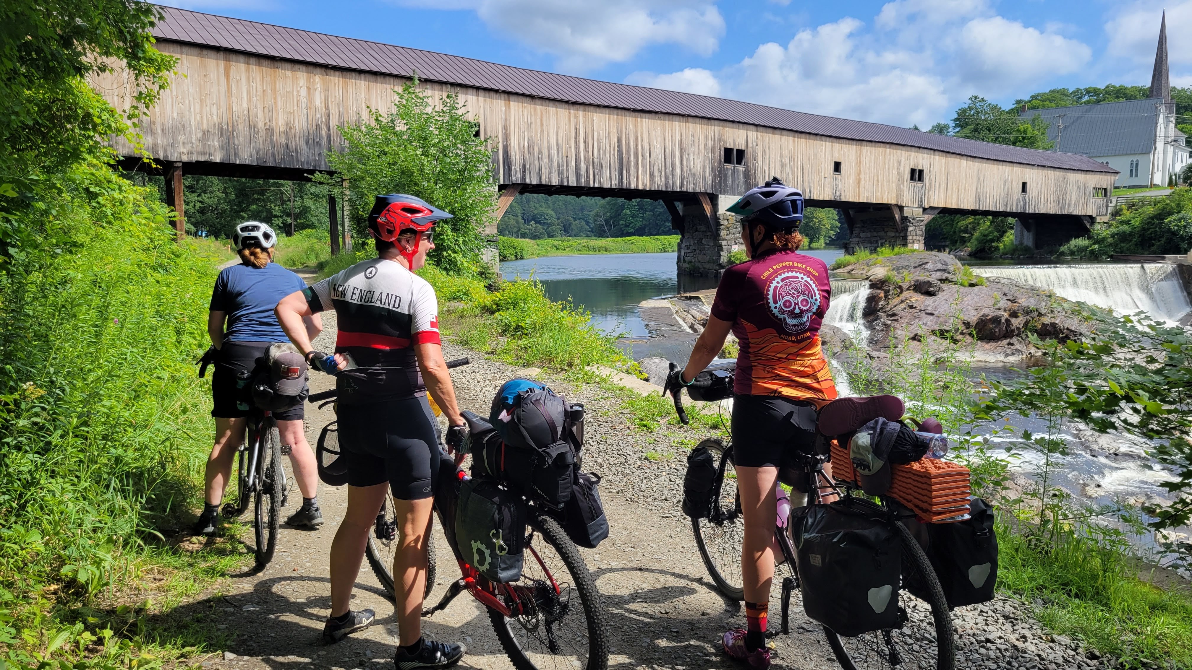
Covered Bridge at Bath
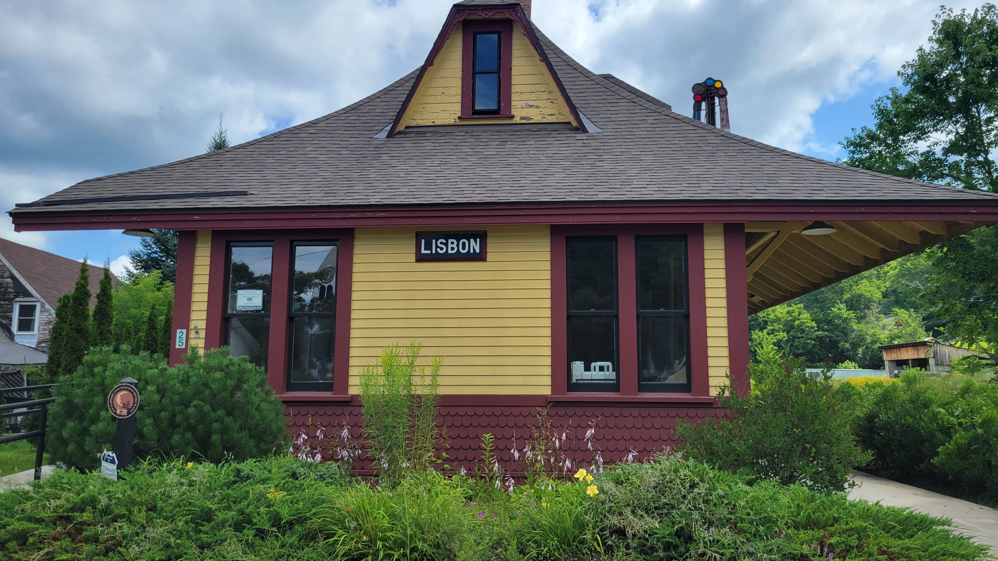
Old Train station in Lisbon
Lunch at Littleton Diner
Getting caught in a pop up rain storm leaving Littleton
11 miles of exposed pavement (Route 116) from Littleton to Whitefield is by far the least enjoyable part of the journey.
The shoulder is wide, but it’s a busy road with lots of logging trucks and virtually no shade or opportunities for shelter when weather changes
Deciding to pick up extra water in Whitefield since we intended to dispersed camp in White Mountain National Forest
Getting caught in another pop-up rainstorm as we leave Whitefield. This has got to be a record year for rainfall in the Northeast.
Back on quiet backroads and the start of actual climbing, not the gentle rail trail grades we’ve been enjoying so far
Old Cherry Mountain Rd is a fantastic climb into White Mountain National Forest
Thunder!
checking dispersed campsite after campsite and finding them all occupied. Feeling disheartened, but also that we need to get set up quickly because a thunderstorm is approaching.
Recalling there is a campground at the bottom of the descent … and going up to the front door of the house to see if we can get a site …. quickly
Spending the next hour on their covered front porch while thunderstorms form, merge, and then move south … while another forms in its place and dumping lots and lots of rain.
Fortunately the campground had hot showers for the coldest among us … and the owners brought us firewood so we could have a fire
Setting up camp, enjoying dinner and laughter by the fire
Helinox chairs are worth the weight when it’s been raining!
Finishing the day at 50 miles
Day Two Highlights
Everything is somehow still wet from overnight – but the temps are rapidly rising and drying things off
checking the weather forecast and realizing Sunday is 95% chance of .5″ of rain and by heading westbound, we won’t see any tapering off. Sunday is our longest day, an expected 65 miles on the Presidential Rail Trail, Route 116, and Ammonoosuc Rail Trails.
Making the decision to finish the NWM Loop portion of the route and then head back to the cars for a total of 57 miles for the day.
It’s hot. We take frequent breaks in the shade
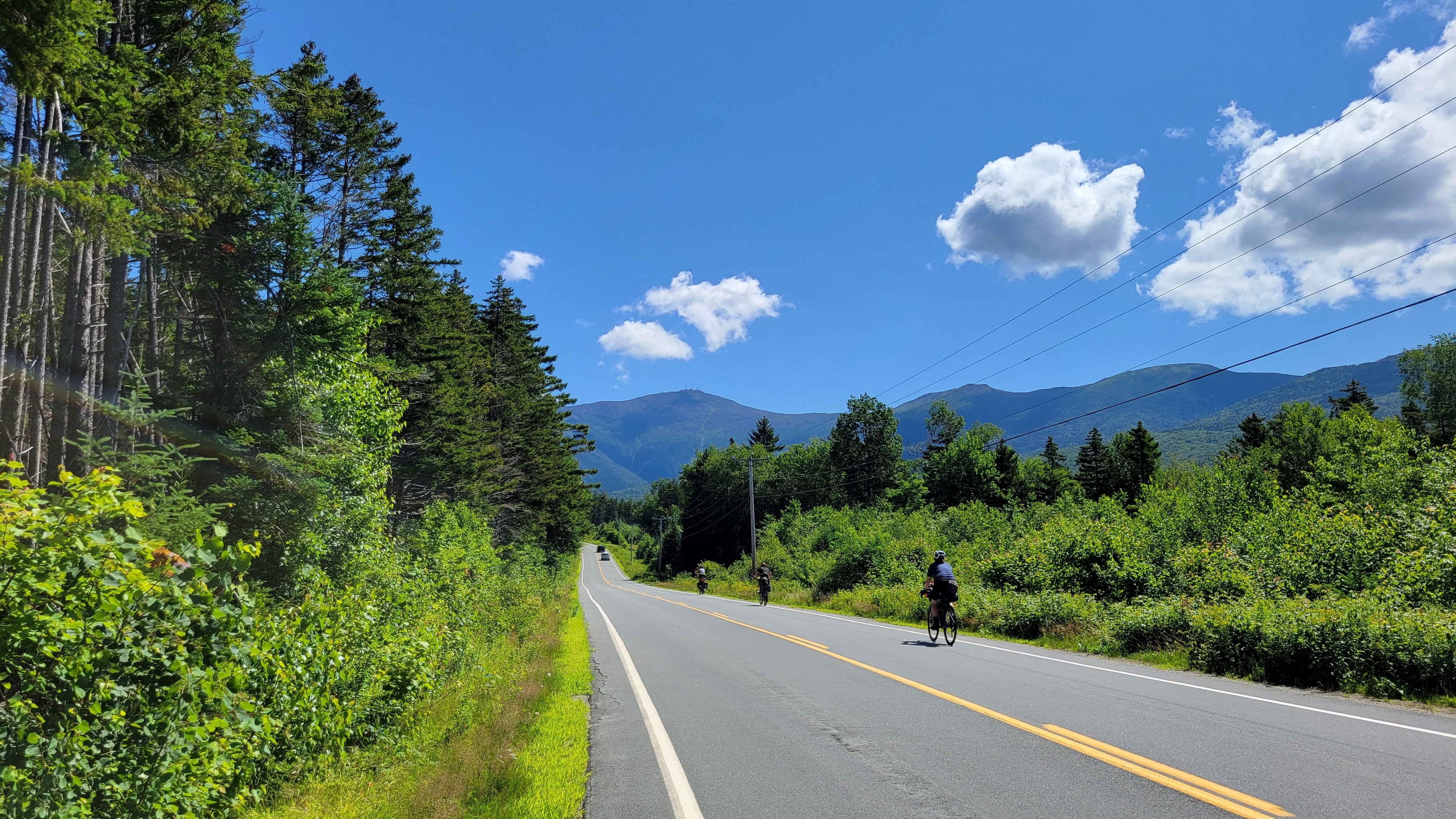
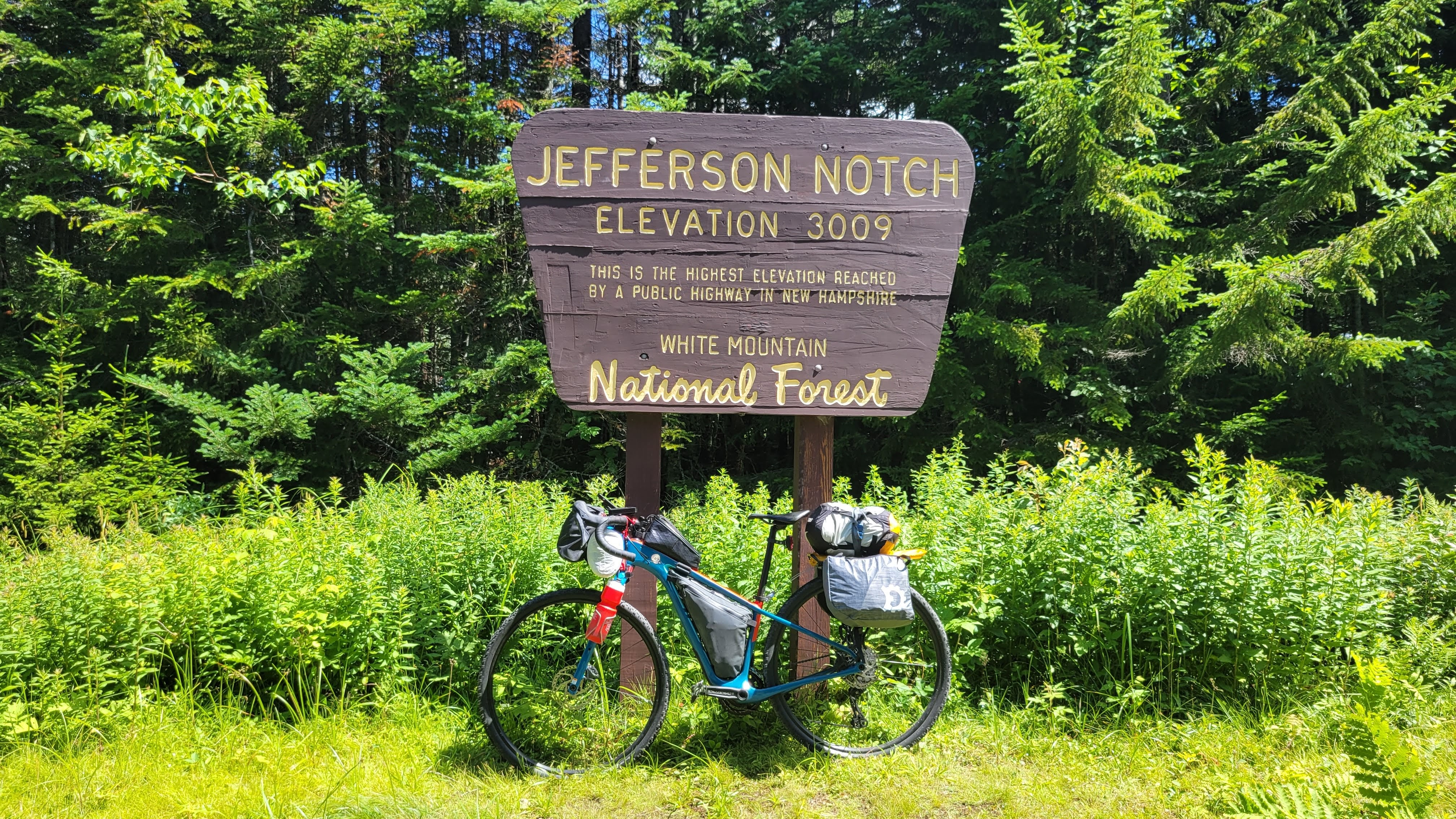
Turning left onto Jefferson Notch Rd and feeling relieved to see it’s a gorgeous shaded dirt road
Everyone taking the climb at their own pace
SO HOT at the summit!! Photos, food, quick break in the shade, then 6 miles downhill
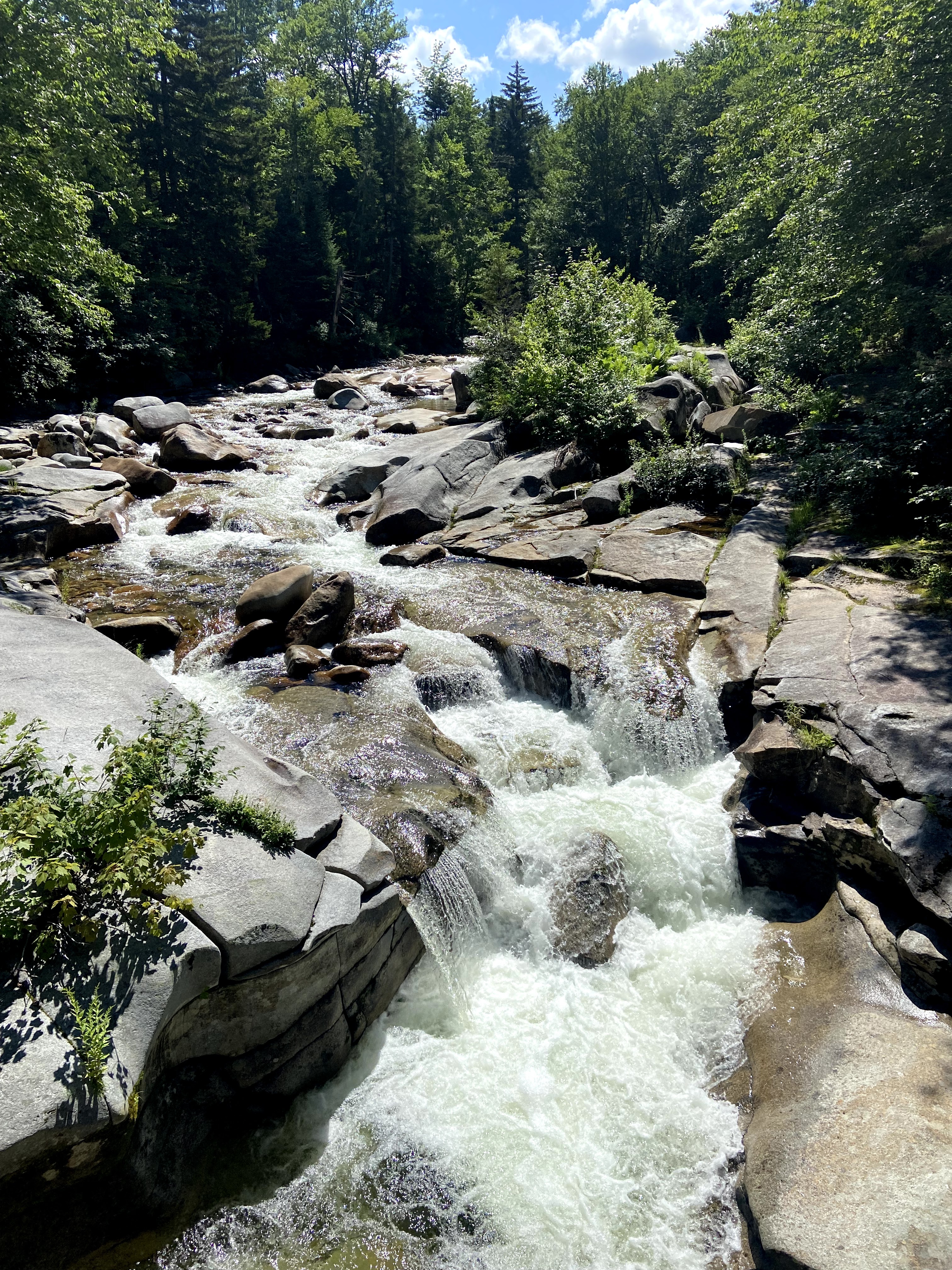
Learning the Presidential Rail Trail is significantly more rustic than the Ammonoosuc Rail Trail. But the views!!
The heat is starting to get to some in the group so we start taking frequent breaks in whatever shade we can find
Whitefield Market for food and time in the A/C
lunch in the shady grass at the center common park was peak bike adventure happiness
Back on Route 116, which is still really exposed but now really hot as well
Arriving in Littleton and deciding to head to the river and put our feet in
GAME CHANGER! The river was so refreshing and cool.
It’s all downhill from here, with gravity gently pulling our bikes a little faster
Arriving back at our cars tired, dirty, sweaty, and happy for the overnight adventure with girl friends
Pro Tips & Takeaways
Align expectations prior to the start. Want to stop for photos and ice cream? Prefer to heads-down hammer between resupply stops? Be open and honest about this. Not everyone knew each other on this trip and talking over dinner about what we hoped to get from this trip put us all in the same mindset so we could have an amazing time together.
Be sure to “train” and acclimate. If you’re a regular reader of this blog, you know “training” generally means finding something similar to what you’re about to do and doing that a few times before the trip. If you prefer a training plan, knock yourself out.
This includes in all kinds of conditions – hot, cold, rain, exposure, shade. Know how your body reacts and how to adjust on the ride. And if the situation goes sideways, always prioritize health over schedules or expectations. Do not put yourself in a dangerous place for whatever perceived “glory” you’ll get from the trip.
Planning is essential for any adventure – know options and have back up plans.
We expected to camp at the dispersed campsites but they were already claimed with no one around to ask if we could share the site. Thankfully we had scoped a campground on the planning map that had room for us for the night.
Also changing our plans due to weather. Much easier to consider because we knew where the route option points were and distance between towns/resupply.
Prioritize packing for health and safety on the trip. Literally putting out legs in the ice cold river helped relieve the heat of the day and provided a nice respite.
Creature Comforts are important too!
Box Wine was worth the weight while around the campfire the first night
As were the Helinox and Z-chairs. The deluge had made everything at the campsite completely soaked – having a dry place to sit and warm ourselves by the fire was amazing
Rail Trail grades are appealing – but know the energy consumption increases as the surface gets progressively more rustic. Long stretches at a 1-2% incline can also sap energy reserves! Fuel appropriately and consider tire choice before heading out.
Not every adventure has to be EXTREME. Be safe, have fun, pick two.
Packing List
total gear+supplies weight estimated at 24 pounds bike weight estimated at 25 pounds
The Bike & The Packs
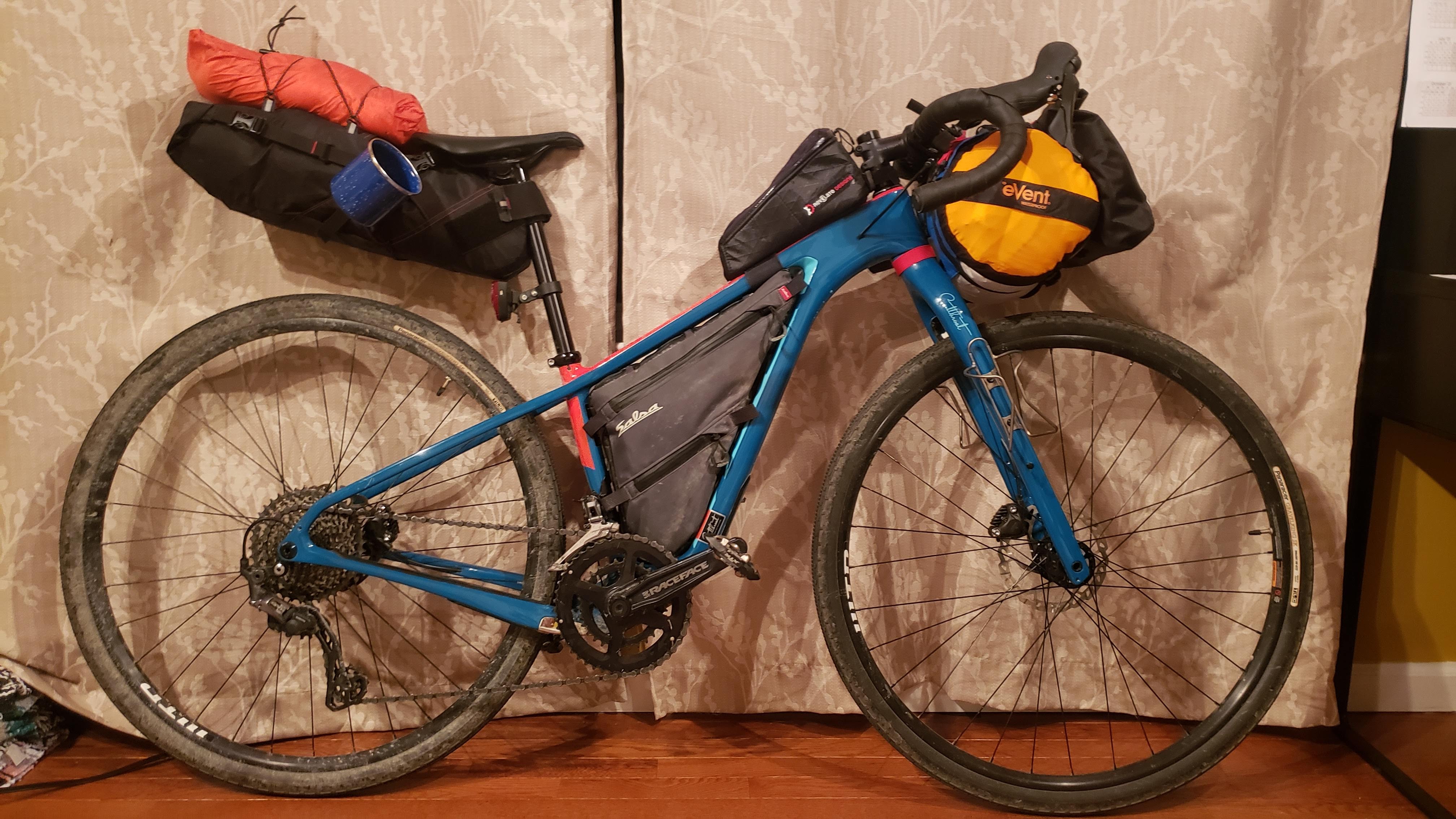
Salsa Cutthroat GRX600, size 52 modifications: 11-40 cassette Teravail Rutland 42mm <– very pleased at the low rolling resistance and good traction in the chunk Salsa bolt-on framebag Revelate Designs Pronghorn Harness w/small drybag <–no impediment to shifters and minimized overpacking Revelate Designs Egress Pocket Revelate Designs Nano Panniers Revelate Designs Gas Can Topeak Explore MTB rack Sea to Summit eVent waterproof compression sack, Medium (14L) 26oz water bottles, mounted to fork 17oz collapsible Platypus bottle for extra water on Day 2
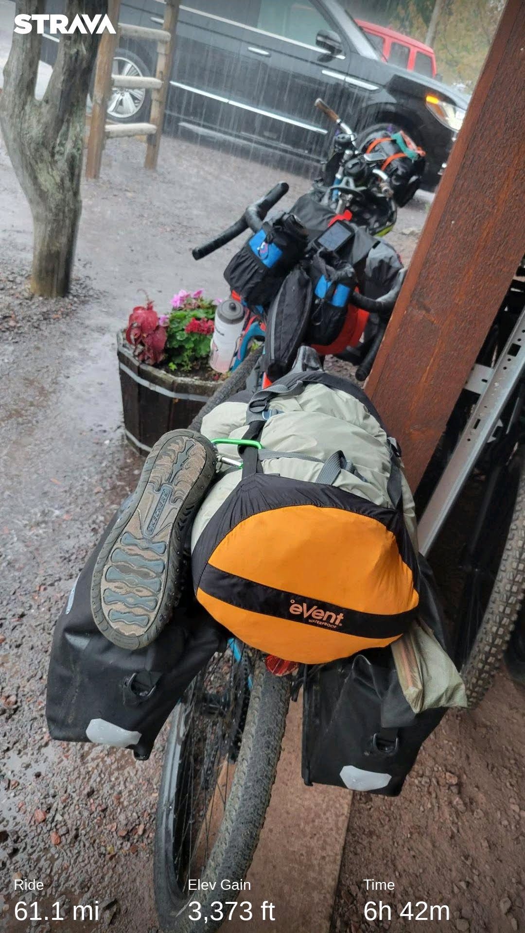
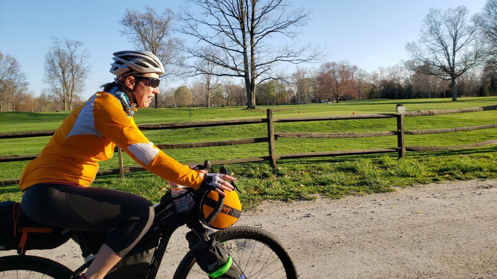
This past weekend my friend Anna and I put together a last-minute bikepacking trip to a local county park … for one night. I booked the campsite, threw together a quick route, about 25 miles each way with different roads, and scrambled to get my bike packed up the night before.
Isn’t that a lot of effort for not a lot of payoff?
Sure. And because it’s only (basically) 24 hours or less, one can experiment with minimalism and going as light as possible. Do I need this for the next 24 hours? No? Awesome – not being packed.
Adventure Bike is back!
For this overnight, I wanted to try out a few things:
38mm GravelKing SK tires (vs the 2.2″ Teravails that come stock on the Cutthroat that I’ve previously used for bikepacking)
Narrower Tires. For this trip, we had mostly pavement and smooth hardpack with the only chunky gravel in the county park. The narrower tires kept things light and quick, especially when the road started tilting upward. The narrower set up was squirrely in the chunky gravel so if this had been a longer trip, I may have switched to the 2″ tires for the added plushness and stability.
Compression Sack for front harness. I was able to cram my tent, sleeping attire, rain jacket, and a few other items into the compression sack and then smoosh it down to fit between my bars. Being able to thread the front harness straps through the compression straps felt more secure than my usual dry bag.
Inflatable sleep pad. I have only used the self-inflating kind so this was new. The Thermarest was extremely comfortable and warmth-retaining despite packing down well and being very light. However it does fit exactly under you so I had to figure out how to place my arms so they wouldn’t be laying on the ground (and cold). It crinkles when you roll over, which wasn’t awful but I was worried about waking up my friend every time I moved.
Ultralight, ultra-packable sleep system. The 50*F quilt, liner, and sleeping pad all pack down super small, making it easy to just toss in the seatpost bag.
Prepaying for firewood to be left at the site by the ranger. Once the sun went down, having a fire to hang out around was super nice. Not having to schlep it by bike was even better.
Water Drop. I was able to bribe my kid with gas money to drop off a few gallons of water for us at the campsite since there is no water available in the park.
ThinGs That Didn’t Work So Well
Summer-weight sleep quilt with spring overnight lows. I didn’t pay attention to the “comfort” limit being 57* for my 50* bag. So even with all my layers plus puffy plus thermal liner, I was chilly all night and slept superficially (low was 43*F) . Going to need to figure out how to bring my down 20* sleeping bag in the future for spring and fall bikepacking.
Forgetting to take my digestive enzymes with dinner. While my digestion has stabilized pretty well over the last 10 months, I still have issues with fats and sugars, especially at the levels most backpacking meals contain. The PackIt Gourmet Chili was delicious – but my guts were gurgling unhappily all night.
Shoes. This was a mix – they were very comfortable around the campsite but after a dozen miles or so or riding, I was getting uncomfortable under the balls of my feet. Likely because the shoes need to straddle being stiff enough for riding without being too stiff for walking around after. Seeing as these are a 2013 model that I bought for bike commuting but then never wore, I’m sure technology has changed and may be able to find something that straddles this divide better.
Somewhere to sit that’s not The Ground. Because we had the fire going, I rolled over a tree stump to use as chair. Anna brought a lightweight backpacking chair. Exploring the idea of getting a lightweight backpacking chair to bring for the good times spent hanging out around the campsite with friends. Need to weigh the weight to need return – but sometimes creature comforts make or break a trip.
Conclusion
Bikepacking overnights are a great way to satisfy the need to get away for a bit and try new things in a low-risk way. It also just feels cool to be riding around on familiar roads with everything you need for a day or a weekend while everyone else is just out for their weekend ride. The gear signals Adventure Is Happening and hopefully sparks others to explore their proverbial backyards too.
Nothing hurts and I can’t wait to sign up for next year.
Last year’s FDGG was a test of strength, stamina, grit, and tenacity. The ride is still pretty beastly but this year, the weather gods smiled upon us and gifted us with flawless conditions.
Farmer’s Daughter Gravel Grinder (FDGG) is a 65 mile gravel ride featuring 6,500′ of climbing and 6 off-road segments to keep things spicy. The ride is limited to 400 intrepid people and is not something to sign up for on a whim. The course features back-to-back rollers with grades ticking up into the high-teens.
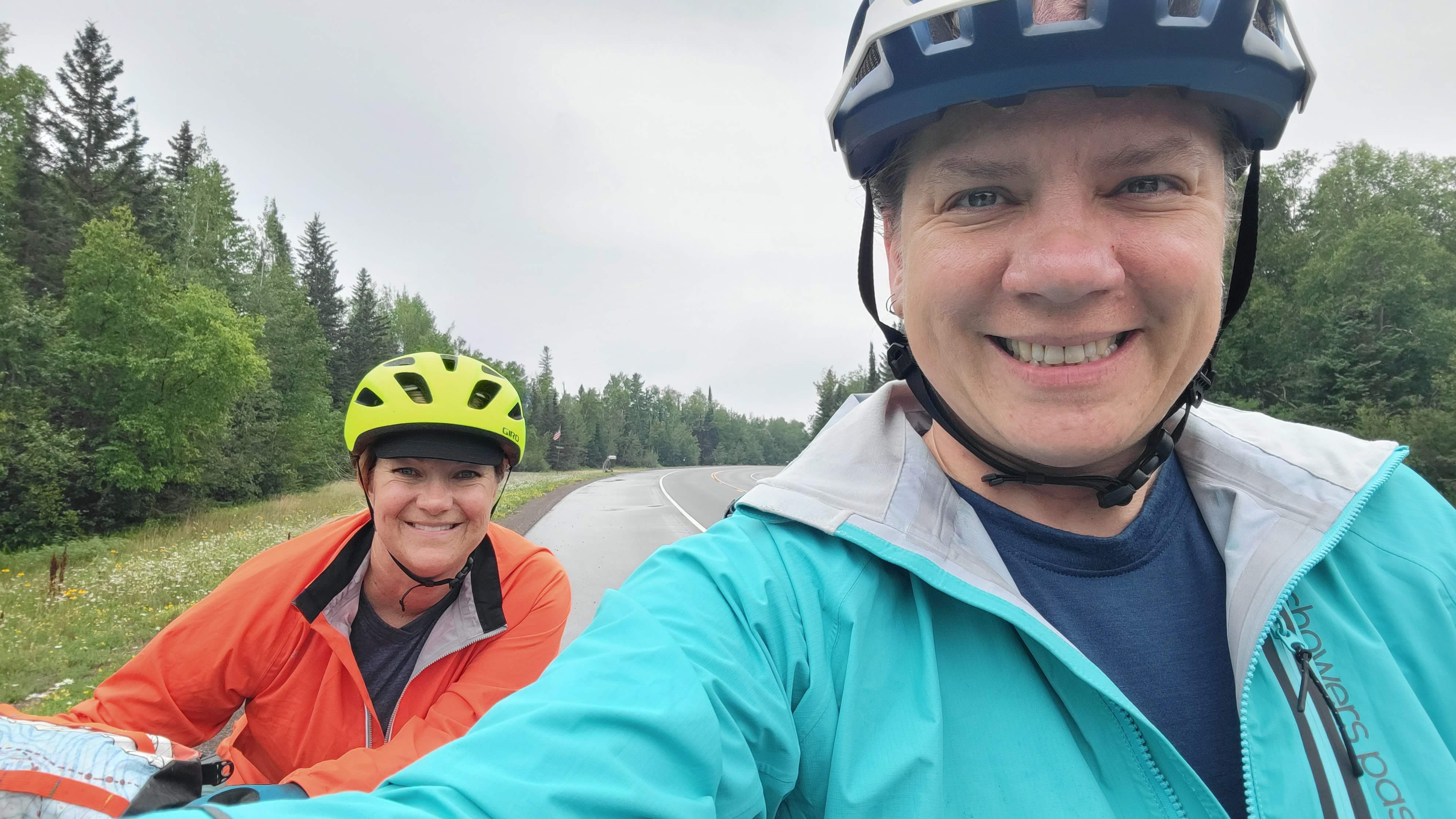
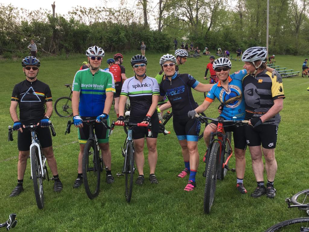
This year I rode with Gail (her inaugural year) and Matt (round 2 with me). At the start I also saw my friends Curt, Kyle, Reba, Melissa, and a few others that I didn’t get to see but knew were there. We also ran into a woman from an online bike ride group I belong to and ended up yo-yo’ing with her for the last half of the ride.
photo courtesy of my friend Melissa
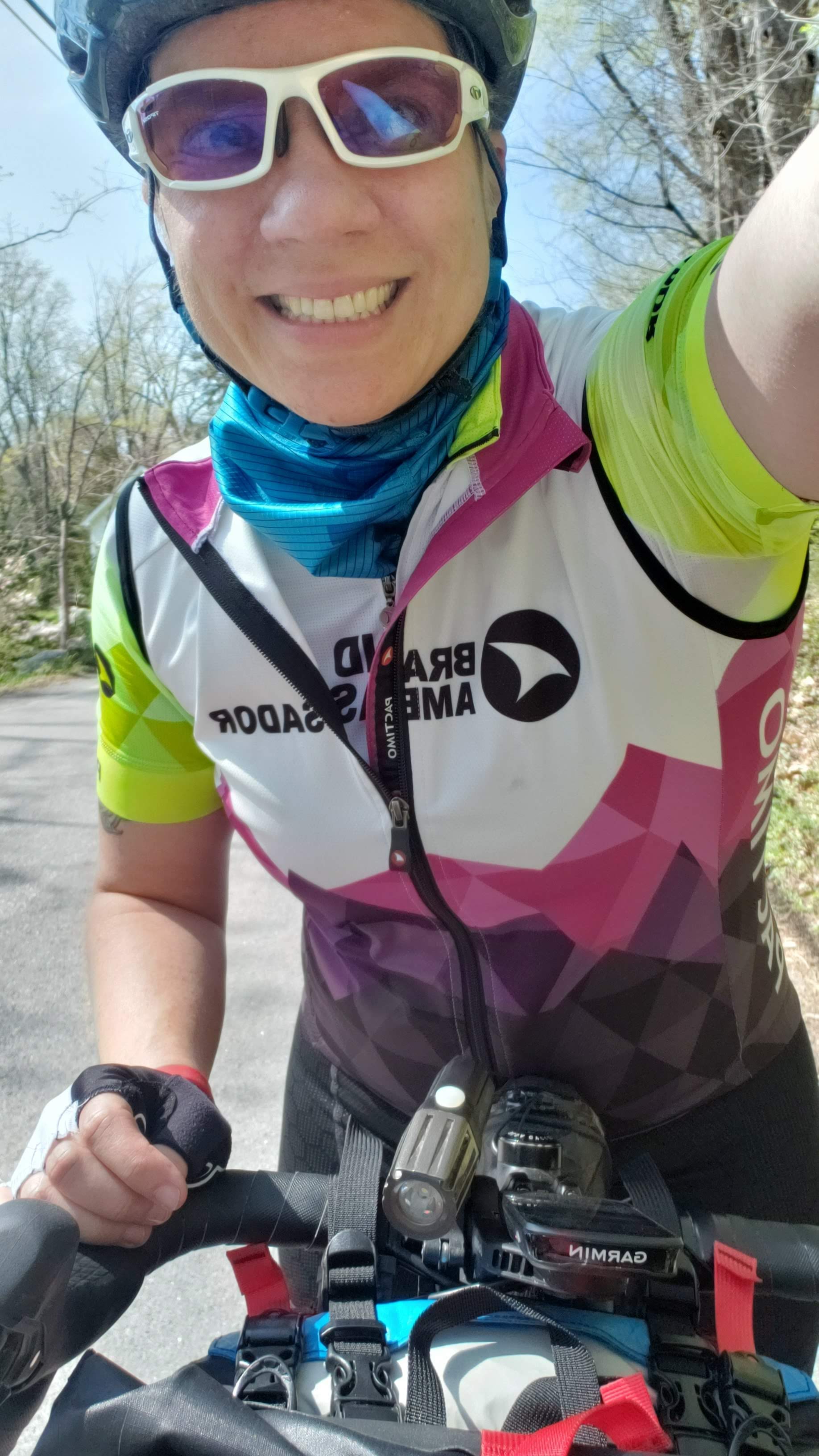
I don’t think I’ve mentioned that I joined a cycling team this year – Splunk. This should be interesting because I don’t race and my idea of training is just to ride my bike more. But the kit is pretty nice looking. I recently learned that I can get the kit from Pactimo instead of the other provider. So I’m re-ordering my kit because Pactimo is high quality and super comfortable. And they are based in Colorado. JUST LIKE MY HEART.
ANYWAY … over the course of the day we passed many riders who ultimately took shortcuts or SAG’d back to the start. Pro Tip: do not underestimate the Farmer’s Daughter.
At one point we had been climbing for a while and I was feeling particularly spunky rolling up on a bearded guy. We started chatting about the ride, how he was tired already, but I encouraged him to keep going. After a few minutes he asks me if I was also at Cross Mountain Crusher (I was). Apparently we spoke at that ride too!
I guess find me at a ride and I will encourage you up any hill. ha!
I have my own philosophy about how gravel grinders don’t need to be super hard or have sections that select few can actually ride while the rest of us mere mortals have to walk, but that’s a blog post for another day. If you are local to the NYC area and looking for a rad gravel ride closer to home, check out my gravel ride in October, The Dirty Apple.
So what was different from last year?
Significantly less mud. My bike was fresh off a tune-up and upgrades to my bottom bracket, handlebars (everyone needs more cowbell in their life), and seatpost. It had never been so clean …
Weather. The day started with gray skies that threatened to rain but ended up with brilliant blue skies and a healthy dose of muggy humidity.
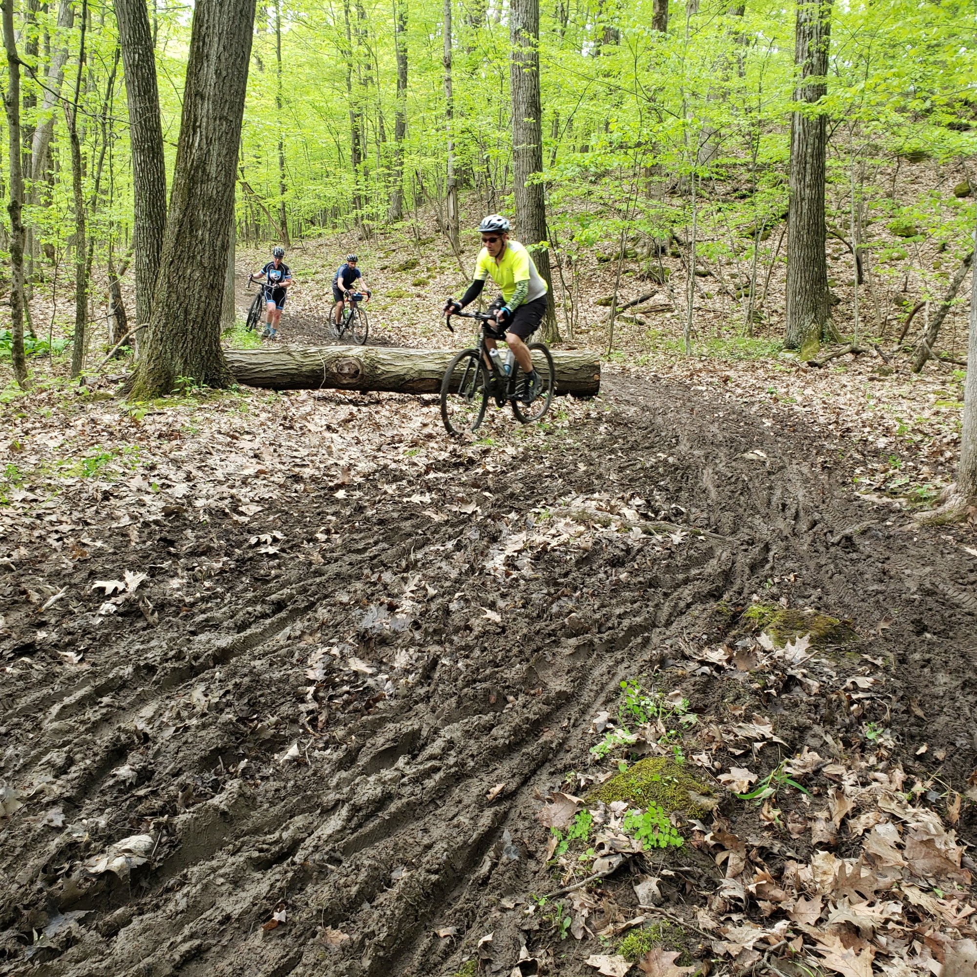
Conditions. The roads were in great shape from rain earlier in the week and dried out enough to be fast-rolling. The off-road segments remained an absolute mud fest, just significantly less so. We ended up walking several sections of mud with standing water that threatened to pull off our shoes when we walked through it.
Photo Ops. Because we didn’t need to spend our energy *just* *moving* *forward*, we were able to take a look around and enjoy the stunning scenery that Columbia County offers.
And let’s not forget the incredible volunteers who check you in, keep you on course, feed you at the rest stops, and cook up plenty of food so that even the stragglers are well fed before cleaning up and going home.
FDGG is getting more popular every year and it’s no wonder why – Columbia County has a bounty of stunning views and wide network of dirt roads to explore. FDGG and the organizers’ other ride, Farmer’s Fatty, are fantastically well organized and run events. If you are in the New York/New England area, put these events on your calendar for next year.
I had spun myself into a pretty impressive anxiety spiral. So much so that just looking at the French toast in front of me, made from buttery croissants and paired with fresh local maple syrup and bright red raspberries, was causing my stomach to flip. I couldn’t eat and I couldn’t figure out why my anxiety was like a tea kettle on the stove, whistling that it was ready.
The Cross Mountain Crusher is a 55-mile, 5,000’+ of climbing gravel ride in the Catskills of New York featuring five monstrous climbs. The namesake ride up Cross Mountain features grades that pitch up to and a touch over 20%. Billed as a training ride for Farmer’s Daughter Gravel Grinder in May, this ride is meant to test your strength, stamina, and endurance.
This spring’s weather has been all over the place – torrential downpours and bright sunny days juxtaposing themselves in a way where it’s hard to find any time to mountain bike because if the trails aren’t mud, they are not quite dry yet. Rinse and repeat.
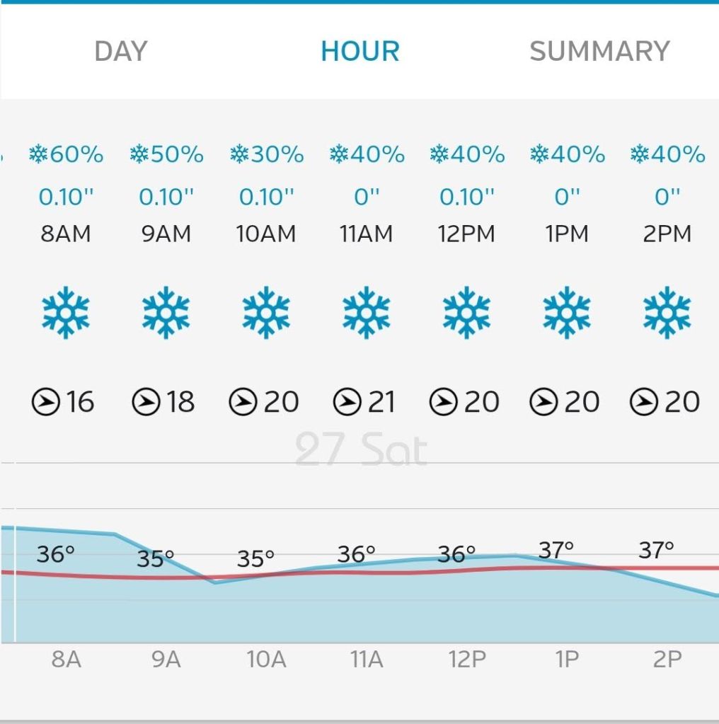
The 10-day forecast called for low-60s and sunshine for this year’s Crusher. The reality that was slowly eating my sanity was I had signed up for a grueling ride and the forecast was looking … well, not low-60s and sunny.
Actual forecast: 35*, snow, wind on tap for this year’s event
I booked myself a room at the Meadowood Inn, about a half-mile from the start location to maximize my sleeping in time, but the weather forecast had my brain running wildly.
Let’s talk about the weather for a minute. The temps did indeed sit at about 35* all day. The winds were formidable, but gravel roads tend to be in wooded areas so this really only impacted us when we popped out into open fields between climbs.
It ended up snowing all day with periods of sleet. Somehow the sleet squalls coincided with descents, which made visibility a challenge but also, exfoliated my face pretty sufficiently. On the last downhill, the winds picked up so not only were we being pelted by thousands of tiny knife-like ice pellets, but also being pushed across the road by the wind. GOOD TIMES.
The ride itself was amazing and will only be better under warmer spring temps and a little more sunshine. The dirt roads are quiet and scenic – had I not started freezing anytime I stopped moving, I may have had some beautiful photos to share. You’ll just have to go look at the website and trust me. The climbs truly separate the racers from the people looking to enjoy the day. Nothing is unmanageable but one would do well to ride some ridiculous rides with obscene levels of climbing to prep.
The descents on dirt were washed out in places and some had large rocks littering the way way so it wasn’t possible for me to really let go and enjoy the descents. But again, nothing unmanageable for anyone with adequate mountain biking or cyclocross skills.
Quite possibly the worst part of the ride is the last 15 miles, which are 2 miles of downhill followed by 13 miles of flat-to-gently-rolling pavement. After so many back to back big climbs, my legs were D O N E and I just wanted to be back at the start for some well-deserved lunch. Peeling off multiple soaked-through layers of clothing was painful, although putting on warm, dry clothing and a down puffy jacket was delicious.
Rides like this are best completed with friends. My friend Kyle rode with me for this event and I am so thankful he did. We saw our friends Curt and Ralph at the start but they quickly disappeared with the lead pack. We found our other friend Matt on the first climb and fortunately we kept finding each other along the way. When the weather is this challenging, it’s nice to have someone to talk to and make the miles tick by faster.
THREE THINGS I DID RIGHT:
My bike choice. I rode my Salsa Colossal Ti with 26mm Panaracer GravelKing SKs. Despite the rain all day prior to the ride, the dirt was flawlessly tacky for the event. I had brought up my hardtail mountain bike in case conditions were deeply muddy, but I’m glad I didn’t ride it.
Not driving up the morning of. Staying overnight locally meant I wasn’t too stiff from sitting in the car for 2 hours right before a ride.
It’s a ride, not a race. I’m not the fastest gravel rider because my philosophy is one should always have enough in the tank to get back home. The first two climbs were really tough but saving some legs for later was key. You can see my stats here.
THREE THINGS I DID NOT DO RIGHT:
Overpacking. I was terrified that I would be too cold on such a long ride and Girl Scout Mode kicked in. I had a few different options stuffed into my backpack – insulated gloves, neck gaiter, wind vest, windbreaker, and a ton of food. In the end I wore a windbreaker over my jersey after shoving my winter bike jacket into the pack. The thing probably added a good 5 pounds to my effort. DO NOT DO THIS ON A CLIMBY RIDE.
Using a hydration bladder instead of bottles. Again, lighten up, lady! 1.5 litres of water was nice but unnecessary on a SUPPORTED RIDE. But this was the result of thinking I would be on my mountain bike, which only has one bottle cage. Had I been on my mountain bike (horrible choice), this would have been an excellent decision.
Getting stuck in my own head. There really wasn’t any reason to be so anxious. The Cross Mountain Crusher is a well supported, great event in a beautiful part of New York, put on by an awesome group of people.
Last year I did my first gravel grinder, and I’ve been hooked ever since. Dirt and gravel roads are some of the quietest, most scenic ways to see an area by bicycle. And yes, they often have hills that challenge your mind and body to just. Get. To. The. Top. one pedal stroke at a time.
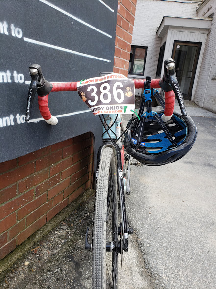
When Onion River Sports closed last year, the fate of the event was in limbo – but fortunately, a group of former employees decided the show must go on! If you’ve ever doubted what a small band of committed people can accomplish, look no further than this year’s Muddy Onion.
The route was revamped. The rest stops streamlined. The hospitality still off the charts.
Whereas last year we had perfect sunny, dry conditions – this year was almost the total opposite. Winter didn’t start relinquishing control until just a few weeks before the ride. It has been raining more than it’s been dry and sunny, and the roads and trails are in a nearly perpetual state of mud. Lots of people opted for mountain bikes and fat bikes this year over gravel or cross bikes.
Tire Selection
Let’s take a moment to talk about what everyone seemed to be talking about leading up to the event: tire choice.
Mud2 clearance is “tight”
Last year I threw on 30mm Michelin Mud2s, which are excellent mud tires but sadly do not provide enough clearance on my Salsa Colossal to be used in truly muddy conditions.
After extensive online research (because apparently, no one makes mud tires narrower than 32mm generally), I asked my local shop to order Panaracer GravelKing SK 26s for me.
This was a flawless choice for this year’s conditions, ranging from wet sand to wet hardpack to full-on mud-pits conveniently located at the bottom of every really nice descent. The tires tracked beautifully in suboptimal conditions and were fast-rolling on paved sections.
26mm tires and traction for days
To be sure though – no tire will save you if you can’t handle your bike when it’s sliding in a few different directions. Pro tip: mountain biking on a hardtail will give you the skills needed to improve handling on the road too.
The Ride
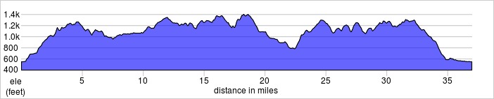
Vermont is blessed with an abundance of dirt roads and beautiful scenery – and the Muddy Onion gives you an opportunity to experience both. The first 5 miles still trend up, and by the rest stop at mile 10, we had climbed over 1,300′ while passing family farms, open fields, and taking in views of the Green Mountains.
the better conditions encountered
The middle 17 miles looped us up to Mirror Lake and the tiny towns that dot Vermont. Screaming downhill to flat lake-side roads that provide an air conditioning effect – not much needed when it’s barely 60*F out! I had pulled off my arm warmers sometime in the first 10 miles, and I certainly wished I had them on as we passed the lake. We passed through beautifully dense pine forest, the scent of pine filling the air. Coming into the final rest stop with around 3,000′ of climbing under our legs.
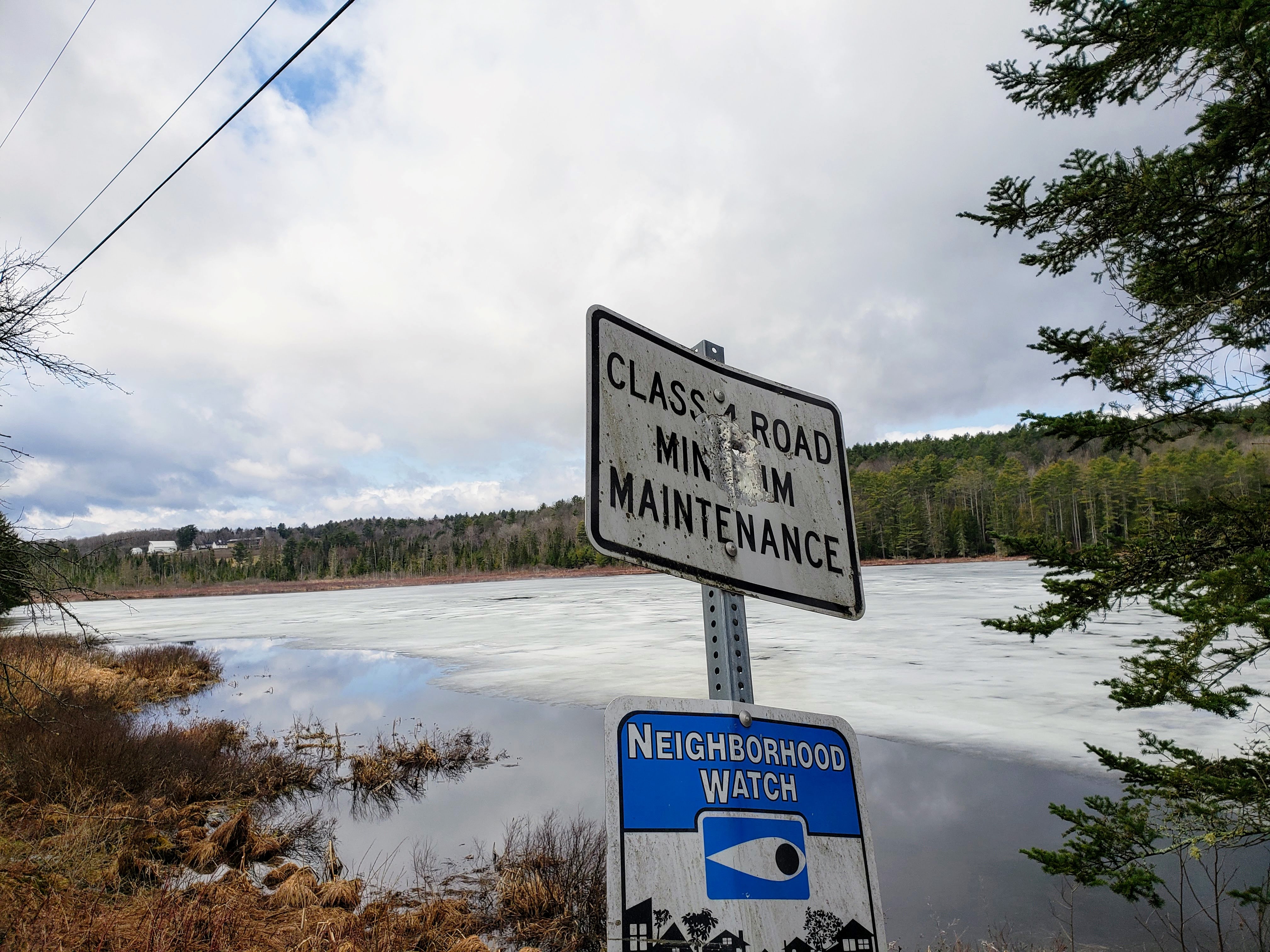
Class 4 means Quality
The final 10 miles feature that last few hundred feet of climbing and the last 4 miles trending DOWN and the welcome sight of getting back to Montpelier after 37 miles, 3,650′ of climbing, and a whole lot of dirty fun.
at the rest stop
Racked the bikes and enjoyed the post-ride BBQ and beverages before getting cleaned up and heading back into town for a coffee at Capitol Grounds Cafe/802 Coffee and purchases at the state store. Sadly, no one at the store knew the whereabouts of Richard. Richard was our superlative Southern Gentleman/MOT clerk last year, and we were hoping to see him again this year.
(I’d love to know how much the Muddy Onion, a smaller gravel event, brings Montpelier in tourism dollars: in accommodations, food, and other purchases. I drive 5 hours each way and purchase gas, stay in a hotel, eat at local restaurants, and make purchases while visiting. Bikes Mean Business!)
Conclusion
The Muddy Onion has once again proven gravel grinders don’t have to be gratuitous sufferfests or hike-a-bike. With an enjoyable route that features stunning scenery and quiet backroads, none of the hills were insurmountable despite providing a truly meaningful challenge (although let’s be real, this year’s peanut butter-like conditions made the steepest of hills that much more challenging).
this. all. day.
Thank you Onion River Outdoors for another spectacular event. See you next year!!